This is a list of properties and historic districts in Arkansas that are listed on the National Register of Historic Places. There are more than 2,600 listings in the state, including at least 8 listings in each of Arkansas's 75 counties.

This is a list of the National Register of Historic Places listings in Forest County, Pennsylvania.
Colville is an unincorporated community in Benton County, Arkansas, United States. It is the location of Mt. Hebron M.E. Church South and Cemetery, which is located at 1079 Mt. Hebron Road and is listed on the National Register of Historic Places.
Osage Mills is an unincorporated community in Benton County, Arkansas, United States. The millsite and associated dam is located on Little Osage Creek about eight miles southwest of Rogers. It is the location of the following places listed on the National Register of Historic Places on January 28, 1988:

This is a list of the National Register of Historic Places listings in Washington County, Arkansas.

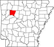
This is a list of the National Register of Historic Places listings in Benton County, Arkansas.
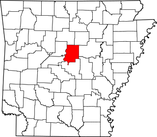
This is a list of the National Register of Historic Places listings in Faulkner County, Arkansas.

This is a list of the National Register of Historic Places listings in Garland County, Arkansas.

This is a list of the National Register of Historic Places listings in Jefferson County, Arkansas.
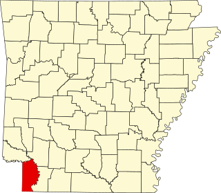
This is a list of the National Register of Historic Places listings in Miller County, Arkansas.

This is a list of the National Register of Historic Places listings in Searcy County, Arkansas.

This is a list of the National Register of Historic Places listings in Stone County, Arkansas.

This is a list of the National Register of Historic Places listings in White County, Arkansas.

This is a list of the National Register of Historic Places listings in Little Rock, Arkansas.

Harmony Hill Methodist Church is a Methodist Episcopal house of worship affiliated with the United Methodist Church and located about one mile north of the village of Stillwater in Stillwater Township, in the Sussex County, New Jersey, United States.
West Richwoods is an unincorporated community in Stone County, Arkansas, United States. West Richwoods is located on Arkansas Highway 9, 4.2 miles (6.8 km) southwest of Mountain View. The Samuel Brown House and the West Richwoods Church & School, which are both listed on the National Register of Historic Places, are located in West Richwoods.

The Antioch Missionary Baptist Church Cemetery is located at 500 North McKinney Road in Sherrill, Arkansas, behind the Antioch Missionary Baptist Church. The earliest graves contain the remains of emancipated slaves, originally enslaved on the Good Hope Plantation in South Carolina, but moved to Jefferson County, Arkansas in 1860. Reverenced Lewis Mazique, a leader in the community, was the earliest documented burial, in 1885. The cemetery continues to be used today, although infrequently.

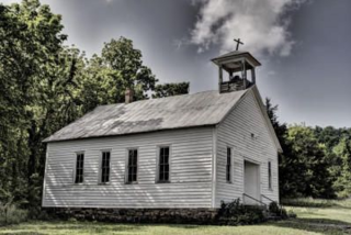
Harmony Presbyterian Church is a historic church on the north side of Highway 103, approximately 8 miles (13 km) north of Clarksville in Harmony, Arkansas. It is a two-story masonry structure with a stone cut basement, built out of cut stone blocks and covered by a hip roof. A wood-frame square tower rises above the main entrance, topped by a flared pyramidal roof. The main entrance and windows are set in pointed-arch openings, giving the building a Gothic flavor. It was built in 1915-17 for a congregation organized in 1844.

St. Elizabeth's Catholic Church is a historic church at the northeast corner of Sycamore and Mason Streets in DeValls Bluff, Arkansas in the United States. It was built in 1912 and added to the National Register of Historic Places in 2009.
The National Register Information System (NRIS) is a database of properties that have been listed on the United States National Register of Historic Places. The database includes more than 84,000 entries of historic sites that are currently listed on the National Register, that were previously listed and later removed, or that are pending listing. The database includes approximately 45 pieces of data for each listed property. Accuracy of the NRIS database may be imperfect. For example, a 2004 paper addressed accuracy of spatial location data for part of the NRIS content.