Knoxville, Arkansas | |
---|---|
Coordinates: 35°22′41″N93°21′47″W / 35.37806°N 93.36306°W Coordinates: 35°22′41″N93°21′47″W / 35.37806°N 93.36306°W | |
Country | United States |
State | Arkansas |
County | Johnson |
Government | |
• Mayor | John Tyson |
Area | |
• Total | 3.19 sq mi (8.27 km2) |
• Land | 3.18 sq mi (8.25 km2) |
• Water | 0.01 sq mi (0.02 km2) |
Elevation | 387 ft (118 m) |
Population (2020) | |
• Total | 660 |
• Density | 207.29/sq mi (80.02/km2) |
Time zone | UTC-6 (Central (CST)) |
• Summer (DST) | UTC-5 (CDT) |
ZIP code | 72845 |
Area code | 479 |
FIPS code | 05-37300 |
GNIS feature ID | 2405959 [2] |
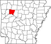
Knoxville is a city [3] in Johnson County, Arkansas, United States. [4] The population was 731 at the 2010 census.
According to the United States Census Bureau, the city has a total area of 2.2 square miles (5.7 km2), all land.
Census | Pop. | Note | %± |
---|---|---|---|
1970 | 202 | — | |
1980 | 264 | 30.7% | |
1990 | 239 | −9.5% | |
2000 | 511 | 113.8% | |
2010 | 731 | 43.1% | |
2020 | 660 | −9.7% | |
U.S. Decennial Census [5] |
As of the census [6] of 2000, there were 511 people, 194 households, and 138 families residing in the city. The population density was 230.3 inhabitants per square mile (88.9/km2). There were 210 housing units at an average density of 94.7 per square mile (36.6/km2). The racial makeup of the city was 95.89% White, 1.57% Native American, 0.20% Asian, 1.37% from other races, and 0.98% from two or more races. 4.11% of the population were Hispanic or Latino of any race.
There were 194 households, out of which 34.5% had children under the age of 18 living with them, 59.8% were married couples living together, 8.8% had a female householder with no husband present, and 28.4% were non-families. 22.2% of all households were made up of individuals, and 10.3% had someone living alone who was 65 years of age or older. The average household size was 2.63 and the average family size was 3.13.
In the city the population was spread out, with 27.8% under the age of 18, 9.0% from 18 to 24, 29.2% from 25 to 44, 20.7% from 45 to 64, and 13.3% who were 65 years of age or older. The median age was 35 years. For every 100 females, there were 110.3 males. For every 100 females age 18 and over, there were 95.2 males.
The median income for a household in the city was $31,250, and the median income for a family was $34,375. Males had a median income of $22,031 versus $22,857 for females. The per capita income for the city was $15,404. About 9.2% of families and 12.6% of the population were below the poverty line, including 13.5% of those under age 18 and 18.3% of those age 65 or over.
Johnson County is a county located in the U.S. state of Arkansas. As of the 2020 census, the population was 25,749. The county seat is Clarksville. Johnson County is Arkansas's 30th county, formed on November 16, 1833, from a portion of Pope County and named for Benjamin Johnson, a Territorial Judge. It is an alcohol prohibition or dry county.
Norfork is a city in Baxter County, Arkansas, United States. The population was 550 at the 2010 census.
Gum Springs is a town in Clark County, Arkansas, United States. The population was 120 at the 2010 census, down from 194 in 2000.
Newark is a city in Independence County, Arkansas, United States. The population was 1,180 at the 2020 census.
Lamar is a city in Johnson County, Arkansas, United States. The population was 1,605 at the 2010 census, up from 1,415 at the 2000 census.
Stamps is a city in Lafayette County, Arkansas, United States. The population was 1,693 at the 2010 census, down from 2,131 at the 2000 census.
Humnoke is a city in Lonoke County, Arkansas, United States. The population was 284 at the 2010 census. It is part of the Little Rock–North Little Rock–Conway Metropolitan Statistical Area.
Jasper is a city in Newton County, Arkansas, United States. According to the 2020 census, its population is 547. The city is the county seat of Newton County.
Pottsville is a city in Pope County, Arkansas, United States. As of the 2020 census the population was 3,140. It is part of the Russellville Micropolitan Statistical Area.
Mansfield is a city in Scott and Sebastian counties Arkansas, United States. The Sebastian County portion of the city is part of the Fort Smith, Arkansas-Oklahoma Metropolitan Statistical Area. As of the 2010 Census, the population was 1,139. The population was 1,097 at the 2000 census.
Aurora is a city in Buchanan County, Iowa, United States. The population was 169 in the 2020 census, a decline from 194 in 2000.
Royal is a city in Clay County, Iowa, United States. The population was 379 in the 2020 census, a decline from 479 in 2000.
Maynard is a city in Fayette County, Iowa, United States. The population was 476 at the time of the 2020 census.
Harvey is a city in Marion County, Iowa, United States. At the time of the 2020 census, its population was 236.
St. Wendel Township is a township in Stearns County, Minnesota, United States. The population was 2,150 at the 2010 census.
HolcombHAW-kəm is a city in Dunklin County, Missouri, United States. The population was 635 at the 2010 census.
Holland is a town in Pemiscot County, Missouri, United States. The population was 194 at the 2020 census.
Fifty Lakes is a city in Crow Wing County, Minnesota, United States. The population was 387 at the 2010 census. It is part of the Brainerd Micropolitan Statistical Area.
Rushsylvania is a village located in Logan County, Ohio, United States. The population was 516 at the 2010 census.
Deerfield Township is a township in Tioga County, Pennsylvania, United States. The population was 541 at the 2020 census.