Village Creek State Park (Arkansas)

Last updated
Village Creek State Park
Arkansas state park
Village Creek State Park Wynne AR 07.jpg
Lake Dunn, 2010
Named for:Village Creek
Country United States
State Arkansas
Region Crowley's Ridge
Counties Cross County, St. Francis
City Wynne
Location Visitor Center
 - coordinates 35°9′48″N90°43′7″W / 35.16333°N 90.71861°W / 35.16333; -90.71861 Coordinates: 35°9′48″N90°43′7″W / 35.16333°N 90.71861°W / 35.16333; -90.71861
Area 6,909 acres (2,796 ha) [1]
Geology Loess
Plant Oak and hickory
Founded June 27, 1976 [1]
Management Arkansas Department of Parks and Tourism
USA Arkansas location map.svg
Red pog.svg
Location of Village Creek State Park in Arkansas
Website: Village Creek State Park

Village Creek State Park is a 6,909-acre (2,796 ha) Arkansas state park in Cross and St. Francis counties, Arkansas in the United States. The park was formed as a result of a study commissioned by the Arkansas General Assembly to form a large park in east Arkansas. Segments of the Old Military Road, later used as the Trail of Tears run through the park, which also features two lakes and 27 holes of golf. [2]

Cross County, Arkansas County in the United States

Cross County is a county located in the U.S. state of Arkansas. As of the 2010 census, the population was 17,870. The county seat is Wynne. Cross County is Arkansas's 53rd county, formed on 15 November 1862 and named for Confederate Colonel David C. Cross, a political leader in the area.

St. Francis County, Arkansas County in the United States

St. Francis County is a county located in the U.S. state of Arkansas. As of the 2010 census, the population was 28,258. The county seat is Forrest City.

Arkansas State of the United States of America

Arkansas is a state in the southern region of the United States, home to over 3 million people as of 2018. Its name is of Siouan derivation from the language of the Osage denoting their related kin, the Quapaw Indians. The state's diverse geography ranges from the mountainous regions of the Ozark and the Ouachita Mountains, which make up the U.S. Interior Highlands, to the densely forested land in the south known as the Arkansas Timberlands, to the eastern lowlands along the Mississippi River and the Arkansas Delta.

Contents

History

Old Military Road/Trail of Tears running through Village Creek State Park Village Creek State Park Wynne AR 53.jpg
Old Military Road/Trail of Tears running through Village Creek State Park

The Arkansas General Assembly authorized a study in 1967 in the interests of forming a recreational area in eastern Arkansas. In addition to the natural value, the Village Creek area contained the historically significant Old Military Road, later used as the Trail of Tears, and parts of William Strong's mid-1800s plantation. Land acquisition began in 1972, and the park was dedicated on June 27, 1976 in a large ceremony including David Pryor and Charlie Rich. [1]

Memphis to Little Rock Road-Village Creek Segment

The Memphis to Little Rock Road-Village Creek Segment is a historic military road in Cross County, Arkansas. Located entirely within Village Creek State Park, this 1.5-mile (2.4 km) segment of roadway is one of the best-preserved portions of the military road built between Memphis, Tennessee and Little Rock, Arkansas in 1828. This road is notable for the large numbers of westward-traveling pioneers who used it en route to settling the American Plains, and for its use in the forced migration of several Native American tribes in the 1830s. The roadway portion, in parts set in dramatically deep cuts in the hills, extends from Village Creek in the east to the western boundary of the park, and is accessible today as a hiking trail.

David Pryor United States politician

David Hampton Pryor is an American politician and former Democratic member of the United States House of Representatives and United States Senator from the State of Arkansas. Pryor also served as 39th Governor of Arkansas from 1975 to 1979 and was a member of the Arkansas House of Representatives from 1960 to 1966. He served as the interim chairman of the Arkansas Democratic Party, following Bill Gwatney's assassination.

Charlie Rich American country music singer and musician

Charles Allan Rich was an American country music singer, songwriter, and musician. His eclectic style of music was often difficult to classify, encompassing the rockabilly, jazz, blues, country, soul, and gospel genres.

Recreation

Lake Austell Village Creek State Park Wynne AR 45.jpg
Lake Austell

Village Creek State Park offers two lakes for boating and fishing, Lake Austell and Lake Dunn. Fishers will find bass, bream, catfish, and crappie, and boat rentals are available between Memorial Day and Labor Day. [2] There are 10 modern cabins, ranging from one to three bedrooms in addition to 96 campsites (24 premium class A, 5 standard class A, 67 Class B). [3] Campers also have access to five modern bathhouses, a swimming beach, boat dock, and playground.

Bass is a name shared by many species of fish. The term encompasses both freshwater and marine species, all belonging to the large order Perciformes, or perch-like fishes. The word bass comes from Middle English bars, meaning "perch".

Common bream species of fish

The common bream, freshwater bream, bream, bronze bream or carp bream, is a European species of freshwater fish in the family Cyprinidae. It is now considered to be the only species in the genus Abramis.

Catfish order of fishes

Catfish are a diverse group of ray-finned fish. Named for their prominent barbels, which resemble a cat's whiskers, catfish range in size and behavior from the three largest species alive, the Mekong giant catfish from Southeast Asia, the wels catfish of Eurasia and the piraíba of South America, to detritivores, and even to a tiny parasitic species commonly called the candiru, Vandellia cirrhosa. There are armour-plated types and there are also naked types, neither having scales. Despite their name, not all catfish have prominent barbels. Members of the Siluriformes order are defined by features of the skull and swimbladder. Catfish are of considerable commercial importance; many of the larger species are farmed or fished for food. Many of the smaller species, particularly the genus Corydoras, are important in the aquarium hobby. Many catfish are nocturnal, but others are crepuscular or diurnal.

Picnic tables, grills, and bathhouses are available at Lake Austell Day Use Area, and four pavilions are available for rent. The visitor center includes interpretive displays about the culture, history, and wildlife of Crowley's Ridge and information on the four tribes forced to use the Trail of Tears. An auditorium, grocery store and gift shop are also housed in the visitor's complex. The 27 hole Ridges at Village Creek golf course is accessible from the pro shop. Seven trails, including Big Ben Nature Trail and Austell Hiking Trail are available for hiking or walking, in addition to the Military Road Trail, a part of the Congressionally-designated Trail of Tears National Historic Trail. [2]

Crowleys Ridge

Crowley's Ridge is an unusual geological formation that rises 250 to 550 feet (170 m) above the alluvial plain of the Mississippi embayment in a 150-mile (240 km) line from southeastern Missouri to the Mississippi River near Helena, Arkansas. It is the most prominent feature in the Mississippi Alluvial Plain between Cape Girardeau, Missouri, and the Gulf of Mexico.

United States Congress Legislature of the United States

The United States Congress is the bicameral legislature of the Federal Government of the United States. The legislature consists of two chambers: the House of Representatives and the Senate.

Four other state parks accompany Village Creek State Park atop Crowley's Ridge: Crowley's Ridge State Park, Lake Frierson State Park, Parkin Archeological State Park, and Lake Poinsett State Park are all nearby.

Crowleys Ridge State Park

Crowley's Ridge State Park is a 291-acre (118 ha) Arkansas state park in Greene County, Arkansas in the United States atop Crowley's Ridge. Located on the former homesite of pioneer Benjamin Crowley, the park contains many excellent examples of the work done by the Civilian Conservation Corps in the 1930s. One of Arkansas's most popular state parks, the parks is bisected by Crowley's Ridge Parkway, a National Scenic Byway. The site became a state park in 1933 in an effort to honor Crowley and the heritage of the Crowley's Ridge area.

Lake Frierson State Park

Lake Frierson State Park is a 114-acre (46 ha) Arkansas state park on Crowley's Ridge in Greene County, eastern Arkansas.

Parkin Archeological State Park Archaeological site

Parkin Archeological State Park, also known as Parkin Indian Mound, is an archeological site and state park in Parkin, Cross County, Arkansas. Around 1350–1650 CE an aboriginal palisaded village existed at the site, at the confluence of the St. Francis and Tyronza rivers. Artifacts from this site are on display at the site museum. The Parkin Site is the type site for the Parkin phase, an expression of the Mississippian culture from the Late Mississippian period. Many archeologists believe it to be part of the province of Casqui, documented as visited by Spanish explorer Hernando de Soto in 1542. Archeological artifacts from the village of the Parkin people are dated to 1400–1650 CE.

See also

Flag of Arkansas.svg Arkansasportal

Related Research Articles

Allegany State Park

Allegany State Park is a state park in western New York State, located in Cattaraugus County just north of the Allegheny National Forest in Pennsylvania. The park is divided into two sections: The Red House Area and the Quaker Run Area. It lies within the Allegheny Highlands forests ecoregion.

Ozark–St. Francis National Forest

The Ozark – St. Francis National Forest is a United States National Forest that is located in the state of Arkansas. It is composed of two separate forests, Ozark National Forest in the Ozark Mountains; and St. Francis National Forest on Crowley's Ridge. Each forest has distinct biological, topographical, and geological differences.

Petit Jean State Park

Petit Jean State Park is a 3,471-acre park in Conway County, Arkansas managed by the Arkansas Department of Parks and Tourism. It is located atop Petit Jean Mountain adjacent to the Arkansas River in the area between the Ouachita Mountains and Ozark Plateaus.

Bull Shoals-White River State Park

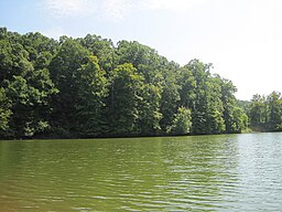
Bull Shoals-White River State Park is a 732-acre (296 ha) Arkansas state park in Baxter and Marion Counties, Arkansas in the United States. Containing one of the nation's best trout-fishing streams, the park entered the system in 1955 after the United States Army Corps of Engineers built Bull Shoals Dam on the White River. The park runs along the shoreline of Bull Shoals Lake and the White River above and below the dam, and contains picnic areas, a marina, boat rentals, interpretive programs, and a visitors' center with gift shop.

Cane Creek State Park

Cane Creek State Park is a 2,053-acre (831 ha) Arkansas state park in Lincoln County, Arkansas in the United States. Straddling the Gulf Coastal Plain and the Mississippi Delta, the park includes the 1,675-acre (678 ha) Cane Creek Lake, a wooded lake which borders Bayou Bartholomew, the world's longest bayou. The park became a reality when the U.S. Department of Agriculture’s Soil Conservation Service said it would provide federal funds to the project in 1973, prompting the Arkansas Game and Fish Commission (AGFC) to pledge to build and maintain the lake within the park. The park is characterized by rolling wooded hills, deep draws, and steeply sloping ridges.

Robbers Cave State Park

Robbers Cave State Park is a state park in Latimer County, Oklahoma. It is located 5 miles (8.0 km) north of Wilburton, Oklahoma, on State Highway 2. Originally named Latimer State Park, it received its current name in 1936. It is located in the scenic, hilly woodlands of the Sans Bois Mountains of southeast Oklahoma. This park is a favorite of rappellers, equestrians, hikers and outdoor lovers. The park and adjoining wildlife management area covers more than 8,000 acres (3,200 ha) and includes three lakes. It offers visitors acres of discovery and enjoyment including trout fishing in season, boating, hunting, mountain biking, trails for hikers and horses, sandstone cliffs for climbing and rappelling, and fall foliage viewing. In addition, Robbers Cave is historically notable as a former hideout for infamous outlaws Belle Starr and Jesse James.

Moraine State Park

Moraine State Park is a Pennsylvania state park on 16,725 acres (6,768 ha) in Brady, Clay, Franklin, Muddy Creek, and Worth townships in Butler County, Pennsylvania, in the United States.

Whiteshell Provincial Park provincial park in Manitoba

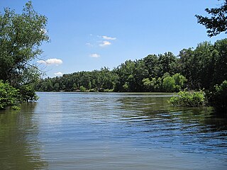
Whiteshell Provincial Park is a 2,721 km2 park centrally located in Canada in the province of Manitoba. It is found in the southeast region of the province along the Manitoba-Ontario boundary, approximately 130 km east of the city of Winnipeg. The park is located in the Canadian Shield region and has many rivers, remote lakes, boreal forest and bare granite ridges. It has rare archeological sites of petroforms on flat granite ridges. The park is used year-round for nature-oriented recreation activities.

Three Rivers Park District

Three Rivers Park District is a special park district serving the suburban areas of the Twin Cities including suburban Hennepin, Carver, Dakota, Scott and Ramsey counties. Three Rivers's mission is "To promote environmental stewardship through recreation and education in a natural resources-based park system." Three Rivers operates twenty parks and ten regional trails, with at least two more regional trails planned. Nearly seven million people visit Three Rivers facilities each year.

DeGray Lake Resort State Park

DeGray Lake Resort State Park is a 984-acre (398 ha) Arkansas state park in Clark and Hot Spring counties, Arkansas in the United States. Situated in the Ouachita Mountains, the park features the 13,800-acre (5,600 ha) DeGray Lake, the park features a championship rated 18 hole golf course and Arkansas's only state park resort. The United States Army Corps of Engineers began constructing DeGray Dam on the Caddo River in 1963, and support for a state park began growing shortly after. The park was created in 1974, and the resort and golf course were added by 1975.

French Creek State Park

French Creek State Park is a 7,526-acre (3,046 ha) Pennsylvania state park in North Coventry and Warwick Townships in Chester County and Robeson and Union Townships in Berks County, Pennsylvania in the United States. It straddles northern Chester County and southern Berks County along French Creek. It is located in the Hopewell Big Woods. The park is the home of two lakes: Hopewell Lake, a 68-acre (28 ha) warm water lake, and Scotts Run Lake, a 22-acre (8.9 ha) cold water lake. The state record smallmouth bass was caught in Scotts Run Lake. There are extensive forests, and almost 40 miles (64 km) of hiking and equestrian trails. The park is also friendly to mountain bikers, having some renowned technical trails. Hopewell Furnace National Historic Site, which features a cold blast furnace restored to its 1830s appearance, is surrounded by the park. The Six Penny Day Use Area and Group Camp are listed on the National Register of Historic Places. French Creek State Park is located off of Pennsylvania Route 345 to the south of Birdsboro.

Marsh Creek State Park

Marsh Creek State Park is a 1,705 acres (690 ha) Pennsylvania state park in Upper Uwchlan and Wallace Townships, Chester County, Pennsylvania in the United States. The park is the location of the 535-acre (217 ha) man-made Marsh Creek Lake. With an average depth of 40 feet, the lake is stocked with fish and is a stop for migrating waterfowl. Marsh Creek State Park is 2 miles (3.2 km) west of Eagle on Pennsylvania Route 100. Park road hours 8:00 am until sunset. All other access open 24 hours.

Warriors Path State Park

Warriors' Path State Park is a 950 acre (3.84 km²) Tennessee State Park in Colonial Heights, Kingsport, Sullivan County, Tennessee, in the United States. It is named for the Great Indian Warpath that was used by the Iroquois in war raids with the Cherokee and other tribes. The park is located around the Fort Patrick Henry Reservoir and Duck Island on the South Fork Holston River. This land was acquired from the Tennessee Valley Authority in 1952.

Geography of Arkansas

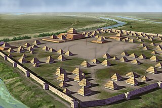
The geography of Arkansas varies widely. The state is covered by mountains, river valleys, forests, lakes, and bayous in addition to the cities of Arkansas. Hot Springs National Park features bubbling springs of hot water, formerly sought across the country for their healing properties. Crowley's Ridge is a geological anomaly rising above the surrounding lowlands of the Mississippi embayment.

Devils Den State Park Arkansas state park in Washington County, near West Fork, Arkansas in the United States

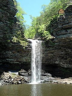
Devil's Den State Park is a 2,500-acre (1,000 ha) Arkansas state park in Washington County, near West Fork, Arkansas in the United States. The park was built by the Civilian Conservation Corps, beginning in 1933. Devil's Den State Park is in the Lee Creek Valley in the Boston Mountains, which are the southwestern part of The Ozarks. The park, with an 8 acres (3.2 ha) CCC-built lake, is open for year-round recreation, with trails for hiking, mountain biking and horseback riding. Devil's Den State Park also has several picnic areas, a swimming pool and cabins, with camping sites ranging from modern to primitive. Fossils of coral and crinoids can be found along the banks and within Lee Creek at Devil's Den State Park.

Lake Poinsett State Park

Lake Poinsett State Park is a 132-acre (53 ha) Arkansas state park on Crowley's Ridge in Poinsett County, Arkansas in the United States. The park was formed after the damming of Distress Creek to create a recreational lake in the county in 1960. The park is located along the western bank of the lake and is open for year-round for camping/picnicking. Boat rentals are available from February to November.

Mount Magazine State Park state park in Arkansas

Mount Magazine State Park is a 2,234-acre park located in Logan County, Arkansas. Inhabited since the 1850s, Mount Magazine first became part of the Ouachita National Forest in 1938, was re-designated as part of the Ozark National Forest in 1941, and became a state park after a 22-year conversion process from the U.S. Forest Service to the Arkansas Department of Parks and Tourism. Mount Magazine State Park is the highest park in Arkansas. The park contains Mossback Ridge, including the peak of Mount Magazine which contains The Lodge at Mount Magazine, cabins, trails, and a hang gliding area.

Lake Charles State Park

Lake Charles State Park is a 140-acre (57 ha) Arkansas state park in Lawrence County, Arkansas in the United States. Situated in The Ozarks along the Black River, the park features the 645-acre (261 ha) artificial Lake Charles. The lake is a result of a partnership of four agencies to construct a multipurpose lake just north of Shirey Bay Rainey Brake Wildlife Management Area in an effort to control flooding and preserve the watershed. Construction on the lake began in 1964, and the park was dedicated in 1967.

References

  1. 1 2 3 Staff of the Arkansas Department of Parks and Tourism (May 12, 2012). "Village Creek State Park". The Encyclopedia of Arkansas History and Culture. The Butler Center. Retrieved January 15, 2012.
  2. 1 2 3 Staff (2012). "Village Creek State Park" (PDF). Retrieved July 8, 2012.
  3. "Village Creek State Park". Arkansas State Parks Guide, 2011. Arkansas Department of Parks and Tourism. p. 44. Retrieved July 8, 2012.