Dardanelle is a city in northeast Yell County, Arkansas, United States. The population was 4,517 at the 2020 census. Along with Danville, it serves as a county seat for Yell County. It is located near Lake Dardanelle.

Beaver Lake is a man-made reservoir in the Ozark Mountains of Northwest Arkansas and is formed by a dam across the White River. Beaver Lake has some 487 miles (784 km) of shoreline. With towering limestone bluffs, natural caves, and a wide variety of trees and flowering shrubs, it is a popular tourist destination. Beaver Lake is the source of drinking water in Northwest Arkansas, which is managed, treated and sold by Beaver Water District, serving more than 450,000 customers. One out of 7 people in Arkansas get their drinking water from Beaver Lake.
The Ozark – St. Francis National Forest is a United States National Forest that is located in the state of Arkansas. It is composed of two separate forests, Ozark National Forest in the Ozark Mountains; and St. Francis National Forest on Crowley's Ridge. Each forest has distinct biological, topographical, and geological differences.

Table Rock Lake is an artificial lake or reservoir in the Ozarks of southwestern Missouri and northwestern Arkansas in the United States. Designed, built and operated by the U.S. Army Corps of Engineers, the lake is impounded by Table Rock Dam, which was constructed from 1954 to 1958 on the White River.

Oak Mountain State Park is a public recreation area located approximately 20 miles (32 km) south of Birmingham in the northeast quadrant of the city of Pelham, Alabama, United States. It is the state's largest state park at 9,940 acres (4,020 ha) and is home to the Alabama Wildlife Center, Oak Mountain Interpretive Center, and Oak Mountain BMX Track. Park activities include hiking, running, mountain biking, swimming, camping, fishing, horseback riding, and golf. The park is managed by the Alabama Department of Conservation and Natural Resources.
Summit Metro Parks is a Metroparks system serving the citizens of Summit County, Ohio by managing 14,000 acres (5,700 ha) in 16 developed parks, six conservation areas and more than 150 miles (240 km) of trails, with 22.4 miles (36.0 km) of the Ohio & Erie Canal Towpath Trail.
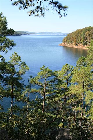
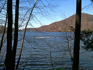
Lake Ouachita is a reservoir created by the damming of the Ouachita River by Blakely Mountain Dam.

Whitewater Memorial is the sixteenth state park in Indiana. It is located 47 miles (76 km) in Union County, Indiana, west-southwest of Dayton, Ohio. At 23,000 acres (93 km2), it is the third-largest state park in Indiana; its seventeen miles (27 km) stretches between Brookville, Indiana, and Liberty, Indiana, paralleled by Indiana State Road 101. The park was established as a memorial to those American soldiers who lost their lives in World Wars I and II. The park receives about 240,000 visitors annually.

The Metacomet-Monadnock Trail is a 114-mile-long (183 km) hiking trail that traverses the Metacomet Ridge of the Pioneer Valley region of Massachusetts and the central uplands of Massachusetts and southern New Hampshire. Although less than 70 miles (110 km) from Boston and other large population centers, the trail is considered remarkably rural and scenic and includes many areas of unique ecologic, historic, and geologic interest. Notable features include waterfalls, dramatic cliff faces, exposed mountain summits, woodlands, swamps, lakes, river floodplain, farmland, significant historic sites, and the summits of Mount Monadnock, Mount Tom and Mount Holyoke. The Metacomet-Monadnock Trail is maintained largely through the efforts of the Western Massachusetts Chapter of the Appalachian Mountain Club (AMC). Much of the trail is a portion of the New England National Scenic Trail.
Clark State Forest, located just north of Henryville, Indiana in the United States, is Indiana's oldest state forest, formed in 1903 as a forest research facility and a nursery and later expanded by the Works Progress Administration. Originally 2,028 acres (8 km2) of total land area, it is now almost 24,000 acres (100 km2) and is bisected by Interstate 65. It features three trails used exclusively for hikers trails: two internal trails, and the 59-mile (95 km) Knobstone Trail. There are nine horse trails, and five miles (8 km) of mountain bike trails. Two nature preserves are also situated within the forest. The forest also contains a 100-yard (91 m) outdoor gun range.

Susquehannock State Park is a Pennsylvania state park on 224 acres (91 ha) in Drumore Township, Lancaster County, Pennsylvania in the United States. The park is on a scenic plateau overlooking the Susquehanna River and Conowingo Reservoir. The park is named for the Susquehannock people, who lived in the area. Susquehannock State Park is located on small roads a few miles south of Pennsylvania Route 372 and west of Pennsylvania Route 272. The nearest city is Quarryville, Pennsylvania, about 12 miles (19 km) East.
There are five county parks in Collin County, Texas.

Bald Eagle State Park is a 5,900-acre (2,388 ha) Pennsylvania state park in Howard, Liberty, and Marion townships in Centre County, Pennsylvania in the United States. The park includes the Foster Joseph Sayers Reservoir, formed by damming Bald Eagle Creek and other smaller streams and covering 1,730 acres (700 ha). Bald Eagle State Park is at the meeting point of two distinct geologic features. The Allegheny Plateau is to the north and the Ridge and Valley area of Pennsylvania is to the south. The park is in the Bald Eagle Valley off Pennsylvania Route 150 in Howard, between Milesburg and Lock Haven.
Big Ridge State Park is a state park in Union County, Tennessee, in the southeastern United States. The park consists of 3,687 acres (14.92 km2) on the southern shore of the Norris Reservoir, an impoundment of the Clinch River created by the completion of Norris Dam in 1936. Much of the park's recreational focus is on Big Ridge Lake, a 45-acre (0.18 km2) sub-impoundment of Norris near the center of the park.

Pinckney State Recreation Area is a Michigan state recreation area in Dexter, Sylvan and Lyndon Townships, Washtenaw County and Putnam and Unadilla Townships, Livingston County in the U.S. state of Michigan. The park is 11,000 acres (4,500 ha) and sits at an elevation of 922 feet (281 m). The park is connected to the nearby Waterloo State Recreation Area by the 35-mile (56 km) Waterloo–Pinckney Trail. Pinckney State Recreation Area is open for year-round recreation including hiking, fishing, swimming, hunting and a variety of winter sports.
The Lillinonah Trail is a 5.9-mile (9.5 km) Blue-Blazed hiking trail "system" in the lower Housatonic River valley in Fairfield County and, today, is entirely in Newtown. Most of the trail is in the upper block of Paugussett State Forest.

Okmulgee Park is a city park in Okmulgee, Oklahoma in the United States. The park contains 1,075 acres (435 ha) and sits at an elevation of 758 feet (231 m). The park is adjacent to Dripping Springs Park and is located on Okmulgee Lake. Okmulgee Park, a municipal park established in 1963, is open for year-round recreation including camping, fishing, swimming and hiking.

Lake Frierson State Park is a 114-acre (46 ha) Arkansas state park on Crowley's Ridge in Greene County, eastern Arkansas.

Winchell Trail is a five-mile (8 km) round trip, pedestrian-only trail in Minneapolis, Minnesota, United States, that runs along the west side of the Mississippi River between Franklin Avenue South and East 44th Street. Popular with bird watchers and naturalists, the rustic trail provides Upper Mississippi River gorge access and views. The trail is separate from the adjacent multi-use bicycle path, taking hikers past sandy beaches, an oak savanna restoration project, and the floodplain forest. The trail has multiple access points and the section from East 38th Street to East 44th Street is paved. Described as moderate and for all hiking skill levels, the out-and-back Winchell Trail has total elevation gain of 501 feet (153 m). Portions of the trail can be hiked in near solitude as its age and general destitute make it a widely forgotten place to explore.
Lake Whitney State Park is a state park located in Hill County, Texas, near Whitney, Texas. The park is 775 acres (314 ha).