
The Ouachita Mountains, simply referred to as the Ouachitas, are a mountain range in western Arkansas and southeastern Oklahoma. They are formed by a thick succession of highly deformed Paleozoic strata constituting the Ouachita Fold and Thrust Belt, one of the important orogenic belts of North America. The Ouachitas continue in the subsurface to the northeast, where they make a poorly understood connection with the Appalachians and to the southwest, where they join with the Marathon uplift area of West Texas. Together with the Ozark Plateaus, the Ouachitas form the U.S. Interior Highlands. The highest natural point is Mount Magazine at 2,753 feet (839 m).
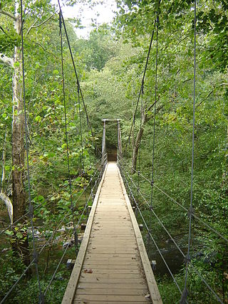
Eno River State Park is a 4,319-acre (17.48 km2) North Carolina state park in Durham and Orange Counties, North Carolina. Together with the adjoining West Point on the Eno city park, the two parks preserve over 14 miles (22.5 km) of the Eno River and surrounding lands.

Trail Ridge Road is the name for the 48-mile (77 km) stretch of U.S. Highway 34 that traverses Rocky Mountain National Park from Estes Park, Colorado in the east to Grand Lake, Colorado in the west. Together with the connecting 6.9-mile (11 km) Beaver Meadow Road, Trail Ridge Road forms the 55-mile (89 km) Trail Ridge Road/Beaver Meadow National Scenic Byway, an All-American Road. With a high point at 12,183 feet (3,713 m) elevation, Trail Ridge Road is the highest continuous paved road in North America. The higher portion of Trail Ridge Road is closed from October to May.

Hudson Highlands State Park is a non-contiguous state park in the U.S. state of New York, located on the east side of the Hudson River. The park runs from Peekskill in Westchester County, through Putnam County, to Beacon in Dutchess County, in the eastern section of the Hudson Highlands.
The Arkansas Arboretum is a 71-acre (29 ha) arboretum within Pinnacle Mountain State Park in Little Rock, Arkansas, United States. Situated below Pinnacle Mountain along the Little Maumelle River, the arboretum's flora and tree plantings correspond to Arkansas's six geographical regions, ranging from the flat-topped hills and steep valleys of the Ozark Plateau to the flat bottomland and tallgrass prairies of the Mississippi alluvial plain, with a 0.6-mile (1 km) paved interpretive trail.

Cougar Mountain Regional Wildland Park is a regional park in King County, Washington, near the towns of Bellevue and Issaquah. The park was established in June 1983 to protect the central core of Cougar Mountain, the park covers 3,115 acres (12.61 km2) with 38 miles (61 km) of hiking trails and 12 miles (19 km) of equestrian trails.

Blue Knob State Park is a 6,128-acre (2,480 ha) Pennsylvania state park in Kimmel, Lincoln, and Pavia townships in Bedford County, Pennsylvania, in the United States. The average annual snowfall at the park is about 12 feet (370 cm). The park is named for Blue Knob, the second highest mountain in Pennsylvania at 3,146 feet (959 m). It is the location of Blue Knob All Seasons Resort, the ski slope in Pennsylvania with the highest elevation. Blue Knob State Park is just off Interstate 99 on Pennsylvania Route 869 west of Pavia.
Mount Blue is a mountain in Maine, USA. It is a hiking destination with outstanding views from the observation deck of a tower at the summit. Its name is shared with Mount Blue State Park in Weld and Mount Blue High School in Farmington.
Ouachita National Recreation Trail is a 223-mile (359 km) long, continuous hiking trail through the Ouachita Mountains of Oklahoma and Arkansas. It is the longest backpacking trail in the Ouachita National Forest, spanning 192 miles across its length. Approximately 177 miles of the trail is in Arkansas and 46 miles of the trail is in Oklahoma. The trail is used by hikers, backpackers, hunters, and mountain bikers. It is a non-motorized single track trail open only to foot traffic and partially open to mountain bicycles. Segments opened to mountain bikes are from the western terminus of the Ouachita Trail at Talimena State Park to the Big Cedar trailhead on US Highway 259 at approximately Mile Marker (MM) 30.5 in Oklahoma, and from the Talimena Scenic Drive Trailhead at MM 54.1, east to Highway 7 at mile 160.4, north of Jessieville, Arkansas.

Kaaterskill High Peak is one of the Catskill Mountains, located in the Town of Hunter in Greene County, New York, United States. It was once believed to be the highest peak in the entire range, but its summit, at 3,655 feet (1,114 m) in elevation, places it only 23rd among the Catskill High Peaks. It is, however, the fourth most prominent peak in the range. Due to its situation as the easternmost High Peak, its summit is just outside the watersheds of New York City's reservoirs in the region.
Prompton State Park is a Pennsylvania state park on 2,000 acres (809 ha) in Clinton and Dyberry Townships, Wayne County, Pennsylvania in the United States. This park, which was established in 1962, is officially listed by the Pennsylvania Department of Conservation and Natural Resources as being undeveloped. This means that it is officially a state park but the PA-DCNR is not currently managing the park. However, the lands of the park are open to visitors. Friends of Prompton State Park, a grassroots organization is working to take over management of the park in much the same way that Salt Springs State Park in Susquehanna County is managed by The Friends of Salt Springs Park. Northeast Sports Ltd. of Honesdale sponsors several outdoor sports events that are held at the park. Prompton State Park is 4.2 miles (6.8 km) west of Honesdale on Pennsylvania Route 170.

Natural Steps is an unincorporated census-designated place in Pulaski County, Arkansas, United States. It is located 18 miles (29 km) northwest of Little Rock along the southern bank of the Arkansas River, on Arkansas Highway 300. Per the 2020 census, the population was 413. Today, it is a small farming community with scattered businesses. Most of the natural steps, a geologic formation, still stand today and are used as a marker for river runners. The Natural Steps are not open to the public for viewing.

Table Rock State Park is a 3,083-acre (12.48 km2) park at the edge of the Blue Ridge Mountains in northern Pickens County, South Carolina. The park includes Pinnacle Mountain, the tallest mountain totally within the state.

Totoket Mountain, with a high point of (est.) 720 ft (220 m) above sea level, is a traprock massif with several distinct summits, located 7 mi (11 km) northeast of New Haven, Connecticut. It is part of the Metacomet Ridge that extends from the Long Island Sound near New Haven, north through the Connecticut River Valley of Massachusetts to the Vermont border. Totoket Mountain is known for its 500 ft-high (150 m) scenic cliffs, microclimate ecosystems, rare plant communities, and for Lake Gaillard, a 2.5 mi-wide (4.0 km) public reservoir nearly enclosed by the mountain. The north ridge of Totoket Mountain is traversed by the 50 mi (80 km) Mattabesett Trail and a significant network of shorter trails. The name "Totoket Mountain" applies to both the entire mountain and to a subordinate northwestern peak.
Higby Mountain or Mount Higby 892 feet (272 m), is a traprock mountain ridge located 3.75 miles (6.04 km) east of Meriden, Connecticut. It is part of the narrow, linear Metacomet Ridge that extends from Long Island Sound near New Haven, Connecticut, north through the Connecticut River Valley of Massachusetts to the Vermont border. Higby Mountain is known for its high cliff faces, unique microclimate ecosystems, and rare plant communities. It rises steeply 600 feet (180 m) above the Quinnipiac River valley and the city of Meriden to the west as a continuous 2-mile (3 km) long ledge. The mountain is traversed by the 50-mile (80 km) Mattabesett Trail.

The Roundtop Trail is an American hiking trail in Sevier County and Blount County sections of the Great Smoky Mountains National Park. The trail traverses the crest of Roundtop, a 3,077-foot (938 m) mountain that straddles the park's northern boundary. This trail, which passes through a thick forest of pine and oak and provides vistas of the valleys to the north and the mountains to the south, is one of the least-used trails in the park.

The Sugarland Mountain Trail is an American hiking trail, in the Great Smoky Mountains National Park of Sevier County, Tennessee. The trail traverses Sugarland Mountain, a massive ridge running perpendicular to the main crest of the Smokies and effectively dividing the park's north-central section from its northwestern section. Sugarland Mountain is flanked by the deep upper valleys of two of the park's major watersheds— the West Fork of the Little Pigeon River and Little River. The trail passes through several forest types, including deciduous forest at lower elevations, heaths ("hells") along the mountain's backbone formations, and a stand of Southern Appalachian spruce-fir forest in the upper elevations. Occasional breaks in the foliage allow for views of Mount Le Conte and Sevier County to the east and Blanket Mountain and the ridges above Elkmont to the west.

Brace Mountain is the peak of a ridge in the southern Taconic Mountains, near the tripoint of the U.S. states of New York, Connecticut and Massachusetts. Its 2,311-foot (704 m) main summit is located in New York; it is the highest point in that state's Dutchess County.

Highway 300 is a designation for two state highway segments in Central Arkansas. The main route of 34.11 miles (54.89 km) runs from Highway 9 and Highway 10 east to Highway 10 in Little Rock. A second segment runs 1.45 miles (2.33 km) east from Interstate 430 as Colonel Glenn Road.

Pinnacle Mountain is a 1,011-foot summit and the second highest natural point in Pulaski County, Arkansas; it is also the primary attraction of the 2,356-acre Pinnacle Mountain State Park. Located in the foothills of the Ouachita Mountains approximately 13 miles northwest of downtown Little Rock, Pinnacle Mountain is one of the most iconic landforms of the U.S. Interior Highlands.


