
Colorado is a landlocked state in the Western United States. It is one of the Mountain states, sharing the Four Corners region with Arizona, New Mexico, and Utah. It is also bordered by Wyoming to the north, Nebraska to the northeast, Kansas to the east, and Oklahoma to the southeast. Colorado is noted for its landscape of mountains, forests, high plains, mesas, canyons, plateaus, rivers, and desert lands. It encompasses most of the Southern Rocky Mountains, as well as the northeastern portion of the Colorado Plateau and the western edge of the Great Plains. Colorado is the eighth most extensive and 21st most populous U.S. state. The United States Census Bureau estimated the population of Colorado at 5,877,610 as of July 1, 2023, a 1.80% increase since the 2020 United States census.

The Rocky Mountains, also known as the Rockies, are a major mountain range and the largest mountain system in North America. The Rocky Mountains stretch 3,000 miles in straight-line distance from the northernmost part of Western Canada, to New Mexico in the Southwestern United States. Depending on differing definitions between Canada and the U.S., its northern terminus is located either in northern British Columbia's Terminal Range south of the Liard River and east of the Trench, or in the northeastern foothills of the Brooks Range/British Mountains that face the Beaufort Sea coasts between the Canning River and the Firth River across the Alaska-Yukon border. Its southernmost point is near the Albuquerque area adjacent to the Rio Grande rift and north of the Sandia–Manzano Mountain Range. Being the easternmost portion of the North American Cordillera, the Rockies are distinct from the tectonically younger Cascade Range and Sierra Nevada, which both lie farther to its west.

Mountain Dew, stylized as Mtn Dew in some countries, is a soft drink brand, produced and owned by PepsiCo. The original formula was invented in 1940 by Tennessee beverage bottlers Barney and Ally Hartman. A revised formula was created by Bill Bridgforth in 1958. The rights to this formula were obtained by the Tip Corporation of Marion, Virginia. William H. "Bill" Jones of the Tip Corporation further refined the formula, launching that version of Mountain Dew in 1961. In August 1964, the Mountain Dew brand and production rights were acquired from Tip by the Pepsi-Cola company, and the distribution expanded across the United States and Canada.

The Cascade Range or Cascades is a major mountain range of western North America, extending from southern British Columbia through Washington and Oregon to Northern California. It includes both non-volcanic mountains, such as many of those in the North Cascades, and the notable volcanoes known as the High Cascades. The small part of the range in British Columbia is referred to as the Canadian Cascades or, locally, as the Cascade Mountains. The highest peak in the range is Mount Rainier in Washington at 14,411 feet (4,392 m).

The White Mountains are a mountain range covering about a quarter of the state of New Hampshire and a small portion of western Maine in the United States. They are a subrange of the northern Appalachian Mountains and the most rugged mountains in New England. Several of the higher peaks contain an Alpine tundra. The range is heavily visited due to its proximity to Boston, New York City, and Montreal.

Mount Hood, also known as Wy'east, is an active stratovolcano in the Cascade Range and is a member of the Cascade Volcanic Arc. It was formed by a subduction zone on the Pacific Coast and rests in the Pacific Northwest region of the United States. It is located about 50 mi (80 km) east-southeast of Portland, on the border between Clackamas and Hood River counties, and forms part of the Mount Hood National Forest. Much of the mountain outside the ski areas is part of the Mount Hood Wilderness. With a summit elevation of 11,249 ft, it is the highest mountain in the U.S. state of Oregon and is the fourth highest in the Cascade Range. Ski areas on the mountain include Timberline Lodge ski area which offers the only year-round lift-served skiing in North America, Mount Hood Meadows, Mount Hood Skibowl, Summit Ski Area, and Cooper Spur ski area. Mt. Hood attracts an estimated 10,000 climbers a year.

Denali is the highest mountain peak in North America, with a summit elevation of 20,310 feet (6,190 m) above sea level. It is the tallest mountain in the world from base-to-peak on land, measuring 18,000 ft (5,500 m), with a topographic prominence of 20,194 feet (6,155 m) and a topographic isolation of 4,621.1 miles (7,436.9 km), Denali is the third most prominent and third-most isolated peak on Earth, after Mount Everest and Aconcagua. Located in the Alaska Range in the interior of the U.S. state of Alaska, Denali is the centerpiece of Denali National Park and Preserve.

The Green Mountains are a mountain range in the U.S. state of Vermont and are a subrange of the Appalachian Mountains. The range runs primarily south to north and extends approximately 250 miles (400 km) from the border with Massachusetts to the border with Quebec, Canada. The part of the same range that is in Massachusetts and Connecticut is known as The Berkshires or the Berkshire Hills and the Quebec portion is called the Sutton Mountains, or Monts Sutton in French.
The Reedy Glacier is a major glacier in Antarctica, over 100 nautical miles long and 6 to 12 nautical miles wide, descending from the polar plateau to the Ross Ice Shelf between the Michigan Plateau and Wisconsin Range in the Transantarctic Mountains. It marks the limits of the Queen Maud Mountains on the west and the Horlick Mountains on the east.
Lillie Glacier is a large glacier in Antarctica, about 100 nautical miles long and 10 nautical miles wide. It lies between the Bowers Mountains on the west and the Concord Mountains and Anare Mountains on the east, flowing to Ob' Bay on the coast and forming the Lillie Glacier Tongue.
Tucker Glacier is a major valley glacier of Victoria Land, Antarctica, about 90 nautical miles long, flowing southeast between the Admiralty Mountains and the Victory Mountains to the Ross Sea. There is a snow saddle at the glacier's head, just west of Homerun Range, from which the Ebbe Glacier flows northwestward.

The Usarp Mountains are a major mountain range in North Victoria Land, Antarctica. They are west of the Rennick Glacier and trend north to south for about 190 kilometres (118 mi). The mountains are bounded to the north by Pryor Glacier and the Wilson Hills. They are west of the Bowers Mountains.
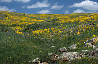
Wichita Mountains Wildlife Refuge, located in southwestern Oklahoma near Lawton, has protected unique wildlife habitats since 1901 and is the oldest managed wildlife facility in the United States Fish and Wildlife Service system. The refuge's location in the geologically unique Wichita Mountains and its areas of undisturbed mixed grass prairie make it an important conservation area. The Wichita Mountains are approximately 500 million years old. Measuring about 59,020 acres (238.8 km2), the refuge hosts a great diversity of species: 806 plant species, 240 species of birds, 36 fish, and 64 reptiles and amphibians are present.

The Scott Glacier is a major glacier, 120 nautical miles long, that drains the East Antarctic Ice Sheet through the Queen Maud Mountains to the Ross Ice Shelf. The Scott Glacier is one of a series of major glaciers flowing across the Transantarctic Mountains, with the Amundsen Glacier to the west and the Leverett and Reedy glaciers to the east.
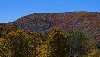
Mount Sherrill is a mountain located in Greene County, New York, and is named after Eliakim Sherrill, and is part of the Catskill Mountains. Mount Sherrill is flanked to the east by North Dome, and to the west by Balsam Mountain.
Pryor Glacier is a glacier flowing northeastward, to the north of Mount Shields and Yermak Point, into Rennick Bay. The feature is about 30 nautical miles long and forms a physical separation between Wilson Hills and Usarp Mountains.
