Maumelle, Arkansas

Last updated

Maumelle, Arkansas
Pulaski County Arkansas Incorporated and Unincorporated areas Maumelle Highlighted 0544600.svg
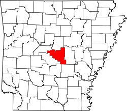
Location of Maumelle in Pulaski County, Arkansas.
Usa edcp location map.svg
Red pog.svg
Maumelle, Arkansas
Location in the United States
Coordinates: 34°51′13″N92°24′24″W / 34.85361°N 92.40667°W / 34.85361; -92.40667
Country United States
State Arkansas
County Pulaski
Founded1974
Incorporated 1985
Government
   Mayor Caleb Norris
Area
[1]
   City 13.32 sq mi (34.49 km2)
  Land12.08 sq mi (31.28 km2)
  Water1.24 sq mi (3.22 km2)
Elevation
[2]
351 ft (107 m)
Population
 (2020)
   City 19,251
  Density1,594.15/sq mi (615.50/km2)
   Metro
729,135 ('14) (Little Rock)
Time zone UTC-6 (CST)
  Summer (DST) UTC-5 (CDT)
ZIP codes
72113, 72118
Area code 501
FIPS code 05-44600
GNIS feature ID0067577 [2]
Website www.maumelle.org

Maumelle is a city in Pulaski County, Arkansas, United States. As of the 2020 census, the city's population was 19,251. The city is located northwest of Little Rock, bordering the opposite shore of the Arkansas River and is part of the Little Rock metropolitan area.

Contents

History

Maumelle was the location of the second oldest Target Corporation distribution center; the center closed in 2009. [3]

Geography

According to the United States Census Bureau, the city has a total area of 12.05 square miles (31.2 km2), of which 8.8 square miles (23 km2) is land and 0.5 square miles (1.3 km2) (5.07%) is water.

Demographics

Historical population
CensusPop.Note
1990 6,714
2000 10,55757.2%
2010 17,16362.6%
2020 19,25112.2%
U.S. Decennial Census [4]

Maumelle belongs to the Little Rock North Little Rock Conway Metropolitan Statistical Area.

2020 census

Maumelle racial composition [5]
RaceNumberPercentage
White (non-Hispanic)13,37369.47%
Black or African American (non-Hispanic)3,51318.25%
Native American 660.34%
Asian 5292.75%
Pacific Islander 50.03%
Other/Mixed 1,0075.23%
Hispanic or Latino 7583.94%

As of the 2020 United States census, there were 19,251 people, 7,383 households, and 5,184 families residing in the city.

2010 census

As of the census [6] of 2010, there were 17,163 people, 6,531 households, and 3,174 families residing in the city. The population density was 463.2/km2 (1,199.3/mi2). There were 4,294 housing units at an average density of 188.4/km2 (487.8/mi2). The racial makeup of the city was 82.9% White, 12.1% Black or African American, 0.40% Native American, 2.3% Asian, 0.01% Pacific Islander, 0.41% from other races, and 0.97% from two or more races. 1.77% of the population were Hispanic or Latino of any race.

There were 6,531 households, out of which 39.4% had children under the age of 18 living with them, 66.8% were married couples living together, 8.0% had a female householder with no husband present, and 23.1% were non-families. 19.8% of all households were made up of individuals, and 6.0% had someone living alone who was 65 years of age or older. The average household size was 2.59 and the average family size was 2.94.

The population consisted of 25.8% under the age of 18, 5.6% from 18 to 24, 35.2% from 25 to 44, 25.5% from 45 to 64, and 10.2% who were 65 years of age or older. The median age was 36 years. For every 100 females, there were 93.2 males. For every 100 females age 18 and over, there were 88.9 males.

The median income for a household in the city was $71,826, and the median income for a family was $82,122. Males had a median income of $50,220 versus $35,461 for females. The per capita income for the city was $37,453. 5.3% of the population and 1.3% of families were below the poverty line. Out of the total population, 2.7% of those under the age of 18 and 15.2% of those 65 and older were living below the poverty line.

Recreation

Maumelle has two recreational lakes, Lake Willastein and Lake Valencia, both surrounded by parkland, bicycle trails, and wooden bridges. Picnicking and fishing are available at both lakes. The Maumelle Veterans Memorial was formally dedicated on April 8, 2006, and is located on the shores of Lake Willastein.

The city has one of the most extensive municipal bicycle trail systems in Arkansas (13 miles) that offers access to wooded greenbelts.

Education

Public education is provided by the Pulaski County Special School District [7] [8] and the city is home to Pine Forest Elementary School (prekindergarten through grade 5), Maumelle Middle School (grades 6 through 8), and Maumelle High School (grades 9 through 12).

Other parts of the city are zoned to Crystal Hill Elementary. [8]

Maumelle is also served by Maumelle Charter School (K-12) inside the city limits. Central Arkansas Christian Schools, a private middle school and high school, is located two miles east of the city limits.

Public libraries

The Maumelle Public Library, located at 10 Lakepoint Drive, is part of the Central Arkansas Library System.

Infrastructure

Water in Maumelle is provided by Central Arkansas Water since March 1, 2016 [9] when it acquired the former utility. All other utilities in the county use surface water from two reservoirs tapped by Central Arkansas Water.

The 4,226-foot-long (1,288 m) Big Dam Bridge, the second-longest pedestrian bridge in the United States, is located three miles east of Maumelle along Highway 100 (Maumelle Boulevard). The 14-foot-wide (4.3 m) bridge was designed by the United States Army Corps of Engineers and rises 65 feet (20 m) above the Arkansas River and Murray Lock and Dam. It is the longest pedestrian bridge in North America originally designed and built for that purpose. Pulaski County Judge "Buddy" Villines formally opened the bridge to the public on September 30, 2006.

Notable people

Related Research Articles

<span class="mw-page-title-main">Pulaski County, Arkansas</span> County in Arkansas, United States

Pulaski County is a county in the U.S. state of Arkansas. With a population of 399,125 as of the 2020 United States Census, it is the most populous county in Arkansas. The county is included in the Little Rock–North Little Rock–Conway metropolitan area. Its county seat is Little Rock, which is also Arkansas's capital and largest city.

<span class="mw-page-title-main">Perry County, Arkansas</span> County in Arkansas, United States

Perry County is a county located in the U.S. state of Arkansas. Its population was 10,019 at the 2020 United States Census. The county seat is Perryville. The county was formed on December 18, 1840, and named for Commodore Oliver Hazard Perry, naval hero in the War of 1812. It is an alcohol prohibition or dry county.

<span class="mw-page-title-main">Conway County, Arkansas</span> County in Arkansas, United States

Conway County is a county located in the U.S. state of Arkansas. Created as Arkansas's 11th county on October 20, 1825, Conway County has four incorporated municipalities, including Morrilton, the county seat and most populous city. The county is also the site of numerous unincorporated communities and ghost towns. The county is named for Henry Wharton Conway, a politician from a powerful political family who served as the delegate from the Arkansas Territory to the U.S. Congress from 1823 to 1827.

<span class="mw-page-title-main">Briarcliff, Arkansas</span> City in Arkansas, United States

Briarcliff is a second-class city in Baxter County, Arkansas, United States. The population was 236 at the 2010 census.

<span class="mw-page-title-main">Springtown, Arkansas</span> Town in Arkansas, United States

Springtown is a town in Benton County, Arkansas, United States. The population was 83 at the 2020 census. It is part of the Northwest Arkansas region.

<span class="mw-page-title-main">Lake City, Arkansas</span> City in Arkansas, United States

Lake City is a city in Craighead County, Arkansas, United States, along the St. Francis River. Lake City is one of two county seats in Craighead County. The population was 2,326 as of the 2020 census. It is included in the Jonesboro, Arkansas Metropolitan Statistical Area.

<span class="mw-page-title-main">Anthonyville, Arkansas</span> Town in Arkansas, United States

Anthonyville is a town in Crittenden County, Arkansas, United States. The population was 161 at the 2010 census, down from 250 in 2000.

<span class="mw-page-title-main">Horseshoe Lake, Arkansas</span> Town in Arkansas, United States

Horseshoe Lake is a town in Crittenden County, Arkansas, United States. The population was 264 at the 2020 census.

<span class="mw-page-title-main">Lake Hamilton, Arkansas</span> Census-designated place in Arkansas, United States

Lake Hamilton is a census-designated place (CDP) in Garland County, Arkansas, United States. It is part of the Hot Springs Metropolitan Statistical Area. The population was 2,135 at the 2010 census. It is named after Lake Hamilton, one of the area's man-made lakes.

<span class="mw-page-title-main">White Hall, Arkansas</span> City in Arkansas, United States

White Hall is a city in Washington Township, located in Jefferson County, Arkansas, United States. With a population of 5,526 in the 2010 census, it is included in the Pine Bluff Metropolitan Statistical Area and the greater Little Rock-North Little Rock-Pine Bluff Combined Statistical Area. White Hall is home to the Pine Bluff Arsenal.

<span class="mw-page-title-main">Scott, Arkansas</span> Census-designated place in Arkansas, United States

Scott is an unincorporated community and census-designated place (CDP) in Lonoke and Pulaski counties in the central part of the U.S. state of Arkansas. Per the 2020 census, the population was 97. It is part of the Little Rock–North Little Rock–Conway Metropolitan Statistical Area.

<span class="mw-page-title-main">Hindsville, Arkansas</span> Town in Arkansas, United States

Hindsville is a town in Madison County, Arkansas, United States. The population was 90 at the 2020 census. It is part of the Northwest Arkansas region.

<span class="mw-page-title-main">St. Paul, Arkansas</span> Town in Arkansas, United States

St. Paul is a town in Madison County, Arkansas, United States. The population was 111 at the 2020 census. It is on the edge of the Northwest Arkansas region.

<span class="mw-page-title-main">Norman, Arkansas</span> Town in Arkansas, United States

Norman is a town in Montgomery County, Arkansas, United States. It was known as Womble until 1925. The population was 303 at the 2020 census, down from 378 in 2010.

<span class="mw-page-title-main">Jacksonville, Arkansas</span> City in Arkansas, United States

Jacksonville is a city in Pulaski County, Arkansas, United States, and a suburb of Little Rock. As of the 2010 census, the population of the city was 28,364. It is part of the Little Rock–North Little Rock–Conway Metropolitan Statistical Area with 729,135 people as of 2014.

<span class="mw-page-title-main">Landmark, Arkansas</span> CDP in Arkansas, United States

Landmark is a census-designated place (CDP) in Pulaski County, Arkansas, United States. Per the 2020 census, the population was 3,585. It is part of the Little Rock–North Little Rock–Conway Metropolitan Statistical Area.

<span class="mw-page-title-main">Sweet Home, Arkansas</span> Census-designated place in Pulaski County, Arkansas, USA

Sweet Home is a census-designated place (CDP) in Pulaski County, Arkansas, United States. Its population was 849 at the 2010 census. It is part of the 'Little Rock-North Little Rock-AR Metropolitan Statistical Area'.

<span class="mw-page-title-main">Woodson, Arkansas</span> CDP in Arkansas, United States

Woodson is a census-designated place (CDP) in Pulaski County, Arkansas, United States. Its population was 403 at the 2010 census. It is part of the Little Rock–North Little Rock–Conway Metropolitan Statistical Area. Woodson and its accompanying Woodson Lake and Wood Hollow are the namesake for Ed Wood Sr., a prominent plantation owner, trader, and businessman at the turn of the 20th century. Woodson is adjacent to the Wood Plantation, the largest of the plantations own by Ed Wood Sr.

<span class="mw-page-title-main">Bryant, Arkansas</span> City in Arkansas, United States

Bryant is a city in Saline County, Arkansas, United States and a suburb of Little Rock. According to the 2010 Census, the population of the city was 16,688. It is part of the Central Arkansas region.

<span class="mw-page-title-main">Shannon Hills, Arkansas</span> City in Arkansas, United States

Shannon Hills is a city in Saline County, Arkansas, United States. The population was 3,143 at the 2010 census, rising to 4,490 with the 2020 census. It is part of the Little Rock–North Little Rock–Conway Metropolitan Statistical Area.

References

  1. "2020 U.S. Gazetteer Files". United States Census Bureau. Retrieved October 29, 2021.
  2. 1 2 U.S. Geological Survey Geographic Names Information System: Maumelle, Arkansas
  3. Target Corporation. "Target Corporation Announces Workforce Reduction". investors.target.com. Target Corporation. Archived from the original on March 23, 2019. Retrieved April 10, 2018.
  4. "Census of Population and Housing". Census.gov. Retrieved June 4, 2015.
  5. "Explore Census Data". data.census.gov. Retrieved December 31, 2021.
  6. "U.S. Census website". United States Census Bureau . Retrieved January 31, 2008.
  7. "SCHOOL DISTRICT REFERENCE MAP (2010 CENSUS): Pulaski County, AR" (PDF). U.S. Census Bureau . Retrieved February 28, 2021.
  8. 1 2 "School Zone Map". Pulaski County Special School District . Retrieved March 3, 2021.
  9. "Maumelle Passes on Sewer Control" . Retrieved May 9, 2017 via PressReader.