Little Italy, Arkansas | |
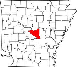
---|---|
Coordinates: 34°56′15″N92°35′10″W / 34.93750°N 92.58611°W | |
Country | United States |
State | Arkansas |
Counties | Perry Pulaski |
Townships | Big Rock Township Wye Township |
Elevation | 692 ft (211 m) |
Time zone | UTC-6 (Central (CST)) |
• Summer (DST) | UTC-5 (CDT) |
ZIP code | 72135 72016 |
Area code | +1 (501) |
GNIS feature ID | 51290 [1] |
Website | http://littleitalyarkansas.com |
Established initially as Alta Villa by Italian immigrants in 1915, [2] Little Italy is an unincorporated community in Pulaski and Perry counties in the U.S. state of Arkansas. [1] The culturally rich and historically significant village is located in high terrain along Arkansas Highway 300 amidst the northeastern foothills of the Ouachita Mountains [3] bestriding Wye Mountain [4] and Kryer Mountain. [5]
In 2015, as part of a multi-decade heritage preservation effort, Little Italy's residents unsuccessfully sought to become an incorporated municipality. [6] [7] [8] As part of that same effort to preserve its history and culture, the community opened a heritage museum in 2019. [9] With similar sentiment, Little Italy marks its important anniversaries with homecoming events and celebrations. [10] [11] Since 1927, its residents also host an annual Italian festival highlighted by a spaghetti and sausage dinner featuring original, intergenerational recipes. [12] [13] [14]
Catholic Point, Arkansas
Sunnyside Plantation, Arkansas
Tontitown, Arkansas
Arkansas is a landlocked state in the West South Central region of the Southern United States. It borders Missouri to the north, Tennessee and Mississippi to the east, Louisiana to the south, Texas to the southwest, and Oklahoma to the west. Its name derives from the Osage language, and refers to their relatives, the Quapaw people. The state's diverse geography ranges from the mountainous regions of the Ozark and Ouachita Mountains, which make up the U.S. Interior Highlands, to the densely forested land in the south known as the Arkansas Timberlands, to the eastern lowlands along the Mississippi River and the Arkansas Delta.
Washington County is a regional economic, educational, and cultural hub in the Northwest Arkansas region. Created as Arkansas's 17th county on November 30, 1848, Washington County has 13 incorporated municipalities, including Fayetteville, the county seat, and Springdale. The county is also the site of small towns, bedroom communities, and unincorporated places. The county is named for George Washington, the first President of the United States.
Pulaski County is a county in the U.S. state of Arkansas. With a population of 399,125 as of the 2020 United States Census, it is the most populous county in Arkansas. The county is included in the Little Rock–North Little Rock–Conway metropolitan area. Its county seat is Little Rock, which is also Arkansas's capital and largest city.
Perry County is a county located in the U.S. state of Arkansas. Its population was 10,019 at the 2020 United States Census. The county seat is Perryville. The county was formed on December 18, 1840, and named for Commodore Oliver Hazard Perry, naval hero in the War of 1812. It is an alcohol prohibition or dry county.
Conway County is a county located in the U.S. state of Arkansas. Created as Arkansas's 11th county on October 20, 1825, Conway County has four incorporated municipalities, including Morrilton, the county seat and most populous city. The county is also the site of numerous unincorporated communities and ghost towns. The county is named for Henry Wharton Conway, a politician from a powerful political family who served as the delegate from the Arkansas Territory to the U.S. Congress from 1823 to 1827.
Baxter County is a county in the Ozark Mountains of Arkansas. Created as Arkansas's 66th county on March 24, 1873, the county has eight incorporated municipalities, including Mountain Home, its largest city and county seat. The county is named for Elisha Baxter, the tenth governor of Arkansas. It is coterminal with the Mountain Home Micropolitan Statistical Area.
Scott is an unincorporated community and census-designated place (CDP) in Lonoke and Pulaski counties in the central part of the U.S. state of Arkansas. Per the 2020 census, the population was 97. It is part of the Little Rock–North Little Rock–Conway Metropolitan Statistical Area.
North Little Rock is a city in Pulaski County, Arkansas, United States. It is the twin city of Little Rock. The population was 64,591 at the 2020 Census, making it the seventh-most populous city in Arkansas.
Central Arkansas, also known as the Little Rock metro, designated by the United States Office of Management and Budget as the Little Rock-North Little Rock-Conway Metropolitan Statistical Area, is the most populous metro area in the U.S. state of Arkansas. With an estimated 2020 population of 748,031, it is the most populated area in Arkansas. Located at the convergence of Arkansas's other geographic regions, the region's central location make Central Arkansas an important population, economic, education, and political center in Arkansas and the South. Little Rock is the state's capital and largest city, and the city is also home to two Fortune 500 companies, Arkansas Children's Hospital, and University of Arkansas for Medical Sciences (UAMS).
Highway 5 is a designation for three state highways in Arkansas. The southern segment of runs from US 70 and US 70B in Hot Springs north to Interstate 430 (I-430) and US 70 in Little Rock.
Arkansas Highway 10 is an east–west state highway in West Arkansas. The route runs 135.41 miles (217.92 km) from Oklahoma State Highway 120 near Hackett east to Interstate 30 in Little Rock, the state's capitol. The highway serves both the Fort Smith metropolitan area and the Little Rock – North Little Rock – Conway metropolitan area.
Little Rock is the capital and most populous city of the U.S. state of Arkansas. The city's population was 202,591 as of the 2020 census. The six-county Little Rock metropolitan area is the 81st-most populous in the United States with 748,031 residents according to the 2020 census.
Annabelle Davis Clinton Imber Tuck is an American lawyer who served as an associate justice of the Arkansas Supreme Court for thirteen years. The first woman elected to the Arkansas Supreme Court, Imber is best known for a case she handled while she was a chancery judge in the 6th Judicial District.
The Arkansas River Valley is a region in Arkansas defined by the Arkansas River in the western part of the state. Generally defined as the area between the Ozark and Ouachita Mountains, the River Valley is characterized by flat lowlands covered in fertile farmland and lakes periodically interrupted by high peaks. Mount Magazine, Mount Nebo, and Petit Jean Mountain compose the Tri-Peaks Region, a further subdivision of the River Valley popular with hikers and outdoors enthusiasts. In addition to the outdoor recreational activities available to residents and visitors of the region, the River Valley contains Arkansas's wine country as well as hundreds of historical sites throughout the area. It is one of six natural divisions of Arkansas.
Highway 300 is a designation for two state highway segments in Central Arkansas. The main route of 34.11 miles (54.89 km) runs from Highway 9/Highway 10 east to Highway 10 in Little Rock. A second segment runs 1.45 miles (2.33 km) east from Interstate 430 as Colonel Glenn Road.
East End School District (EESD) is a public school district based in Bigelow, Arkansas, United States. The school district supports more than 650 students in prekindergarten through grade 12 in the 2010–11 school year by employing more than 95 faculty and staff on a full time equivalent basis for its two schools.
The following is a timeline of the history of the city of Little Rock, Arkansas, US.
There was a historical trend of immigration of Italians into the U.S. state of Arkansas in the 19th and 20th centuries.
Highway 338 is an east–west state highway in Pulaski County, Arkansas. The highway begins at Highway 5 in Little Rock and runs east, crossing three Interstate highways before terminating at Highway 365 in Sweet Home. It is maintained by the Arkansas Department of Transportation (ArDOT). The designation was also applied to a section of Roosevelt Road in Little Rock near Clinton National Airport between 1973 and 1981.