State Scenic Highway System (California)

Last updated

State Scenic Highway System
California Scenic State.svg California Scenic.svg
State Scenic Highway System signage
Highway names
Interstates Interstate XX (I-XX)
US Highways U.S. Route XX (US XX)
State State Route XX (SR XX)
System links

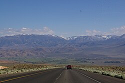
The State Scenic Highway System in the U.S. state of California is a list of highways, mainly state highways, that have been designated by the California Department of Transportation (Caltrans) as scenic highways. They are marked by the state flower, a California poppy, inside either a rectangle for state-maintained highways or a pentagon for county highways. [1] [2]

Contents

The California State Legislature makes state highways eligible for designation as a scenic highway, listing them in the Article 2.5 of Chapter 2 of Division 1 of the California Streets and Highways Code. [3] For a highway to then be declared scenic by Caltrans, the local government with jurisdiction over abutting land must adopt a "scenic corridor protection program" that limits development, outdoor advertising, and earthmoving, and Caltrans must agree that it meets the criteria. The desire to create such a designation has at times been in conflict with the property rights of abutters, for example on State Route 174. [4] [5]

Any county highway that is believed to have outstanding scenic qualities is considered eligible, and the county with jurisdiction must follow Caltrans' same approval process as state highways to be declared scenic. [1]

California Historic Parkways

Entering the Arroyo Seco Parkway in Pasadena WelcomeToTheHistoricArryoSecoParkway.jpg
Entering the Arroyo Seco Parkway in Pasadena
The Cabrillo Freeway, looking south from the Cabrillo Bridge in Balboa Park Cabrillo Freeway from Cabrillo Bridge.jpg
The Cabrillo Freeway, looking south from the Cabrillo Bridge in Balboa Park

California Historic Parkways are defined in the Streets and Highways Code, sections 280–284, as a subset of the State Scenic Highway System. Such historic parkways must have been constructed prior to 1945, and have been determined by either Caltrans or the Office of Historic Preservation in the California Department of Parks and Recreation to have historical significance. They must not at time of designation be traversed by more than 40,000 vehicles per day on an annual daily average basis. They also must be "bounded on one or both sides by federal, state, or local parkland, Native American lands or monuments, or other open space, greenbelt areas, natural habitat or wildlife preserves, or similar acreage used for or dedicated to historical or recreational uses". [3]

List of eligible and designated scenic state highways

SR 1 and State Scenic Highway markers California State Route 1 All American Road sign.jpg
SR 1 and State Scenic Highway markers
SR 2 entering Angeles National Forest from the south Entering Angeles National Forest on SR2 from the south 2014.jpg
SR 2 entering Angeles National Forest from the south
Subalpine meadow at SR 4/Ebbetts Pass Ebbetts Pass 04 (4894171880).jpg
Subalpine meadow at SR 4/Ebbetts Pass
SR 24 running through Lafayette, with Mount Diablo in the distance View of Mount Diablo and CA Highway 24 from Lafayette Heights.jpg
SR 24 running through Lafayette, with Mount Diablo in the distance
View northeast from near Pine Mountain Summit on SR 33 SR33-Pinos.JPG
View northeast from near Pine Mountain Summit on SR 33
SR 49 through the historic mining community of Downieville. Downieville, California, at Main and Commercial St., looking south.jpg
SR 49 through the historic mining community of Downieville.
View from US 50/Echo Summit towards Lake Tahoe US 50 from Echo Summit towards Lake Tahoe.jpg
View from US 50/Echo Summit towards Lake Tahoe
SR 62 and State Scenic Highway markers in Whitewater. CA62s2 20150913.jpg
SR 62 and State Scenic Highway markers in Whitewater.
SR 68 eastbound approaching the Monterey Peninsula. CA 68 approaching Monterey.jpg
SR 68 eastbound approaching the Monterey Peninsula.
SR 75/San Diego-Coronado Bridge, 2016 San Diego-Coronado Bridge by Frank Mckenna.jpg
SR 75/San Diego–Coronado Bridge, 2016
SR 78 in Anza-Borrego Desert State Park, looking east CA 78 Anza-Borrego.jpg
SR 78 in Anza-Borrego Desert State Park, looking east
SR 88 in Alpine County near Red Lake Hwy 88 near Carson snow park just past Red Lake - panoramio.jpg
SR 88 in Alpine County near Red Lake
SR 89 through Emerald Bay State Park overlooking Lake Tahoe Emerald Bay State Park - panoramio (4).jpg
SR 89 through Emerald Bay State Park overlooking Lake Tahoe
US 101 northbound near Gaviota Tunnel. The open road (4944517055).jpg
US 101 northbound near Gaviota Tunnel.
SR 116 bridge over the Russian River in Guerneville. Route 116 bridge from historic Guerneville Bridge.jpg
SR 116 bridge over the Russian River in Guerneville.
SR 154 and State Scenic Highway markers CA154w3 20150917.jpg
SR 154 and State Scenic Highway markers
SR 160 southbound about 5 miles (8.0 km) north of Rio Vista. On CA State Route 160 S 1.JPG
SR 160 southbound about 5 miles (8.0 km) north of Rio Vista.
SR 168, heading up Bishop Creek. Highway-168.jpg
SR 168, heading up Bishop Creek.
SR 190/Death Valley Scenic Byway in Death Valley National Park. Death Valley Scenic Byway, California, USA (49099071942).jpg
SR 190/Death Valley Scenic Byway in Death Valley National Park.
San Gorgonio Mountain seen from SR 243 near Banning. San gorgonio from SR 243 2010.jpg
San Gorgonio Mountain seen from SR 243 near Banning.
I-280 and State Scenic Highway markers Cal poppy scenic route sign.jpg
I-280 and State Scenic Highway markers
US 395 descending south into Owens Valley US395descending intobishop.JPG
US 395 descending south into Owens Valley
Descending from Mission Pass on I-680 northbound View from I-680 (2).jpg
Descending from Mission Pass on I-680 northbound

Designated county highways

Mulholland Highway through Leo Carrillo State Park, with Sandstone Peak in the distance Mulholland Highway.jpg
Mulholland Highway through Leo Carrillo State Park, with Sandstone Peak in the distance

See also

References

  1. 1 2 "The California Scenic Highway Program". California Department of Transportation. 2007. Archived from the original on January 8, 2008. Retrieved June 4, 2024.
  2. "CA MUTCD 2014 Revision 4". California Department of Transportation. Retrieved April 26, 2019.
  3. 1 2 3 4 "Article 2.5 of Chapter 2 of Division 1 of the California Streets and Highways Code". Sacramento: California Office of Legislative Counsel . Retrieved May 3, 2019.
  4. "Scenic Highway Concept Spurs Alarm". Sacramento Bee . March 25, 1999. p. N1.
  5. Moller, Dave (August 7, 2004). "CABPRO's Urke steps down". Union of Grass Valley .
  6. 1 2 3 4 5 6 California Department of Transportation (2017). "List of eligible and officially designated State Scenic Highways". Sacramento: California Department of Transportation. Retrieved May 2, 2019.
  7. Lech, Steve (2012). For Tourism and a Good Night's Sleep: J. Win Wilson, Wilson Howell, and the Beginnings of the Pines-to-Palms Highway. Riverside, California: Steve Lech. p. 230. ISBN   978-0-9837500-1-7.
  8. 1 2 3 4 5 6 7 8 California Department of Transportation. "List of Officially Designated County Scenic Highways" (PDF). Sacramento: California Department of Transportation. Retrieved May 2, 2019.