Santa Ysabel | |
---|---|
![]() | |
Coordinates: 33°6′33″N116°40′23″W / 33.10917°N 116.67306°W | |
Country | ![]() |
State | ![]() |
County | San Diego |
Time zone | UTC-8 (Pacific (PST)) |
• Summer (DST) | UTC-7 (PDT) |
ZIP codes | 92070 |
Area codes | 442/760 |
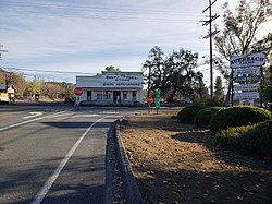
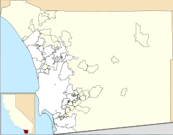
Santa Ysabel (Spanish for "St. Elizabeth") is an unincorporated community in the Santa Ysabel Valley of eastern San Diego County, California.
The 1818 Santa Ysabel Asistencia is located here, a Spanish mission asistencia (sub-mission) of Mission San Diego de Alcalá. The town site is within the former Rancho Santa Ysabel, an 1844 Mexican land grant to José Joaquín Ortega and Eduardo Stokes. In 1878, what began as the town of Santa Ysabel began with a store owned by C. R. Wellington, and grew to include a hotel and a blacksmith. [1] By June 26, 1889, it had acquired its own post office. [2]
The town is located near the San Diego River, just north of the Cleveland National Forest at the junction of Highway 78 and Highway 79.
Other notable sights of the small town include the famous Dudley's Bakery and the Julian Apple Pie factory. The town serves as a gateway to the mountain areas of San Diego County, including the Laguna Mountains, Julian, and Palomar Mountain.
According to the Köppen Climate Classification system, Santa Ysabel has a warm-summer Mediterranean climate, abbreviated "Csa" on climate maps. [3]
The San Antonio de Pala Asistencia, or the "Pala Mission", was founded on June 13, 1816, as an asistencia or "sub-mission" to Mission San Luis Rey de Francia, some twenty miles inland upstream from the latter mission on the San Luis Rey River. Pala Mission was part of the Spanish missions, asistencias, and estancias system in Las Californias—Alta California. Today it is located in the Pala Indian Reservation located in northern San Diego County, with the official name of Mission San Antonio de Pala. It is the only historic mission facility still serving a Mission Indian tribe.
The Santa Ysabel Asistencia was founded on September 20, 1818, at Cañada de Santa Ysabel in the mountains east of San Diego, as a asistencia or "sub-mission" to Mission San Diego de Alcalá, and to serve as a rest stop for those travelling between San Diego and Sonora. The native population of approximately 450 neophytes consisted of both Luiseño and Diegueño peoples. Based on historical records, Santa Ysabel enjoyed a higher-than-average conversion rate when compared to the other California missions. Given its remote location, the facility was visited infrequently by the padres after secularization of the missions in the 1830s.
The Santa Margarita de Cortona Asistencia was established in 1787 as an asistencia ("sub-mission") to Mission San Luis Obispo de Tolosa, then in the Spanish Las Californias Province. Its site is near the present-day city of Santa Margarita, in San Luis Obispo County, central California.
State Route 79 (SR 79) is an approximately 106-mile (171 km) north-south state highway in the U.S. state of California. The highway's southern terminus is at Interstate 8 (I-8) at the Descanso Junction in San Diego County. Its northern terminus is at Interstate 10 (I-10) in the city of Beaumont in Riverside County. In San Diego County, SR 79 connects with Lake Cuyamaca and Cuyamaca Rancho State Park, the communities of Julian and Warner Springs. In Riverside County, the highway runs through the cities of Temecula, Murrieta, Hemet, and San Jacinto before reaching Beaumont.
Santa Margarita, Spanish for Saint Margaret, may refer to:
Santa Margarita is a unincorporated community located in San Luis Obispo County, California. It was founded in 1889 near Cuesta Peak and San Luis Obispo along State Route 58. The town's name comes from the Mexican Alta California land grant of Rancho Santa Margarita. It is home to the Santa Margarita de Cortona Asistencia site. For statistical purposes, the United States Census Bureau has defined Santa Margarita as a census-designated place (CDP). The population was 1,259 at the 2010 census.
Rancho Peñasquitos is a suburban community in northeastern San Diego, California. It is named after the first Mexican land grant in San Diego County, Rancho Santa Maria de Los Peñasquitos. The community abuts Los Peñasquitos Canyon Preserve, an open space preserve that offers hiking, biking, and equestrian trails. The community is commonly abbreviated "PQ."
Mission Indians are the Indigenous peoples of California who lived in Southern california and were forcibly relocated from their traditional dwellings, villages, and homelands to live and work at 15 Franciscan missions in Southern California and the Asistencias and Estancias established between 1769 and 1823 in the Las Californias Province of the Viceroyalty of New Spain.
The Campo Indian Reservation is home to the Campo Band of Diegueño Mission Indians, also known as the Campo Kumeyaay Nation, a federally recognized tribe of Kumeyaay people in the southern Laguna Mountains, in eastern San Diego County, California. The reservation was founded in 1893 and is 16,512 acres (66.82 km2).
San Pasqual Valley, historically spelled as San Pascual, is the northernmost community of San Diego, California. It is named for the Kumeyaay village of San Pasqual that was once located there. It is bordered on the north by the city of Escondido, on the east and west by unincorporated land within San Diego County, and on the south by the city of Poway and the community of Rancho Bernardo. San Pasqual Valley is home to the San Diego Zoo Safari Park.
Warner Springs is set of springs and a small unincorporated community in northern San Diego County, California. It is on the Pacific Crest Trail.
Rancho Guadalasca was a 30,594-acre (123.81 km2) Mexican land grant in present-day Ventura County, California, given in 1836 by Governor Mariano Chico to Ysabel Yorba. The grant was in the southern part of the county, bordering on Los Angeles County. The grant extended along the Pacific coast near Point Mugu for about eight miles and extended into the interior along Guadalasca Creek in the Santa Monica Mountains for about ten miles.
Rancho Cuyamaca was a 35,501-acre (143.67 km2) Mexican land grant in the Cuyamaca Mountains and Laguna Mountains, in present-day San Diego County, California, United States.
Rancho Santa Ysabel was a 17,719-acre (71.71 km2) Mexican land grant in present-day San Diego County, California given in 1844 by Governor Manuel Micheltorena to José Joaquín Ortega and Edward Stokes after the Mexican secularization act of 1833. The grant was located in the Santa Ysabel Valley at the northern Cuyamaca Mountains, and encompassed present-day Santa Ysabel.
The Santa Ysabel Band of Diegueño Mission Indians of the Santa Ysabel Reservation is a federally recognized tribe of Kumeyaay Indians, who are sometimes known as Mission Indians.
Ballena is an unincorporated community in the Ballena Valley of San Diego County, California.
San Pasqual, the Kumeyaay pueblo, in San Diego County, California, that was once located in the San Pasqual Valley and for which the valley is named.
The Mexican Secularization Act of 1833, officially called the Decree for the Secularization of the Missions of California, was an act passed by the Congress of the Union of the First Mexican Republic which secularized the Californian missions. The act nationalized the missions, transferring their ownership from the Franciscan Order of the Catholic Church to the Mexican authorities.
James T. Hubbell was an American visual artist, architectural designer, painter, sculptor, stained-glass designer and founder of the Ilan-Lael Foundation who lived in Santa Ysabel, California. He was best known for designing and building organic-style structures that have been referred to as "hobbit houses", with one such example being his collaboration with Kendrick Bangs Kellogg on the Onion House in Holualoa, Hawaii. His own Pacific Rim Park on San Diego's Shelter Island, is the site where James Hubbell's Final Tribute and 3rd Annual Friendship Walk was held on August 24, 2024.