
Juan Bautista de Anza was born in the Spanish province of New Navarre in Viceroyalty of New Spain. Of Basque descent, he served as an expeditionary leader, military officer, and politician primarily in California and New Mexico under the Spanish Empire. He is credited as one of the founding fathers of Spanish California and served as an official within New Spain as Governor of the Province of New Mexico.
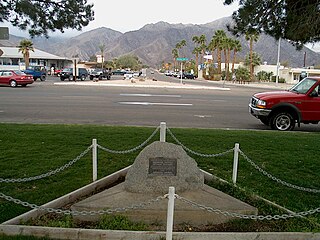
Borrego Springs is a census-designated place (CDP) in San Diego County, California. The population was 3,429 at the 2010 census, up from 2,535 at the 2000 census, made up of both seasonal and year-round residents. Borrego Springs is completely surrounded by Anza-Borrego State Park, the largest California State Park.

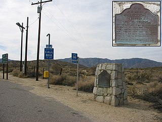
Anza-Borrego Desert State Park (ABDSP) is a California State Park located within the Colorado Desert of southern California, United States. The park takes its name from 18th century Spanish explorer Juan Bautista de Anza and borrego, a Spanish word for sheep. With 600,000 acres (240,000 ha) that includes one-fifth of San Diego County, it is the largest state park in California.

The Vallecito Mountains are located in the Colorado Desert, in eastern San Diego County, Southern California. They are about 28 miles (45 km) north of the U.S. border with Mexico.

The Fish Creek Mountains Wilderness is located about 25 miles west of Brawley, California, and southeast of the Vallecito Mountains in the United States. The wilderness is located in the Fish Creek Mountains region in the northern part of the Carrizo Impact Area, which is closed to the public.

The San Felipe Hills are a low mountain range in eastern San Diego County, southern California.

The Sawtooth Mountains Wilderness is a federal wilderness area of 32,136 acres (130.0 km2) located in the Sawtooth Mountains in eastern San Diego County, California. It is located in the Colorado Desert, 35 miles (56 km) south of Borrego Springs, near Anza Borrego Desert State Park.

The Santa Rosa Wilderness is a 72,259-acre (292.42 km2) wilderness area in Southern California, in the Santa Rosa Mountains of Riverside and San Diego counties, California. It is in the Colorado Desert section of the Sonoran Desert, above the Coachella Valley and Lower Colorado River Valley regions in a Peninsular Range, between La Quinta to the north and Anza Borrego Desert State Park to the south. The United States Congress established the wilderness in 1984 with the passage of the California Wilderness Act, managed by the both US Forest Service and the Bureau of Land Management. In 2009, the Omnibus Public Land Management Act was signed into law which added more than 2,000 acres (8.1 km2). Most of the Santa Rosa Wilderness is within the Santa Rosa and San Jacinto Mountains National Monument.
Rancho Valle de San Felipe was a 9,972-acre (40.36 km2) Mexican land grant in present-day San Diego County, California given in 1846 by Governor Pío Pico to Felipe Castillo. The grant was located in the San Felipe Valley in the Laguna Mountains east of present-day Julian.
There are 34 routes assigned to the "S" zone of the California Route Marker Program, which designates county routes in California. The "S" zone includes county highways in Imperial, Orange, Riverside, San Diego, and Santa Barbara counties.

San Diego County, officially the County of San Diego, is a county in the southwestern corner of the state of California, in the United States. As of the 2010 census, the population was 3,095,313. making it California's second-most populous county and the fifth-most populous in the United States. Its county seat is San Diego, the eighth-most populous city in the United States. It is the southwesternmost county in the 48 contiguous United States.
The Regions of the San Diego metropolitan area and San Diego County, as they cover the same area are:
Earthquake Valley is a desert valley east of Julian, California, which contains parts of the Anza-Borrego Desert State Park. It is the location of the Shelter Valley Ranchos subdivision, which is also known as the unincorporated community of Shelter Valley. The official USGS place name for the geologic feature in which Shelter Valley is situated is "Earthquake Valley", and the 1959 USGS Topographic map makes no reference to Shelter Valley. The name of the unincorporated community Shelter Valley is typically used both locally and by the media to refer generally to the geological feature of Earthquake Valley, and it is common for both names to be referen-8-1962-NO.4968" /> establishment of the subdivision. Author, poet, artist and primitivist Marshal South lived in and wrote about the general area, in a series of articles for Desert Magazine between 1941 and 1948. A number of notable trails pass through the valley, including the Pacific Crest Trail, the California Riding and Hiking Trail, and the Southern Emigrant Trail.

San Felipe Valley is an inland valley of the Peninsular Ranges, located in eastern San Diego County, California. Most of the valley is protected within the San Felipe Valley Wildlife Area.
Scissors Crossing is a place name in San Diego County, California, in the United States. It is a wrong-way concurrency junction where State Route 78 intersects with County Route S2, and is a notable point on the Pacific Crest Trail. The unincorporated community of Shelter Valley lies 2 mi (3.2 km) to the south of Scissors Crossing along County Road S2.

The Carrizo Badlands are a landform of badlands that lie within Anza-Borrego Desert State Park in eastern San Diego County, and in the Carrizo Impact Area in western Imperial County, in southern California.
San Felipe Creek is a stream in Imperial and San Diego Counties of California. It arises in the Volcan Mountains of San Diego County 33°11′57″N116°37′35″W, and runs eastward, gathering the waters of most of the eastern slope of the mountains and desert of the county before it empties into the Salton Sea. It is probably the last remaining perennial natural desert stream in the Colorado Desert region. In 1974, the San Felipe Creek Area was designated as a National Natural Landmark by the National Park Service.

The Tomahawk Fire was the second largest wildfire of the May 2014 San Diego County wildfires, behind the Pulgas Fire. The fire, which started on May 14 around 9:45 AM, on the Naval Weapons Station Seal Beach Detachment Fallbrook, scorched 5,367 acres (21.72 km2). The Fallbrook Naval Weapons Station is on the eastern side of, and provides an entry point to, Marine Corps Base Camp Pendleton and is adjacent to the community of Fallbrook. Evacuation orders were issued for several schools and housing areas, as well as the Fallbrook Naval Weapons Station and the closed San Onofre Nuclear Generating Station. By 8 PM PDT on May 14, the Tomahawk Fire had reached a size of 6,000 acres (2,400 ha). On May 16, the fire had burned 6,300 acres (2,500 ha), and it was 23% contained. By May 17, it had burned 6,500 acres (2,600 ha) and was 65% contained. During the evening of May 18, the fire was reported to be 100% contained.
Borrego Valley Groundwater Basin, located in the very southern region of California, is one of the driest basins in the state. With climate change predicted to have strong effects into foreseeable future, the region is viewed with a skepticism in the sustainable use of water at current rates of consumption. Both natural and man-made geographic divisions within this basin allow for a closer inspection of the various management techniques implemented throughout the years, and provide a basis for what may be pursued for an uncertain future.


