Related Research Articles
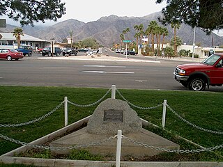
Borrego Springs is a census-designated place (CDP) in San Diego County, California. The population was 3,429 at the 2010 census, up from 2,535 at the 2000 census, made up of both seasonal and year-round residents. Borrego Springs is completely surrounded by Anza-Borrego State Park, the largest California State Park.

Spring Valley is a census-designated place (CDP) in San Diego County, California. The population was 28,205 at the 2010 census.
Boulevard is a census-designated place (CDP) in the Mountain Empire area of southeastern San Diego County, California. At the 2010 census, it had a population of 315. The area is rural desert along the Mexican border near the eastern extent of San Diego County.

Campo is an unincorporated community in the Mountain Empire area of southeastern San Diego County, California, United States. The population was 2,684 at the 2010 census. For statistical purposes, the United States Census Bureau has defined Campo as a census-designated place (CDP). The census definition of the area may not precisely correspond to local understanding of the area with the same name.
The Agua Caliente Band of Cahuilla Indians of the Agua Caliente Indian Reservation is a federally recognized tribe of the Cahuilla, located in Riverside County, California. They inhabited the Coachella Valley desert and surrounding mountains between 5000 BCE and 500 CE. With the establishment of the reservations, the Cahuilla were officially divided into 10 sovereign nations, including the Agua Caliente Band.

Mission El Descanso was founded in 1817 among the Kumeyaay by Dominican missionary Tomás de Ahumada at a site 22 kilometers south of the present-day city of Rosarito, Baja California, Mexico.
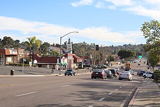
Casa de Oro is a neighborhood in east San Diego County, California, United States. The community, twelve miles east of San Diego, is in the unincorporated town of Spring Valley and an unincorporated part of La Mesa. The United States Census Bureau has also divided the neighborhood between two census-designated places (CDPs), Spring Valley CDP and Casa de Oro-Mount Helix CDP. Casa de Oro's main thoroughfare is Campo Road.
The Campo Indian Reservation is home to the Campo Band of Diegueño Mission Indians, also known as the Campo Kumeyaay Nation, a federally recognized tribe of Kumeyaay people in the southern Laguna Mountains, in eastern San Diego County, California. The reservation was founded in 1893 and is 16,512 acres (66.82 km2).

The Long Beach Area Council (LBAC), headquartered in Long Beach and founded in 1919, is one of five Boy Scouts of America councils in Los Angeles County, California.

Radnor Township is located in Peoria County, Illinois. As of the 2010 census, its population was 3,613 and it contained 1,330 housing units. Radnor Township was named after Radnor, Pennsylvania.

Whitewater is a census-designated place in Riverside County, California. It is directly off Interstate 10 halfway between North Palm Springs and Cabazon on the way from Palm Springs to Los Angeles. It is known as the site of the San Gorgonio Pass Wind Farm. The ZIP Code is 92282, and the community is inside area code 760. The population was 859 at the 2010 census. The elevation is 1,575 feet (480 m).

Brush Creek is an unincorporated community near Oroville in Butte County, California, United States. It lies at the east end of State Route 162, just beyond the Lake Oroville State Recreation Area. It lies at an elevation of 3,540 feet. A post office operated at Brush Creek from 1856 until 1916, having moved once in 1902.
Oro Loma is an unincorporated community in Fresno County, California. It is located 13 miles (21 km) west of Firebaugh, at an elevation of 174 feet.

Shregegon is a former Yurok settlement in Humboldt County, California. It was located about 1 mile (1.6 km) above the mouth of Pecwan Creek, at an elevation of 125 feet.

Spring Coulee is a hamlet in southern Alberta, Canada within Cardston County, located 2 kilometres (1.2 mi) east of Highway 5, approximately 42 kilometres (26 mi) southwest of Lethbridge.

The Morongo Band of Mission Indians is a federally recognized tribe in California, United States. The main tribal groups are Cahuilla and Serrano. Tribal members also include Cupeño, Luiseño, and Chemehuevi Indians. Although many tribes in California are known as Mission Indians, some, such as those at Morongo, were never a part of the Spanish Missions in California.

The Viejas Group of Capitan Grande Band of Mission Indians of the Viejas Reservation, also called the Viejas Band of Kumeyaay Indians, is a federally recognized tribe of Kumeyaay Indians.

The Mountain Empire is a rural area in southeastern San Diego County, California. The Mountain Empire subregion consists of the backcountry communities in southeastern San Diego County. The area is also sometimes considered part of the East County region of San Diego County.
Flinn Springs is an unincorporated community near El Cajon, in southern San Diego County, California.

Tecate Creek is a stream in northern Baja California, Mexico with its headwaters in southern San Diego County, California in the United States. It begins along the Tecate Divide in the In-Ko-Pah Mountains, near Live Oak Springs. The upper reaches of the stream in the US are known as Campo Creek. It flows southwest, crossing the Mexico–United States border at Canyon City, before flowing through the city of Tecate, Baja California. West of Tecate it flows through a gorge and briefly re-enters the US where it combines with Cottonwood Creek to form the Rio Alamar, a tributary of the Tijuana River which it joins in Central Tijuana.
References

Coordinates: 32°41′26″N116°20′4″W / 32.69056°N 116.33444°W
| This San Diego County, California–related article is a stub. You can help Wikipedia by expanding it. |