De Luz Heights, California

Last updated
De Luz Heights, California
USA California location map.svg
Red pog.svg
De Luz Heights, California
Coordinates: 33°25′52″N117°16′36″W / 33.43111°N 117.27667°W / 33.43111; -117.27667 Coordinates: 33°25′52″N117°16′36″W / 33.43111°N 117.27667°W / 33.43111; -117.27667
Country Flag of the United States.svg  United States
State Flag of California.svg  California
County Flag of San Diego County, California.png San Diego
Elevation
396 m (1,299 ft)
Time zone UTC-8 (Pacific (PST))
  Summer (DST) UTC-7 (PDT)
Area codes 442/760
GNIS feature ID1868370 [1]

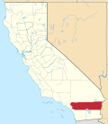
De Luz Heights (De Luz, Spanish for "Of Light") is an unincorporated community that is in northwestern San Diego County, California, United States.

Contents

Geography

View north of De Luz Heights and Ross Lake. Looking down on Ross Lake from Cathy Lane in De Luz Heights.JPG
View north of De Luz Heights and Ross Lake.
View north of De Luz Heights Road, to its terminus at Big Rock Ranch. De Luz Heights Rd looking north toward Big Rock Ranch.JPG
View north of De Luz Heights Road, to its terminus at Big Rock Ranch.

De Luz Heights is on the Santa Rosa Plateau of the Santa Ana Mountains. It is between De Luz Road to the west and Sandia Creek Drive to the east. It is northwest of Fallbrook, southwest of Temecula, and immediately east of Marine Corps Base Camp Pendleton.

De Luz Heights is an agricultural community with narrow country lanes lined by avocado groves, commercial flower nurseries, citrus ranches, and vineyards.

See also

Related Research Articles

Santa Rosa County, Florida County in Florida, United States

Santa Rosa County is a county located in the northwestern portion of the U.S. state of Florida. As of 2020, the population is 184,313. The county seat is Milton, which lies in the geographic center of the county. Other major communities within Santa Rosa County are Navarre, Pace, and Gulf Breeze. Navarre is the most populated community with a population of approximately 45,000 residents.

Walton County, Florida County in Florida, United States

Walton County is located on the Emerald Coast in the northwestern part of the U.S. state of Florida, with its southern border on the Gulf of Mexico. As of the 2010 census, the population was 55,043. Its county seat is DeFuniak Springs. The county is home to the highest natural point in Florida: Britton Hill, at 345 feet (105 m).

Sonoma County, California County in California, United States

Sonoma County is a county in the U.S. state of California. As of the 2010 United States Census, its population was 483,878. Its county seat and largest city is Santa Rosa. It is to the north of Marin County and the south of Mendocino County. It is west of Napa County and Lake County.

Santa Rosa, California City in California, United States

Santa Rosa is a city and the county seat of Sonoma County, in the North Bay region of the Bay Area in California. Its estimated 2019 population was 176,753. It is the largest city in California's Wine Country and Redwood Coast, as well as the fifth most populous city in the Bay Area after San Jose, San Francisco, Oakland, and Fremont; and the 27th most populous city in California.

Santa Rosa, New Mexico City in New Mexico, United States

Santa Rosa is a city in and the county seat of Guadalupe County, New Mexico, United States. The population was 2,848 at the 2010 census. It lies between Albuquerque and Tucumcari, situated on the Pecos River at the intersection of Interstate 40 and U.S. Route 54 and 84. The city is located on the western edge of the Llano Estacado or "staked plains" of eastern New Mexico and west Texas.

Rose of Lima Peruvian colonist and Dominican saint

Rose of Lima was a member of the Third Order of Saint Dominic in Lima, Peru, who became known for both her life of severe penance and her care of the poverty stricken of the city through her own private efforts. Saint Rose of Lima was born to a noble family and is the Patron Saint of embroidery, gardening and cultivation of blooming flowers. A lay member of the Dominican Order, she was declared a saint by the Catholic Church, being the first person born in the Americas to be canonized as such.

Santa Rosa, La Pampa City in La Pampa, Argentina

Santa Rosa is a city in the Argentine Pampas, and the capital of La Pampa Province, Argentina. It lies on the east of the province, on the shore of the Don Tomás Lagoon, at the intersection of National Routes 5 and 35. The city (94,340) and its surroundings hold 102,610 inhabitants ,Census-ar 2.010 hold 124.101 inhabitants the capital y Toay around a third of the population of the province. Its current mayor is Leandro Altolaguirre. Founded in 1892 by Tomás Mason, Santa Rosa did not develop into a relatively important agricultural centre until the second half of the 20th century. It is still one of the smallest provincial capitals of the country after Patagonian Rawson, Ushuaia and Viedma.

Santa Rosa Range

The Santa Rosa Range is a mountain range in Humboldt County, Nevada, United States. Most of the range is included within the Humboldt-Toiyabe National Forest. The highest peaks in the range are Granite Peak and Santa Rosa Peak. The range extends for approximately 75 miles (120 km) north from Winnemucca Mountain near Winnemucca through eastern Humboldt County to the border with Oregon. The upper elevations of the southern section of the range are protected as the Santa Rosa-Paradise Peak Wilderness Area.

Santa Ana Mountains

The Santa Ana Mountains are a short peninsular mountain range along the coast of Southern California in the United States. They extend for approximately 61 miles (98 km) southeast of the Los Angeles Basin largely along the border between Orange and Riverside counties.

Gilberto Santa Rosa Puerto Rican musician

Gilberto Santa Rosa, nicknamed "El Caballero de la Salsa", is a Puerto Rican bandleader and singer of salsa and bolero. He is a six time Grammy Award Winner and has sold over 3 million records in the United States and Puerto Rico. Santa Rosa also starred in a comedy.

Navarre, Florida Census-designated place and unincorporated community in Florida, US

Navarre is a census-designated place and unincorporated community in Santa Rosa County in the northwest Florida Panhandle. It is a major bedroom community for mostly U.S. military personnel, federal civil servants, local population, retirees and defense contractors. Due to Navarre Beach and the four miles of beach front on the Gulf of Mexico thereof, as well as several miles of beaches within the Navarre Beach Marine Park and the Gulf Islands National Seashore, it has a small, but rapidly growing community of nature enthusiasts and tourists. Navarre has grown from being a small town of around 1,500 in 1970 to a town with a population estimated at 44,876 as of 2019.

<i>Alcanzar una estrella</i>

Alcanzar una estrella is a Mexican telenovela first broadcast on Canal de las Estrellas in 1990. Also broadcast in Latin America and on Univision in the United States, the telenovela tells the story of an introverted girl's infatuation with her teen idol. The leading roles were played by singers Mariana Garza and Eduardo Capetillo, ex-members of the Mexican pop band Timbiriche. The two also sang the theme songs, which were written by Ricardo Arjona. Arjona and other singers such as Patricia Manterola also made acting cameos. The story was produced by Luis de Llano, producer and manager of Timbiriche and Garibaldi, and written by actress Rita Macedo, de Llano's mother. Alcanzar una estrella turned out to be Macedo's last credit as an actress before she committed suicide in the mid-1990s.

Santa Rosa Plateau

The Santa Rosa Plateau is an upland plateau and southeastern extension of the Santa Ana Mountains in Riverside County, southern California. It is bounded by the rapidly urbanizing Inland Empire cities of Murrieta and Temecula to the northeast and southeast, respectively.

Mark West Creek

Mark West Creek is a 29.9-mile-long (48.1 km) stream that rises in the Mayacamas Mountains of Sonoma County, California, United States. Tributaries of Mark West Creek include Porter Creek and Hummingbird Creek, both of which originate in the same mountain range. Discharge waters of Mark West Creek reach the Russian River after a confluence with the Laguna de Santa Rosa. The Community Clean Water Institute has developed a program for monitoring pollutants in Mark West Creek.
Rancho Santa Rosa (Moreno)

Rancho Santa Rosa was a 47,815-acre (193.50 km2) Mexican land grant in present day Riverside County, California given in 1846 by Governor Pio Pico to Juan Moreno. At the time of the US patent, Rancho Santa Rosa was a part of San Diego County. Riverside County was created by the California Legislature in 1893 by taking land from both San Bernardino and San Diego Counties. The site is now registered as a California Historical Landmark.

De Luz, California Unincorporated community in California, United States

De Luz is an unincorporated community in San Diego County, California. De Luz is 6 miles (9.7 km) northwest of Fallbrook and due west of Temecula. The region is approximately 12 miles (19 km) east of the Pacific Ocean and lies at the southern end of the Santa Ana Mountains.

Riverside County, California County in southern portion of California, United States

Riverside County is a county located in the southern portion of the U.S. state of California. As of the 2010 census, the population was 2,189,641, making it the fourth-most populous county in California and the 10th-most populous in the United States. The name was derived from the city of Riverside, which is the county seat.

Cañoncito, Santa Fe County, New Mexico Unincorporated community in New Mexico, United States

Cañoncito is an unincorporated community in Santa Fe County, New Mexico, United States. Cañoncito is located on Interstate 25, 11.5 miles (18.5 km) southeast of Santa Fe. Nuestra Señora de Luz Church and Cemetery, which is listed on the National Register of Historic Places, is located in Cañoncito.

Broxson, Florida Unincorporated community in Florida, United States

Broxson is an unincorporated community in Santa Rosa County, Florida, United States. The community is located on Florida State Road 87, 8.4 miles (13.5 km) southeast of Milton. Broxson is located between the Yellow River and the ridges and plateau of Eglin Air Force Base.

References

  1. "US Board on Geographic Names". United States Geological Survey. October 25, 2007. Retrieved January 31, 2008.