Cherry Valley, California | |
---|---|
Coordinates: 33°58′29″N116°58′13″W / 33.97472°N 116.97028°W | |
Country | United States |
State | California |
County | Riverside |
Area | |
• Total | 8.02 sq mi (20.77 km2) |
• Land | 8.02 sq mi (20.77 km2) |
• Water | 0.00 sq mi (0.00 km2) 0% |
Elevation | 2,821 ft (860 m) |
Population (2020) | |
• Total | 6,509 |
• Density | 811.60/sq mi (313.34/km2) |
Time zone | UTC-8 (PST) |
• Summer (DST) | UTC-7 (PDT) |
ZIP code | 92223 |
Area code | 951 |
FIPS code | 06-12916 |
GNIS feature IDs | 1660476, 2408019 |
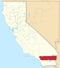
Cherry Valley is a census-designated place (CDP) in Riverside County, California, United States. The population was 6,362 at the 2010 census, up from 5,891 at the 2000 census. It is situated at the most northwestern point of the San Gorgonio Pass.
The area was planted with many cherry trees, for which Cherry Valley was named. While many of the trees have long since been removed and replaced with homes, a few can still be spotted in backyards throughout the area.
In the early 1800s, the area was known as Rancho San Gorgonio, an outpost for the San Gabriel Mission. A large portion of the area was a Spanish Land Grant made to a man by the name of Paulino Weaver. In 1853, Weaver sold some of his land to Dr. Isaac William Smith, who was struck by the land's natural beauty while looking for stray cattle. Dr. Smith purchased a 1,000 acres for $1,000 from Weaver and established Smith Ranch and Highland Springs Ranch & Inn. The original Smith residence stood near where the swimming pool is today. In 1862, Smith's ranch was dubbed "Smith Station" and was made a stagecoach stop. In 1865, a young Wyatt Earp drove the route from San Bernardino to La Paz, Arizona on which Smith Station was a popular stop.
From 1864 to 1866, the route through Highland Springs along the Bradshaw Trail was the single connecting line for passenger, mail and the express travel between Southern California and the eastern regions of the nation. Smith's Station slowly developed into a hotel bustling with traffic. In 1884, the Smith property was purchased by a Los Angeles company that built a three-story hotel on the property called Highland Home. The first cherry trees in the area were planted here, contributing to the name that it is still known by today.
In 1927, Fred and William Hirsch bought the old Smith place, renamed it Highland Springs Resort, and developed it into a health resort. Fred Hirsch himself was made healthy through following the philosophy of Professor Arnold Ehret, who was an early proponent of juice fasting and colon cleansing. The restaurant on the resort was vegetarian and Hirsch grew a lot of the produce served at the restaurant on the property. He also grew his own grapes and operated a small vineyard. The resort became known as "The Last Resort" as many sick people who were not able to get well with traditional methods, were able to recover through Hirsch's health practices while staying at the resort. From 1941 to 1945 there was a large World War 2 medical treatment facility at the site:Cherry Valley Hospital. [3]
Cherry Valley is located at 33°58′29″N116°58′13″W / 33.97472°N 116.97028°W (33.974848, -116.970300). [4]
With an elevation of 2,980 feet above sea level, Cherry Valley is at the highest point on the San Gorgonio Pass between San Bernardino and Palm Springs. According to the United States Census Bureau, the CDP has a total area of 8.1 square miles (21 km2), all of it land.
According to the Köppen Climate Classification system, Cherry Valley has a hot-summer Mediterranean climate, abbreviated "Csa" on climate maps. [5]
Census | Pop. | Note | %± |
---|---|---|---|
2000 | 5,891 | — | |
2010 | 6,362 | 8.0% | |
2020 | 6,509 | 2.3% | |
U.S. Decennial Census [6] 1850–1870 [7] [8] 1880-1890 [9] 1900 [10] 1910 [11] 1920 [12] 1930 [13] 1940 [14] 1950 [15] 1960 [16] 1970 [17] 1980 [18] 1990 [19] 2000 [20] 2010 [21] |
At the 2010 census Cherry Valley had a population of 6,362. The population density was 786.7 inhabitants per square mile (303.7/km2). The racial makeup of Cherry Valley was 5,450 (85.7%) White (73.5% Non-Hispanic White), [22] 63 (1.0%) African American, 102 (1.6%) Native American, 87 (1.4%) Asian, 4 (0.1%) Pacific Islander, 451 (7.1%) from other races, and 205 (3.2%) from two or more races. Hispanic or Latino of any race were 1,347 persons (21.2%). [23]
The census reported that 6,203 people (97.5% of the population) lived in households, 98 (1.5%) lived in non-institutionalized group quarters, and 61 (1.0%) were institutionalized.
There were 2,612 households, 540 (20.7%) had children under the age of 18 living in them, 1,375 (52.6%) were opposite-sex married couples living together, 236 (9.0%) had a female householder with no husband present, 98 (3.8%) had a male householder with no wife present. There were 115 (4.4%) unmarried opposite-sex partnerships, and 16 (0.6%) same-sex married couples or partnerships. 769 households (29.4%) were one person and 500 (19.1%) had someone living alone who was 65 or older. The average household size was 2.37. There were 1,709 families (65.4% of households); the average family size was 2.89.
The age distribution was 1,057 people (16.6%) under the age of 18, 448 people (7.0%) aged 18 to 24, 1,039 people (16.3%) aged 25 to 44, 1,967 people (30.9%) aged 45 to 64, and 1,851 people (29.1%) who were 65 or older. The median age was 51.9 years. For every 100 females, there were 90.7 males. For every 100 females age 18 and over, there were 90.0 males.
There were 2,874 housing units at an average density of 355.4 per square mile, of the occupied units 2,098 (80.3%) were owner-occupied and 514 (19.7%) were rented. The homeowner vacancy rate was 4.4%; the rental vacancy rate was 5.5%. Of the population 4,853 people (76.3%) lived in owner-occupied housing units and 1,350 people (21.2%) lived in rental housing units.
According to the 2010 United States Census, Cherry Valley had a median household income of $54,929, with 7.2% of the population living below the federal poverty line. [22]
At the 2000 census there were 5,891 people, 2,434 households, and 1,740 families in the CDP. The population density was 714.6 inhabitants per square mile (275.9/km2). There were 2,627 housing units at an average density of 318.6 per square mile (123.0/km2). A law was passed in which there could only be 1 house per acre. The racial makeup of the CDP was 80.1% White, 0.1% Black or African American, 2.2% Native American, 2.1% Asian, 2.2% Pacific Islander, 4.3% from other races, and 2.5% from two or more races. 13.4% of the population were Hispanic or Latino of any race. [24] Of the 2,434 households 20.1% had children under the age of 18 living with them, 61.8% were married couples living together, 6.5% had a female householder with no husband present, and 28.5% were non-families. Of all households 24.5% were one person and 15.7% were one person aged 65 or older. The average household size was 2.4 and the average family size was 2.8.
The age distribution was 18.8% under the age of 18, 5.7% from 18 to 24, 18.9% from 25 to 44, 26.8% from 45 to 64, and 29.8% 65 or older. The median age was 50 years. For every 100 females, there were 92.5 males. For every 100 females age 18 and over, there were 90.5 males.
The median household income was $39,199 and the median family income was $45,777. Males had a median income of $37,281 versus $29,561 for females. The per capita income for the CDP was $21,669. About 3.3% of families and 5.8% of the population were below the poverty line, including 6.4% of those under age 18 and 5.7% of those age 65 or over.
Cherry Valley unsuccessfully attempted to incorporate into a city in the 1990s and early 2000s.
In the California State Legislature, Cherry Valley is in the 23rd Senate District , represented by Republican Rosilicie Ochoa Bogh, and in the 42nd Assembly District , represented by Democrat Jacqui Irwin. [25]
In the United States House of Representatives, Cherry Valley is in California's 36th congressional district , represented by Democrat Ted Lieu. [26]
Parks and recreational activities are provided by the Beaumont-Cherry Valley Recreation and Park District.
Most of the CDP is in the Beaumont Unified School District while a portion is in Yucaipa-Calimesa Joint Unified School District. [27]
Bear Valley is a census-designated place in Alpine County, California, best known as the location of the Bear Valley ski area. The population was 121 at the 2010 census, down from 133 at the 2000 census.
Byron is a census designated place (CDP) in Contra Costa County, California, United States.
Bertsch–Oceanview is a census-designated place (CDP) in Del Norte County, California, United States. The community is located east of Crescent City, at an elevation of 20 feet (6.1 m), Bertsch–Oceanview has a total area of 5.9 square miles (15 km2) of which 5.5 square miles (14 km2) is land and 0.3 square miles (0.78 km2) is water. Its population is 2,520 as of the 2020 census, up from 2,436 from the 2010 census. The Elk Valley Rancheria Indian reservation is located within Bertsch–Oceanview.
Bowles is a census-designated place (CDP) in Fresno County, California, United States. The population was 166 at the 2010 census, down from 182 at the 2000 census. Bowles is located 11 miles (18 km) south of downtown Fresno, at an elevation of 279 feet.
Bear Valley Springs is a guarded-gate community in Kern County, California, United States. The unincorporated community is in the Tehachapi Mountains and is part of the greater Tehachapi area. The elevation ranges from 4,121 feet (1,256 m) to 6,934 feet (2,113 m). The population fluctuates between a low during the winter months when snow is common, to a high in the summer months when its elevation keeps it much cooler than surrounding areas and major cities. The population was 5,172 at the 2010 census, up from 4,232 at the 2000 census. For statistical purposes, the United States Census Bureau has defined Bear Valley Springs as a census-designated place (CDP). The census definition of the area may not precisely correspond to local understanding of the area with the same name.
Bodfish is a census-designated place (CDP) in the southern Kern River Valley of the Southern Sierra Nevada, in Kern County, California.
Cobb is a census designated place (CDP) in Lake County, California, United States. Cobb is located 1 mile (1.6 km) northwest of Whispering Pines, at an elevation of 2,631 feet (802 m). The population was 1,778 at the 2010 census, up from 1,638 at the 2000 census.
Charter Oak is a census-designated place (CDP) in Los Angeles County, California, approximately 26 miles (42 km) east of downtown Los Angeles. The population was 9,310 at the 2010 census, up from 9,027 at the 2000 census.
Citrus is a census-designated place (CDP) in Los Angeles County, California, United States. It is located in the San Gabriel Valley between Azusa to the north and west, Glendora to the east, and Covina to the south. The population was 10,866 at the 2010 census, up from 10,581 at the 2000 census. Citrus is named after Citrus Avenue, which passes through the community.
Covelo is a census-designated place (CDP) in Mendocino County, California, United States. Covelo is located 14 miles (23 km) east-northeast of Laytonville, at an elevation of 1,398 feet (426 m). The population was 1,394 at the 2020 census, up from 1,255 at the 2010 census. 405 acres (1.64 km2) of Covelo is part of the Round Valley Indian Reservation.
Boronda is an unincorporated community and census-designated place (CDP) in Monterey County, California, United States. The population was 1,760 at the 2020 census. Boronda is located directly west of Salinas and is named after José Eusebio Boronda, a Californio ranchero, and located on the lands of his Rancho Rincón del Sanjón.
Chualar is an unincorporated community and census-designated place (CDP) in the Salinas Valley of Monterey County, California, United States. Chualar is located 10 miles (16 km) southeast of Salinas, at an elevation of 115 feet (35 m). The population was 1,185 at the 2020 census.
Angwin is a census-designated place (CDP) in Napa County, California, best known as the site of Pacific Union College. It is part of the northern San Francisco Bay Area. The population was 3,051 at the 2010 census. Its area code is 707. Its two ZIP codes are 94508 and 94576. It is in the Pacific time zone.
Alta Sierra is a census-designated place (CDP) in Nevada County, California, United States. The population was 6,911 at the 2010 census, up from 6,522 at the 2000 census.
Cabazon is an unincorporated community in Riverside County, California, United States. Cabazon is on the Pacific Crest Trail. In the 21st century, the area has become a tourist stop, due to the Morongo Casino, Resort & Spa and Desert Hills Premium Outlets. The population was 2,535 during the 2010 Census. For statistical purposes, the United States Census Bureau has defined Cabazon as a census-designated place (CDP).
Big Bear City is an unincorporated community in San Bernardino County, California, United States along the east shore of Big Bear Lake and surrounded by the San Bernardino National Forest. It is 27 miles (43 km) northeast of the city of San Bernardino, and immediately east of the incorporated city of Big Bear Lake. For statistical purposes, the United States Census Bureau has defined Big Bear City as a census-designated place (CDP). Its population was 12,304 at the 2010 census, up from 5,779 at the 2000 census. Big Bear City is mostly residential, with smaller houses and cabins laid out in typical square block fashion. Big Bear is on the Pacific Crest Trail.
Casa de Oro-Mount Helix is a census-designated place (CDP) in the East County region of San Diego County, California.
Aptos Hills-Larkin Valley is an unincorporated community in Santa Cruz County, California, United States. It is identified as one of several small communities with a combined population of 24,402 forming the unincorporated town of Aptos by the local Chamber of Commerce along with:
Boyes Hot Springs is a census-designated place (CDP) in Sonoma Valley, Sonoma County, California, United States. The population was 6,656 people at the 2010 census. Resorts in Boyes Hot Springs, El Verano, Fetters Hot Springs, and Agua Caliente were popular health retreats for tourists from San Francisco and points beyond until the middle of the 20th century because of the geothermic hot springs that still well up from deep within the Earth.
Carmel Valley Village is an unincorporated community and census-designated place (CDP) in Monterey County, California, United States. At the time of the 2020 census the CDP population was 4,524, up from 4,407 at the 2010 census. In November 2009, a majority of residents voted against incorporation.