Twentynine Palms, California | |
---|---|
Motto: "A Beautiful Desert Oasis" | |
Coordinates: 34°08′08″N116°03′15″W / 34.13556°N 116.05417°W [1] | |
Country | United States |
State | California |
County | San Bernardino |
Incorporated | November 23, 1987 [2] |
Government | |
• Type | Council–manager [3] |
Area | |
• Total | 58.76 sq mi (152.18 km2) |
• Land | 58.76 sq mi (152.18 km2) |
• Water | 0 sq mi (0 km2) 0% |
Elevation | 1,988 ft (606 m) |
Population | |
• Total | 28,065 |
• Density | 480/sq mi (180/km2) |
Time zone | UTC−8 (Pacific) |
• Summer (DST) | UTC−7 (PDT) |
ZIP codes | 92277-92278 |
Area codes | 442/760 |
FIPS code | 06-80994 |
GNIS feature IDs | 1652804, 2412119 |
Website | ci.twentynine-palms.ca.us |
Twentynine Palms (also known as 29 Palms) is a city in San Bernardino County, California. It serves as one of the entry points to Joshua Tree National Park and the Mojave Desert region.
This section needs additional citations for verification .(March 2021) |
Native Americans, such as the Serrano, Chemehuevi and Cahuilla peoples, lived in the area. Colonel Henry Washington made the first recorded exploration of Twentynine Palms, where he found people of the Chemehuevi who lived in the surrounding hills and near the spring they called "Mar-rah" or "Oasis of Mara". [6] The community was named for the 29 palms ( Washingtonia filifera ) that the Serrano had planted surrounding the Oasis of Mara. Nearby is also a small Indian reservation belonging to the Twenty-Nine Palms Band of Mission Indians. [6] [7]
A post office was established in 1927. [8] A road named Utah Trail honors the late-19th century wagon trains and pioneers, allegedly originating in St. George, Utah, and stretching all the way to Twentynine Palms.
Joshua Tree National Park, which lies just to the south of Twentynine Palms, was designated a US national monument in 1936, and became a national park in 1994. The nearby Marine Corps Air Ground Combat Center Twentynine Palms was founded in 1952.
Census | Pop. | Note | %± |
---|---|---|---|
1970 | 5,667 | — | |
1980 | 7,465 | 31.7% | |
1990 | 11,821 | 58.4% | |
2000 | 14,764 | 24.9% | |
2010 | 25,048 | 69.7% | |
2019 (est.) | 26,073 | [9] | 4.1% |
U.S. Decennial Census [10] |
Its population as of the 2020 census was 28,065. [11]
At the 2010 census, [12] there were 25,048 people in 8,095 households, including 5,847 families, in the city. The population density was 423.5 inhabitants per square mile (163.5/km2). There were 9,431 housing units at an average density of 159.5 per square mile, of the occupied units 2,742 (33.9%) were owner-occupied and 5,353 (66.1%) were rented. The homeowner vacancy rate was 3.6%; the rental vacancy rate was 9.2%. 6,876 people (27.5% of the population) lived in owner-occupied housing units and 14,825 people (59.2%) lived in rental housing units. The racial makeup of the city was 71.6% White (60.8% non-Hispanic), [13] 8.2% African American, 1.3% Native American, 3.9% Asian, 1.4% Pacific Islander, 6.7% from other races, and 6.9% mixed with two or more races. Hispanic or Latino people of any race were 20.8% of the population.
The census reported that 21,701 people (86.6% of the population) lived in households, and 3,347 (13.4%) lived in non-institutionalized group quarters.
Of the 8,095 households, 43.3% had children under the age of 18 living in them, 54.5% were opposite-sex married couples living together and 12.9% had a female householder with no husband present, while 4.9% had a male householder with no wife present. There were 5% of residents living as unmarried opposite-sex partnerships, and 1.6% as same-sex married couples or partnerships. Some 21.1% of households were one person, and 5.6% were one person aged 65 or older. The average household size was 2.68, and the average family size was 3.1.
The age distribution was 25.6% under the age of 18, 30% aged 18 to 24, 25.5% aged 25 to 44, 13.1% aged 45 to 64, and 5.8% who were over 65. The median age was 23.5 years. For every 100 females, there were 129 males. For every 100 females aged 18 and older, there were 139.9 males.
The median household income was $42,572; about 14.4% of the population were living below the poverty line. [13]
At the 2000 census there were 14,764 people in 5,653 households, including 3,855 families, in the city. The population density was 269.3 inhabitants per square mile (104.0 inhabitants/km2). There were 6,952 housing units at an average density of 126.8 units per square mile (49.0 units/km2). The racial makeup of the city was 71% White, 9.4% African American, 1.5% Native American, 3.8% Asian, 10.2% Pacific Islander, 6.2% from other races, and 6.4% from two or more races. Hispanic or Latino people of any race were 14.9%. [14]
Of the 5,653 households 39.1% had children under the age of 18 living with them, 49.8% were married couples living together, 13.7% had a female householder with no husband present, and 31.8% were non-families. 25.1% of households were one person and 7.4% were one person aged 65 or older. The average household size was 2.6 and the average family size was 3.1.
The age distribution was 31.2% under the age of 18, 15.2% from 18 to 24, 28.4% from 25 to 44, 16.7% from 45 to 64, and 8.6% 65 or older. The median age was 27 years. For every 100 females, there were 101.8 males. For every 100 females age 18 and over, there were 98.7 males.
The median household income was $31,178 and the median family income was $32,251. Males had a median income of $25,081 versus $25,141 for females. The per capita income for the city was $14,613. About 13.6% of families and 16.8% of the population were below the poverty line, including 25.3% of those under age 18 and 10% of those age 65 or over.
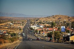
The city is located in the Mojave Desert, in inland Southern California. It lies on the northern side of Joshua Tree National Park and contains one of the entrances to Joshua Tree, the Oasis of Mara.
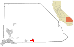
According to the United States Census Bureau, the city has a total area of 59.1 square miles (153 km2), all land. [15] The city is at an elevation of 1,988 feet (606 m) above sea level. [1]
Due, in large part, to its elevation of more than 1,900 ft (580 m) above sea level, Twentynine Palms has a slightly cooler climate, especially during winter, than nearby Palm Springs, but with essentially the same subtropical-desert characteristics. On average, temperatures reach 100 °F (38 °C) on 89 days of the year and 90 °F (32 °C) on 154 days; the freezing mark is reached an average of 17 nights, annually. Extremes range from 10 °F (−12 °C) on December 23, 1990, to 118 °F (48 °C) on July 11, 1961. Winters are moderately cool, with daytime highs in the 60s °F and lows in the 40s °F. Summers are very hot, with regular daytime high temperatures above 100 °F (38 °C). The wettest month is August, with 0.65 in (17 mm) inches of rain, mostly from monsoon thunderstorms; in some areas of low-lying terrain or canyons, flash flooding may be a concern.
Climate data for Twentynine Palms, California, 1991–2020 normals, extremes 1935–present | |||||||||||||
---|---|---|---|---|---|---|---|---|---|---|---|---|---|
Month | Jan | Feb | Mar | Apr | May | Jun | Jul | Aug | Sep | Oct | Nov | Dec | Year |
Record high °F (°C) | 85 (29) | 90 (32) | 95 (35) | 102 (39) | 112 (44) | 117 (47) | 118 (48) | 116 (47) | 114 (46) | 106 (41) | 93 (34) | 86 (30) | 118 (48) |
Mean maximum °F (°C) | 74.3 (23.5) | 78.1 (25.6) | 86.9 (30.5) | 95.0 (35.0) | 101.8 (38.8) | 109.6 (43.1) | 112.4 (44.7) | 110.5 (43.6) | 105.4 (40.8) | 96.6 (35.9) | 83.9 (28.8) | 73.9 (23.3) | 113.3 (45.2) |
Mean daily maximum °F (°C) | 63.3 (17.4) | 67.2 (19.6) | 74.1 (23.4) | 81.1 (27.3) | 89.9 (32.2) | 99.4 (37.4) | 104.0 (40.0) | 102.7 (39.3) | 96.5 (35.8) | 84.7 (29.3) | 71.6 (22.0) | 62.0 (16.7) | 83.0 (28.3) |
Daily mean °F (°C) | 52.6 (11.4) | 55.7 (13.2) | 61.7 (16.5) | 67.8 (19.9) | 76.4 (24.7) | 85.1 (29.5) | 90.7 (32.6) | 89.6 (32.0) | 82.9 (28.3) | 71.2 (21.8) | 59.3 (15.2) | 50.9 (10.5) | 70.3 (21.3) |
Mean daily minimum °F (°C) | 41.8 (5.4) | 44.1 (6.7) | 49.3 (9.6) | 54.5 (12.5) | 62.9 (17.2) | 70.7 (21.5) | 77.4 (25.2) | 76.4 (24.7) | 69.3 (20.7) | 57.8 (14.3) | 47.0 (8.3) | 39.9 (4.4) | 57.6 (14.2) |
Mean minimum °F (°C) | 28.6 (−1.9) | 30.6 (−0.8) | 35.8 (2.1) | 41.0 (5.0) | 48.8 (9.3) | 56.7 (13.7) | 66.8 (19.3) | 64.4 (18.0) | 55.7 (13.2) | 42.9 (6.1) | 31.8 (−0.1) | 27.0 (−2.8) | 25.0 (−3.9) |
Record low °F (°C) | 11 (−12) | 18 (−8) | 23 (−5) | 24 (−4) | 33 (1) | 43 (6) | 53 (12) | 52 (11) | 38 (3) | 24 (−4) | 14 (−10) | 10 (−12) | 10 (−12) |
Average precipitation inches (mm) | 0.50 (13) | 0.56 (14) | 0.35 (8.9) | 0.12 (3.0) | 0.05 (1.3) | 0.00 (0.00) | 0.40 (10) | 0.65 (17) | 0.34 (8.6) | 0.15 (3.8) | 0.19 (4.8) | 0.56 (14) | 3.87 (98) |
Average precipitation days (≥ 0.01 in) | 3.9 | 3.2 | 2.3 | 1.0 | 0.6 | 0.1 | 1.7 | 2.3 | 1.7 | 1.1 | 1.0 | 2.2 | 21.1 |
Source: NOAA [16] [17] |
The city has a series of 26 outdoor murals painted on local buildings featuring various aspects of desert life and history. [18] [19]
The 29 Palms Historical Society, housed in the original schoolhouse of the city, maintains a museum devoted to local history. [20] The Historical Society also hosts an annual "Weed Show" each November devoted to art work composed of weeds. [21] [22] The Twentynine Palms Artists' Guild maintains exhibits devoted to local artists. [23]
The Oasis of Mara, [24] the original source of water and the historic source of all economic activity in the area, is divided into two parts: to the east, a long strip of palm trees terminates at the Joshua Tree National Park Visitor's Center, which is visited by approximately 140,000 people every year, and is maintained by the United States National Park Service. To the west, the remainder of the oasis is owned by the 29 Palms Inn, a historic hotel, and ends in a large shaded pond. [25]
The current economy depends largely on the local Marine Corps Air Ground Combat Center, as well as tourism associated with Joshua Tree National Park. In February 2015, the city set in place rules governing vacation rentals, and has granted approximately one hundred permits, [26] compared to over one thousand in the nearby community of Joshua Tree.
The city uses a council-manager form of government. An elected city council establishes policy and appoints a city manager who executes these policies. [3]
In the California State Legislature, Twentynine Palms is in the 19th Senate District , represented by Republican Rosilicie Ochoa Bogh, and in the 34th Assembly District , represented by Republican Tom Lackey. [27]
In the United States House of Representatives, Twentynine Palms is in California's 23rd congressional district , represented by Republican Jay Obernolte. [28]
This section needs additional citations for verification .(December 2017) |
The Desert Trail newspaper in Yucca Valley is published weekly. [32] The Sun Runner Magazine of California Desert Life and Culture is published bi-monthly. [33]
There are two TV stations: K15FC-D (KESQ-TV (ABC), KPSP (CBS), KDFX (Fox), KCWQ-LD (CW) and KUNA-LD (Telemundo) subchannels) and KPSE-LD (My Network) 29 (also KMIR-TV (NBC), ION, MeTV and Movies! subchannels) from the Riverside County, California TV market, but the area is actually part of the Palm Springs TV market.
KEXV and KPLM are low power TV stations for the town and Yucca Valley.
KVMD is licensed in Twentynine Palms and serves all of Los Angeles and the Inland Empire.
There is one AM station: KNWH a transmitter of KNWQ-1140 "KNews" Radio – Twentynine Palms (Inland Empire, California and Coachella Valley radio markets) CA US news/talk. There are seven commercial and two public FM stations:
Low power FM translators:
Local stations:
On April 22, 1945, The Jack Benny Program was broadcast from Twentynine Palms Auxiliary Naval Air Station. There were jokes about the base's dry, hot weather, along with a comedic sketch of the town's history. [48]
San Bernardino County, officially the County of San Bernardino and sometimes abbreviated as S.B. County, is a county located in the southern portion of the U.S. state of California, and is located within the Inland Empire area. As of the 2020 U.S. Census, the population was 2,181,654, making it the fifth-most populous county in California and the 14th-most populous in the United States. The county seat is San Bernardino.
Banning is a city in Riverside County, California, United States. Its population was 29,505 as of the 2020 census, down from 29,603 at the 2010 census. It is situated in the San Gorgonio Pass, also known as Banning Pass. It is named for Phineas Banning, stagecoach line owner and the "Father of the Port of Los Angeles."
Cabazon is an unincorporated community in Riverside County, California, United States. Cabazon is on the Pacific Crest Trail. In the 21st century, the area has become a tourist stop, due to the Morongo Casino, Resort & Spa and Desert Hills Premium Outlets. The population was 2,535 during the 2010 Census. For statistical purposes, the United States Census Bureau has defined Cabazon as a census-designated place (CDP).
Desert Hot Springs is a city in Riverside County, California, United States. The city is located within the Coachella Valley geographic region. The population was 32,512 as of the 2020 census, up from 25,938 at the 2010 census. The city has experienced rapid growth since the 1970s when there were 2,700 residents. The city is commonly referred to by its initials, DHS.
Palm Desert is a city in the Coachella Valley region of Riverside County, California. The city is located in the Colorado Desert arm of the Sonoran Desert, about 14 miles (23 km) east of Palm Springs, 121 miles (195 km) northeast of San Diego and 122 miles (196 km) east of Los Angeles. The population was 51,163 at the 2020 census, and the city has been one of the state's fastest-growing since 1980, when its population was 11,801.
Joshua Tree is a census-designated place (CDP) in San Bernardino County, California, United States. The population was 7,414 at the 2010 census. At approximately 2,700 feet above sea level, Joshua Tree and its surrounding communities are located in the High Desert of California. The center of the business district in Joshua Tree is on California State Route 62.
The Marine Corps Air Ground Combat Center (MCAGCC), also known as 29 Palms, is the largest United States Marine Corps base. The base covers a total area of 1,102 square miles.
Yucca Valley is an incorporated town in San Bernardino County, California, United States. The population was 21,738 as of the 2020 census. Yucca Valley lies 20 miles (32 km) north of Palm Springs, and 49 miles (79 km) east of San Bernardino. Bordered to the south by the Joshua Tree National Park and to the west by the San Bernardino Mountains, the town of Yucca Valley is located in the Mojave Desert at roughly 3,300 feet (1,000 m) above sea level.
The Coachella Valley is an arid rift valley in the Colorado Desert of Southern California in Riverside County. The valley has been referred to as Greater Palm Springs and occasionally the Palm Springs Area due to the historic prominence of the city of Palm Springs. The valley extends approximately 45 mi (72 km) southeast from the San Gorgonio Pass to the northern shore of the Salton Sea and the neighboring Imperial Valley, and is approximately 15 mi (24 km) wide along most of its length. It is bounded on the northeast by the San Bernardino and Little San Bernardino Mountains, and on the southwest by the San Jacinto and Santa Rosa Mountains.
The Cahuilla, also known as ʔívil̃uqaletem or Ivilyuqaletem, are a Native American people of the various tribes of the Cahuilla Nation, living in the inland areas of southern California. Their original territory encompassed about 2,400 square miles (6,200 km2). The traditional Cahuilla territory was near the geographic center of Southern California. It was bounded to the north by the San Bernardino Mountains, to the south by Borrego Springs and the Chocolate Mountains, to the east by the Colorado Desert, and to the west by the San Jacinto Plain and the eastern slopes of the Palomar Mountains.
State Route 62 is a state highway in the U.S. state of California that cuts across the Little San Bernardino Mountains in Riverside and San Bernardino counties. Its western terminus is at Interstate 10 in unincorporated Riverside County outside the borders of Whitewater and Palm Springs. Its eastern terminus is at the Arizona state line just east of Parker, Arizona. The highway passes through the city of Twentynine Palms and along the northern boundary of the Joshua Tree National Park.
The Morongo Basin is an endorheic basin and valley region located in eastern San Bernardino County, in Southern California.
The Big Morongo Canyon Preserve is a 31,000-acres (130 km2) native plants habitat and wildlife preserve located in the Little San Bernardino Mountains of the Transverse Ranges, in the transition zone between the higher Mojave Desert and lower elevation Colorado Desert section of the Sonoran Desert. Due to its location within this transition zone, the area is especially high in natural diversity. The natural spring fed desert oasis found here is one of the 10 largest Cottonwood and Willow riparian habitats in California. It is also identified by the Audubon Society as one of the most important avian habitat areas in California.
California's 23rd congressional district is a congressional district in the U.S. state of California. The district is represented in the 118th United States Congress by Jay Obernolte.
The Morongo Unified School District (MUSD) is a public education governing body in the Mojave high desert of Southern California. MUSD has more than 1,100 employees who provide educational services to 9,301 students.
The High Desert is a vernacular region with non-discrete boundaries covering areas of the western Mojave Desert in Southern California. The region encompasses various terrain with elevations generally between 2,000 and 4,000 ft above sea level, and is located just north of the San Gabriel, San Bernardino, and Little San Bernardino Mountains.
Joshua Tree National Park is a national park of the United States in southeastern California, east of San Bernardino and Los Angeles and north of Palm Springs. It is named after the Joshua trees native to the Mojave Desert. Originally declared a national monument in 1936, Joshua Tree was redesignated as a national park in 1994 when the U.S. Congress passed the California Desert Protection Act. Encompassing a total of 795,156 acres – slightly larger than the state of Rhode Island – the park includes 429,690 acres of designated wilderness. Straddling San Bernardino and Riverside Counties, the park includes parts of two deserts, each an ecosystem whose characteristics are determined primarily by elevation: the higher Mojave Desert and the lower Colorado Desert. The Little San Bernardino Mountains traverse the southwest edge of the park.
Riverside County is a county located in the southern portion of the U.S. state of California. As of the 2020 census, the population was 2,418,185, making it the fourth-most populous county in California and the 10th-most populous in the United States. The name was derived from the city of Riverside, which is the county seat.
Wonder Valley is a sparsely populated unincorporated community in the Morongo Basin of Southern California's High Desert region, straddling Amboy Road and State Route 62 in San Bernardino County, California, United States, approximately 10 miles (16 km) east of the city of Twentynine Palms.
{{cite web}}
: CS1 maint: numeric names: authors list (link){{cite AV media}}
: CS1 maint: numeric names: authors list (link)