El Cerrito, Riverside County, California

Last updated

El Cerrito
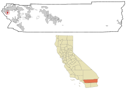
Riverside County California Incorporated and Unincorporated areas El Cerrito Highlighted.svg
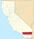
Location in Riverside County and the state of California
Coordinates: 33°50′22″N117°31′20″W / 33.83944°N 117.52222°W / 33.83944; -117.52222 [1]
Country United States
State California
County Riverside
Area
[2]
  Total2.778 sq mi (7.194 km2)
  Land2.553 sq mi (6.612 km2)
  Water0.225 sq mi (0.582 km2)  8.09%
Elevation
[1]
860 ft (262 m)
Population
 (2020) [3]
  Total5,058
  Density1,800/sq mi (700/km2)
Time zone UTC-8 (PST)
  Summer (DST) UTC-7 (PDT)
ZIP code
92881
Area code 951
GNIS feature ID 2408053

El Cerrito (Spanish for "The Little Hill") is a census-designated place (CDP) in Riverside County, California, United States. It is an unincorporated area mostly surrounded by the city of Corona. The population was 5,100 at the 2010 census, up from 4,590 at the 2000 census.

Contents

Geography

El Cerrito is located southeast of downtown Corona and about 15 miles (25 km) southwest of the city of Riverside.

According to the United States Census Bureau, the CDP has a total area of 2.8 square miles (7.3 km2), of which, 2.6 square miles (6.7 km2) of it is land and 0.2 square miles (0.52 km2) of it (8.09%) is water.

Demographics

2010

At the 2010 census El Cerrito had a population of 5,100. The population density was 1,836.1 inhabitants per square mile (708.9/km2). The racial makeup of El Cerrito was 3,542 (69.5%) White, 91 (1.8%) African American, 54 (1.1%) Native American, 95 (1.9%) Asian, 11 (0.2%) Pacific Islander, 1,122 (22.0%) from other races, and 185 (3.6%) from two or more races. Hispanic or Latino of any race were 2,657 persons (52.1%). [4]

The census reported that 5,088 people (99.8% of the population) lived in households, 12 (0.2%) lived in non-institutionalized group quarters, and no one was institutionalized.

There were 1,386 households, 648 (46.8%) had children under the age of 18 living in them, 937 (67.6%) were opposite-sex married couples living together, 153 (11.0%) had a female householder with no husband present, 97 (7.0%) had a male householder with no wife present. There were 71 (5.1%) unmarried opposite-sex partnerships, and 13 (0.9%) same-sex married couples or partnerships. 126 households (9.1%) were one person and 50 (3.6%) had someone living alone who was 65 or older. The average household size was 3.67. There were 1,187 families (85.6% of households); the average family size was 3.82.

The age distribution was 1,380 people (27.1%) under the age of 18, 548 people (10.7%) aged 18 to 24, 1,274 people (25.0%) aged 25 to 44, 1,387 people (27.2%) aged 45 to 64, and 511 people (10.0%) who were 65 or older. The median age was 35.7 years. For every 100 females, there were 109.0 males. For every 100 females age 18 and over, there were 104.6 males.

There were 1,449 housing units at an average density of 521.7 per square mile, of the occupied units 1,099 (79.3%) were owner-occupied and 287 (20.7%) were rented. The homeowner vacancy rate was 1.2%; the rental vacancy rate was 4.0%. 3,991 people (78.3% of the population) lived in owner-occupied housing units and 1,097 people (21.5%) lived in rental housing units.
2000

As of the census [5] of 2000, there were 4,590 people, 1,292 households, and 1,122 families in the CDP. The population density was 1,545.6 inhabitants per square mile (596.8/km2). There were 1,331 housing units at an average density of 448.2 per square mile (173.1/km2). The racial makeup of the CDP was 71.0% White, 2.2% Black or African American, 0.9% Native American, 1.2% Asian, 0.5% Pacific Islander, 19.8% from other races, and 4.3% from two or more races. 37.2% of the population were Hispanic or Latino of any race.

Of the 1,292 households 45.7% had children under the age of 18 living with them, 72.7% were married couples living together, 9.1% had a female householder with no husband present, and 13.1% were non-families. 9.4% of households were one person and 2.2% were one person aged 65 or older. The average household size was 3.6 and the average family size was 3.7.

The age distribution was 31.3% under the age of 18, 9.4% from 18 to 24, 28.9% from 25 to 44, 23.5% from 45 to 64, and 7.0% 65 or older. The median age was 33 years. For every 100 females, there were 108.6 males. For every 100 females age 18 and over, there were 105.7 males.

The median household income was $61,190 and the median family income was $62,981. Males had a median income of $42,552 versus $36,886 for females. The per capita income for the CDP was $19,466. About 5.2% of families and 8.5% of the population were below the poverty line, including 11.1% of those under age 18 and 5.0% of those age 65 or over.

Government

Municipal

In the Riverside County Board of Supervisors, El Cerrito is in the Second District, represented by Karen Spiegel.

State

In the California State Legislature, El Cerrito is in the 31st Senate District , represented by Democrat Richard Roth, and in the 60th Assembly District , represented by Democrat Corey Jackson. [6]

Federal

In the United States House of Representatives, El Cerrito is in California's 42nd congressional district , represented by Democrat Robert Garcia. [7] Democrats Dianne Feinstein and Alex Padilla represent California in the United States Senate.

Related Research Articles

<span class="mw-page-title-main">East Richmond Heights, California</span> Unincorporated community in California, United States

East Richmond Heights is an unincorporated community and census-designated place (CDP) in western Contra Costa County, California, United States. Its population was 3,280 at the 2010 census.

<span class="mw-page-title-main">Raisin City, California</span> Census-designated place in California, United States

Raisin City is a census-designated place (CDP) in Fresno County, California, United States. The population was 380 at the 2010 census, up from 165 at the 2000 census. Raisin City is located 13 miles (21 km) south-southwest of downtown Fresno, at an elevation of 236 feet.

<span class="mw-page-title-main">Westhaven-Moonstone, California</span> Census-designated place in California, United States

Westhaven-Moonstone is a census-designated place (CDP) located in Humboldt County, California, United States. As of the 2010 census the population was 1,205, up from 1,044 at the 2000 census.

<span class="mw-page-title-main">Ocotillo, California</span> Census-designated place in California, United States

Ocotillo is a census-designated place (CDP) in Imperial County, California. Ocotillo is located 26 miles (42 km) west of El Centro, The population was 215 at the 2020 census, down from 266 at the 2010 census and 296 at the 2000 census. It is part of the El Centro, California Metropolitan Statistical Area.

<span class="mw-page-title-main">Palo Verde, California</span> Census-designated place in California, United States

Palo Verde is a census-designated place (CDP) in Imperial County, California. Its name comes from the native desert tree, Palo Verde, which in turn takes its name from the Spanish for stick (palo) and green (verde), sharing its name with the Palo Verde Valley, the valley it is located.

<span class="mw-page-title-main">Seeley, California</span> Census-designated place in California, United States

Seeley is a census-designated place (CDP) in Imperial County, California. Seeley is located 7.5 miles (12 km) west of El Centro. The population was 1,823 at the 2010 census, up from 1,624 in 2000. It is part of the El Centro Metropolitan Area.

<span class="mw-page-title-main">Winterhaven, California</span> Census-designated place in California, United States

Winterhaven is a census-designated place (CDP) in Imperial County, California. Winterhaven is 6.5 miles (10 km) east of Pilot Knob, The population was 394 at the 2010 census, down from 529 at the 2000 census. It is part of the El Centro, CA Metropolitan Area. North of Interstate 8 and bordering Yuma, Arizona, the town is partly in the Fort Yuma Indian Reservation. The Colorado River marks the town's southern border.

<span class="mw-page-title-main">West Bishop, California</span> Census-designated place in California, United States

West Bishop is a census-designated place (CDP) in Inyo County, California, United States. The population was 2,607 at the 2010 census, down from 2,807 at the 2000 census.

<span class="mw-page-title-main">Wilkerson, California</span> Census-designated place in California, United States

Wilkerson is a census-designated place (CDP) in Inyo County, California, United States. The population was 563 at the 2010 census, up from 562 at the 2000 census.

<span class="mw-page-title-main">Alondra Park, California</span> Census designated place in California, United States

Alondra Park, also known as El Camino Village, is a census designated place (CDP) in the South Bay region of Los Angeles County, California, United States. It is the unincorporated area north of Alondra Community Regional Park and El Camino College. It is east of Lawndale, south of Hawthorne, west of Gardena, and north of Torrance. Manhattan Beach Boulevard and Crenshaw Boulevard are the two major cross streets in the area. The population was 8,569 at the 2020 census, down from 8,592 at the 2010 census. There is an official Alondra Park Post Office of the U.S. Postal Service in nearby Gardena, California. Urbanized cement-lined Dominguez Creek bisects a portion of Alondra Park.

<span class="mw-page-title-main">Mayflower Village, California</span> Census-designated place in California, United States

Mayflower Village is a census-designated place (CDP) in the San Gabriel Valley, in Los Angeles County, California, United States. The population was 5,515 at the 2010 census, up from 5,081 at the 2000 census. The ZIP Codes serving the community are 91006, which is served by Arcadia and 91016, which is served by Monrovia.

<span class="mw-page-title-main">North El Monte, California</span> Census-designated place in California, United States

North El Monte is a census-designated place (CDP) in the San Gabriel Valley, in Los Angeles County, California, United States. The population was 3,723 at the 2010 census, up from 3,703 at the 2000 census.

<span class="mw-page-title-main">West Rancho Dominguez, California</span> Unincorporated community in California, United States

West Rancho Dominguez, formerly known as West Compton and also known as East Gardena, is an unincorporated census-designated place (CDP) located in southern Los Angeles County, California. Per the 2020 census, the population was 24,347. The community lies to the west of the city of Compton. The ZIP Codes encompassing the CDP area are 90220 & 90248.

<span class="mw-page-title-main">Taylorsville, California</span> Census-designated place in California, United States

Taylorsville is a census-designated place (CDP) in Plumas County, California, United States. The population was 150 at the 2010 census, down from 154 at the 2000 census. The annual Stone Ranch Reunion is held in Taylorsville.

<span class="mw-page-title-main">Lakeview, California</span> Census-designated place in California, United States

Lakeview is a census-designated place (CDP) in Riverside County, California, United States. The population was 2,104 at the 2010 census, up from 1,619 at the 2000 census. The community is named for nearby Mystic Lake.

<span class="mw-page-title-main">Crest, California</span> Census-designated place in California, United States

Crest is an unincorporated community in the East County region of San Diego County, California. The Crest census-designated place (CDP) had a population of 2,828 at the 2020 census, a rise from 2,593 at the 2010 census.

<span class="mw-page-title-main">Country Club, California</span> Census-designated place in California, United States

Country Club is a census-designated place (CDP) in San Joaquin County, California, United States. The population was 9,379 at the 2010 census, down from 9,462 at the 2000 census. It comprises an unincorporated "island" within the City of Stockton.

<span class="mw-page-title-main">El Verano, California</span> Census-designated place in California, United States

El Verano is a census-designated place (CDP) in Sonoma Valley, Sonoma County, California, United States. The population was 4,123 at the 2010 census, falling to 3,867 at the 2020 census.

<span class="mw-page-title-main">Terra Bella, California</span> Census-designated place in California, United States

Terra Bella is a census-designated place (CDP) in Tulare County, California, United States. The population was 2,910 at the 2020 census, down from 3,310 at the 2010 census.

<span class="mw-page-title-main">Seagate, North Carolina</span> Former census-designated place in North Carolina, United States

Seagate was a census-designated place (CDP) in New Hanover County, North Carolina, United States. The last census count in 2000 was 4,590. It was annexed by the city of Wilmington in 1998.

References

  1. 1 2 "El Cerrito Census Designated Place". Geographic Names Information System . United States Geological Survey, United States Department of the Interior . Retrieved November 11, 2014.
  2. "2010 Census U.S. Gazetteer Files – Places – California". United States Census Bureau.
  3. "US Census Bureau". www.census.gov. Retrieved September 10, 2024.
  4. "2010 Census Interactive Population Search: CA - El Cerrito CDP". U.S. Census Bureau. Archived from the original on July 15, 2014. Retrieved July 12, 2014.
  5. "U.S. Census website". United States Census Bureau . Retrieved January 31, 2008.
  6. "Statewide Database". Regents of the University of California . Retrieved April 9, 2015.
  7. "California's 42nd Congressional District - Representatives & District Map". Civic Impulse, LLC.