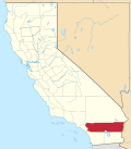
East Hemet, California | |
---|---|
Coordinates: 33°44′10″N116°56′25″W / 33.73611°N 116.94028°W | |
Country | United States |
State | California |
County | Riverside |
Area | |
• Total | 5.20 sq mi (13.45 km2) |
• Land | 5.20 sq mi (13.45 km2) |
• Water | 0.00 sq mi (0.00 km2) 0% |
Elevation | 1,690 ft (515 m) |
Population (2020) | |
• Total | 19,432 |
• Density | 3,740.52/sq mi (1,444.27/km2) |
Time zone | UTC-8 (PST) |
• Summer (DST) | UTC-7 (PDT) |
ZIP code | 92544 |
Area code | 951 |
FIPS code | 06-20697 |
GNIS feature ID | 1867016 |
East Hemet is a census-designated place (CDP) in Riverside County, California, United States, located east of Hemet. East Hemet is in an unincorporated area outside the city limits of Hemet. The population was 17,418 at the 2010 census, up from 14,823 at the 2000 census.
East Hemet is located at 33°44′10″N116°56′25″W / 33.73611°N 116.94028°W (33.736120, -116.940305). [3]
According to the United States Census Bureau, the CDP has a total area of 5.2 square miles (13 km2), all of it land.
Census | Pop. | Note | %± |
---|---|---|---|
2020 | 19,432 | — | |
U.S. Decennial Census [4] |
The 2010 United States Census [5] reported that East Hemet had a population of 17,418. The population density was 3,341.2 inhabitants per square mile (1,290.0/km2). The racial makeup of East Hemet was (62.4%) White, (11.9%) African American, (1.9%) Native American, (1.6%) Asian, (0.2%) Pacific Islander, (17.2%) from other races, and (4.9%) from two or more races. Hispanic or Latino of any race was 38.9%.
The Census reported that 17,352 people (99.6% of the population) lived in households, 56 (0.3%) lived in non-institutionalized group quarters, and 10 (0.1%) were institutionalized.
There were 5,320 households, out of which 2,499 (47.0%) had children under the age of 18 living in them, 2,908 (54.7%) were opposite-sex married couples living together, 936 (17.6%) had a female householder with no husband present, 408 (7.7%) had a male householder with no wife present. There were 429 (8.1%) unmarried opposite-sex partnerships, and 48 (0.9%) same-sex married couples or partnerships. 797 households (15.0%) were made up of individuals, and 349 (6.6%) had someone living alone who was 65 years of age or older. The average household size was 3.26. There were 4,252 families (79.9% of all households); the average family size was 3.55.
The population was spread out, with 5,224 people (30.0%) under the age of 18, 1,912 people (11.0%) aged 18 to 24, 4,319 people (24.8%) aged 25 to 44, 4,145 people (23.8%) aged 45 to 64, and 1,818 people (10.4%) who were 65 years of age or older. The median age was 32.2 years. For every 100 females, there were 98.1 males. For every 100 females age 18 and over, there were 94.5 males.
There were 5,869 housing units at an average density of 1,125.8 per square mile (434.7 per km2), of which 3,510 (66.0%) were owner-occupied, and 1,810 (34.0%) were occupied by renters. The homeowner vacancy rate was 3.5%; the rental vacancy rate was 10.1%. 10,808 people (62.1% of the population) lived in owner-occupied housing units and 6,544 people (37.6%) lived in rental housing units.
As of the census [6] of 2000, there were 14,823 people, 4,831 households, and 3,787 families residing in the CDP. The population density was 4,597.8 people per square mile (1,777.4 per km2). There were 5,064 housing units at an average density of 1,570.7 per square mile (607.2 per km2). The racial makeup of the CDP was 70.0% White, 12.5% Black or African American, 1.4% Native American, 1.0% Asian, 0.1% Pacific Islander, 11.9% from other races, and 4.0% from two or more races. 23.9% of the population were Hispanic or Latino of any race.
There were 4,831 households, out of which 42.4% had children under the age of 18 living with them, 57.7% were married couples living together, 15.1% had a female householder with no husband present, and 21.6% were non-families. 17.4% of all households were made up of individuals, and 7.9% had someone living alone who was 65 years of age or older. The average household size was 3.0 and the average family size was 3.4.
In the CDP, the population was spread out, with 32.8% under the age of 18, 8.5% from 18 to 24, 26.1% from 25 to 44, 19.8% from 45 to 64, and 12.8% who were 65 years of age or older. The median age was 33 years. For every 100 females, there were 94.4 males. For every 100 females age 18 and over, there were 89.5 males.
The median income for a household in the CDP was $39,828, and the median income for a family was $42,356. Males had a median income of $34,500 versus $24,493 for females. The per capita income for the CDP was $15,486. About 13.4% of families and 17.1% of the population were below the poverty line, including 22.4% of those under age 18 and 8.0% of those age 65 or over.
In the California State Legislature, East Hemet is in the 23rd Senate District , represented by Republican Rosilicie Ochoa Bogh, and in the 42nd Assembly District , represented by Democrat Jacqui Irwin. [7]
In the United States House of Representatives, East Hemet is in California's 25th congressional district , represented by Democrat Raul Ruiz. [8]
It is in the Hemet Unified School District. [9]
Le Grand is an unincorporated community and census-designated place (CDP) in Merced County, California, United States. Le Grand is 14 miles (23 km) east-southeast of Merced, the county seat at an elevation of 253 feet (77 m). The population was 1,592 at the 2020 census, down from 1,659 at the 2010 census.
Homeland is a census-designated place (CDP) in Riverside County, California, United States. The population was 5,969 at the 2010 census, up from 3,710 at the 2000 census.
Valle Vista is a unincorporated area in Riverside County, California, United States and is located in the San Jacinto Valley. Valle Vista is adjacent to and east of the cities of San Jacinto and Hemet. The population was 11,036 at the 2010 census, up from 8,356 at the 2000 census. For statistical purposes, the United States Census Bureau has defined Valle Vista as a census-designated place (CDP).
Winchester is a census-designated place (CDP) in Riverside County, California, USA. As of the 2010 census, the CDP had a total population of 2,534, up from 2,155 at the 2000 census.
La Presa is a census-designated place (CDP) in the East County region of San Diego County, California, United States. The population was 34,169 at the 2010 census, up from 32,721 at the 2000 census.
Solana is an unincorporated community and census-designated place (CDP) in Charlotte County, Florida, United States. The population was 671 at the 2020 census, down from 742 at the 2010 census. It is part of the Punta Gorda, Florida Metropolitan Statistical Area, included in the North Port-Bradenton, Florida Combined Statistical Area.
Lake Catherine is an unincorporated community and census-designated place (CDP) in Lake County, Illinois, United States. Per the 2020 census, the population was 1,279.
Harwich Center is a census-designated place (CDP) in the town of Harwich in Barnstable County, Massachusetts, United States. The population was 1,798 at the 2010 census.
Ashland is an unincorporated community and census-designated place (CDP) located within Cherry Hill, in Camden County, in the U.S. state of New Jersey. As of the 2010 United States Census, the CDP's population was 8,302.
Wanamassa is an unincorporated community and census-designated place (CDP) within Ocean Township, in Monmouth County, New Jersey, United States. As of the 2020 census, the CDP's population was 4,344. The community was named for Wanamassa, a Native American leader of the 17th century.
Lake Telemark is an unincorporated community and census-designated place (CDP) located within Rockaway Township, in Morris County, in the U.S. state of New Jersey. As of the 2010 United States Census, the CDP's population was 1,255.
Crestwood Village is an unincorporated community and census-designated place (CDP) located within Manchester Township, in Ocean County, in the U.S. state of New Jersey. As of the 2010 United States Census, the CDP's population was 7,907.
Leisure Village East is an unincorporated community and census-designated place (CDP) located within Lakewood Township, in Ocean County, in the U.S. state of New Jersey. As of the 2010 United States Census, the CDP's population was 4,217. Leisure Village East is one of several active adult communities bearing similar names. Leisure Village and Leisure Village West are the other two communities nearby.
Pleasant Run is a census-designated place (CDP) in Colerain Township, Hamilton County, Ohio, United States. The population was 4,861 at the 2020 census.
Kenilworth is a census-designated place (CDP) in North Coventry Township, Chester County, Pennsylvania, United States. The population was 2,148 at the 2020 census.
Berea is a census-designated place (CDP) in Greenville County, South Carolina, United States. The population was 14,295 at the 2010 census. It is part of the Greenville–Mauldin–Easley Metropolitan Statistical Area.
East Sumter is a census-designated place (CDP) in Sumter County, South Carolina, United States. The population was 1,220 at the 2000 census. It is included in the Sumter, South Carolina Metropolitan Statistical Area.
Lipscomb is an unincorporated community and census-designated place (CDP) in Lipscomb County, Texas, United States. It is the Lipscomb county seat. The population was 66 at the 2020 census.
Potter Lake is a census-designated place (CDP) in the town of East Troy, Walworth County, Wisconsin, United States. The population was 1,117 at the 2020 census.
Alpine Northwest is a census-designated place (CDP) in Lincoln County, Wyoming, United States. The population was 305 at the 2020 census.