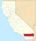
Edgemont, Riverside County, California

Last updated

Edgemont, California
USA California location map.svg
Red pog.svg
Location of Edgemont in California
Usa edcp location map.svg
Red pog.svg
Edgemont, Riverside County, California (the United States)
Coordinates: 33°55′00″N117°16′43″W / 33.91667°N 117.27861°W / 33.91667; -117.27861
Country United States
State California
County Riverside
Elevation
[1]
1,554 ft (474 m)
Time zone UTC-8 (PST)
  Summer (DST) UTC-7 (PDT)
[2]

Edgemont was an unincorporated community in Riverside County, California, and is now part of the City of Moreno Valley. [3]

Geography

Edgemont is located in Moreno Valley, California in Riverside County, California. [4] The coordinates are 33.510N, −117.14W, the elevation is 1,564 feet, and it is in the Pacific Time Zone (UTC-8, UTC-7 in the summer).

Edgemont lies in the coast region of California, and is about 57 miles (92 km) from Los Angeles. [5]

It was originally named Rose Arbor, and it was subdivided for poultry ranches in 1923. [6]

References

  1. U.S. Geological Survey Geographic Names Information System: Edgemont, California. Retrieved on 2008-07-10.
  2. "Edgemont CA". ZIP Code Lookup. Archived from the original on June 15, 2011. Retrieved July 10, 2008.
  3. "Edgemont Populated Place Profile / Riverside County, California Data". California.HomeTownLocator.com. Retrieved January 21, 2018.
  4. "Edgemont, CA - Edgemont, California Map & Directions - MapQuest". www.MapQuest.com. Retrieved January 21, 2018.
  5. "Google Maps". Google Maps . Retrieved January 21, 2018.
  6. Durham, David L. (2001). Place-Names of California's Desert Counties. Clovis, CA: World Dancer Press. p. 56. ISBN   1-884995-31-4.