El Cariso, California

Last updated

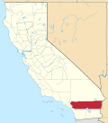
El Cariso is an unincorporated community in Riverside County, California. It lies along the Ortega Highway, just west of where it crosses the crest of the Santa Ana Mountains a few miles southwest of Lake Elsinore. It lies within the Trabuco District of the Cleveland National Forest. El Cariso Campground is north of the town across the highway from the El Cariso Fire Station.
Contents

History

El Cariso is believed to be near the location of the mountain hideout of Juan Flores, the leader of the Flores Daniel Gang. Located just over the county line in Riverside County, its mountain meadows provided a safe place to keep horses stolen in Los Angeles and San Bernardino Counties outside the jurisdiction of their Sheriff before they were driven elsewhere to be sold.

It is one of the sites believed to be the location of the 1857 shootout between the gang and a large posse from Los Angeles, and Temecula that found then killed or captured many of the gang. [1]

In September 2024, the community was heavily impacted by the Airport Fire, destroying dozens of homes in the area. [2]

Related Research Articles

<span class="mw-page-title-main">Southern California</span> American geographic and cultural region

Southern California is a geographic and cultural region that generally comprises the southern portion of the U.S. state of California. It includes the Los Angeles metropolitan area as well as the Inland Empire. The region generally contains ten of California's 58 counties: Los Angeles, San Diego, Orange, Riverside, San Bernardino, Kern, Ventura, Santa Barbara, San Luis Obispo, and Imperial counties.

<span class="mw-page-title-main">San Bernardino County, California</span> County in southern California, United States

San Bernardino County, officially the County of San Bernardino and sometimes abbreviated as S.B. County, is a county located in the southern portion of the U.S. state of California, and is located within the Inland Empire area. As of the 2020 U.S. Census, the population was 2,181,654, making it the fifth-most populous county in California and the 14th-most populous in the United States. The county seat is San Bernardino.

<span class="mw-page-title-main">California State Route 74</span> Highway in California

State Route 74, part of which forms the Palms to Pines Scenic Byway or Pines to Palms Highway, and the Ortega Highway, is a state highway in the U.S. state of California. It runs from Interstate 5 in San Juan Capistrano in Orange County to the city limits of Palm Desert in Riverside County. Stretching about 111 miles (179 km), it passes through several parks and National Forests between the Pacific coast and the Coachella Valley.

<span class="mw-page-title-main">Angeles National Forest</span> National forest in California, United States

The Angeles National Forest (ANF) of the U.S. Forest Service is located in the San Gabriel Mountains and Sierra Pelona Mountains, primarily within Los Angeles County in southern California. The ANF manages a majority of the San Gabriel Mountains National Monument.

<span class="mw-page-title-main">Gorman, California</span> Unincorporated community in California, United States

Gorman is an unincorporated community in northwestern Los Angeles County, California, United States. It is located in Peace Valley south of the Tejon Pass, which links Southern California with the San Joaquin Valley and Northern California. Due to this location, the area has served as a historic travel stop dating back to the indigenous peoples of California. Tens of thousands of motorists travel through Gorman daily on the Golden State Freeway since the highway's completion in the mid-20th Century.

<span class="mw-page-title-main">Victor Valley</span> Arid valley in southern California, United States

The Victor Valley is a valley in the Mojave Desert and subregion of the Inland Empire, in San Bernardino County in Southern California.

<span class="mw-page-title-main">Desert Center, California</span> Census-designated place in California, United States

Desert Center is a census designated place in the Colorado Desert in Riverside County, California. It is in southern California, between the cities of Indio and Blythe at the junction of Interstate 10 and State Route 177, about halfway between Phoenix and Los Angeles. The ZIP Code is 92239, and the community is in telephone area codes 442 and 760. The elevation is 656 feet (200 m). The population was 204 at the 2010 census.

The Imperial Highway is a west-east thoroughfare in the counties of Los Angeles, Orange, Riverside, San Diego, and Imperial in the U.S. state of California. The main portion of the existing route begins at Vista Del Mar in Los Angeles near the Los Angeles International Airport and ends at the Anaheim–Orange city line at Via Escola where it becomes Cannon Street. Historically, the Imperial Highway extended from Vista Del Mar to Calexico, where a portion of the highway still exists. The original route was replaced with other highways, leading the older portions of the Imperial Highway to fall out of use.

<span class="mw-page-title-main">Hemet-Ryan Airport</span> Airport

Hemet-Ryan Airport is three miles (6 km) southwest of Hemet, in Riverside County, California.

<span class="mw-page-title-main">Interstate 10 in California</span> Interstate Highway in California

Interstate 10 (I-10) is a transcontinental Interstate Highway in the United States, stretching from Santa Monica, California, to Jacksonville, Florida. The segment of I-10 in California, also known as the Pearl Harbor Memorial Highway, runs east from Santa Monica through Los Angeles, San Bernardino, and Palm Springs before crossing into the state of Arizona. In the Greater Los Angeles area, it is known as the Santa Monica and San Bernardino freeways, linked by a short concurrency on I-5 at the East Los Angeles Interchange. I-10 also has parts designated as the Rosa Parks and Sonny Bono Memorial freeways. Some parts were also formerly designated as the Christopher Columbus Transcontinental Highway. However, the California State Legislature removed this designation following the passage of a bill on August 31, 2022. I-10 is also known colloquially as "the 10" to Southern California residents (See also California English § Freeways).

<span class="mw-page-title-main">Modjeska Canyon, California</span> Unincorporated community in Orange County, California, United States

Modjeska Canyon is an unincorporated community and census designated place (CDP) on the western slope of the Santa Ana Mountains in eastern Orange County, California. It is a suburban community of several hundred residents, with a small park and a volunteer fire station. The ZIP Code is 92676, and the community is inside area code 714.

<span class="mw-page-title-main">San Timoteo Canyon</span> Landform in Riverside and San Bernardino Counties, California

San Timoteo Canyon is a river valley canyon southeast of Redlands, in the far northwestern foothills of the San Jacinto Mountains in the Inland Empire region of Southern California.

<span class="mw-page-title-main">San Jacinto Valley</span> Valley in Riverside County, California

The San Jacinto Valley is a valley located in Riverside County, in Southern California, in the Inland Empire. The valley is located at the base of the San Jacinto Mountains in the east and Santa Rosa Hills to the south with the San Gorgonio Pass to the north. The average elevation is 1,500 feet (460 m), with the highest points in the foothills south of Hemet and the western slopes of the San Jacinto Mountains. It is home to two cities, Hemet and San Jacinto, and several unincorporated communities. According to the 2020 census, the valley has a combined population of over 190,000 residents, including more than 143,000 residents within the city limits of Hemet and San Jacinto. The valley is also where the story and play "Ramona" was set; the story was written after author Helen Hunt Jackson visited the valley in the 1880s. The valley is also known for being an area of agriculture, which has given way to more urbanized development.

<span class="mw-page-title-main">Riverside County, California</span> County in California, United States

Riverside County is a county located in the southern portion of the U.S. state of California. As of the 2020 census, the population was 2,418,185, making it the fourth-most populous county in California and the 10th-most populous in the United States. The name was derived from the city of Riverside, which is the county seat.

Rancho Potreros de San Juan Capistrano was a 1,168-acre (4.73 km2) Mexican land grant in present-day Orange County and Riverside County, California given in 1845 by Governor Pío Pico to John Forster. The grant was composed of three detached tracts, called, Rancho Potrero los Pinos, Rancho Potrero el Cariso, and Rancho Potrero de la Cienega. The grants were located in the Santa Ana Mountains in the present-day Cleveland National Forest in the southeast corner of the Orange County and western Riverside County.

<span class="mw-page-title-main">Elsinore Mountains</span> Mountain ridge in Riverside County, California

The Elsinore Mountains are a ridge of mountains within the larger range of the Santa Ana Mountains, in the Cleveland National Forest, Riverside County, California, United States. the tallest peaks within the range is the unofficially named San Mateo Peak at 3,591 ft (1,095 m). Second is officially named Elsinore Peak at 3,536 ft (1,078 m). The Elsinore Mountanins run in a ridge from just east of El Cariso, southeast to Elsinore Peak. Beyond that peak the ridge begins to descend and curves to the east. From Elsinore Peak, a ridge runs to the west and then northwest to San Mateo Peak, enclosing the Morrell Potrero on the south and west.

<span class="mw-page-title-main">Inland Empire</span> Metropolitan area in California, United States

The Inland Empire is a metropolitan area and region inland of and adjacent to coastal Southern California, centering around the cities of San Bernardino and Riverside, and bordering Los Angeles County and Orange County to the west and San Diego County to the south. The bulk of the population is centered in the cities of northwestern Riverside County and southwestern San Bernardino County, and is sometimes considered to include the desert communities of the Coachella and Victor Valleys, respectively on the other sides of the San Gorgonio Pass and San Bernardino Mountains from the Santa Ana River watershed that forms the bulk of the Inland Empire; a much broader definition includes all of Riverside and San Bernardino counties. The combined land area of the counties of the Inland Empire is larger than ten U.S. states—West Virginia, Maryland, Hawaii, Massachusetts, Vermont, New Hampshire, New Jersey, Connecticut, Delaware and Rhode Island.

<span class="mw-page-title-main">Holy Fire (2018)</span> 2018 wildfire in Southern California

The Holy Fire was a wildfire that burned in the Cleveland National Forest in Orange and Riverside Counties, California. The wildfire started on August 6, 2018, at around 1:15 PM PDT, in the vicinity of Trabuco Canyon. A suspected arsonist was booked into the Orange County jail in Santa Ana, California but found not guilty in 2023. The blaze burned 23,136 acres (94 km2) and destroyed 18 buildings, before it was fully contained on September 13, 2018. While the fire was actively spreading in early and mid-August, residents of the nearby cities of Corona, Temescal Valley, and Lake Elsinore were placed under evacuation orders.

<span class="mw-page-title-main">Loop Fire</span> 1966 wildfire in Southern California

The Loop Fire was a wildfire in Angeles National Forest, above Sylmar, California. Twelve members of the El Cariso Hotshots were killed: 10 died at the scene November 1, 1966; two died later as a result of their injuries while hospitalized.

<span class="mw-page-title-main">Fairview Fire</span> 2022 wildfire in Southern California

The Fairview Fire is a deadly and destructive wildfire that burned during the 2022 California wildfire season southwest of Valle Vista and east of Hemet in Riverside County, California in the United States. The fire ignited on September 5, 2022, during a severe heatwave that had plagued much of the southwest throughout early September and, due to the extreme weather conditions, grew to a deadly and destructive conflagration in the chaparral-filled foothills within just several hours of igniting.

References

  1. Chris Enss, Outlaw Tales of California: True Stories of the Golden State's Most Infamous Crooks, Culprits, and Cutthroats, Globe Pequot, 2008, pp. 67. [ permanent dead link ]
  2. Wenzke, Marissa (September 14, 2024). "More than 80 homes lost in Southern California's massive Airport Fire: "I don't have nowhere to go"". cbsnews.com. CBS News . Retrieved September 14, 2024.

33°38′11″N117°25′13″W / 33.63639°N 117.42028°W / 33.63639; -117.42028