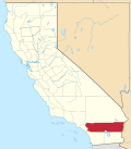
Bonnie Bell, California

Last updated
Bonnie Bell
California Locator Map with US.PNG
Red pog.svg
Bonnie Bell
Location in California
Usa edcp location map.svg
Red pog.svg
Bonnie Bell
Bonnie Bell (the United States)
Coordinates: 33°56′56″N116°38′35″W / 33.9488°N 116.6431°W / 33.9488; -116.6431 Coordinates: 33°56′56″N116°38′35″W / 33.9488°N 116.6431°W / 33.9488; -116.6431
Country United States
State California
County Riverside County
Elevation
[1]
1,683 ft (513 m)

Bonnie Bell is an unincorporated community in Riverside County, California. [1] It lies at an elevation of 1683 feet (513 m). [1]

Bonnie Bell is located 3 miles (4.8 km) north of Interstate 10 on Whitewater Canyon Road beside the Whitewater River. The community sits where the most eastern end of the San Gorgonio Pass meets the most northwestern end of the Coachella Valley, 9.5 miles (15.3 km) northwest of Palm Springs. [2]

Wind turbine controversy

The transition point from the San Gorgonio Pass to the Coachella Valley is one of the windiest locations in the United States. This makes the area ideal for wind energy projects. Beginning in the 1980s the San Gorgonio Pass wind farm started being developed. Many wind turbines were proposed and constructed around the community of Bonnie Bell. Though a tiny community, the people of Bonnie Bell strongly resisted any wind development that encroached on the town, or the ridges around the town. In 1992 the residents successfully lobbied the Bureau of Land Management, and Mesa Wind Developers, to move 24 wind turbines from the eastern edge of the company's right-of-way, further back into the San Bernardino Mountains. [3]

In 1999, and again in 2019, new proposals to install wind turbines on the ridges of Whitewater Canyon, above Bonnie Bell, were submitted for consideration. The residents claimed the settlement in 1992 prevented any additional development on the ridge, but the Bureau of Land Management has said future development had not been agreed to in the 1992 settlement.

Related Research Articles

Beaumont, California American city in California, United States

Beaumont is a city in Riverside County, California, United States, located at the summit of the San Gorgonio Pass, between the San Bernardino Mountains and Mount San Gorgonio to the north, and the San Jacinto Mountains and San Jacinto Peak to the south. Early native American inhabitants included the Serrano and Cahuilla people, who still live on reservation lands in the area.

Calimesa, California American city in California, United States

Calimesa is a city in Riverside County, California, United States in the Greater Los Angeles area. The population was 7,879 at the 2010 census, up from 7,139 at the 2000 census. It is situated in the San Gorgonio Pass.

Cathedral City, California American city in California, United States

Cathedral City, colloquially known as "Cat City", is a desert resort city in Riverside County, California, United States, within the Colorado Desert's Coachella Valley. Situated between Palm Springs and Rancho Mirage, the city has the second largest population, after Indio, of the nine cities in the Coachella Valley. Its population was 51,200 at the 2010 census.

Palm Desert, California American city in California, United States

Palm Desert is a city in Riverside County, California, United States, in the Coachella Valley, approximately 14 miles (23 km) east of Palm Springs, 121 miles (195 km) northeast of San Diego and 122 miles (196 km) east of Los Angeles. The population was 48,445 at the 2010 census, up from 41,155 at the 2000 census. The city was one of the state's fastest growing in the 1980s and 1990s, beginning with 11,801 residents in 1980, doubling to 23,650 in 1990, 35,000 in 1995, and nearly double its 1990 population by 2000. A major center of growth in the Coachella Valley, Palm Desert is a popular retreat for "snowbirds" from colder climates, who swell its population by an estimated 31,000 each winter. Palm Desert has seen more residents become "full-timers", mainly from the coasts and urban centers of California, who have come for both affordable and high-valued homes.

San Bernardino Mountains Mountain range in Southern California

The San Bernardino Mountains are a high and rugged mountain range in Southern California in the United States. Situated north and northeast of San Bernardino and spanning two California counties, the range tops out at 11,503 feet (3,506 m) at San Gorgonio Mountain – the tallest peak in all of Southern California. The San Bernardinos form a significant region of wilderness and are popular for hiking and skiing.

San Jacinto Mountains Mountain range in Riverside County, in southern California

The San Jacinto Mountains are a mountain range in Riverside County, located east of Los Angeles in southern California in the United States. The mountains are named for one of the first Black Friars, Saint Hyacinth, who is a popular patron in Latin America.

Coachella Valley Valley in Southern California

The Coachella Valley is an arid rift valley in the Colorado Desert of Southern California's Riverside County. The valley extends approximately 45 mi (72 km) southeast from the San Gorgonio Pass to the northern shore of the Salton Sea and the neighboring Imperial Valley, and is approximately 15 mi (24 km) wide along most of its length. It is bounded on the northeast by the San Bernardino and Little San Bernardino Mountains, and on the southwest by the San Jacinto and Santa Rosa Mountains.

Santa Rosa Mountains (California) Mountain range in California

The Santa Rosa Mountains are a short mountain range in the Peninsular Ranges system, located east of the Los Angeles Basin and northeast of the San Diego metropolitan area of southern California, in the southwestern United States.

Cahuilla Native American people, living in the inland areas of southern California

The Cahuilla, also known as ʔívil̃uqaletem or Ivilyuqaletem, are a Native American people of the various tribes of the Cahuilla Nation, living in the inland areas of southern California. Their original territory included an area of about 2,400 square miles (6,200 km2). The traditional Cahuilla territory was near the geographic center of Southern California. It was bounded to the north by the San Bernardino Mountains, to the south by Borrego Springs and the Chocolate Mountains, to the east by the Colorado Desert, and to the west by the San Jacinto Plain and the eastern slopes of the Palomar Mountains.

San Gorgonio Wilderness

The San Gorgonio Wilderness is located in the eastern San Bernardino Mountains, in San Bernardino County and into northern Riverside County, Southern California.

San Gorgonio Pass Mountain pass in Riverside County, California, United States

The San Gorgonio Pass, or Banning Pass, is a 2,600 ft (790 m) elevation gap on the rim of the Great Basin between the San Bernardino Mountains to the north and the San Jacinto Mountains to the south. The pass was formed by the San Andreas Fault, a major transform fault between the Pacific plate and the North American plate. The tall mountain ranges on either side of the pass result in the pass being a transitional zone from a Mediterranean climate west of the pass, to a Desert climate east of the pass. This also makes the pass area one of the windiest places in the United States, and why it is home to the San Gorgonio Pass wind farm.

Santa Rosa and San Jacinto Mountains National Monument Protected area in California

The Santa Rosa and San Jacinto Mountains National Monument is a National Monument in southern California. It includes portions of the Santa Rosa and San Jacinto mountain ranges, the northernmost ones of the Peninsular Ranges system. The national monument covers portions of Riverside County, west of the Coachella Valley, approximately 100 miles (160 km) southeast of downtown Los Angeles.

Whitewater River (California)

The Whitewater River is a small permanent stream in western Riverside County, California, with some upstream tributaries in southwestern San Bernardino County. The river's headwaters are in the San Bernardino Mountains and it terminates at the Salton Sea in the Colorado Desert. The area drained by the Whitewater River is part of the larger endorheic Salton Sea drainage basin.

The San Gorgonio River is a 26.8-mile-long (43.1 km) river primarily flowing in western Riverside County, with a small upstream section in southwestern San Bernardino County, in southern California.

San Gorgonio Pass wind farm

The San Gorgonio Pass wind farm is a wind farm that stretches from the eastern slope of the San Gorgonio Pass, near Cabazon, to North Palm Springs, on the western end of the Coachella Valley, in Riverside County, California. Flanked by Mount San Gorgonio and the Transverse Ranges to the North, and Mount San Jacinto and the Peninsular Ranges to the South, the San Gorgonio Pass is a transitional zone from a Mediterranean climate west of the pass, to a Desert climate east of the pass. This makes the pass area one of the windiest places in the United States.

Whitewater, California census-designated place in California, United States

Whitewater is a census-designated place in Riverside County, California. It is directly off Interstate 10 halfway between North Palm Springs and Cabazon on the way from Palm Springs to Los Angeles. It is known as the site of the San Gorgonio Pass Wind Farm. The ZIP Code is 92282, and the community is inside area code 760. The population was 859 at the 2010 census. The elevation is 1,575 feet (480 m).

Riverside County, California County in southern portion of California, United States

Riverside County is a county located in the southern portion of the U.S. state of California. As of the 2010 census, the population was 2,189,641, making it the fourth-most populous county in California and the 10th-most populous in the United States. The name was derived from the city of Riverside, which is the county seat.

The Coachella Valley Water District is an independent special district formed in 1918, specifically to protect and conserve local water sources in the Coachella Valley. Since then, the district has grown into a multi-faceted agency that delivers irrigation and domestic (drinking) water, collects and recycles wastewater, provides regional storm water protection, replenishes the groundwater basin and promotes water conservation.

1986 North Palm Springs earthquake

The 1986 North Palm Springs earthquake occurred on July 8 at 02:20:44 local time with a moment magnitude of 6.0 and a maximum Mercalli Intensity of VII. The shock occurred in a complex setting along the San Andreas Fault Zone where it bisects San Gorgonio Mountain and San Jacinto Peak at the San Gorgonio Pass and was the first in a series of three earthquakes that affected southern California and the northern Owens Valley in July 1986. Numerous strong motion instruments recorded the event, one of which showed relatively high accelerations. Between 29 and 40 people were injured, and financial losses were estimated to be in the range of $4.5 to 6 million.

Sand to Snow National Monument

Sand to Snow National Monument is a U.S. National Monument located in San Bernardino County and into northern Riverside County, Southern California.

References

  1. 1 2 3 U.S. Geological Survey Geographic Names Information System: Bonnie Bell, California
  2. Durham, David L. (1998). California's Geographic Names: A Gazetteer of Historic and Modern Names of the State. Clovis, Calif.: Word Dancer Press. p. 1397. ISBN   1-884995-14-4.
  3. "Bonnie Bell Residents Bid Turbines Farewell". Palm Springs, California: Gannett. The Desert Sun. May 20, 1992. p. A3.