Calimesa, California

Last updated

City of Calimesa
California Landmark No. 749 Saahatpa Indian Villiage Site - panoramio.jpg
Saahatpa plaque
Riverside County California Incorporated and Unincorporated areas Calimesa Highlighted 0609864.svg
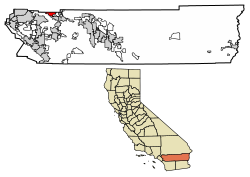
Location of Calimesa in Riverside County, California.
Usa edcp relief location map.png
Red pog.svg
City of Calimesa
Location in the United States
Coordinates: 34°00′14″N117°03′43″W / 34.00389°N 117.06194°W / 34.00389; -117.06194
Country Flag of the United States.svg United States
State Flag of California.svg  California
County Flag of Riverside County, California.png Riverside
Incorporated (city) December 1, 1990 [1]
Government
  Type Council-Manager [2]
   Mayor William "Bill" Davis [2]
  Mayor Pro Tem Wendy Hewitt
   City Council Linda Molina
Jeff Cervantez
John Manly
Area
[3]
  Total14.87 sq mi (38.50 km2)
  Land14.87 sq mi (38.50 km2)
  Water0.00 sq mi (0.00 km2)  0%
Elevation
[4]
2,392 ft (729 m)
Population
 (2020)
  Total10,026
  Density674.38/sq mi (260.39/km2)
Time zone UTC-8 (PST)
  Summer (DST) UTC-7 (PDT)
ZIP code
92320
Area code 909
FIPS code 06-09864
GNIS feature IDs 1667904, 2409961
Website www.cityofcalimesa.net

Calimesa (portmanteau of California and Mesa, Spanish for "table") is a city in Riverside County, California, United States in the Greater Los Angeles area. The population was 7,879 at the 2010 census, up from 7,139 at the 2000 census. It is situated in the San Gorgonio Pass.

Contents

History

Etymology

Historically, Calimesa began as a small rural town with mostly single-family homes and ranches. With completion of U.S. Route 99 (modern day I-10), businesses opened and Calimesa began to take on a separate identity from the larger neighboring town of Yucaipa. In June 1929, nearly 100 residents attended a meeting and decided to apply for their own post office and to start a “name contest” in which the winner was paid $10. Calimesa was chosen from 107 names submitted, and is said to come from “cali” (referring to California) and “mesa” from the Spanish word meaning "table" or "table-lands." The first post office was the grocery store at Calimesa Boulevard and Avenue K.

Beginnings

Serrano people and the Cahuilla people inhabited the area. [5]

The modern history of the area was initiated with the establishment of Spanish missions in Alta California in 1769. The need for a land route to these missions inspired Captain Juan Bautista de Anza to lead a party through the area in 1774. As early as 1820, reference can be found to the messenger footpath for the missions in Arizona to the San Gabriel Mission.

The Assistencia in Redlands (which has been rebuilt), and Rancho San Gorgonio, were part of the San Gabriel Mission located near today's Los Angeles. The San Gorgonio rancheria covered most of the San Gorgonio Pass area. [6] A site within the rancheria, the location of the present Highland Springs Ranch & Inn, along with Whitewater, and a house at the east end of present-day Singleton Road in Calimesa, all became stage stops along this path.

The post office reinforced the residents' feeling of a community separate from the town of Yucaipa. In 1939 or 1940, the Calimesa Improvement Association, Inc. was formed. According to the constitution of the association, “The object and purpose of the association shall be the development and improvement of Calimesa and The Community”. Volunteers built a community center at the corner of Bryant and Avenue H, which had been designated a park site by the Redlands-Yucaipa Land Company. The "South Mesa Water Company" purchased the land for a well site and allowed the association to use it for community events.

In 1962, the Calimesa Improvement Association became the Calimesa Chamber of Commerce. The Improvement Association and the Chamber have operated as a mix of promoting Calimesa, providing community service, and being a sounding board for residents’ problems. Prior to 1949, the fire protection for the valley was provided by the California Department of Forestry at the Avenue A station, which today is the office of County Service Area 63 in Yucaipa. Calimesa community members felt the need for more protection on the south side of the wash, so in 1949 they formed the Volunteer Fire Department.

Incorporation

The City of Calimesa was incorporated on December 1, 1990, soon after the incorporation of its northern neighbor, the City of Yucaipa. Prior to its incorporation, the City of Calimesa existed as an unincorporated census designated town that straddled the Riverside–San Bernardino County line at the location where Interstate 10 climbs the San Gorgonio Pass going eastward from Redlands, California.

Future

The previous decade saw several planned communities approved for development within the city, including the JP Ranch Development (approximately 750 total homes), Calimesa Springs Development (approximately 270 homes), Summerwind Ranch at Oak Valley (3,841 homes, 260 acres of mixed-use commercial), and Mesa Verde (3,500 homes, and 64 acres of mixed-use commercial space). The number of approved units currently outnumbers the total population within the city. However, development of these large tracts have been slow to move forward until the demand increases. [7]

Sandalwood Fire

The Sandalwood Fire was a wildfire that burned in the city of Calimesa in Riverside County, California. The fire started on October 10, 2019 in the afternoon, killing two people [8] and destroying 74 structures. [9] The fire burned for five days. [10]

Transportation

The city is accessible from Interstate 10, which geographically traverses the city from north to south. Major transportation corridors include County Line Road (which runs east–west from the freeway), Sandalwood Drive (which runs east–west from the freeway), Singleton Road (which runs east–west from the freeway), Cherry Valley Boulevard (which runs east–west from the freeway), Avenue "L" (which runs east–west from the freeway), Myrtlewood Drive (which runs east–west from Calimesa Boulevard to California Street), Calimesa Boulevard (which runs north–south and parallels the freeway from Live Oak Canyon Road in Yucaipa to Cherry Valley Boulevard/Tukwet Canyon Parkway near Beaumont), and Bryant Street (which runs north–south from Highway 38/Mill Creek Road/Mentone Boulevard and connects with Singleton Road). The city has no airports or direct access to railroads.

Geography

The city is located in the northwestern portion of Riverside County, between Yucaipa and Beaumont. It is within the Yucaipa Valley section of Southern California's Inland Valley, and at the western edge of the San Gorgonio Pass between San Bernardino and Palm Springs. Calimesa is located in the region known as the Inland Empire, which covers San Bernardino and Riverside Counties.

Situated within the foothills of the San Bernardino Mountains, the city's elevation ranges between 2,300 to 3,500 feet (700 to 1,070 m) above sea level.

According to the United States Census Bureau, the city has a total area of 14.8 square miles (38 km2), all of it land.

City limits

Historically, Calimesa is divided from the City of Yucaipa by the Wildwood Canyon Wash; politically, "County Line Road" divides the two towns. Much of what was originally known as "Calimesa" actually lies within the city boundaries of Yucaipa, including "I-Street" (Calimesa) Park and Calimesa Elementary School. Because State of California law prohibits the incorporation or annexation of cities over county lines, the city was unable to adjoin what was considered the town of Calimesa when it finally incorporated. When Yucaipa incorporated, it included the area outside of the Yucaipa Valley on the "hilltop" or "mesa" that was traditionally known as Calimesa within its city boundaries, so as not to leave a gap of unincorporated area between the two towns. Although the two cities are in separate counties, both Yucaipa and Calimesa share the same basic street grid system and addressing, including many named and alphabetical streets which extend from Yucaipa well into Calimesa. The general boundary between the two cities is County Line Road, which does not follow the exact county line in some places due to the alignment of Calimesa Creek, which meanders in and out of both Yucaipa and Calimesa.

The city limits of Calimesa also extend south to the City of Beaumont, California. Although much less refined, the boundaries between Beaumont and Calimesa fall generally along the Southern California Edison (SCE) right-of-way that extends from the El Casco electrical sub-station facility near Moreno Valley, California, eastward. Near Interstate 10, Champions Drive is the common boundary between the two cities.

Demographics

Historical population
CensusPop.Note
1990 4,647
2000 7,13953.6%
2010 7,87910.4%
2020 10,02627.2%
U.S. Decennial Census [11]

2010

At the 2010 census Calimesa had a population of 7,879. The population density was 530.7 inhabitants per square mile (204.9/km2). The racial makeup of Calimesa was 6,777 (86.0%) White (72.7% Non-Hispanic White), [12] 88 (1.1%) African American, 99 (1.3%) Native American, 100 (1.3%) Asian, 10 (0.1%) Pacific Islander, 565 (7.2%) from other races, and 240 (3.0%) from two or more races. Hispanic or Latino of any race were 1,762 persons (22.4%). [13]

The census reported that 7,828 people (99.4% of the population) lived in households, 42 (0.5%) lived in non-institutionalized group quarters, and 9 (0.1%) were institutionalized.

There were 3,314 households, 773 (23.3%) had children under the age of 18 living in them, 1,609 (48.6%) were opposite-sex married couples living together, 334 (10.1%) had a female householder with no husband present, 157 (4.7%) had a male householder with no wife present. There were 162 (4.9%) unmarried opposite-sex partnerships, and 22 (0.7%) same-sex married couples or partnerships. 1,024 households (30.9%) were one person and 609 (18.4%) had someone living alone who was 65 or older. The average household size was 2.36. There were 2,100 families (63.4% of households); the average family size was 2.94.

The age distribution was 1,414 people (17.9%) under the age of 18, 602 people (7.6%) aged 18 to 24, 1,513 people (19.2%) aged 25 to 44, 2,310 people (29.3%) aged 45 to 64, and 2,040 people (25.9%) who were 65 or older. The median age was 48.8 years. For every 100 females, there were 92.4 males. For every 100 females age 18 and over, there were 89.8 males.

There were 3,687 housing units at an average density of 248.3 per square mile, of the occupied units 2,674 (80.7%) were owner-occupied and 640 (19.3%) were rented. The homeowner vacancy rate was 5.9%; the rental vacancy rate was 10.3%. 6,059 people (76.9% of the population) lived in owner-occupied housing units and 1,769 people (22.5%) lived in rental housing units.

According to the 2010 United States Census, Calimesa had a median household income of $44,817, with 14.5% of the population living below the federal poverty line. [12]

2000

At the 2000 census there were 7,139 people in 2,982 households, including 2,006 families, in the city. The population density was 458.3 inhabitants per square mile (177.0/km2). There were 3,248 housing units at an average density of 208.5 per square mile (80.5/km2). The racial make-up of the city was 89.1% White, 0.6% Black or African American, 0.7% Native American, 1.1% Asian, 0.1% Pacific Islander, 5.4% from other races, and 3.1% from two or more races. 14.1% of the population were Hispanic or Latino of any race. [14] Of the 2,982 households 24.2% had children under the age of 18 living with them, 54.3% were married couples living together, 9.2% had a female householder with no husband present, and 32.7% were non-families. 28.1% of households were one person and 16.8% were one person aged 65 or older. The average household size was 2.36 and the average family size was 2.87.

The age distribution was 21.8% under the age of 18, 6.2% from 18 to 24, 23.0% from 25 to 44, 23.0% from 45 to 64, and 26.0% 65 or older. The median age was 44 years. For every 100 females, there were 88.6 males. For every 100 females age 18 and over, there were 84.8 males.

The median income for a household in the city was $37,849 in 2000, and $43,557 in 2007. The median family income in 2000 was $43,220. Males had a median income of $41,533 versus $27,232 for females. The per capita income for the city was $20,242. About 8.4% of families and 12.2% of the population were below the poverty line, including 18.2% of those under age 18 and 9.6% of those age 65 or over.

Government

In the California State Legislature, Calimesa is in the 23rd Senate District , represented by Republican Rosilicie Ochoa Bogh, and in the 42nd Assembly District , represented by Democrat Jacqui Irwin. [15]

In the United States House of Representatives, Calimesa is in California's 41st congressional district , represented by Republican Ken Calvert.

Calimesa was one of a few cities in California to elect a Libertarian mayor, by the name of Jeff Hewitt, serving from December 2015 to December 2018. [16]

2009 Voter Registration Information

  • Democrats - 1,373 or 32%
  • Republican - 2,121 or 49%
  • Other - 180 or 4%
  • Decline to State - 627 or 15%

Voting History

Calimesa city vote
by party in presidential elections
Year Democratic Republican Third Parties
2020 [17] 34.16% 1,96862.25%3,5863.59% 207
2016 [18] 31.40% 1,17763.11%2,3665.49% 206

Education

Public education for most Calimesa children is provided by the Yucaipa-Calimesa Joint Unified School District, with the remaining southernmost area now served by the neighboring Beaumont Unified School District. [19] Few of the existing "developed" portions of the city are currently within the Beaumont boundaries, but the area within the Beaumont Unified School District boundaries is the fastest growing area of town.[ citation needed ]

Schools

The City of Calimesa is within two school districts; the Yucaipa-Calimesa Joint Unified School District serves the western portion of the city, while the southeastern end of the city is served by the Beaumont Unified School District. There is currently only one public school in Calimesa, Mesa View Middle School, which opened in late August 2009. Mesa View was built to be the school district's second high school. However, due to a slowdown in home construction, the district is facing declining enrollment. As a result, Mesa View will remain a middle school until growth requires a change. In November 2017, a 13-year-old student at Mesa View Middle School who was frequently bullied committed suicide, increasing global awareness about bullying and suicide among young adults.

Calimesa Elementary School is actually located within the City of Yucaipa, and high school students attend Yucaipa High School. Calimesa's only currently-operating elementary school—and only currently operating high school—is Mesa Grande Academy, a private K-12 school owned by the Seventh-day Adventist Church.

The nearest community college is Crafton Hills College in Yucaipa.

Public safety

Police services in Calimesa are provided by the Riverside County Sheriff's Department via the Cabazon regional station.

The city of Calimesa is served by the Calimesa Fire Department.

Although there are several clinics in Calimesa, the nearest medical facilities are in Yucaipa, Redlands, Banning and Beaumont.

Related Research Articles

<span class="mw-page-title-main">Santa Ana, California</span> City in California, United States

Santa Ana is a city in and the county seat of Orange County, California, United States. Located in the Greater Los Angeles region of Southern California, the city's population was 310,227 at the 2020 census, making Santa Ana the second most populous city in Orange County, the 14th-most populous city in California, and the 65th most populous city in the United States. Santa Ana is a major regional economic and cultural hub for the Orange Coast.

<span class="mw-page-title-main">San Bernardino County, California</span> County in southern California, United States

San Bernardino County, officially the County of San Bernardino and sometimes abbreviated as S.B. County, is a county located in the southern portion of the U.S. state of California, and is located within the Inland Empire area. As of the 2020 U.S. Census, the population was 2,181,654, making it the fifth-most populous county in California and the 14th-most populous in the United States. The county seat is San Bernardino.

<span class="mw-page-title-main">Greater Los Angeles</span> Metropolitan area in California, US

Greater Los Angeles is the most populous metropolitan area in the U.S. state of California, encompassing five counties in Southern California extending from Ventura County in the west to San Bernardino County and Riverside County in the east, with the City of Los Angeles and Los Angeles County at its center, and Orange County to the southeast. The Los Angeles–Anaheim–Riverside combined statistical area (CSA) covers 33,954 square miles (87,940 km2), making it the largest metropolitan region in the United States by land area. The contiguous urban area is 2,281 square miles (5,910 km2), whereas the remainder mostly consists of mountain and desert areas. With an estimated population of over 18.3 million, it is the second-largest metropolitan area in the country, behind New York, as well as one of the largest megacities in the world.

<span class="mw-page-title-main">Costa Mesa, California</span> City in Orange County, California, United States

Costa Mesa is a city in Orange County, California, United States. Since its incorporation in 1953, the city has grown from a semi-rural farming community of 16,840 to an urban area including part of the South Coast Plaza–John Wayne Airport edge city, one of the region's largest commercial clusters, with an economy based on retail, commerce, and light manufacturing. The city is home to the two tallest skyscrapers in Orange County. The population was 111,918 at the 2020 census.

<span class="mw-page-title-main">Banning, California</span> American city in California, United States

Banning is a city in Riverside County, California, United States. Its population was 29,505 as of the 2020 census, down from 29,603 at the 2010 census. It is situated in the San Gorgonio Pass, also known as Banning Pass. It is named for Phineas Banning, stagecoach line owner and the "Father of the Port of Los Angeles."

<span class="mw-page-title-main">Beaumont, California</span> City in California, United States

Beaumont is a city in Riverside County, California, United States, located at the summit of the San Gorgonio Pass, between the San Bernardino Mountains and Mount San Gorgonio to the north, and the San Jacinto Mountains and San Jacinto Peak to the south.

<span class="mw-page-title-main">Cherry Valley, California</span> Census-designated place in California, United States

Cherry Valley is a census-designated place (CDP) in Riverside County, California, United States. The population was 6,362 at the 2010 census, up from 5,891 at the 2000 census. It is situated at the most northwestern point of the San Gorgonio Pass.

<span class="mw-page-title-main">Corona, California</span> City in California, United States

Corona is a city in northwestern Riverside County, California, United States. At the 2020 census, the city had a population of 157,136, up from 152,374 at the 2010 census. Corona is surrounded by Norco to the north and northeast, Yorba Linda to the northwest, Cleveland National Forest and the Santa Ana Mountains to the west, southwest, and south. Several unincorporated communities are along the rest of the city's borders. Downtown Corona is approximately 48 miles southeast of Downtown Los Angeles and 95 miles (153 km) north-northwest of San Diego.

<span class="mw-page-title-main">Moreno Valley, California</span> City in Riverside County, California, United States

Moreno Valley is a city in Riverside County, California, United States, and is part of the Riverside–San Bernardino–Ontario metropolitan area. It is the second-largest city in Riverside County by population and one of the Inland Empire's population centers. The city's population was 208,634 at the 2020 census. Moreno Valley is also part of the greater Los Angeles area.

<span class="mw-page-title-main">Murrieta, California</span> City in the United States

Murrieta is a city in southwestern Riverside County, California, United States. The population of Murrieta was 110,949 as of the 2020 census. Murrieta experienced a 133.7% population increase between 2000 and 2010, making Murrieta one of the fastest-growing cities in the state during that period. Largely residential in character, Murrieta is typically characterized as a bedroom community. Murrieta is bordered by the city of Temecula to the south, the cities of Menifee and Wildomar to the north, and the unincorporated community of French Valley to the east. Murrieta is located in the center of the Los Angeles-San Diego mega-region. Murrieta is named for Juan Murrieta, a Californio ranchero who founded the town.

<span class="mw-page-title-main">Bloomington, California</span> Place in California, United States

Bloomington is an urban unincorporated community in San Bernardino County, California, United States. The population was 23,851 at the 2010 census, up from 19,318 at the 2000 census. For statistical purposes, the United States Census Bureau has defined Bloomington as a census-designated place (CDP).

<span class="mw-page-title-main">Yucaipa, California</span> City in California, United States

Yucaipa is a city located 10 miles (16 km) east of San Bernardino, in San Bernardino County, California, United States. The population was 54,542 at the 2020 census, up from 51,367 at the 2010 census. Yucaipa has the distinction of being the longtime home to a large population of Serrano Native Americans.

<span class="mw-page-title-main">California State Route 60</span> State highway in California

State Route 60 (SR 60) is an east–west state highway in the U.S. state of California. It serves the cities and communities on the eastern side of the Los Angeles metropolitan area and runs along the south side of the San Gabriel Valley. It functions as a bypass route of Interstate 10 (I-10) through the area between the East Los Angeles Interchange in Los Angeles and Beaumont. SR 60 provides a route across several spurs of the Peninsular Ranges, linking the Los Angeles Basin with the Pomona Valley and San Gabriel Valley. The highway also runs concurrently with SR 57 and I-215. Portions of SR 60 are designated as either the Pomona Freeway or the Moreno Valley Freeway.

Citrus Belt League (CBL) is a high school sports league in the Inland Empire region within the Greater Los Angeles area of California's CIF Southern Section.

<span class="mw-page-title-main">San Gorgonio Pass</span> Mountain pass in Riverside County, California, United States

The San Gorgonio Pass, or Banning Pass, is a 2,600 ft (790 m) elevation gap on the rim of the Great Basin between the San Bernardino Mountains to the north and the San Jacinto Mountains to the south. The pass was formed by the San Andreas Fault, a major transform fault between the Pacific Plate and the North American Plate that is slipping at a rate of 7.2 ±2.8 mm/year. The tall mountain ranges on either side of the pass result in the pass being a transitional zone from a Mediterranean climate west of the pass, to a Desert climate east of the pass. This also makes the pass area one of the windiest places in the United States, and why it is home to the San Gorgonio Pass wind farm.

<span class="mw-page-title-main">Interstate 10 in California</span> Interstate Highway in California

Interstate 10 (I-10) is a transcontinental Interstate Highway in the United States, stretching from Santa Monica, California, to Jacksonville, Florida. The segment of I-10 in California, also known as the Pearl Harbor Memorial Highway, runs east from Santa Monica through Los Angeles, San Bernardino, and Palm Springs before crossing into the state of Arizona. In the Greater Los Angeles area, it is known as the Santa Monica and San Bernardino freeways, linked by a short concurrency on I-5 at the East Los Angeles Interchange. I-10 also has parts designated as the Rosa Parks and Sonny Bono Memorial freeways. Some parts were also formerly designated as the Christopher Columbus Transcontinental Highway. However, the California State Legislature removed this designation following the passage of a bill on August 31, 2022. I-10 is also known colloquially as "the 10" to Southern California residents (See also California English § Freeways).

South San Diego is a district within San Diego, and is in the larger South Bay region of southwestern San Diego County, California. It is a practical exclave of San Diego, having no land connection with the rest of the city. It is the only part of the city which borders Mexico. South San Diego includes four of the city's official community planning areas: Otay Mesa, Otay Mesa-Nestor, San Ysidro, and the Tijuana River Valley.

<span class="mw-page-title-main">Yucaipa-Calimesa Joint Unified School District</span> Public school district serving San Bernardino and Riverside Counties, California

Yucaipa-Calimesa Joint Unified School District is a school district serving Yucaipa and Calimesa, in California, United States.

<span class="mw-page-title-main">Riverside County, California</span> County in California, United States

Riverside County is a county located in the southern portion of the U.S. state of California. As of the 2020 census, the population was 2,418,185, making it the fourth-most populous county in California and the 10th-most populous in the United States. The name was derived from the city of Riverside, which is the county seat.

Beaumont Unified School District is located in central Riverside County, California. The district services the vast majority of Beaumont, California, as well as portions of Banning, and most of Calimesa and the census-designated place of Cherry Valley. It extends into San Bernardino County, where it includes a portion of Oak Glen CDP.

References

  1. "California Cities by Incorporation Date". California Association of Local Agency Formation Commissions. Archived from the original (Word) on November 3, 2014. Retrieved August 25, 2014.
  2. 1 2 "City Council". City of Calimesa. Archived from the original on February 25, 2020. Retrieved November 16, 2019.
  3. "2020 U.S. Gazetteer Files". United States Census Bureau. Archived from the original on March 18, 2021. Retrieved October 30, 2021.
  4. "Calimesa". Geographic Names Information System . United States Geological Survey, United States Department of the Interior . Retrieved December 4, 2014.
  5. "Historical Calimesa | Calimesa, CA". www.cityofcalimesa.net. Archived from the original on March 20, 2024. Retrieved March 20, 2024.
  6. Gunther, Jane Davies (1984). Riverside County, California, Place Names; Their Origins and Their Stories (1st ed.). p. 458.
  7. "Existing & Proposed Development" (PDF). The Hoffman Company. p. 11. Archived from the original (PDF) on July 11, 2011. Retrieved June 27, 2010.
  8. "Second Person Now Confirmed Dead In Sandalwood Fire". CBSN Los Angeles. October 12, 2019. Retrieved October 12, 2019.
  9. Asmelash, Leah. "Rapidly spreading wildfire destroys mobile homes in Calimesa, California". CNN. Retrieved October 11, 2019.
  10. Gerber, Marisa (October 18, 2019). "After a trash truck dumped a fiery load, dozens of mobile homes burned and an 89-year-old woman died". Los Angeles Times . Retrieved October 22, 2019.
  11. "Census of Population and Housing". Census.gov. Archived from the original on July 1, 2021. Retrieved June 4, 2015.
  12. 1 2 "Calimesa (City) QuickFacts from the US Census Bureau". Archived from the original on March 29, 2015. Retrieved December 31, 2013.
  13. "2010 Census Interactive Population Search: CA - Calimesa city". U.S. Census Bureau. Archived from the original on July 15, 2014. Retrieved July 12, 2014.
  14. "U.S. Census website". United States Census Bureau. Archived from the original on July 1, 2021. Retrieved January 31, 2008.
  15. "Statewide Database". UC Regents. Archived from the original on February 1, 2015. Retrieved February 11, 2015.
  16. "Hewitt voted in as Calimesa's new mayor". Calimesa News Mirror. December 11, 2015. Retrieved July 17, 2024.
  17. Statement of Votes Cast General Election Countywide November 3, 2020 (PDF). voteinfo.net (Report). December 3, 2020. Archived from the original (PDF) on February 14, 2021.
  18. "Results" (PDF). elections.cdn.sos.ca.gov. 2016. Archived (PDF) from the original on April 12, 2019. Retrieved September 26, 2019.
  19. "2020 CENSUS - SCHOOL DISTRICT REFERENCE MAP: Riverside County, CA" (PDF). U.S. Census Bureau. p. 2 (PDF p. 3/6). Retrieved October 4, 2024. - Text list