Lake Forest, California

Last updated

Lake Forest, California
Lake Forest and Laguna Hills Photo Don Ramey Logan.jpg
Aerial view showing portion of Lake Forest to the left
City of Lake Forest, California.gif
Seal of Lake Forest, California.png
Orange County California Incorporated and Unincorporated areas Lake Forest Highlighted 0639496.svg
Location of Lake Forest in Orange County, California
Usa edcp relief location map.png
Red pog.svg
Lake Forest, California
Location in the United States
Coordinates: 33°38′30″N117°41′27″W / 33.64167°N 117.69083°W / 33.64167; -117.69083
Country United States
State California
County Orange
Incorporated December 20, 1991 [1]
Government
  Type Council–manager [2]
   Mayor Doug Cirbo [2]
   Mayor Pro Tem Mark Tettemer
   City Council Benjamin Yu
Robert Pequeno
Scott Voigts
   City Manager Debra D. Rose
  Assistant City ManagerKeith Neves
Area
[3]
  Total16.79 sq mi (43.49 km2)
  Land16.71 sq mi (43.29 km2)
  Water0.08 sq mi (0.20 km2)  0.48%
Elevation
[4]
489 ft (148 m)
Population
 (2020) [5]
  Total85,858
  Rank 97th in California
  Density5,100/sq mi (2,000/km2)
Time zone UTC-8 (PST)
  Summer (DST) UTC-7 (PDT)
ZIP codes
92609, 92610, 92630, 92679
Area code 949
FIPS code 06-39496
GNIS feature IDs 1656503, 2411602
Website www.lakeforestca.gov

Lake Forest is a city in Orange County, California, United States. The population was 85,858 at the 2020 census.

Contents

Lake Forest incorporated as a city on December 20, 1991. Prior to incorporation, the community had been known as El Toro. [6] Following a vote in 2000, Lake Forest expanded its city limits to include the master-planned developments of Foothill Ranch and Portola Hills. This expansion brought new homes and commercial centers to the northeastern boundary of the city.

Lake Forest has two lakes from which the city gets its name. The lakes are man-made, and condominiums and custom homes ranging from large to small line their shores. Neighborhood associations manage the lakes (Lake 1, known as the Lake Forest Beach and Tennis Club, and Lake 2, the Sun and Sail Club.) Each facility features tennis courts, gyms, basketball courts, barbecue pits, volleyball courts, multiple swimming pools, saunas, hot tubs and club houses for social events.

The "forest" for which the city is also named lies in the area between Ridge Route, Jeronimo, Lake Forest and Serrano roads, and consists mostly of Eucalyptus trees. It is also man-made, and was created in the first decade of the 1900s when a local landowner, Dwight Whiting, planted 400 acres (1.6 km2) of Eucalyptus groves in the vicinity of Serrano Creek as part of a lumber operation intended to draw development to the area. [6] In the late 1960s, the Occidental Petroleum company developed a residential community in and around the Eucalyptus groves, which had long since expanded and grown much more dense.

History

Lake Forest's origins lie in Rancho Canada de los Alisos, granted in 1842 to Jose Antonio Serrano. By 1863, the community that grew up in Serrano's rancho came to be known as El Toro. Rancho Canada de los Alisos.jpg
Lake Forest's origins lie in Rancho Cañada de los Alisos, granted in 1842 to José Antonio Serrano. By 1863, the community that grew up in Serrano's rancho came to be known as El Toro.

From 1863, the community had been known as El Toro. In 1874 José Serrano and his family occupied eleven thousand acres of the Rancho Cañada de los Alisos that had been granted to them by the Government of Mexico, and that eventually reached the hands of Dwight Whiting. Whiting was instrumental in bringing the Santa Fe rail line through the region. [6] The Rancho Niguel was granted to Juan B. Alvarado, Juan Avila and his sister Conception, the widow of one Pedro Sánchez. From them it passed to other owners and was divided into plots, including Yorba. In 1874, most of it was owned by Cyrus B. Rawson. Jonathan E. Bacon also owned 1600 acres. In addition to the Serranos, established in Aliso Canyon, there was a group of pioneers who lived in the foothills and several miles above El Toro, many of whom were among the first settlers of this neighborhood.

El Toro Road at the I-5 Freeway was the epicenter of the Saddleback Valley from the late 19th century to the end of the 2nd millennium. However, the area gradually deteriorated, and most of the shops closed or moved to other cities. After years of planning, the city has worked with the property owners of some aging strip malls and developed the "Arbor at Lake Forest" commercial district. The new center now competes with large shopping centers in cities that surround Lake Forest.

In 1991, residents chose to incorporate, and chose the name "Lake Forest" in a referendum. Controversy ensued for months, as residents of the newer subdivisions arguing that "Lake Forest" sounded better than "El Toro", while long-time residents complained that the name change aimed to erase the town's history in favor of an artificial name that referred to man-made lakes. [7] El Toro High School kept its name and continues to do so to this day. In subsequent years as the city came to be referred to as Lake Forest, mentions of "El Toro" in the press usually referred to the Marine Corps Air Station El Toro, decommissioned in 1999 and later repurposed.

Geography

According to the United States Census Bureau, the city has a total area of 17.9 square miles (46 km2). 17.8 square miles (46 km2) of its land and 0.1 square miles (0.26 km2) of it (0.48%) is water.

Lake Forest is bordered by Irvine on the west and northwest, Laguna Hills and Laguna Woods on the southwest, Mission Viejo on the southeast, Trabuco Canyon and Silverado Canyon on the east, and Limestone Canyon Regional Park on the north.

Lake Forest is located in the heart of the Saddleback Valley, the north-east end located in the Foothills of the Santa Ana Mountains. It is also in the northern section of South Orange County.

It has two man-made lakes identified by the clubhouses on the lakes  the Beach and Tennis Club (Hidden Lakes, formerly Lake I) and the Sun and Sail Club (Lake II).

Infrastructure

Transportation

Highways

I-5 (CA).svg Interstate 5 travels along the western border of Lake Forest, forming the border with Laguna Hills. I-5 has two interchanges in the city: Lake Forest Drive and El Toro Road (Highway S18).

California 241.svg California State Route 241 passes through the Foothill Ranch community of Lake Forest, in close proximity to several residential and commercial areas. SR 241 has three interchanges in Lake Forest: Alton Parkway, Lake Forest Drive (a partial interchange with a southbound exit and northbound entrance only), and Portola Parkway.

Orange County S18.svg County Route S18, also known as El Toro Road, is a major road in Lake Forest, traveling the entire length and width of the city limits, about 10.5 miles. El Toro road has 8 major intersections in the city and passes through numerous communities, such as Portola Hills. At Live Oak Canyon Road, El Toro becomes Santiago Canyon Road, forming the far northeast boundary of Lake Forest, before heading through the mountains and becoming Chapman Avenue in northern Orange County.

Demographics

Historical population
CensusPop.Note
2000 58,707
2010 77,26431.6%
2020 85,85811.1%
U.S. Decennial Census [8]

2020

The 2020 United States Census reported a population of 85,858. The racial makeup was 63.3% White (47.18% Non-Hispanic white), 2.2% African American, 18.1% Asian, and 23.2% Hispanic or Latino of any race. [9]

Lake Forest city, California – Racial and ethnic composition
Note: the US Census treats Hispanic/Latino as an ethnic category. This table excludes Latinos from the racial categories and assigns them to a separate category. Hispanics/Latinos may be of any race.
Race / Ethnicity (NH = Non-Hispanic)Pop 2000 [10] Pop 2010 [11] Pop 2020 [12] % 2000% 2010% 2020
White alone (NH)39,16144,17740,50666.71%57.18%47.18%
Black or African American alone (NH)9981,1581,3121.70%1.50%1.53%
Native American or Alaska Native alone (NH)1431951530.24%0.25%0.18%
Asian alone (NH)5,6479,98516,6509.62%12.92%19.39%
Pacific Islander alone (NH)1131721440.19%0.22%0.17%
Some Other Race alone (NH)1021664500.17%0.21%0.52%
Mixed Race or Multi-Racial (NH)1,6302,3874,6982.78%3.09%5.47%
Hispanic or Latino (any race)10,91319,02421,94518.59%24.62%25.56%
Total58,70777,26485,858100.00%100.00%100.00%

2010

The 2010 United States Census [13] reported that Lake Forest had a population of 77,264. The population density was 4,315.9 inhabitants per square mile (1,666.4/km2). The racial makeup of Lake Forest was 54,341 (70.3%) White (57.2% Non-Hispanic White), [14] 1,295 (1.7%) African American, 384 (0.5%) Native American, 10,115 (13.1%) Asian, 191 (0.2%) Pacific Islander, 7,267 (9.4%) from other races, and 3,671 (4.8%) from two or more races. Hispanic or Latino of any race were 19,024 persons (24.6%).

The Census reported that 76,749 people (99.3% of the population) lived in households, 299 (0.4%) lived in non-institutionalized group quarters, and 216 (0.3%) were institutionalized.

There were 26,224 households, out of which 10,407 (39.7%) had children under the age of 18 living in them, 15,603 (59.5%) were married couples, 2,710 (10.3%) had a female householder with no husband present, 1,299 (5.0%) had a male householder with no wife present. There were 1,217 (4.6%) unmarried partnerships, and 201 (0.8%)same-sex couples. 4,883 households (18.6%) were made up of individuals, and 1,432 (5.5%) had someone living alone who was 65 years of age or older. The average household size was 2.93. There were 19,612 families (74.8% of all households); the average family size was 3.30.

The population was spread out, with 19,115 people (24.7%) under the age of 18, 6,775 people (8.8%) aged 18 to 24, 22,099 people (28.6%) aged 25 to 44, 22,184 people (28.7%) aged 45 to 64, and 7,091 people (9.2%) who were 65 years of age or older. The median age was 37.2 years. For every 100 females, there were 98.7 males. For every 100 females age 18 and over, there were 96.5 males.

There were 27,088 housing units at an average density of 1,513.1 per square mile (584.2/km2), of which 18,579 (70.8%) were owner-occupied, and 7,645 (29.2%) were occupied by renters. The homeowner vacancy rate was 1.3%; the rental vacancy rate was 4.3%. 54,082 people (70.0% of the population) lived in owner-occupied housing units and 22,667 people (29.3%) lived in rental housing units.

2000

As of the census [15] of 2000, there were 58,707 people, 20,008 households, and 14,745 families residing in the city. The population density was 4,698.8 inhabitants per square mile (1,814.2/km2). There were 20,486 housing units at an average density of 1,639.7 per square mile (633.1/km2). The racial makeup of the city was 76.02% White, 1.83% African American, 0.50% Native American, 9.70% Asian, 0.20% Pacific Islander, 7.51% from other races, and 4.24% from two or more races. Hispanic or Latino of any race were 18.59% of the population.

There were 20,008 households, out of which 39.2% had children under the age of 18 living with them, 59.1% were married couples living together, 10.3% had a female householder with no husband present, and 26.3% were non-families. 19.4% of all households were made up of individuals, and 5.1% had someone living alone who was 65 years of age or older. The average household size was 2.89 and the average family size was 3.31.

In the city, the population was spread out, with 27.0% under the age of 18, 8.0% from 18 to 24, 33.3% from 25 to 44, 23.2% from 45 to 64, and 8.6% who were 65 years of age or older. The median age was 35 years. For every 100 females, there were 96.7 males. For every 100 females age 18 and over, there were 93.6 males.

According to a 2007 estimate, the median income for a household in the city was $86,285, and the median income for a family was $96,133. [16] Males had a median income of $52,019 versus $37,100 for females. The per capita income for the city was $28,583. About 3.2% of families and 5.3% of the population were below the poverty line, including 5.0% of those under age 18 and 4.4% of those age 65 or over.

Economy

The city is home to the headquarters of eyewear manufacturer Oakley, Inc.; metals company Kaiser Aluminum, in-flight entertainment provider Panasonic Avionics; Karem Aircraft [17] an aircraft company developing UAV's with major aircraft companies; telecommunications software developer Greenlight Wireless Corp.; barbecue retailer Barbeques Galore; restaurant chains Johnny Rockets and Del Taco; medical equipment maker Apria Healthcare; and skateboarding companies Sole Technology, Inc., Etnies, Autism Behavior Services Inc., and Tilly's; among others. It is also the home of the corporate headquarters for Eagle Community Credit Union, a credit union focused on serving postal and federal employees who live or work in Orange County.

Top employers

According to the City's 2020 Comprehensive Annual Financial Report, [18] the top employers in the city are:

#Employer# of employees
1 Panasonic Avionics Corporation 2,290
2 LoanDepot 2,049
3 Oakley 1,400
4 Schneider Electric (Invensys)500
5 Spectrum Brands [19] 494
6 Cox Communications 491
7Bal Seal Engineering423
8 The Home Depot 348
9 Walmart 340
10 Alcon Research315

Arts and culture

Lake Forest is served by two branches of the Orange County Public Library system known as OC Public Libraries: the El Toro branch and the Foothill Ranch branch. [20]

The city is the location of Rick Warren's megachurch, Saddleback Church, the sixth-largest evangelical church in the United States. [21]

The city of Lake Forest puts on an annual summer concert [22] at Pittsford Park. Other public events include the Fourth of July 5K run [23] and fireworks display over the lake at the Sun & Sail Club. [24] On Wednesdays at 4 pm, there is a farmers market at the Sports Park and Recreation Center, where locals can go and buy products from the local farmers and vendors.

In 2020, the classical music organization Chamber Music | OC moved its operations from Chapman University in Orange, California to the Lake Forest Business Center where they are headquartered. [25]

Parks and recreation

Lake Forest Sports Park and Recreation Center opened on November 1, 2014, across the street from Saddleback Church. [26] The 86.2-acre Sports Park, built with fees collected from developers for a "study" that led to the rezoning of surrounding areas, is one of the largest sports parks in Orange County. [27] [28] The Recreation Center houses classrooms/activities rooms and a gymnasium, hosting many education and recreation programs that have previously been hosted at the rented City Hall facility. [26]

Lake Forest is also home to two county parks. Whiting Ranch Wilderness Park in the eastern part of the city was the site of an infamous mountain lion mauling in 2004 that captured the attention of the West Coast news media. [29]

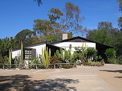
Heritage Hill Historical Park and Museum is home to some of the oldest buildings in Orange County, including the Jose Serrano Adobe, an original adobe home and settlement built in 1863; El Toro's first school, the old El Toro School House; El Toro's first church, St. Georges Episcopal Church; and the Harvey Bennett Ranch House, built in 1908, from which the Bennett Ranch development in Lake Forest derives its name. The Bennetts raised oranges for Sunkist, and owned the State-deeded water rights to Aliso Creek, which was very rare in California, and instrumental to their success. It is also the location of "Ritchie's Park," per signs along Aliso Creek, which was a naturally set childhood playground along the stream, where all of the Bennett children and grandchildren played. Frequently, the children found Indian artifacts along the banks, and met relatives of the Indians whose ancestors had actually lived there, including "Al" and "Cy" who were older Indians working for the Bennetts. The park is named for Richard Bennett Harvey, the grandchild whom Harvey and Frances Bennett raised, their seventh and last "child" who grew up on the ranch in youth, and lived there later in early marriage, working on the ranch until it was sold. The Bennett's son, Richard Beach Bennett, was educated in Animal Husbandry at California Polytechnic State University, Pomona, and grew replacement trees for farmers, before starting his own ranch in Balcom Canyon in Ventura County.

Lake Forest also has etnies Skatepark, which is the largest public skatepark with over 40,000 square feet (3,700 m2). [30]

Government

Former Lake Forest City Hall Lake Forest CA (2013) 04.JPG
Former Lake Forest City Hall

Marine Corps Air Station El Toro was located one mile (1.6 km) from the city of Lake Forest in the city of Irvine. At one time, El Toro was considered a military town, but the city blossomed independently in the 1980s and 1990s before the base closed in 1999.[ clarification needed ]

Doug Cirbo serves as Lake Forest's Mayor and Mark Tettemer serves as Mayor Pro Tempore. In addition to Cirbo and Tettemer, the three other City Council members are Robert Pequeno, Scott Voigts, and Benjamin Yu.

State and federal representation

Lake Forest city vote
by party in presidential elections
Year Democratic Republican Third Parties
2020 [31] 52.38%23,81045.40% 20,6382.21% 1,006
2016 [32] 46.00% 16,22146.76%16,4887.24% 2,553
2012 [33] 40.72% 13,30756.57%18,4842.71% 885
2008 [34] 44.23% 14,93753.40%18,0342.37% 802
2004 [35] 34.71% 11,20064.11%20,6911.18% 381
2000 [36] 36.13% 10,96860.56%18,3863.31% 1,005
1996 [37] 34.19% 7,51154.94%12,06910.87% 2,389
1992 [38] 27.58% 6,90845.76%11,46426.66% 6,680

In the California State Legislature, Lake Forest is in the 37th Senate District , represented by Democrat Dave Min, and in the 72nd Assembly District , represented by Republican Diane Dixon. [39]

In the United States House of Representatives, Lake Forest is in California's 40th congressional district , represented by Republican Young Kim,. [40]

According to the Secretary of State of California, as of February 10, 2019, Lake Forest has 46,014 registered voters. Of those, 17,329 (37.66%) are registered Republicans, 13,402 (29.13%) are registered Democrats, and 13,080 (28.43%) have no political party preference/are independents. [41]

Historically, Lake Forest has, like most of southern Orange County, been a Republican fortress in presidential elections. Changing demographics and the intensely polarizing urban/rural divide, however, has made Lake Forest more fertile footing for Democrats, who in recent elections have been trimming the GOP margins in the city. In 2020, Joe Biden became the first Democratic presidential nominee to win Lake Forest since its incorporation.

Education

Lake Forest has one high school, El Toro High School, which opened in 1973, and one high school on the border of Lake Forest and Mission Viejo, Trabuco Hills High School. The city also has eight elementary schools and a middle school. [42] The mascot is a bull and its teams are known as the Chargers; its school colors are blue and gold. Lake Forest is served entirely by the Saddleback Valley Unified School District, or SVUSD.

Notable people

Former

Related Research Articles

<span class="mw-page-title-main">Anaheim, California</span> City in the United States

Anaheim is a city in northern Orange County, California, United States, part of the Greater Los Angeles area. As of the 2020 census, the city had a population of 346,824, making it the most populous city in Orange County, the tenth-most populous city in California, and the 55th-most populous city in the United States. The second largest city in Orange County in terms of land area, Anaheim is known for being the home of the Disneyland Resort, the Anaheim Convention Center, and two major league sports teams: the Los Angeles Angels of Major League Baseball (MLB) and the Anaheim Ducks of the National Hockey League (NHL).

<span class="mw-page-title-main">Aliso Viejo, California</span> City in California, United States

Aliso Viejo is a city in the San Joaquin Hills of southern Orange County, California. It had a population of 52,176 as of the 2020 census, up from 47,823 as of the 2010 census. It became Orange County's 34th city on July 1, 2001, the only city in Orange County to be incorporated since 2000. It is bordered by the cities of Laguna Beach on the west and southwest, Laguna Hills on the east, Laguna Niguel on the southeast, and Laguna Woods on the north. It is similarly named to another nearby city, Mission Viejo.

<span class="mw-page-title-main">Brea, California</span> City in California, United States

Brea is a city in northern Orange County, California. The population as of the 2010 census was 39,282. It is 33 miles (53 km) southeast of Los Angeles. Brea is part of the Los Angeles metropolitan area.

<span class="mw-page-title-main">Buena Park, California</span> City in California, United States

Buena Park is a city in northern Orange County, California, United States. As of the 2020 census its population was 84,034. It is the location of several tourist attractions, including Knott's Berry Farm. It is about 12 miles (20 km) northwest of downtown Santa Ana, the county seat, and is within the Los Angeles metropolitan area.

<span class="mw-page-title-main">Costa Mesa, California</span> City in Orange County, California, United States

Costa Mesa is a city in Orange County, California, United States. Since its incorporation in 1953, the city has grown from a semi-rural farming community of 16,840 to an urban area including part of the South Coast Plaza–John Wayne Airport edge city, one of the region's largest commercial clusters, with an economy based on retail, commerce, and light manufacturing. The city is home to the two tallest skyscrapers in Orange County. The population was 111,918 at the 2020 census.

<span class="mw-page-title-main">Foothill Ranch, California</span> Human settlement in California, United States of America

Foothill Ranch is a neighborhood of the city of Lake Forest in Orange County, California, United States. The population was 10,899 at the 2000 census. The master planned community was a census-designated place prior to being incorporated into the city in 2000.

<span class="mw-page-title-main">Laguna Hills, California</span> City in California, United States

Laguna Hills is a city in southern Orange County, California, United States. Its name refers to its proximity to Laguna Canyon and the much older Laguna Beach. Other newer cities nearby—Laguna Niguel and Laguna Woods—are similarly named. The population was 31,374 at the 2020 census.

<span class="mw-page-title-main">Laguna Niguel, California</span> City in California, United States

Laguna Niguel is a city in Orange County, California, United States. The name Laguna Niguel is derived from the words "Laguna" and "Niguili". As of the 2020 census, the population was 64,355. Laguna Niguel is located in the San Joaquin Hills in the southeastern corner of Orange County, close to the Pacific Ocean, and borders the cities of Aliso Viejo, Dana Point, Laguna Beach, Laguna Hills, Mission Viejo, and San Juan Capistrano.

<span class="mw-page-title-main">Laguna Woods, California</span> City in Orange County, California, U.S.

Laguna Woods is a city in Orange County, California, United States. The population was 17,644 at the 2020 census, up from 16,192 at the 2010 census, with a median age of 74.5.

<span class="mw-page-title-main">Mission Viejo, California</span> City in the United States

Mission Viejo is a commuter city in the Saddleback Valley in Orange County, California, United States. Mission Viejo is considered one of the largest master-planned communities ever built under a single project in the United States and is rivaled only by Highlands Ranch in size. Its population as of 2020 was 93,653.

<span class="mw-page-title-main">Orange, California</span> City in California, United States

Orange is a city located in northern Orange County, California, United States. It is approximately 3 miles (4.8 km) north of the county seat, Santa Ana. Orange is unusual in this region because many of the homes in its Old Town District were built before 1920. While many other cities in the region demolished such houses in the 1960s, Orange decided to preserve them. The small city of Villa Park is surrounded by the city of Orange. The population of Orange was 139,911 as of 2020.

<span class="mw-page-title-main">Placentia, California</span> City in California, United States

Placentia is a city in northern Orange County, California, United States. Its population was 51,233 during the 2020 census, up from 46,488 in the 2000 census. This includes the community of Atwood, which is included in the city of Placentia, and is located in its southeastern quadrant. Primarily referred to as a bedroom community, Placentia is known for its quiet neighborhoods.

<span class="mw-page-title-main">Rancho Santa Margarita, California</span> City in California, United States

Rancho Santa Margarita is a city in Orange County, California, United States. One of Orange County's youngest cities, Rancho Santa Margarita is a master-planned community. The population was 47,853 at the 2010 census, up from 47,214 at the 2000 census. Although it is named for Rancho Santa Margarita y Las Flores, which was in San Diego County, the city limits fall within the borders of Rancho Mission Viejo. At 20 characters long, it is the longest city name in California.

<span class="mw-page-title-main">Stanton, California</span> City in California, United States

Stanton is a city in northern Orange County, California, United States, within the Los Angeles metropolitan area. The population was 37,962 at the 2020 United States Census. The city was incorporated in 1956 and operates under the council–manager form of government, providing a full range of municipal services. Stanton is bounded by Cypress on the west, Anaheim on the north, and east, and Garden Grove on the east and south.

<span class="mw-page-title-main">Tustin, California</span> City in Orange County, California, US

Tustin is a city located in Orange County, California, United States, within the Los Angeles metropolitan area. In 2020, Tustin had a population of 80,276. The city does not include the unincorporated community of North Tustin.

<span class="mw-page-title-main">Villa Park, California</span> City in California, United States

Villa Park is a city in northern Orange County, California, United States. It was founded in 1962. At the 2010 census, the city had a population of 5,812, making it the smallest city in Orange County.

<span class="mw-page-title-main">Westminster, California</span> City in California, United States

Westminster is a city in western Orange County, California, United States. Westminster was founded in 1870 by Rev. Lemuel Webber as a Presbyterian temperance colony and was incorporated in 1957.

<span class="mw-page-title-main">Canyon Lake, California</span> American city in California, United States

Canyon Lake is a city and gated community in Riverside County, California, United States, located on Canyon Lake reservoir. Canyon Lake began as a master-planned community developed by the Corona Land Company in 1968. The City of Canyon Lake was incorporated on December 1, 1990. Railroad Canyon Dam was built in 1927, and impounds the San Jacinto River to fill the reservoir, which covers 383 acres (1.55 km2) and has 14.9 miles (24.0 km) of shoreline.

<span class="mw-page-title-main">Ladera Ranch, California</span> Place in California, United States

Ladera Ranch is a master-planned community and census-designated place located in south Orange County, California, just outside the city limits of Mission Viejo.

<span class="mw-page-title-main">Irvine, California</span> City in California, United States

Irvine is the largest city and a master-planned city in central Orange County, California, United States, in the Los Angeles metropolitan area. The Irvine Company started developing the area in the 1960s and the city was formally incorporated on December 28, 1971. The 66-square-mile (170 km2) city had a population of 307,670 at the 2020 census; it is the 63rd most populous city in the United States.

References

  1. "California Cities by Incorporation Date". California Association of Local Agency Formation Commissions. Archived from the original (Word) on November 3, 2014. Retrieved August 25, 2014.
  2. 1 2 "Elected Officials". City of Lake Forest. Retrieved January 1, 2023.
  3. "2019 U.S. Gazetteer Files". United States Census Bureau. Retrieved July 1, 2020.
  4. "Lake Forest". Geographic Names Information System . United States Geological Survey, United States Department of the Interior . Retrieved January 27, 2015.
  5. "Lake Forest (city) QuickFacts". United States Census Bureau . Retrieved July 14, 2021.
  6. 1 2 3 WHITCOMB, JANET (September 6, 2013). "El Toro's founding father meets his death" . Retrieved July 16, 2016.
  7. "El Toro: Will It Change to Lake Forest?". Los Angeles Times. March 7, 1991. Retrieved June 25, 2019.
  8. "Census of Population and Housing". Census.gov. Retrieved June 4, 2015.
  9. "U.S. Census Bureau QuickFacts: Lake Forest city, California". www.census.gov. Retrieved August 17, 2022.
  10. "P004 Hispanic or Latino, and Not Hispanic or Latino by Race – 2000: DEC Summary File 1 – Lake Forest city, California". United States Census Bureau .
  11. "P2 Hispanic or Latino, and Not Hispanic or Latino by Race – 2010: DEC Redistricting Data (PL 94-171) – Lake Forest city, California". United States Census Bureau .
  12. "P2 Hispanic or Latino, and Not Hispanic or Latino by Race – 2020: DEC Redistricting Data (PL 94-171) – Lake Forest city, California". United States Census Bureau .
  13. "2010 Census Interactive Population Search: CA - Lake Forest city". U.S. Census Bureau. Archived from the original on July 15, 2014. Retrieved July 12, 2014.
  14. "Population estimates, July 1, 2015, (V2015)". Archived from the original on February 17, 2016. Retrieved July 16, 2016.
  15. "U.S. Census website". United States Census Bureau . Retrieved January 31, 2008.
  16. "2007 American Community Survey 1-Year Estimate". US Census Bureau . Archived from the original on February 12, 2020. Retrieved May 3, 2009.
  17. "Welcome to Karem Aircraft, Inc" . Retrieved July 16, 2016.
  18. City of Lake Forest CAFR Archived January 11, 2022, at the Wayback Machine
  19. Journal, State. "Spectrum Brands wraps up Stanley Black and Decker acquisition" . Retrieved July 16, 2016.
  20. "Library Locator". OC Public Libraries. Retrieved November 4, 2014.
  21. Top 100 Largest Churches in America at Sermon Central; published 2017; retrieved 2019
  22. "City of Lake Forest Recreation Calendar". Archived from the original on June 29, 2011. Retrieved May 26, 2011.
  23. "Lake Forest Firecracker 5K Run".
  24. "Lake Forest II Sun & Sail. Club". Archived from the original on March 24, 2012. Retrieved May 26, 2011.
  25. "Chamber Music OC looks toward future with a new venue". Los Angeles Times . December 4, 2020.
  26. 1 2 Sarah de Crescenzo (October 24, 2014). "Grand opening slated for Lake Forest Sports Park". The Orange County Register . Retrieved November 4, 2014.
  27. "Sports Park and Recreation Center". City of Lake Forest, California. Archived from the original on November 4, 2014. Retrieved November 4, 2014.
  28. "Lake Forest Sports Park". RJM Design Group. Archived from the original on November 4, 2014. Retrieved November 4, 2014.
  29. "Mountain Lion Killed After Attack". CBS News . Retrieved July 16, 2016.
  30. "Etnies Skatepark Of Lake Forest Aerial" . Retrieved August 21, 2010.
  31. "Precinct results" (PDF). www.ocvote.com. 2020. Retrieved November 27, 2020.
  32. "SOV.xls" (PDF). www.ocvote.com. 2016. Retrieved May 31, 2020.
  33. "SOV.xls" (PDF). www.ocvote.com. 2012. Retrieved May 31, 2020.
  34. "SOV.xls" (PDF). www.ocvote.com. 2008. Retrieved May 31, 2020.
  35. "SOV.xls" (PDF). www.ocvote.com. 2013. Retrieved May 31, 2020.
  36. "SOV.xls" (PDF). www.ocvote.com. 2000. Retrieved May 31, 2020.
  37. California. Secretary of State (March 30, 1968). "Statement of vote". Sacramento, Calif. : The Secretary via Internet Archive.
  38. California. Secretary of State (March 30, 1968). "Statement of vote". Sacramento, Calif. : The Secretary via Internet Archive.
  39. "California Districts". UC Regents. Retrieved January 5, 2023.
  40. "California's 40th Congressional District - Representatives & District Map". Civic Impulse, LLC.
  41. "CA Secretary of State – Report of Registration – February 10, 2019" (PDF). ca.gov. Retrieved June 26, 2019.
  42. "Schools - Lake Forest Schools". www.lakeforestschools.org. Retrieved May 26, 2017.
  43. "Eye on O.C.: Positivity, loud and clear". Orange County Register. June 25, 2013. Retrieved April 19, 2022.
  44. CRESCENZO, SARAH de (January 30, 2014). "'Dead Come to Life' singer returning to where it all began" . Retrieved July 16, 2016.