Parts of this article (those related to the Business sector, specifically regarding the closure of the Westminster Mall) need to be updated.(August 2025) |
Westminster, California | |
|---|---|
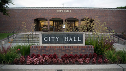 Westminster City Hall, Tet 2024 | |
 Flag 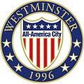 Seal | |
| Motto: "The City of Progress Built on Pride." [1] | |
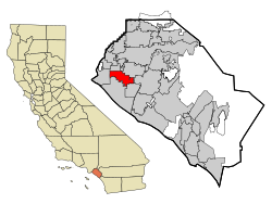 Location of Westminster within Orange County, California | |
 Westminster, California Location in the United States | |
| Coordinates: 33°45′5″N117°59′38″W / 33.75139°N 117.99389°W | |
| Country | United States |
| State | California |
| County | Orange [2] |
| Incorporated (city) | March 27, 1957 [3] |
| Government | |
| • Type | Council-Manager |
| • Mayor | Chi Charlie Nguyen(R) |
| • Vice Mayor | Carlos Manzo(District 2) |
| • City council [4] |
|
| • City manager | Christine Cordon [5] |
| Area | |
• Total | 10.04 sq mi (26.00 km2) |
| • Land | 10.04 sq mi (26.00 km2) |
| • Water | 0 sq mi (0.00 km2) 0% |
| Elevation | 39 ft (12 m) |
| Population (2020) | |
• Total | 90,911 |
| • Rank | 92nd in California (2024) |
| • Density | 9,056/sq mi (3,497/km2) |
| Time zone | UTC−8 (PST) |
| • Summer (DST) | UTC−7 (PDT) |
| ZIP Codes | 92683–92685 |
| Area codes | 657/714 |
| FIPS code | 06-84550 |
| GNIS feature IDs | 1652811, 2412236 |
| Website | www |
Westminster is a city in western Orange County, California, United States. Westminster was founded in 1870 by Rev. Lemuel Webber as a Presbyterian temperance colony and was incorporated in 1957.
Contents
- History
- Geography
- Climate
- Demographics
- 2020
- 2010
- Government
- Crime
- Economy
- Top employers
- Business sector
- Education
- Infrastructure
- Transportation
- Water services
- Landmarks
- Notable people
- References
- External links
Westminster is bordered by the city of Seal Beach on the west, by Garden Grove on the north and east, and by Huntington Beach and Fountain Valley on the south. Santa Ana, the county seat of Orange County, is east of Westminster.
Westminster has one of the largest Vietnamese populations in the US. They settled largely in Little Saigon, [7] and the city is known as the "capital" of overseas Vietnamese with 39,799 Vietnamese Americans, or 43.8% of the total population, as of the 2020 United States census. [8]
In the court case Mendez v. Westminster (1947), a Hispanic man sued the Westminster School District for forcing his daughter, Sylvia Mendez, to attend a school for Mexican children. They eventually won and thus began the process of desegregation. Sylvia Mendez was later awarded the Presidential Medal of Freedom by President Barack Obama on February 15, 2011.
Westminster won the All-America City Award in 1996. [9]


