Glendale, California | |
|---|---|
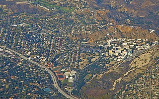
Aerial view of Glendale with the Verdugo Mountains in the background Highrises in Downtown Glendale | |
 Flag  Seal | |
| Nickname: Jewel City | |
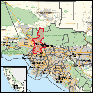
 Location within Los Angeles County | |
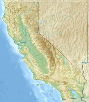 Glendale Location within California  Glendale Location within the United States | |
| Coordinates: 34°08′46″N118°15′18″W / 34.14611°N 118.25500°W | |
| Country | |
| State | |
| County | Los Angeles County |
| Incorporated | February 15, 1906 [1] |
| Government | |
| • Type | Council-Manager [2] |
| • Mayor | Elen Asatryan [2] |
| • City Council | Ardy Kassakhian Vartan Gharpetian Ara Najarian Dan Brotman |
| • City Treasurer | Rafi Manoukian [3] |
| • City Manager | Roubik Golanian [4] |
| Area | |
• Total | 30.60 sq mi (79.25 km2) |
| • Land | 30.47 sq mi (78.92 km2) |
| • Water | 0.13 sq mi (0.33 km2) 0.43% |
| Elevation | 522 ft (159 m) |
| Population | |
• Total | 196,543 |
| • Rank | 4th in Los Angeles County 24th in California 138th in the United States |
| • Density | 6,450.4/sq mi (2,519.7/km2) |
| Demonyms | Glendalian |
| Time zone | UTC−8 (Pacific) |
| • Summer (DST) | UTC−7 (PDT) |
| ZIP Codes [8] | 91201–91210, 91214, 91221, 91222, 91224–91226 |
| Area code | 747 and 818 |
| FIPS code | 06-30000 |
| GNIS feature IDs | 1660679, 2410597 |
| Website | glendaleca |


Glendale is a city in the San Fernando Valley [9] and Verdugo Mountains [10] regions of Los Angeles County, California, United States. At the 2020 U.S. Census the population was 196,543, [7] up from 191,719 at the 2010 census, [11] making it the 4th-most populous city in Los Angeles County and the 24th-most populous city in California. It is located about 10 miles (16 km) north of downtown Los Angeles.
Contents
- History
- Spanish rule
- Mexican rule
- 1847 to present
- Geography
- Geology
- Climate
- Demographics
- Race and ethnicity
- Religion
- LGBT+ community
- Economy
- Aviation
- Film and television industry
- Technology industry
- Arts and culture
- Cuisine
- Landmarks
- Libraries
- Museums and galleries
- Performing arts
- Public art
- Parks and recreation
- Government
- Local government
- County representation
- State and federal representation
- Crime and public safety
- Education
- Media
- Infrastructure
- Public safety
- Transportation
- Notable people
- Sister cities
- See also
- References
- External links
Glendale lies in the Verdugo Mountains, and is a suburb in the Los Angeles metropolitan area. The city is bordered to the northwest by the Shadow Hills and Tujunga neighborhoods of Los Angeles; to the northeast by La Cañada Flintridge and the unincorporated area of La Crescenta; to the west by Burbank and Griffith Park; to the east by Eagle Rock and Pasadena; to the south by the Atwater Village neighborhood of Los Angeles; and to the southeast by Glassell Park neighborhood of Los Angeles. The Golden State, Ventura, Glendale, and Foothill freeways run through the city.