Shadow Hills, Los Angeles

Last updated
Shadow Hills
Location map San Fernando Valley.png
Red pog.svg
Shadow Hills
Location within Los Angeles/San Fernando Valley
USA Los Angeles Metropolitan Area location map.svg
Red pog.svg
Shadow Hills
Shadow Hills (the Los Angeles metropolitan area)
Coordinates: 34°15′43″N118°21′03″W / 34.26194°N 118.35083°W / 34.26194; -118.35083
Country United States
State California
County Los Angeles
City Los Angeles
Time zone UTC−8 (PST)
  Summer (DST) UTC−7 (PDT)
ZIP Code
91040

Shadow Hills (originally Hansen Heights) is a neighborhood in the Verdugo Mountains and northeastern San Fernando Valley, within the city of Los Angeles, California.

Contents

Geography

Shadow Hills is in the northwestern Verdugo Mountains, near the western end of the Crescenta Valley. It is north of the city of Burbank and southeast of the Hansen Dam Reservoir.

It is adjacent to the communities of Lake View Terrace to the north, Sunland and Tujunga to the east, Sun Valley to the south, and Pacoima to the west. The area is primarily equestrian zoned, one of the last remaining such neighborhoods within the City of Los Angeles.

Shadow Hills is an acceptable city name for ZIP Code 91040, with Sunland the default city name assigned to 91040. [1]

Demographics

As of the 2000 census, Shadow Hills had a population of 3,739 people. [2] The racial breakdown was 79% Caucasian, 14% Latino, 3% Asian American, and 1% African American. [3]

Shadow Hills falls within Census Tract 103300.[ citation needed ]

In 2009, the Los Angeles Times 's "Mapping L.A." project supplied these Shadow Hills neighborhood statistics: population: 13,098; median household income: $82,796. [4]

History

The community began as Hansen Heights when it opened for a planned settlement at $150 an acre in 1907. Its first publicity was an article in The Los Angeles Record which announced a "public land meeting" in the Los Angeles Chamber of Commerce Building "with Stereoptican Pictures." [5] Further promotional "illustrated lectures" about these "little farms" were held nightly. [6]

In 1927, "Butterfly Gardens" was a six-acre plot "in the hills a little way off the main traveled road" owned by Mr. and Mrs. Albert Carter which were seeded to wildflowers in the expectation of attracting and "raising" butterflies. [7] In the same year Frank Kenniston owned a grocery in Hansen Heights and also "one of the largest bee apiaries in this part of the country." Kenniston noted that Hansen Street was still unpaved and that owners of large tracts were unwilling to subdivide, "thus retarding development." [8]

In 1946 the Shadow Hills Rodeo grounds were situated "on Wheatland Avenue in the Hansen Heights District of Roscoe," in a "beautiful setting with the green trees standing like guards." [9] The arena was at 9951 Wheatland Avenue, [10] a parcel that in 2021 was occupied by a six-bedroom, four-bath house. [11]

During the area's development, some homes were built on hilltops, reachable only "by narrow roads chewed out of the hillsides." In 1948, Los Angeles City Building and Safety Chief G.E. Morris raised ire when he ordered the property owners on Johanna Street south of Sunland Boulevard to "vacate and demolish" any structure because the roads were so narrow they could not be reached by fire engines. Boyd assured a deputation of angry owners and their families who visited him at Los Angeles City Hall that he would seek a compromise which would not work "undue hardship." [12] The area became known as "Dad's Canyon," which the city claimed was illegal because adequate police, fire, and sanitation could not be provided. [13]

In 1966, the Valley Times reported that "The 'town' – such as it is – includes one market, a hitching post and a beauty parlor." [14]

Renaming

Agitation to rename the area began in 1947 with a mass meeting in the Stonehurst School auditorium called by real estate broker John F. Willey "to discuss the possibility of securing a new post office and delivery district" for Shadow Hills. [15] A second rally featured a song called "Shadow Hills" by Starr von Fluss. [16] [17]

Dorothy Neely, secretary-manager of the Roscoe Chamber of Commerce said that "Shadow Hills people don't like the name of Roscoe," they with others objecting to it as "unimaginative, not euphonious, and not descriptive of the location or the present-day development of the area." [18]

The name change was approved by a vote taken among the four hundred members of the Hansen Heights Improvement Association, who also decided to change the name of their organization to Shadow Hills Civic Association. The officers were Stanley M. Love, president; Norwood Simmons, vice president; Mrs. Lee Payne, treasurer, and Ronald King, secretary. [19]

Shadow Hills did not receive a new post office, but the local address for 1,500 residents was changed from Roscoe to Sunland for properties between Johanna Street and Stonehurst Avenue. [18] [20]

Freeway off-ramp

In the 1960s a section of the Foothill Freeway was mapped from Sunland southwest through Lakeview Terrace to Van Nuys Boulevard. [21] The Shadow Hills Property Owners Association fought against the freeway mainly because its members, mostly horse enthusiasts, feared their rural environment would be spoiled, particularly if a freeway bridge were built over the Tujunga Wash. [22]

Education

Former

A Hansen Heights school district was formed in 1912, with M.W. Fuhrman as one of the trustees and E.D. Lamb as clerk. [23]

Current

By 1931, Hansen Heights School had become a part of the Los Angeles City school system. In June of that year it was announced that Hansen Heights stood "highest of any high or elementary school in the city of Los Angeles in thrift" because every child "has an account in the school savings bank." Evangeline Hymer was the principal. [24] The school, at 9900 Wheatland Avenue, [25] was declared surplus in 1945 and the property put up for sale. [26]

The Los Angeles Unified School District (LAUSD) today serves Shadow Hills. Not one LAUSD school is inside of Shadow Hills. Students must travel outside of Shadow Hills to Sun Valley for Stonehurst Elementary School, Maclay Middle School in Pacoima, and Verdugo Hills High School in Tujunga.

Attendance boundary, 1966

A 1966 plan to require Shadow Hills students to switch from the overcrowded and virtually all-white Mount Gleason Junior High School in Sunland to the more diversified Maclay Junior High in Pacoima was opposed by the Shadow Hills Homeowners Association. The Los Angeles school board approved the boundary switch in a 4–3 vote on July 14, 1966. [27]

Government

Representation

Shadow Hills is represented by:

Public safety

Notable residents

Related Research Articles

<span class="mw-page-title-main">San Fernando Valley</span> Large populated valley in Los Angeles County, California, US

The San Fernando Valley, known locally as the Valley, is an urbanized valley in Los Angeles County, California. Situated to the north of the Los Angeles Basin, it contains a large portion of the City of Los Angeles, as well as unincorporated areas and the incorporated cities of Burbank, Calabasas, Glendale, Hidden Hills, and San Fernando. The valley is well known for its iconic film studios such as Warner Bros. Studio and Walt Disney Studios. In addition, it is home to the Universal Studios Hollywood theme park.

<span class="mw-page-title-main">Pacoima, Los Angeles</span> Neighborhood of Los Angeles in California, United States

Pacoima is a neighborhood in Los Angeles, California. Pacoima is one of the oldest neighborhoods in the San Fernando Valley region of LA.

<span class="mw-page-title-main">Sun Valley, Los Angeles</span> Neighborhood of Los Angeles in California, United States

Sun Valley is a neighborhood in Los Angeles, California in the San Fernando Valley region. The neighborhood is known for its overall youthful population and moderate racial diversity. There are three recreation centers in Sun Valley, one of which is a historic site. The neighborhood has thirteen public schools—including John H. Francis Polytechnic High School and Sun Valley High School—and four private schools.

<span class="mw-page-title-main">California State Route 118</span> Highway in California

State Route 118 is a state highway in the U.S. state of California that runs west to east through Ventura and Los Angeles counties. It travels from State Route 126 at the eastern edge of Ventura immediately northwest of Saticoy, then through Saticoy, in Ventura County east to Interstate 210 near Lake View Terrace in Los Angeles. SR 118 crosses the Santa Susana Pass and the northern rim of the San Fernando Valley along its route.

<span class="mw-page-title-main">Lake View Terrace, Los Angeles</span> Neighborhood of Los Angeles in California, United States

Lake View Terrace is a suburban neighborhood in the San Fernando Valley region of the City of Los Angeles, California.

<span class="mw-page-title-main">Crescenta Valley</span> Valley in Los Angeles County, California

The Crescenta Valley is a small inland valley in Los Angeles County, California, lying between the San Gabriel Mountains on the northeast and the Verdugo Mountains and San Rafael Hills on the southwest. It opens into the San Fernando Valley at the northwest and the San Gabriel Valley at the southeast. It is nearly bisected by the Verdugo Wash, a smaller valley separating the Verdugo Mountains from the San Rafael Hills. Most of the valley lies at an elevation of over 1,500 feet.

<span class="mw-page-title-main">Bob Ronka</span> American politician

Bob Ronka was a member of the Los Angeles City Council from the San Fernando Valley's 1st District between 1977 and 1981.

<span class="mw-page-title-main">Verdugo Mountains</span> Mountain range of the Transverse Ranges in California, United States

The Verdugo Mountains, also known as the Verdugo Hills or simply The Verdugos, are a small, rugged mountain range of the Transverse Ranges system in Los Angeles County, California. Located just south of the western San Gabriel Mountains, the Verdugo Mountains region incorporates the cities of Burbank, Glendale, Pasadena, and La Cañada Flintridge; the unincorporated communities of Altadena and La Crescenta-Montrose; as well as the City of Los Angeles neighborhood of Sunland-Tujunga.

<span class="mw-page-title-main">Hansen Dam</span> Dam in San Fernando Valley

Hansen Dam is a flood control dam in the northeastern San Fernando Valley, in the Lake View Terrace neighborhood of Los Angeles, California. The dam was built by the U.S. Army Corps of Engineers, Los Angeles District in 1940. Hansen Dam was named after horse ranchers Homer and Marie Hansen, who established a ranch in the 19th century.

<span class="mw-page-title-main">San Fernando Road</span> Major street in the City and County Los Angeles

San Fernando Road is a major street in the City of Los Angeles and Los Angeles County. Within the Burbank city limits it is signed as San Fernando Boulevard, and north of Newhall Pass it is signed as The Old Road. It was previously designated as Business Loop 5 in the 1970s.

<span class="mw-page-title-main">California's 29th congressional district</span> U.S. House district for California

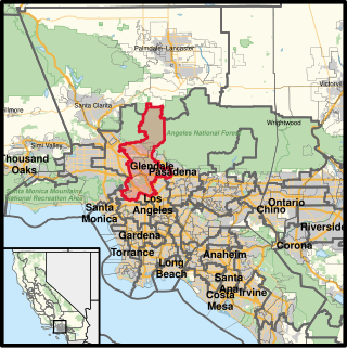
California's 29th congressional district is a congressional district in the U.S. state of California based in the north central San Fernando Valley. The district is represented by Democrat Tony Cárdenas.

<span class="mw-page-title-main">California's 30th congressional district</span> U.S. House district for California

California's 30th congressional district is a congressional district in the U.S. state of California. The 30th district takes in the Linda Vista neighborhood of Pasadena, and the Los Angeles area communities of Tujunga, Burbank, Glendale, Hollywood, West Hollywood, Edendale, Park La Brea, Hancock Park, and westside Echo Park. The district is currently represented by Democrat Adam Schiff.

Van Nuys Boulevard is a major north-south arterial road that runs through the central San Fernando Valley of Los Angeles County, California. The boulevard was notable for its cruising lifestyle that was prevalent in the 1960s and 1970s, which was depicted in the 1979 film Van Nuys Blvd.

<span class="mw-page-title-main">Pacoima Wash</span> River in the United States

Pacoima Wash, 33 miles (53 km) long, is a major tributary of the Tujunga Wash, itself a tributary of the Los Angeles River, in the San Fernando Valley of Los Angeles County, California.

<span class="mw-page-title-main">Los Angeles's 1st City Council district</span> American legislative district

Los Angeles City Council District 1 is one of the 15 districts of the Los Angeles City Council, representing sections of Northeast Los Angeles and Northwest Los Angeles. Councilmember Eunisses Hernandez is the current representative for CD 1; she took office on December 12, 2022, the next election for District 1 will be in 2026.

<span class="mw-page-title-main">Los Angeles's 2nd City Council district</span> American legislative district

Los Angeles City Council District 2 is one of the 15 districts of the Los Angeles City Council. The 2nd District began its existence in the Hollywood area but now covers much of the far eastern and southeastern portions of the San Fernando Valley and parts of the Crescenta Valley. The current representative is Paul Krekorian.

<span class="mw-page-title-main">Sunland-Tujunga, Los Angeles</span> Neighborhood of Los Angeles in California, United States

Sunland-Tujunga is a Los Angeles city neighborhood within the Crescenta Valley and Verdugo Mountains. Sunland and Tujunga began as separate settlements and today are linked through a single police station, branch library, neighborhood council, chamber of commerce, city council district, and high school. The merging of these communities under a hyphenated name goes back as far as 1928. Sunland-Tujunga contains the highest point of the city, Mount Lukens.

<span class="mw-page-title-main">Los Angeles's 7th City Council district</span> American legislative district

Los Angeles City Council District 7 is one of the 15 districts of the Los Angeles City Council. It covers much of the northeastern San Fernando Valley. On May 16, 2017, Monica Rodriguez was elected to fill the open seat following the resignation of Felipe Fuentes and was sworn in as a council member on July 1, 2017.

The La Tuna Fire was a wildfire that started on September 1, 2017, and burned 7,194 acres (2,911 ha) through the Verdugo Mountains in Los Angeles, California. It led to the destruction of 5 homes and the evacuations of over 300 homes. It was the largest wildfire in the city of Los Angeles in 50 years.

References

  1. "ZIP Code Lookup tool". United States Postal Service. Retrieved 2007-03-18.
  2. "City of Los Angeles Population by Community & Race". Los Angeles Almanac. Archived from the original on 2010-01-11. Retrieved 2007-03-18.
  3. "Population of Communities of the City of Los Angeles". Archived from the original on 2010-01-11. Retrieved 2010-04-04.
  4. "Shadow Hills" entry on the Los Angeles Times "Mapping L.A." website
  5. "Little Farms Near the City and the Foothills," Los Angeles Record, September 21, 1907, image 5
  6. "Suburban Acre Homes," Los Angeles Record, September 25, 1907, image 2
  7. "Raising of Butterflies for Market New Work in Hansen Heights," Burbank Daily Review, January 21, 1927, image 2
  8. "Hansen Heights Outlook," Burbank Daily Review, February 17, 1927, image 5
  9. Chris Christopher, "Foothill Findings," Valley Times, March 7, 1946, image 9
  10. "Burbank Boy, 12, Winner at Valley Horse Show," Valley Times, November 3, 1947, image 2
  11. Zillow.com
  12. "Homeowners March on City Hall; Fight Order to Vacate," Daily News, December 10, 1948, image 43
  13. Dan Swinton, "Dad's Canyon Peace Uneasy," Citizen-News, December 17, 1948, image 4
  14. Mary Reinholz, "Shadow Hills," Valley Times, North Hollywood, December 14, 1966, image 3
  15. "Shadow Hills Meeting Set," Valley Times, January 22,1947, image 6
  16. "Shadow Hills Song to Make Debut Tonight," Valley Times, February 19, 1947, image 5
  17. "'Shadow Hills' Makes Ban at Club," Valley Times, February 22, 1947, image 6
  18. 1 2 "Shadow Hills Quits Roscoe Postal Zone," Citizen-News (Valley Edition), April 14, 1948, image 1
  19. "Renamed Shadow Hills Town Now Wants P.O.," Valley Times, May 17, 1947, image 7
  20. "New Mail Service for Shadow Hills," Valley Times, April 13, 1948, image 2
  21. Don Snyder, "Freeway Link to Nowhere May Go Somewhere by Next Spring," Los Angeles Times, San Fernando Valley Section, July 25, 1976, image 414
  22. Don Snyder, "Freeway Link," Los Angeles Times, San Fernando Valley Section, July 25, 1976, image 416
  23. "Local and Personal," The Burbank Review, June 7, 1912, image 8
  24. "Hansen Heights," Burbank Daily Review, June 11, 1931, image 9
  25. "Valley Offices for Draft Registration Are Announced," San Fernando Valley Times, February 6, 1942, image 11
  26. Legal advertisement, Valley Times, March 26, 1945, image 24
  27. Turpin, Dick (15 July 1966). "School Ruling Hit by Angry Parents". Los Angeles Times. p. 3. ProQuest   155478411.
  28. "Welcome to LA Council District 7".
  29. 1 2 "Statewide Database". UC Regents. Retrieved December 10, 2014.
  30. "LAFD - Fire Station 24". Archived from the original on 2006-11-02. Retrieved 2007-02-24.
  31. "LAFD - Fire Station 77". Archived from the original on 2009-08-02. Retrieved 2009-09-23.
  32. "Foothill Community Police Station - Los Angeles Police Department". www.lapdonline.org.
  33. "Ken Osmond The Trouble Maker Eddie Haskell on 'Beaver', Dies at 76". The New York Times . Retrieved on January 16, 2023.
  34. "Ex-'Glee' star Mark Salling indicted on child-porn charges". Houston Chronicle . Saturday, May 28, 2016. Retrieved on May 28, 2016.
  35. " Sunland Tujunga Directory". Retrieved on March 12, 2022.