Van Nuys Boulevard is a major north-south arterial road that runs through the central San Fernando Valley of Los Angeles County, California. The boulevard was notable for its cruising lifestyle that was prevalent in the 1960s and 1970s, which was depicted in the 1979 film Van Nuys Blvd.
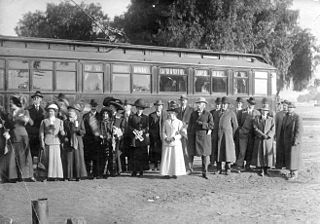
When Van Nuys was plotted in 1911, the main thoroughfare and its offshoots were called Sherman Way. The Pacific ElectricSan Fernando Lineinterurban railway was constructed north to San Fernando between 1911 and 1913 largely in the boulevard's median strip.[1] As the town developed, North Sherman Way was renamed Van Nuys Boulevard as the main boulevard in the town of Van Nuys, which got its name from longtime Valley wheat farmer Isaac Newton Van Nuys.[2] Sherman Way, named for entrepreneur and Valley developer Gen. Moses Hazeltine Sherman, originally included segments of the thoroughfares known today as Chandler and Van Nuys boulevards.[3][4] Rails were removed from the street by 1981.[5]
Geography
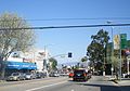
Van Nuys Boulevard at the Metro G Line crossing, 2008
Van Nuys Boulevard runs approximately ten miles from the Santa Monica Mountains in Sherman Oaks at its southern terminus to the foothills of the western end of the San Gabriel Mountains in Lake View Terrace at its northern terminus. It passes through the affluent community of Sherman Oaks, then continues through the community of Van Nuys, passing the numerous automobile dealerships in southern Van Nuys, then passing through the Van Nuys Municipal Center, the government center of the San Fernando Valley, then continuing north through Panorama City, past the old General Motors plant now converted into a shopping plaza called “The Plant,” before veering north east through the communities of Arleta and Pacoima, passing the San Fernando Gardens housing project, and ending in the foothills of the San Gabriel Mountains.
With its wide expanse through the heart of the San Fernando Valley, Van Nuys Boulevard became known from the 1950s through the 1970s as a center of teenage cruising.[6][7][8][9] Its car culture was celebrated in several motion pictures, including Van Nuys Boulevard. Cruising became a thing of the past as police cracked down on the practice, but the car culture still lives on through the numerous automobile dealerships that line both sides of Van Nuys Boulevard in northern Sherman Oaks and southern Van Nuys.
Van Nuys Boulevard has several bus routes running on it, including two Metro routes with heavy ridership, Metro Rapid line 761 and Metro Local line 233. Van Nuys is currently the only arterial bus corridor in the San Fernando Valley running New Flyer XN60articulated buses for both lines (previously operated by NABI60-BRT buses). The Metro G Line has a station at Van Nuys. Further to the north, there is a Metrolink and Amtrak station. In the first half of the 20th century, Pacific Electric interurban trains ran in the median of Van Nuys Boulevard from Chandler Boulevard to Parthenia Street, which would then continue to Sepulveda Boulevard; traces of this route can be seen in the large medians of the streets the tracks used to run on.
Communities along Van Nuys Boulevard (south to north)
Looking south from Lake View Terrace
Sherman Oaks - south of Oxnard Boulevard; population 28,601 (78.6% White (not Hispanic); 8.5% Hispanic; 5.4% Asian)[10]
Van Nuys – between Oxnard Boulevard and Roscoe Boulevard; population 136,443 (50.3% Hispanic; 34.1% White (not Hispanic); 6.5% Asian; 5.9% African-American)[10]
Panorama City - between Roscoe Boulevard and Woodman Avenue; population 65,235 (70.1% Hispanic; 11.6% Asian; 11.9% White (not Hispanic))[10]
Arleta – between Woodman Avenue and I-5; population 32,092 (71.4% Hispanic; 13.4% White (not Hispanic); 11.7% Asian)[10]
The Village at Sherman Oaks - The Village at Sherman Oaks is the name given to the shopping and dining area surrounding the intersection of Ventura Boulevard and Van Nuys Boulevard.[11]
Sherman Oaks Hospital and Grossman Burn Center - Sherman Oaks Hospital is a 153-bed acute care facility on Van Nuys Boulevard in Sherman Oaks. The facility is owned and operated by Prime Healthcare Services, Inc.[12] The Grossman Burn Center, founded by Dr. A. Richard Grossman, at Sherman Oaks Hospital has provided specialized and targeted care to burn patients since 1969. It has grown over the years from two dedicated beds to a 30-bed burn center.[13] In 2007, the Grossman Burn Center treated a 4-year-old Iraqi boy named Youssif who was doused with gasoline and set on fire in Baghdad.[14]
Van Nuys Government Center - The principal government offices for the San Fernando Valley are located in the Van Nuys Government Center on Van Nuys Boulevard. The area includes the Valley Municipal Building, the modern Van Nuys Courthouse designed by Dan Dworsky, the James C. Corman Federal Building, the Van Nuys Branch of the Los Angeles Public Library, and the Marvin Braude San Fernando Valley Constituent Services Center. The Van Nuys Municipal Court building in Van Nuys, California was designed by architect Dan Dworsky and received the Kaufman & Broad Award for Outstanding New Public or Civic Project for the design.[15][16] The federal building in Van Nuys was renamed the James C. Corman Federal Building in 2001 in honor of James C. Corman who represented the San Fernando Valley’s 21st Congressional District from 1961-1981.[17] The $34 million Marvin Braude Constituent Services Center was originally proposed by Marvin Braude; it opened in 2003 and houses various city services.[18][19]
Valley Municipal Building - Constructed in 1932 and designed by Peter K. Schabarum, the Valley Municipal Building (sometimes called Van Nuys City Hall) is a San Fernando Valley landmark and is considered a good example of the WPA-era "Zig-Zag Moderne" architectural styling.[20][21] It was designed as a smaller version of the 29-story Los Angeles City Hall.[22]
Panorama High School - A high school in the Los Angeles Unified School District located on Van Nuys Boulevard across from The Plant shopping center.[23]
Arleta High School - A high school in the Los Angeles Unified School District located on Van Nuys Boulevard in Arleta.[24]
Mural Mile - A section of Van Nuys Boulevard in Pacoima where artists, led by Levi Ponce in 2011, have painted large murals on walls facing the street.[25]
San Fernando Gardens - A sprawling housing project in Pacoima built during World War II to house workers at the nearby Lockheed aerospace manufacturing facilities in Burbank. The project was racially integrated; its wartime black population was the first significant African-American population in the San Fernando Valley.[26] The San Fernando Gardens contains 448 units and 1,621 residents, 48% of whom are under the age of 18. The average annual income is $18,000, more than 45% less than the Los Angeles median family income.[27]
↑ Whiteson, Leon (1990-06-04). "Courting Beauty in Construction: New Van Nuys Municipal Court Combines Functionalism and Dignity of Design". Los Angeles Times.
Van Nuys is a neighborhood in the central San Fernando Valley region of Los Angeles, California. Home to Van Nuys Airport and the Valley Municipal Building, it is the most populous neighborhood in the San Fernando Valley.
Mission Hills is a neighborhood in the City of Los Angeles, California, located in the San Fernando Valley.
The San Fernando Valley, known locally as the Valley, is an urbanized valley in Los Angeles County, California. Situated northwards of the Los Angeles Basin, it comprises a large portion of Los Angeles, the incorporated cities of Burbank, Calabasas, Glendale, Hidden Hills and San Fernando, plus several unincorporated areas. The valley is the home of Warner Bros. Studios, Walt Disney Studios, and the Universal Studios Hollywood theme park.
Arleta is a neighborhood in the San Fernando Valley region of the city of Los Angeles, California. It contains a high percentage of Latino residents and of people born outside the United States.
Sherman Oaks is a neighborhood in the city of Los Angeles, California located in the San Fernando Valley, founded in 1927. The neighborhood includes a portion of the Santa Monica Mountains, which gives Sherman Oaks a lower population density than some other areas in Los Angeles.
Pacoima is a neighborhood in Los Angeles, California. Pacoima is one of the oldest neighborhoods in the San Fernando Valley region of LA.
Panorama City is a neighborhood in the city of Los Angeles, California, in the San Fernando Valley. It has a generally young age range as well as the highest population density in the Valley. More than half of the neighborhood's population was born abroad, the majority being from Mexico. Known as the Valley's first planned community after a transition from agriculture to a post-World War II housing boom, it has been home to several notable residents. It is now a mixture of single-family homes and low-rise apartment buildings.
North Hills, known previously as Sepulveda, is a neighborhood in the San Fernando Valley region of Los Angeles, California.
Van Nuys station is a station on the G Line of the Los Angeles Metro Busway system. It is named after adjacent Van Nuys Boulevard, which travels north-south and crosses the east-west busway route and is located in the Van Nuys district of Los Angeles, in the San Fernando Valley. Adjacent to the station is the G Line Bikeway.
Van Nuys is a neighborhood in the San Fernando Valley of the city of Los Angeles, California.
California's 29th congressional district is a congressional district in the U.S. state of California based in the north central San Fernando Valley. The district is represented by Democrat Tony Cárdenas.
Victory Boulevard is a major east–west arterial road that runs for 25 miles (40 km) traversing the entire length of the San Fernando Valley in Los Angeles County, California.
Riverside Drive is a northeast–southwest road connecting the San Fernando Valley and the Cypress Park neighborhood of the City of Los Angeles. It follows the course of the Los Angeles River.
California's 20th senatorial district is one of 40 California State Senate districts. It is currently represented by Democrat Caroline Menjivar of Panorama City.
The San Fernando Line was a part of the Pacific Electric Railway system in Los Angeles County, California. It was designed to increase the reach of public transportation from the Downtown Los Angeles and Hollywood into the San Fernando Valley, to support land speculation and development expanding Los Angeles.
Pacoima Wash, 33 miles (53 km) long, is a major tributary of the Tujunga Wash, itself a tributary of the Los Angeles River, in the San Fernando Valley of Los Angeles County, California.
Los Angeles's 2nd City Council district is one of the fifteen districts in the Los Angeles City Council. It is currently represented by Democrat Paul Krekorian since 2009, after he won the special election to finish Wendy Greuel's term.
Nahas was a chain of department stores owned by A. S. Nahas, operating in Greater Los Angeles, carrying clothing, household goods and electronics. They also acquired Rathbun's department store at 5311 Lankershim Boulevard in North Hollywood and cobranded it "Nahas Rathbuns" before the branch closed in 1980. The remaining Nahas stores were closed from 1981 to 1982.
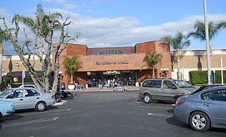
Panorama Mall is a mall in Panorama City, San Fernando Valley, Los Angeles, California. It is an enclosed mall anchored by two large discount stores, Walmart and Curacao, aimed primarily at a Hispanic customer base.
This page is based on this Wikipedia article Text is available under the CC BY-SA 4.0 license; additional terms may apply. Images, videos and audio are available under their respective licenses.