California State Route 19

Last updated

California 19.svg

State Route 19

California State Routes 19 and 164.svg
SR 19 highlighted in red, with the relinquished portions in pink
Route information
Maintained by Caltrans
Length26.2 mi [1]  (42.2 km)
(prior to relinquishments)
Existed1934 [2] –present
Major junctions
South endRose Street at the Lakewood-Bellflower border (State Maintenance)
Major intersections
North end Foothill Boulevard in Pasadena (State Maintenance)
Location
Country United States
State California
Counties Los Angeles
Highway system
California 18.svg SR 18 California 20.svg SR 20
California 163.svg SR 163 California 164.svg California 165.svg SR 165

State Route 19 (SR 19) is a state highway in the U.S. state of California, running along Lakewood Boulevard and Rosemead Boulevard in the Los Angeles area. An additional "hidden" state highway, State Route 164 (SR 164), is also signed as part of SR 19, despite having a legal description separate from Route 19. The combined route is a northsouth four-to-six lane suburban roadway, lying east of the Long Beach Freeway (Interstate 710) and west of the San Gabriel River Freeway (Interstate 605), and connecting the eastern parts of Long Beach and Pasadena via the Whittier Narrows. Under their legal descriptions, SR 19 runs north to Gallatin Road in Pico Rivera, then SR 164 goes from Gallatin Road to Pasadena. Since 1998, several pieces have been relinquished to local governments, and more transfers are authorized by state law.

Contents

Route description

Lakewood Boulevard passing under I-405 and the Long Beach Airport (top of image) I-405 at CA 19.jpg
Lakewood Boulevard passing under I-405 and the Long Beach Airport (top of image)

Locals generally refer to the combined SR 19/164 route as either Lakewood Boulevard or Rosemead Boulevard, not by its numerical designation. The two highways are part of the National Highway System, [3] a network of highways that are considered essential to the country's economy, defense, and mobility by the Federal Highway Administration. [4]

The original official southern terminus of SR 19 was at the Los Alamitos Circle in Long Beach, where Lakewood Boulevard, State Route 1 (Pacific Coast Highway), and Los Coyotes Diagonal converge. SR 19 then proceeded north along Lakewood Boulevard through Long Beach and the City of Lakewood, intersecting with Interstate 405, passing under a runway of the Long Beach Airport [5] (the part through the airport has been relocated to the east; parts of the old alignment remain as airport service roads), then running to the west of Lakewood Center Mall before passing through the neighborhood of Mayfair.

Since the California Legislature relinquished segments of the highway, state control of SR 19 now officially begins at the point where Lakewood Boulevard crosses the Lakewood–Bellflower city limits at Rose Street (SR 19 in Bellflower is also planned to be relinquished by the state [6] ). SR 19 then intersects State Route 91 before straddling the city border between Bellflower and Paramount and later Bellflower and Downey. State control of SR 19 then ends north of Gardendale Street when Lakewood Boulevard fully enters into Downey.

Lakewood Boulevard continues north through Downey, intersecting with Interstate 105 before passing by the large site formerly occupied by North American Aviation, Rockwell International and Boeing Reusable Space Systems and interchanging with Interstate 5. At Telegraph Road at the Downey-Pico Rivera city limits, Lakewood Boulevard turns into Rosemead Boulevard. [7] Rosemead Boulevard continues north through Pico Rivera (where this segment of SR 19 has been relinquished to the city as well [8] ) to Gallatin Road. [9]

The hidden SR 164, but signed as part of SR 19, begins north of Gallatin Road, traveling along Rosemead Boulevard across Whittier Narrows Dam before entering the Whittier Narrows Recreation Area and intersecting with State Route 60. After this, the road enters South El Monte before crossing the Rio Hondo and straddling the city boundary between Rosemead and El Monte. It then intersects with Interstate 10. This portion of Rosemead Boulevard between Gallatin Road and Interstate 10 is still maintained by the state and built to expressway standards.

State maintenance ends again at the Rosemead–Temple City city limits near Grand Avenue. Rosemead Boulevard then continues north through Temple City and the unincorporated areas of East San Gabriel and East Pasadena and into the City of Pasadena. (The highway was relinquished to Temple City, [10] and those portions in the unincorporated areas were transferred to Los Angeles County.) [11] In Pasadena, the state still maintains the short portion of Rosemead Boulevard from Interstate 210 to Foothill Boulevard, with SR 164's legal northern terminus at the latter. Rosemead Boulevard continues northwest under Pasadena's control from Foothill Boulevard to Sierra Madre Villa Avenue. [9]

Bus service is provided by Metro Local line 266 (between Foothill Boulevard and Del Amo Boulevard) and Long Beach Transit line 111 (south of Del Amo Boulevard) throughout Rosemead Boulevard and Lakewood Boulevard. The Metro C Line is also provided by a station in the median of Interstate 105 under Lakewood Boulevard.

History

Former Douglas, McDonnell Douglas and Boeing facilities along Lakewood Boulevard in Long Beach, 2002 CONTEXT VIEW, EASTERN QUADRANT OF PLANT (LAKEWOOD BOULEVARD RIGHT), FACING NORTH. - Douglas Aircraft Company Long Beach Plant, 3855 Lakewood Boulevard, Long Beach, Los Angeles County, CA HAER CA-315-4.tif
Former Douglas, McDonnell Douglas and Boeing facilities along Lakewood Boulevard in Long Beach, 2002

Before the present SR 19 was constructed, San Gabriel Boulevard, which extended from Lamanda Park south to Downey, and was widened and repaved by an assessment tax in 1925, [12] was the main road through the Whittier Narrows, requiring several turns to stay on it and to continue south to Long Beach. [13] [14] [15] The state legislature added Route 168 to the state highway system in 1933, which followed this general alignment between Route 60 (SR 1) in Long Beach and Route 9 (Foothill Boulevard, then US 66) near Lamanda Park. [16] [17] SR 19 was later designated out of the 1964 state highway renumbering.

California 164.svg

State Route 164

Location Pico RiveraPasadena
Length9.56 mi (15.39 km)
Existed1964–present

The 9.56-mile (15.39 km) piece of SR 19 north of Gallatin Road in Pico Rivera has legally been State Route 164 since the 1964 renumbering, but has always been signed as SR 19. Original plans for SR 164 took it southeast to Interstate 605 from the present transition between SR 164 and SR 19, and it was originally planned as the Rio Hondo Freeway. [18]

Many segments of SR 19 have since been relinquished to the cities that they run through. Caltrans relinquished Long Beach's portion of SR 19 to the city on January 27, 1999, [5] and Downey's segment of SR 19 was relinquished to the city on July 3, 2001. [7] However, the segment in Pico Rivera was not relinquished to that city until June 22, 2004. [8] On October 27, 2006, the northern portion of SR 164 that went through an unincorporated area of the county from Callita Street to I-210 was relinquished to the county. [11] In April 2008, the section of SR 164 through Temple City was relinquished to that city. [10] On April 9, 2012, the section of SR 19 through Lakewood was relinquished to that city. [19] In 2017, the relinquishment process in Bellflower has started. [6]

Major intersections

Except where prefixed with a letter, postmiles were measured on the road as it was in 1964, based on the alignment that existed at the time, and do not necessarily reflect current mileage. R reflects a realignment in the route since then, M indicates a second realignment, L refers to an overlap due to a correction or change, and T indicates postmiles classified as temporary (for a full list of prefixes, see California postmile § Official postmile definitions ). [20] Segments that remain unconstructed or have been relinquished to local control may be omitted. The entire route is in Los Angeles County.

LocationPostmile
[20] [21] [22] [23]
DestinationsNotes
Long Beach 0.00 [lower-alpha 1] California 1.svg SR 1 (Pacific Coast Highway) / Los Coyotes Diagonal Newport Beach, Long Beach, Bellflower Los Alamitos Traffic Circle; original south end of SR 19; former US 101 Alt.
1.06 [lower-alpha 1] I-405 (1961).svg I-405 (San Diego Freeway) San Diego, Santa Monica I-405 exit 27; interchange; former SR 7
1.97Airport Sign.svg Donald Douglas Drive to Long Beach Airport / Wardlow Road
Long BeachLakewood line2.97 [lower-alpha 1] Carson StreetFormer SR 214; serves Long Beach City College
3.98 [lower-alpha 1] Del Amo Boulevard
LakewoodBellflower lineN/ARose StreetSouthern end of state maintenance on SR 19
Bellflower 5.89 Artesia Boulevard  Bellflower, Long Beach Former SR 91
6.05California 91.svg SR 91 (Artesia Freeway) Riverside, Manhattan Beach SR 91 east exit 15, west exit 15A; interchange
ParamountDowney line8.37Gardendale StreetNorthern end of state maintenance on SR 19
Downey 8.57I-105 (1961).svg I-105 (Century Freeway) Norwalk, LAX Airport I-105 exit 16; interchange
8.89 Imperial Highway Former SR 90
N/ABellflower BoulevardFormer Legislative Route 169 (1933-1945)
10.38 Firestone Boulevard Former SR 42
12.08I-5 (1961).svg I-5 (Santa Ana Freeway) Santa Ana, Los Angeles I-5 exit 125; interchange; former US 101 Bypass south
DowneyPico Rivera line12.31Telegraph RoadNorth end of Lakewood Boulevard; south end of Rosemead Boulevard; former US 101 Bypass north / SR 26
Pico Rivera N/A Slauson Avenue
N/A Washington Boulevard
15.52 Whittier Boulevard  Whittier, Montebello Former SR 72
16.64
1.39 [lower-alpha 2]
Gallatin RoadSouthern end of state maintenance on SR 164
South El Monte 2.41 [lower-alpha 2] San Gabriel Boulevard, Durfee Avenue
3.34 [lower-alpha 2] California 60.svg SR 60 (Pomona Freeway) Pomona, Los Angeles SR 60 exit 10A; interchange
4.81 [lower-alpha 2] Garvey Avenue  El Monte, Monterey Park Former US 60/US 70/US 99
El MonteRosemead line5.60 [lower-alpha 2] I-10 (1961).svg I-10 (San Bernardino Freeway) San Bernardino, Los Angeles I-10 exit 26B; interchange
Rosemead 6.22 [lower-alpha 2] Valley Boulevard  El Monte, Los Angeles Former SR 212
RosemeadTemple City line6.89 [lower-alpha 2] Northern end of state maintenance on SR 164
Temple City 7.78 [lower-alpha 2] Las Tunas Drive
N/A [lower-alpha 2] Callita Street
East San GabrielEast Pasadena line9.65 [lower-alpha 2] Huntington Drive
East Pasadena 10.74 [lower-alpha 2] Colorado Boulevard Former SR 248 (US 66 post-1933)
Pasadena 10.88 [lower-alpha 2] I-210 (1961).svg I-210 (Foothill Freeway) San Bernardino, Pasadena I-210 exit 30; interchange; southern end of state maintenance
10.95 [lower-alpha 2] Foothill Boulevard Northern end of state maintenance; former Route 210 (US 66 pre-1933)
1.000 mi = 1.609 km; 1.000 km = 0.621 mi
  •        Route transition
  1. 1 2 3 4 Postmiles are measured from SR 19's original southern end at SR 1, before that segment north to Rose Avenue was deleted and relinquished to local control.
  2. 1 2 3 4 5 6 7 8 9 10 11 12 13 Indicates that the postmile represents the distance along SR 164 rather than SR 19.

See also

Related Research Articles

<span class="mw-page-title-main">California State Route 91</span> Highway in California

State Route 91 (SR 91) is a major east–west state highway in the U.S. state of California that serves several regions of the Greater Los Angeles urban area. A freeway throughout its entire length, it officially runs from Vermont Avenue in Gardena, just west of the junction with the Harbor Freeway, east to Riverside at the junction with the Pomona and Moreno Valley freeways.

<span class="mw-page-title-main">Interstate 710 and State Route 710 (California)</span> Interstate and state highway in California

Route 710, consisting of the non-contiguous segments of State Route 710 (SR 710) and Interstate 710 (I-710), is a major north–south state highway and auxiliary Interstate Highway in the Los Angeles metropolitan area of the U.S. state of California. Also called the Los Angeles River Freeway prior to November 18, 1954, the highway was initially planned to connect Long Beach and Pasadena, but a gap in the route exists from Alhambra to Pasadena through South Pasadena due to community opposition to its construction.

<span class="mw-page-title-main">Santa Ana Freeway</span> Highway in California

The Santa Ana Freeway is one of the principal freeways in Southern California, connecting Los Angeles and its southeastern suburbs including the freeway's namesake, the city of Santa Ana. The freeway begins at its junction with the San Diego Freeway, called the El Toro Y, in Irvine, signed as I-5. From there, it generally goes southeast to northwest to the East Los Angeles Interchange, where it takes the designation of U.S. Route 101 (US 101). It then proceeds 2.95 miles (4.75 km) northwest to the Four Level Interchange in downtown Los Angeles. Formerly, the entirety of the route was marked as US 101 until the 1964 highway renumbering, which truncated US 101 to the East Los Angeles Interchange and designated the rest of the freeway as I-5.

<span class="mw-page-title-main">Hollywood Freeway</span> Freeway in California

The Hollywood Freeway is one of the principal freeways of Los Angeles, California and one of the busiest in the United States. It is the principal route through the Cahuenga Pass, the primary shortcut between the Los Angeles Basin and the San Fernando Valley. It is considered one of the most important freeways in the history of Los Angeles and instrumental in the development of the San Fernando Valley. It is the second oldest freeway in Los Angeles. From its southern end at the Four Level Interchange to its intersection with the Ventura Freeway in the southeastern San Fernando Valley, it is signed as part of U.S. Route 101. It is then signed as State Route 170 north to its terminus at the Golden State Freeway.

<span class="mw-page-title-main">Ventura Freeway</span> Freeway in Southern California

The Ventura Freeway is a freeway in southern California, United States, that runs from the Santa Barbara/Ventura county line to Pasadena in Los Angeles County. It is the principal east–west route through Ventura County and in the southern San Fernando Valley in Los Angeles County. From the Santa Barbara County line to its intersection with the Hollywood Freeway in the southeastern San Fernando Valley in Los Angeles, it is signed as U.S. Route 101 (US 101), which was built in the late 1950s and opened on April 5, 1960. The segments from the Santa Barbara County line to Sea Cliff, and from Solimar Beach to Oxnard, are also concurrent with State Route 1 (SR 1), although no signs mention SR 1 there. East of the Hollywood Freeway intersection, the Ventura Freeway is signed as State Route 134 (SR 134), which was built by 1971.

<span class="mw-page-title-main">Interstate 105 (California)</span> Auxiliary Interstate Highway in Los Angeles County, California, United States

Interstate 105 (I-105) is an east–west auxiliary Interstate Highway in the Greater Los Angeles urban area of Southern California. It runs from State Route 1 (SR 1) near El Segundo and Los Angeles International Airport (LAX) to I-605 in the City of Norwalk. It is commonly known as the Century Freeway after Century Boulevard which it parallels, and also officially known as the Glenn Anderson Freeway after the late congressman Glenn M. Anderson who advocated for its construction.

<span class="mw-page-title-main">California State Route 60</span> State highway in California

State Route 60 (SR 60) is an east–west state highway in the U.S. state of California. It serves the cities and communities on the eastern side of the Los Angeles metropolitan area and runs along the south side of the San Gabriel Valley. It functions as a bypass route of Interstate 10 (I-10) through the area between the East Los Angeles Interchange in Los Angeles and Beaumont. SR 60 provides a route across several spurs of the Peninsular Ranges, linking the Los Angeles Basin with the Pomona Valley and San Gabriel Valley. The highway also runs concurrently with SR 57 and I-215. Portions of SR 60 are designated as either the Pomona Freeway or the Moreno Valley Freeway.

<span class="mw-page-title-main">California State Route 82</span> Highway in California

State Route 82 is a state highway in the U.S. state of California that runs from Interstate 880 (I-880) in San Jose to I-280 in San Francisco following the San Francisco Peninsula. It is the spinal arterial road of the peninsula and runs parallel to the nearby Caltrain line along much of the route. For much of its length, the highway is named El Camino Real and formed part of the historic El Camino Real mission trail. It passes through and near the historic downtowns of many Peninsula cities, including Burlingame, San Mateo, Redwood City, Menlo Park, Palo Alto, Mountain View, and Sunnyvale, and through some of the most walkable and transit-oriented neighborhoods in the region.

<span class="mw-page-title-main">California State Route 2</span> State highway in California, United States

State Route 2 (SR 2) is a state highway in the U.S. state of California. It connects the Los Angeles Basin with the San Gabriel Mountains and the Victor Valley in the Mojave Desert. The highway's southwestern end is at the intersection of Centinela Avenue at the Santa Monica-Los Angeles border and its northeastern end is at SR 138 east of Wrightwood. The SR 2 is divided into four segments, and it briefly runs concurrently with U.S. Route 101 (US 101) and Interstate 210 (I-210). The southwestern section of SR 2 runs along a segment of the east–west Santa Monica Boulevard, an old routing of US 66, to US 101 in East Hollywood; the second section runs along segments of both the north–south Alvarado Street and Glendale Boulevard in Echo Park; the third section to I-210 in Glendale is known as the north–south Glendale Freeway; and the northeastern portion from I-210 in La Cañada Flintridge to SR 138 is designated as the Angeles Crest Highway.

<span class="mw-page-title-main">California State Route 72</span> Highway in California

State Route 72 is a state highway in the U.S. state of California. The route runs along Whittier Boulevard in the Los Angeles area from SR 39 in La Habra to Interstate 605 in Whittier. SR 72 forms part of El Camino Real.

<span class="mw-page-title-main">California State Route 39</span> Highway in California

State Route 39 is a state highway in the U.S. state of California that travels through Orange and Los Angeles counties. Its southern terminus is at Pacific Coast Highway, in Huntington Beach. SR 39's northern terminus is at Islip Saddle on Angeles Crest Highway in the Angeles National Forest, but its northernmost 4.5-mile (7.2 km) segment has been closed to public highway traffic since 1978 due to a massive mud and rockslide.

<span class="mw-page-title-main">California State Route 18</span> State route in Los Angeles and San Bernardino counties in California, United States

State Route 18 is a state highway in the U.S. state of California. It serves as a primary route into the San Bernardino Mountains, both from the Riverside–San Bernardino metropolitan area from the south and the Mojave Desert from the north. SR 18 runs from State Route 210 in San Bernardino to State Route 138 in Llano. It has two discontinuities: one in Big Bear Lake, the other in Victorville.

<span class="mw-page-title-main">California State Route 107</span> Highway in California

State Route 107 is a state highway in the U.S. state of California that forms part of Hawthorne Boulevard in the Los Angeles Area from State Route 1 in Torrance north to Redondo Beach Boulevard at the Redondo Beach–Lawndale border.

<span class="mw-page-title-main">California State Route 90</span> Highway in California

State Route 90 is a state highway in the U.S. state of California that consists of two unconnected pieces in Greater Los Angeles.

<span class="mw-page-title-main">California State Route 66</span> Highway in California

State Route 66 is a state highway in the U.S. state of California that runs along a section of old U.S. Route 66 in Los Angeles and San Bernardino counties. It goes from State Route 210 in La Verne east to Interstate 215 in San Bernardino, passing through Claremont, Upland, Rancho Cucamonga, Fontana and Rialto along Foothill Boulevard. In San Bernardino, it is the part of Fifth Street west of H Street.

<span class="mw-page-title-main">Topanga Canyon Boulevard</span> Highway in California

State Route 27, commonly known by its street name Topanga Canyon Boulevard, is a state highway in the U.S. state of California that runs from the Pacific Coast Highway at Topanga State Beach near Pacific Palisades, through the Topanga Canyon in Topanga, and continuing through Woodland Hills, Canoga Park, West Hills, and Chatsworth to the Ronald Reagan Freeway.

<span class="mw-page-title-main">California State Route 225</span> Highway in California

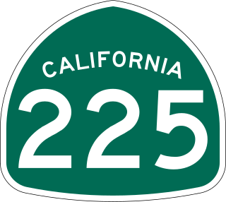
State Route 225 was a state highway in the U.S. state of California that was a loop route of U.S. Route 101 that served the beach areas of the Santa Barbara area. The route was originally defined in 1963. In 2014, control of the highway was transferred from the state to the city of Santa Barbara. As of 2023, however, the California State Legislature has neither deleted nor even amended the legal definition of SR 225 in the California Streets and Highways Code since 2011 when they authorized Caltrans to transfer control of the highway to the city.

<span class="mw-page-title-main">California State Route 132</span> Highway in California

State Route 132 is a state highway in the U.S. state of California that connects the Central Valley with the Sierra Nevada foothills and the California Gold Country. Its western segment also connects the city of Modesto with the San Francisco Bay Area via I-580, although this route is discouraged due to it being a two-lane road between Modesto and Interstate 5. East of Modesto, the road climbs the foothills and eventually ends at SR 49 at Coulterville.

<span class="mw-page-title-main">California State Route 103</span> Highway in California

State Route 103 is a state highway in the U.S. state of California that forms part of the Terminal Island Freeway in Los Angeles and Long Beach. It runs from State Route 47 near Terminal Island north to State Route 1 in Long Beach. At the south end of SR 103, the Terminal Island Freeway runs south with SR 47 over the Commodore Schuyler F. Heim Bridge to its end at Ocean Boulevard on Terminal Island, at the former Long Beach Naval Shipyard. SR 47 then turns west there to its end at Interstate 110.

<span class="mw-page-title-main">California State Route 42</span> Former highway in California

State Route 42 (SR 42) is a decommissioned state highway in the southern region part of the U.S. state of California, running along Manchester Avenue, Manchester Boulevard and Firestone Boulevard in Los Angeles and the cities south of it. In its final official routing that lasted from 1968 to 2000, SR 42 ran from State Route 1 west of Inglewood east to what was then a direct interchange with Interstate 5 in Norwalk. Though signed as SR 42, it was officially Route 105 until it was replaced by the parallel Interstate 105 on October 14, 1993. The entire route was deleted from the California Freeway and Expressway System in 2000, with the remaining portion of SR 42 being relinquished to local jurisdictions in that year. The direct interchange with I-5 was later demolished in 2013 in favor widening that portion of the Interstate. However, some SR 42 signs may still remain along the route.

References

  1. California Department of Transportation, State Truck Route List, updated April 1, 2004
  2. "California Highways: Routes 017-024 to Individual Page Detour". www.cahighways.org. Retrieved 17 September 2023.
  3. Federal Highway Administration (March 25, 2015). National Highway System: Los Angeles, CA (PDF) (Map). Scale not given. Washington, DC: Federal Highway Administration. Retrieved October 19, 2017.
  4. Natzke, Stefan; Neathery, Mike & Adderly, Kevin (June 20, 2012). "What is the National Highway System?". National Highway System. Washington, DC: Federal Highway Administration. Retrieved July 1, 2012.
  5. 1 2 " State begins transfer of Lakewood Boulevard
  6. 1 2 "Archived copy". Archived from the original on 2017-04-29. Retrieved 2017-07-29.{{cite web}}: CS1 maint: archived copy as title (link)
  7. 1 2 "Minutes Of The City Council" (PDF). Archived from the original (PDF) on 2005-02-12. Retrieved 2008-02-16.
  8. 1 2 "Google News". Google News. 17 September 2023. Retrieved 17 September 2023.
  9. 1 2 Los Angeles and Orange Counties Street Guide and Directory (Map). Thomas Brothers. 1999. p. 566, 596, 636, 676, 706, 736, 766, 796.
  10. 1 2 Bill introduced sen.ca.gov [ permanent dead link ]
  11. 1 2 "CPY Document" (PDF). lacounty.info. Retrieved 17 September 2023.[ permanent dead link ]
  12. Los Angeles Times, Celebrate Paving of Boulevard, November 4, 1925
  13. Ben Blow, California Highways: A Descriptive Record of Road Development by the State and by Such Counties as Have Paved Highways, 1920 (Archive.org or Google Books), p. 165
  14. Rand McNally & Company, Los Angeles and Vicinity Archived 2011-07-26 at the Wayback Machine , 1933
  15. Division of Highways, Los Angeles and Vicinity, 1934
  16. California State Assembly. "An act to amend sections 2, 3 and 5 and to add two sections to be numbered 6 and 7 to an act entitled 'An act to provide for the acquisition of rights of way for and the construction, maintenance..." Fiftieth Session of the Legislature. Statutes of California. State of California. Ch. 767 p. 2040.: "State Highway Route 60 near Long Beach to State Highway Route 9 near Lamanda Park."
  17. California State Assembly. "An act to establish a Streets and Highways Code, thereby consolidating and revising the law relating to public ways and all appurtenances thereto, and to repeal certain acts and parts of acts specified herein". Fifty-first Session of the Legislature. Statutes of California. State of California. Ch. 29 p. 286.: "Route 168 is from Route 60 near Long Beach to Route 9 near Lamanda Park."
  18. "California Highways: Routes 161-168 to Individual Page Detour". www.cahighways.org. Retrieved 17 September 2023.
  19. "Caltrans" (PDF). dot.ca.gov. Archived from the original (PDF) on 2022-09-14. Retrieved 2023-09-17.
  20. 1 2 California Department of Transportation. "State Truck Route List". Sacramento: California Department of Transportation. Archived from the original (XLS file) on June 30, 2015. Retrieved June 30, 2015.
  21. California Department of Transportation (July 2007). "Log of Bridges on State Highways". Sacramento: California Department of Transportation.
  22. California Department of Transportation, All Traffic Volumes on CSHS Archived July 21, 2011, at the Wayback Machine , 2006
  23. California Department of Transportation, All Traffic Volumes on CSHS Archived 2012-02-09 at the Wayback Machine , 1999 (the last year before it was updated to remove the relinquished part)
Template:Attached KML/California State Route 19
KML is from Wikidata