Temple Street (Los Angeles)

Last updated
Cathedral of Our Lady of the Angels as seen from Hill Street bridge by Temple Street Cathedral of Our Lady of Angels, Los Angeles.JPG
Cathedral of Our Lady of the Angels as seen from Hill Street bridge by Temple Street

Temple Street is a street in the City of Los Angeles, California. [1] The street is an east-west thoroughfare that runs through Downtown Los Angeles parallel to the Hollywood Freeway between Virgil Avenue past Alameda Street to the banks of the Los Angeles River. It was developed as a simple one-block long lane by Jonathan Temple, a mid-19th Century Los Angeles cattle rancher and merchant.

Contents

Originally, Temple began at Main Street, from which Spring Street also began running towards the southwest. The south side of this intersection where the three streets met was called Temple Block, an important retail building in early Los Angeles. In the 1920s and 1930s, Spring Street was rerouted to be parallel with Main Street, so that it intersected Temple one block west of Main Street.

West Temple Street

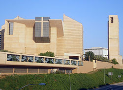
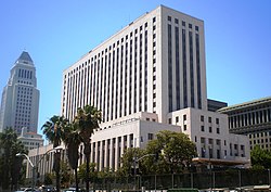
From the late 1860s, development pushed westward from what was then the central business district, and West Temple Street became a fashionable residential thoroughfare, and remained so into the 1880s. The city's High School opened in 1871 at Temple's south edge atop Poundcake Hill, since flattened. It was removed and the prominent "Red Sandstone" Courthouse stood in the same place starting in 1891. A Hall of Records followed in 1911. After the construction of City Hall in 1925, the area between Temple and 3rd Streets, from Los Angeles Street westward to Hill Street, was designated the Civic Center district, and so Temple Street became lined with civic buildings.

Until the 1920s, Temple Street, as the city continued to grow west towards the ocean, was extended all the way to Beverly Hills. With, however, the creation of Beverly Boulevard, Temple Street was terminated at its current location at Virgil Avenue, near Silver Lake Boulevard. From that point, the roadway is Beverly Boulevard to Santa Monica Boulevard.

East Temple Street

On the east side, Only after 1930 was Temple Street extended eastward past Main Street into the industrial district of town. East of Alameda Street, Temple Street occupies the former Turner Street, Temple Street terminates just east of Center Street and just west of the Los Angeles River and the railroad switch yards.

Famous residents

Actor Danny Trejo was born on Temple Street. [2]

Notable landmarks

United States Court House at Temple and Main Streets U.S. Court House, Los Angeles.JPG
United States Court House at Temple and Main Streets

Several important Los Angeles landmarks are on the street:

Education and Transportation

Edward R. Roybal Learning Center near Downtown Los Angeles Roybal Learning Center.jpg
Edward R. Roybal Learning Center near Downtown Los Angeles

Number of LAUSD schools are located at Temple Street, including Downtown Magnets High School, Edward R. Roybal Learning Center, and Camino Nuevo Charter Academy.

Los Angeles Public Library's Echo Park Branch Library is located on the corner of Temple Street and Douglas Street.

Metro Local lines 10 and 92 run on Temple Street.

Related Research Articles

<span class="mw-page-title-main">Sunset Boulevard</span> Thoroughfare in Beverly Hills, West Hollywood and Los Angeles, United States

Sunset Boulevard is a boulevard in the central and western part of Los Angeles, California, United States, that stretches from the Pacific Coast Highway in Pacific Palisades east to Figueroa Street in Downtown Los Angeles. It is a major thoroughfare in the cities of Beverly Hills and West Hollywood, as well as several districts in Los Angeles.

<span class="mw-page-title-main">Mulholland Drive</span> Street and road in the eastern Santa Monica Mountains of Southern California

Mulholland Drive is a street and road in the eastern Santa Monica Mountains of Southern California. It is named after pioneering Los Angeles civil engineer William Mulholland. The western rural portion in Los Angeles and Ventura Counties is named Mulholland Highway. The road is featured in a significant number of films, songs, and novels. David Lynch, who wrote and directed a film named after Mulholland Drive, has said that one can feel "the history of Hollywood" on it. Jack Nicholson has lived on Mulholland Drive for many years, and still lives there today.

<span class="mw-page-title-main">La Cienega Boulevard</span> Highway in California

La Cienega Boulevard is a major north–south arterial road that runs between El Segundo Boulevard in Hawthorne, California on the south and the Sunset Strip/Sunset Boulevard in West Hollywood to the north. It was named for Rancho Las Cienegas, literally "The Ranch Of The Swamps," an area of marshland south of Rancho La Brea.

<span class="mw-page-title-main">Angelino Heights, Los Angeles</span> Neighborhood of Los Angeles in Los Angeles County, California, United States

Angelino Heights, alternately spelled Angeleno Heights, is one of the oldest neighborhoods in Los Angeles. Situated between neighboring Chinatown and Echo Park, the neighborhood is known for its concentration of eclectic architectural styles from three eras: The Victorian, Turn of the Century and Revival eras. Carroll Avenue is listed on the National Register of Historic Places and there are over thirty Historic-Cultural Monuments in the neighborhood.

<span class="mw-page-title-main">Civic Center, Los Angeles</span> Neighborhood of Los Angeles in California, United States

The Civic Center neighborhood of Los Angeles, California, is the administrative core of the City of Los Angeles, County of Los Angeles, and a complex of city, county, state, and federal government offices, buildings, and courthouses. It is located on the site of the former business district of the city during the 1880s and 1890s, since mostly-demolished.

<span class="mw-page-title-main">Wilshire Boulevard</span> Major thoroughfare in the metropolitan Los Angeles area, United States

Wilshire Boulevard ('wɪɫ.ʃɚ) is a prominent 15.83 mi (25.48 km) boulevard in the Los Angeles area of Southern California, extending from Ocean Avenue in the city of Santa Monica east to Grand Avenue in the Financial District of downtown Los Angeles. One of the principal east–west arterial roads of Los Angeles, it is also one of the major city streets through the city of Beverly Hills. Wilshire Boulevard runs roughly parallel with Santa Monica Boulevard from Santa Monica to the west boundary of Beverly Hills. From the east boundary it runs a block south of Sixth Street to its terminus.

<span class="mw-page-title-main">San Vicente Boulevard</span> Street in Western Los Angeles running southeast of Beverly Hills, United States

San Vicente Boulevard is a major northwest-southeast thoroughfare located in the western portion of the metropolitan area of Los Angeles, CA.

<span class="mw-page-title-main">Beverly Boulevard</span> Thoroughfare in Los Angeles, United States

Beverly Boulevard is one of the main east–west thoroughfares in Los Angeles, in the U.S. state of California. It begins off Santa Monica Boulevard in Beverly Hills and ends on the Lucas Avenue overpass near downtown Los Angeles to become 1st Street. A separate Beverly Boulevard begins off 3rd Street and Pomona Boulevard in East Los Angeles, runs through Montebello and Pico Rivera, and becomes Turnbull Canyon Road in Whittier near Rose Hills Memorial Park.

<span class="mw-page-title-main">3rd Street, Los Angeles</span> Street in Los Angeles, California, United States

3rd Street in Los Angeles is a major east–west thoroughfare. The west end is in downtown Beverly Hills by Santa Monica Boulevard, and the east is at Alameda Street in downtown Los Angeles, where it shares a one-way couplet with 4th Street. East of Alameda it becomes 4th Street, where it heads to East Los Angeles, where it turns back into 3rd Street upon crossing Indiana Street. 3rd Street eventually becomes Pomona Boulevard in Monterey Park, where it then turns into Potrero Grande Drive and finally turns into Rush Street in Rosemead and ends in El Monte.

Los Angeles Street, originally known as Calle de los Negros or Alley of the Black People, is a major thoroughfare in Downtown Los Angeles, California, dating back to the origins of the city as the Pueblo de Los Ángeles.

Alondra Boulevard is a west–east thoroughfare in the counties of Los Angeles and Orange.

<span class="mw-page-title-main">1st Street, Los Angeles</span> Street in Los Angeles County, California, United States

1st Street is an east–west thoroughfare in Los Angeles, East Los Angeles, and Monterey Park, California. It serves as a postal divider between north and south and is one of a few streets to run across the Los Angeles River. Though it serves as a major road east of downtown Los Angeles, it is a mostly residential street to the west.

<span class="mw-page-title-main">San Pedro Street</span>

San Pedro Street is a major north–south thoroughfare in Los Angeles, California, running from Little Tokyo in Downtown Los Angeles to West Rancho Dominguez. San Pedro Street was one of the earliest roadways, along with Alameda Street, between central Los Angeles and the Port of Los Angeles; much of the road's original alignment south of Jefferson Boulevard has been renamed Avalon Boulevard.

<span class="mw-page-title-main">Cesar Chavez Avenue</span> Street in Los Angeles

Cesar Chavez Avenue is a major east–west thoroughfare in Downtown Los Angeles, the Eastside and East Los Angeles, measuring 6.19 miles (9.96 km) in length. Named in honor of union leader César Chávez, the street was formed in 1994 from Sunset Boulevard between Figueroa and Main streets, a new portion of roadway, Macy Street between Main Street and Mission Road, and Brooklyn Avenue through Boyle Heights and East Los Angeles into Monterey Park. Much of the street is double-signed with its former names.

<span class="mw-page-title-main">Hollywood Line</span> Pacific Electric streetcar line (1909–1953)

The Hollywood Line was a local streetcar line of the Pacific Electric Railway. It primarily operated between Downtown Los Angeles and Hollywood, with some trips as far away as Beverly Hills and West Los Angeles. It was the company's busiest route prior to the opening of the Hollywood Subway. Designated as route 32, the line operated from 1909 until 1954.

<span class="mw-page-title-main">Coldwater Canyon Avenue</span>

Coldwater Canyon Avenue is a street, primarily within the City of Los Angeles, in Los Angeles County, California. It runs 10.3 miles (16.6 km) from North Beverly Drive at Coldwater Canyon Park in Beverly Hills, north up Coldwater Canyon, including a short stretch shared with Mulholland Drive, ending at a crossroad intersection with Roscoe Boulevard in Sun Valley, where the Coldwater Canyon Avenue changes into Sheldon Street.

<span class="mw-page-title-main">Martin Luther King Jr. Boulevard (Los Angeles)</span> Major east-west thoroughfare in Los Angeles, California

Martin Luther King Jr. Boulevard is an east-west thoroughfare in Los Angeles, California. It stretches 7.1 miles (11.4 km) from Obama Boulevard in Baldwin Hills/Crenshaw to South Alameda Street in Central-Alameda. Prior to 1983, the boulevard was known as Santa Barbara Avenue.

<span class="mw-page-title-main">Victorian Downtown Los Angeles</span> Historical neighborhood in California, US

The late-Victorian-era Downtown of Los Angeles in 1880 was centered at the southern end of the Los Angeles Plaza area, and over the next two decades, it extended south and west along Main Street, Spring Street, and Broadway towards Third Street. Most of the 19th-century buildings no longer exist, surviving only in the Plaza area or south of Second Street. The rest were demolished to make way for the Civic Center district with City Hall, numerous courthouses, and other municipal, county, state and federal buildings, and Times Mirror Square. This article covers that area, between the Plaza, 3rd St., Los Angeles St., and Broadway, during the period 1880 through the period of demolition (1920s–1950s).

References

  1. Ford, Andrea (1989-01-27). "For Health Reasons ... : Queen of Angels Closes Its Doors, Moves In With a Partner". Los Angeles Times.
  2. "Danny Trejo Talks 'Predators,' 'Machete' and The Jonas Brothers". May 26, 2010. Archived from the original on 2010-10-21.