Los Angeles Fashion District | |
|---|---|
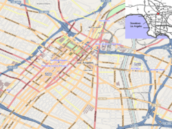 Los Angeles Fashion District Location within Downtown Los Angeles | |
| Coordinates: 34°02′14″N118°15′23″W / 34.037168°N 118.256404°W | |
| Country | |
| State | |
| County | County of Los Angeles |
| City | |
| Area code | 213 |
| Website | https://fashiondistrict.org |


The Los Angeles Fashion District, previously known as the garment district, is a business improvement district (BID) in, and often cited as a sub-neighborhood of, downtown Los Angeles. The neighborhood caters to wholesale selling and has more than 4,000 overwhelmingly independently owned and operated retail and wholesale businesses selling apparel, footwear, accessories, and fabrics. [1]