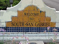
South San Gabriel, California

Last updated

South San Gabriel, California
South san gabriel.JPG
South San Gabriel welcome sign
LA County Incorporated Areas South San Gabriel highlighted.svg
Location of South San Gabriel in Los Angeles County, California.
USA Los Angeles Metropolitan Area location map.svg
Red pog.svg
South San Gabriel
Location of South San Gabriel in Los Angeles County, California
USA California location map.svg
Red pog.svg
South San Gabriel
Location of South San Gabriel in California
Usa edcp location map.svg
Red pog.svg
South San Gabriel
Location of South San Gabriel in the USA
Coordinates: 34°2′57″N118°5′43″W / 34.04917°N 118.09528°W / 34.04917; -118.09528
Country Flag of the United States.svg United States
State Flag of California.svg  California
County Flag of Los Angeles County, California.svg Los Angeles
Area
[1]
  Total0.833 sq mi (2.158 km2)
  Land0.833 sq mi (2.158 km2)
  Water0 sq mi (0.001 km2)  0.03%
Elevation
272 ft (83 m)
Population
 (2010)
  Total8,070
  Density9,700/sq mi (3,700/km2)
Time zone UTC-8 (PST)
  Summer (DST) UTC-7 (PDT)
ZIP code
91770
Area code 626
FIPS code 06-73276
GNIS feature ID1652796

South San Gabriel is a census-designated place (CDP) in Los Angeles County, California, United States. The population was 8,070 at the 2010 census, up from 7,595 at the 2000 census.

Contents

Geography

South San Gabriel is located at 34°2′57″N118°5′43″W / 34.04917°N 118.09528°W / 34.04917; -118.09528 (34.049060, -118.095150). [2]

According to the United States Census Bureau, the CDP has a total area of 0.8 square miles (2.2 km2), over 99% of it land.

Demographics

Historical population
CensusPop.Note
1970 5,051
1980 5,4217.3%
1990 7,70042.0%
2000 7,595−1.4%
source: [3]

2010

At the 2010 census South San Gabriel had a population of 8,070. The population density was 9,684.6 inhabitants per square mile (3,739.2/km2). The racial makeup of South San Gabriel was 2,198 (27.2%) White (5.6% Non-Hispanic White), [4] 83 (1.0%) African American, 56 (0.7%) Native American, 3,990 (49.4%) Asian, 4 (0.0%) Pacific Islander, 1,427 (17.7%) from other races, and 312 (3.9%) from two or more races. Hispanic or Latino of any race were 3,444 persons (42.7%). [5]

The census reported that 7,834 people (97.1% of the population) lived in households, 7 (0.1%) lived in non-institutionalized group quarters, and 229 (2.8%) were institutionalized.

There were 2,249 households, 874 (38.9%) had children under the age of 18 living in them, 1,249 (55.5%) were opposite-sex married couples living together, 393 (17.5%) had a female householder with no husband present, 211 (9.4%) had a male householder with no wife present. There were 96 (4.3%) unmarried opposite-sex partnerships, and 15 (0.7%) same-sex married couples or partnerships. 308 households (13.7%) were one person and 150 (6.7%) had someone living alone who was 65 or older. The average household size was 3.48. There were 1,853 families (82.4% of households); the average family size was 3.76.

The age distribution was 1,648 people (20.4%) under the age of 18, 737 people (9.1%) aged 18 to 24, 2,108 people (26.1%) aged 25 to 44, 2,225 people (27.6%) aged 45 to 64, and 1,352 people (16.8%) who were 65 or older. The median age was 40.5 years. For every 100 females, there were 92.9 males. For every 100 females age 18 and over, there were 90.0 males.

There were 2,353 housing units at an average density of 2,823.8 per square mile, of the occupied units 1,597 (71.0%) were owner-occupied and 652 (29.0%) were rented. The homeowner vacancy rate was 1.1%; the rental vacancy rate was 4.8%. 5,545 people (68.7% of the population) lived in owner-occupied housing units and 2,289 people (28.4%) lived in rental housing units.

2000

At the 2000 census there were 7,595 people, 2,091 households, and 1,727 families in the CDP. The population density was 9,106.3 inhabitants per square mile (3,516.0/km2). There were 2,166 housing units at an average density of 2,597.0 per square mile (1,002.7/km2). The racial makeup of the CDP was 0.39% African American, 1.17% Native American, 33.34% Asian, 0.20% Pacific Islander, 19.93% from other races, and 4.24% from two or more races. Hispanic or Latino 64.96% of the population, and 11.72% White. [6] Of the 2,091 households 37.6% had children under the age of 18 living with them, 57.6% were married couples living together, 17.7% had a female householder with no husband present, and 17.4% were non-families. 13.7% of households were one person and 6.5% were one person aged 65 or older. The average household size was 3.52 and the average family size was 3.85.

The age distribution was 25.0% under the age of 18, 9.0% from 18 to 24, 29.0% from 25 to 44, 22.9% from 45 to 64, and 14.1% 65 or older. The median age was 36 years. For every 100 females, there were 95.5 males. For every 100 females age 18 and over, there were 93.5 males.

The median household income was $51,136 and the median family income was $50,451. Males had a median income of $35,598 versus $30,091 for females. The per capita income for the CDP was $16,345. About 8.2% of families and 11.0% of the population were below the poverty line, including 11.6% of those under age 18 and 14.4% of those age 65 or over.

Education

The community is served by the Montebello Unified School District, [7] and the Garvey School District.

Schools include:

Politics

In the state legislature, South San Gabriel is located in California's 22nd State Senate district, represented by Democrat Susan Rubio, and in California's 49th State Assembly district, represented by Democrat Ed Chau. Federally, South San Gabriel is located in California's 27th congressional district, which is represented by Democrat Judy Chu.

The Los Angeles County Sheriff's Department (LASD) operates the Temple Station in Temple City, serving South San Gabriel. [8]

See also

Related Research Articles

<span class="mw-page-title-main">Avocado Heights, California</span> Census-designated place in California, United States

Avocado Heights is an unincorporated census-designated place (CDP) in the San Gabriel Valley of Los Angeles County, California, United States. It is almost entirely surrounded by the City of Industry with only a small strip of unincorporated Los Angeles County separating it from South El Monte. It is in close proximity to both the Pomona (SR-60) and San Gabriel (I-605) freeways. To the west is the San Gabriel River and the California Country Club. Avocado Heights is approximately 15 miles (24 km) from the downtown Los Angeles Civic Center. The population was 15,411 at the 2010 census, up from 15,148 at the 2000 census.

<span class="mw-page-title-main">Charter Oak, California</span> Census designated place in California, United States

Charter Oak is a census-designated place (CDP) in Los Angeles County, California, approximately 26 miles (42 km) east of downtown Los Angeles. The population was 9,310 at the 2010 census, up from 9,027 at the 2000 census.

<span class="mw-page-title-main">Citrus, California</span> Census-designated place in California, United States

Citrus is a census-designated place (CDP) in Los Angeles County, California, United States. It is located in the San Gabriel Valley between Azusa to the north and west, Glendora to the east, and Covina to the south. The population was 10,866 at the 2010 census, up from 10,581 at the 2000 census. Citrus is named after Citrus Avenue, which passes through the community.

<span class="mw-page-title-main">East Pasadena, California</span> Unincorporated community in California, United States

East Pasadena is an unincorporated community in Los Angeles County, California, United States. The population was 6,144 at the 2010 census, up from 6,045 at the 2000 census. For statistical purposes, the United States Census Bureau has defined East Pasadena as a census-designated place (CDP).

<span class="mw-page-title-main">East San Gabriel, California</span> Census-designated place in California, United States

East San Gabriel is a census-designated place (CDP) in Los Angeles County, California, United States. The population was 14,874 at the 2010 census, up from 14,512 at the 2000 census.

<span class="mw-page-title-main">Mayflower Village, California</span> Census-designated place in California, United States

Mayflower Village is a census-designated place (CDP) in the San Gabriel Valley, in Los Angeles County, California, United States. The population was 5,515 at the 2010 census, up from 5,081 at the 2000 census. The ZIP Codes serving the community are 91006, which is served by Arcadia and 91016, which is served by Monrovia.

<span class="mw-page-title-main">North El Monte, California</span> Census-designated place in California, United States

North El Monte is a census-designated place (CDP) in the San Gabriel Valley, in Los Angeles County, California, United States. The population was 3,723 at the 2010 census, up from 3,703 at the 2000 census.

<span class="mw-page-title-main">South San Jose Hills, California</span> Census-designated place in California, United States

South San Jose Hills is an unincorporated community and census-designated place in Los Angeles County, California, United States. The population was 20,551 at the 2010 census, up from 20,218 at the 2000 census.

<span class="mw-page-title-main">Valinda, California</span> Census-designated place in California, United States

Valinda is a census-designated place (CDP) in the San Gabriel Valley, in Los Angeles County, California, in the United States. At the 2010 census, the population was 22,822, up from 21,776 at the 2000 census.

<span class="mw-page-title-main">Vincent, California</span> Census-designated place in California, United States

Vincent is a census-designated place (CDP) in the central San Gabriel Valley, in Los Angeles County, California, United States. The city name and zipcode for addresses south of Arrow Highway is Covina and 91722, respectively, and Azusa and 91702 for addresses north of Arrow Highway. The population was 15,922 at the 2010 census, up from 15,097 at the 2000 census. Vincent is named after Vincent Avenue, which passes through the community.

<span class="mw-page-title-main">West Puente Valley, California</span> Census-designated place in California, United States

West Puente Valley is an unincorporated community and census-designated place in Los Angeles County, California, USA, northwest of La Puente. The population was 22,636 at the 2010 census, up from 22,589 at the 2000 census. The community is probably named for its location related to the city of La Puente.

<span class="mw-page-title-main">West Whittier-Los Nietos, California</span> Census-designated place in California, United States

West Whittier-Los Nietos is a census-designated place (CDP) in Los Angeles County, California, near the San Gabriel River and the San Gabriel River (I-605) Freeway. The population was 25,540 at the 2010 census, up from 25,129 at the 2000 census. The census area consists of separate unincorporated communities of Los Nietos and West Whittier.

<span class="mw-page-title-main">Camp Pendleton South, California</span> Census-designated place in California, United States

Camp Pendleton South is a census-designated place (CDP) in San Diego County, California, located at the southwest corner of the Marine Corps Base Camp Pendleton. The population was 10,616 at the 2010 census, up from 8,854 at the 2000 census. Much of the population are residents of Camp Pendleton barracks situated in the area, as well as housing communities for married Marine and Navy personnel and their families. It, along with Camp Pendleton Mainside CDP, is one of two CDPs on the base.

<span class="mw-page-title-main">Fruitdale, San Jose</span> Place in California, United States

Fruitdale is a district of San Jose, California, located in West San Jose, though some portions are still unincorporated as a census-designated place. The population of the CDP was 935 at the 2010 census.

Lake Belvedere Estates is a census-designated place (CDP) in Palm Beach County, Florida, United States. It is part of the Miami metropolitan area of South Florida. The population was 2,091 at the 2020 US census.

<span class="mw-page-title-main">Londontowne, Maryland</span> Former census-designated place in Maryland, United States

Londontowne is an unincorporated area and former census-designated place (CDP) in Anne Arundel County, Maryland, United States, and the site of a former colonial seaport founded on the South River in 1683. The population was 7,595 at the 2000 census. At the 2010 census, the area was delineated as the Edgewater CDP.

<span class="mw-page-title-main">Orchard Homes, Montana</span> CDP in Montana, United States

Orchard Homes is a census-designated place (CDP) in Missoula County, Montana, United States. It is part of the Missoula Metropolitan Statistical Area. The population was 5,377 at the 2020 census.

<span class="mw-page-title-main">Beattystown, New Jersey</span> Populated place in Warren County, New Jersey, US

Beattystown is an unincorporated community and census-designated place (CDP) located within Mansfield Township, in Warren County, in the U.S. state of New Jersey. As of the 2010 United States Census, the CDP's population was 4,554.

Seven Oaks is a census-designated place (CDP) in Lexington County, South Carolina, United States, 8 miles (13 km) northwest of downtown Columbia, the state capital. The population of the CDP was 15,144 at the 2010 census. It is part of the Columbia Metropolitan Statistical Area.

<span class="mw-page-title-main">Union Hill-Novelty Hill, Washington</span> Census-designated place in Washington, United States

Union Hill-Novelty Hill is a census-designated place (CDP) in King County, Washington, United States. The area was first recognized by the Census Bureau in the 2000 census. The population was 18,805 at the 2010 census.

References

  1. "2010 Census U.S. Gazetteer Files – Places – California". United States Census Bureau.
  2. "US Gazetteer files: 2010, 2000, and 1990". United States Census Bureau. February 12, 2011. Retrieved April 23, 2011.
  3. "Census of Population and Housing (1790-2000)". U.S. Census Bureau . Retrieved July 17, 2010.
  4. "QuickFacts". United States Census Bureau . Archived from the original on April 18, 2012. Retrieved July 4, 2023.{{cite web}}: CS1 maint: unfit URL (link)
  5. "2010 Census Interactive Population Search: CA - South San Gabriel CDP". U.S. Census Bureau. Archived from the original on July 15, 2014. Retrieved July 12, 2014.
  6. "U.S. Census website". United States Census Bureau . Retrieved January 31, 2008.
  7. "District Map." Montebello Unified School District. Retrieved on January 3, 2017.
  8. "Temple Station Archived 2010-01-30 at the Wayback Machine ." Los Angeles County Sheriff's Department. Retrieved on January 21, 2010.