
Los Angeles County, officially the County of Los Angeles, and sometimes abbreviated as L.A. County, is the most populous county in the United States, with 9,861,224 residents estimated in 2022. Its population is greater than that of 40 individual U.S. states. Comprising 88 incorporated cities and many unincorporated areas within a total area of 4,083 square miles (10,570 km2), it is home to more than a quarter of Californians and is one of the most ethnically diverse U.S. counties. The county's seat, Los Angeles, is the second most populous city in the United States, with 3,822,238 residents estimated in 2022. The county has been world-renowned as the domicile of the U.S. motion-picture industry since the latter's inception in the early 20th century.

Rosamond is an unincorporated community in Kern County, California, US, near the Los Angeles county line. Rosamond is part of Greater Los Angeles and is located in the Mojave Desert just north of Lancaster and Palmdale, two of the largest cities in Antelope Valley. As of the 2010 Census, Rosamond's population was 18,150. For statistical purposes, the United States Census Bureau has defined Rosamond as a census-designated place (CDP).
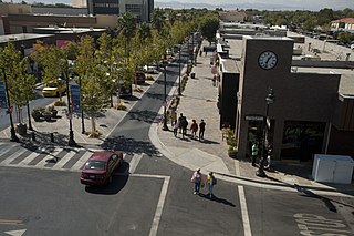
Lancaster is a charter city in northern Los Angeles County, in the Antelope Valley of the western Mojave Desert in Southern California. As of the 2020 census, the population was 173,516, making Lancaster the 153rd largest city in the United States and the 30th largest in California. Lancaster is a twin city with its southern neighbor Palmdale; together, they are the principal cities within the Antelope Valley region.

Littlerock is a census-designated place in California United States. The population was 1,377 at the 2010 census, down from 1,402 at the 2000 census. The Littlerock, and Sun Village community, which is typically referred to as Littlerock, has a population around 15,000. According to the Greater Antelope Valley Economic Alliance report of 2009, the Palmdale / Lancaster urban area has a population of 483,998, which Littlerock is a part of.

Palmdale is a city in northern Los Angeles County in the U.S. state of California. The city lies in the Antelope Valley of Southern California. The San Gabriel Mountains separate Palmdale from the Los Angeles Basin to the south.
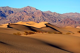
The Mojave Desert is a desert in the rain shadow of the southern Sierra Nevada mountains and Transverse Ranges in the Southwestern United States. Named for the indigenous Mohave people, it is located primarily in southeastern California and southwestern Nevada, with small portions extending into Arizona and Utah.

Antelope Valley California Poppy Reserve is a state-protected reserve of California, United States, harboring the most consistent blooms of California poppies, the state flower. The reserve is located in the rural west side of Antelope Valley in northern Los Angeles County, 15 miles (24 km) west of Lancaster. To the north is Kern County. The reserve is at an elevation ranging from 2,600 to 3,000 feet above sea level, in the Mojave Desert climate zone. The reserve is administered by the California Department of Parks and Recreation. Other wildflowers within the reserve include the Owl's Clover, Lupine, Goldfields, Cream Cups and Coreopsis.

Arthur B. Ripley Desert Woodland State Park is a state park in the western Antelope Valley in Southern California. The park protects mature stands of Joshua trees and California juniper trees in their western Mojave Desert habitat.

The Antelope Valley is located in northern Los Angeles County, California, United States, and the southeast portion of California's Kern County, and constitutes the western tip of the Mojave Desert. It is situated between the Tehachapi, Sierra Pelona, and the San Gabriel Mountains. The valley was named for the pronghorns that roamed there until they were all eliminated in the 1880s, mostly by hunting, or resettled in other areas. The principal cities in the Antelope Valley are Palmdale and Lancaster.

State Route 14 (SR 14) is a north–south state highway in the U.S. state of California that connects Los Angeles to the northern Mojave Desert. The southern portion of the highway is signed as the Antelope Valley Freeway. Its southern terminus is at Interstate 5 in the Los Angeles neighborhoods of Granada Hills and Sylmar just immediately to the south of the border of the city of Santa Clarita. SR 14's northern terminus is at U.S. Route 395 (US 395) near Inyokern. Legislatively, the route extends south of I-5 to SR 1 in the Pacific Palisades area of Los Angeles; however, the portion south of the junction with I-5 has not been constructed. The southern part of the constructed route is a busy commuter freeway serving and connecting the cities of Santa Clarita, Palmdale, and Lancaster to the rest of the Greater Los Angeles area. The northern portion, from Vincent to US 395, is legislatively named the Aerospace Highway, as the highway serves Edwards Air Force Base, once one of the primary landing strips for NASA's Space Shuttle, as well as the Naval Air Weapons Station China Lake that supports military aerospace research, development and testing. This section is rural, following the line between the hot Mojave desert and the forming Sierra Nevada mountain range. Most of SR 14 is loosely paralleled by a rail line originally built by the Southern Pacific Railroad, and was once the primary rail link between Los Angeles and Northern California. While no longer a primary rail line, the southern half of this line is now used for the Antelope Valley Line of the Metrolink commuter rail system.

State Route 138 is an east–west state highway in the U.S. state of California that generally follows the northern foothills of the San Gabriel Mountains and the western Mojave Desert. The scenic highway begins in the west at its junction with Interstate 5 located south of Gorman in the Sierra Pelona Mountains, continues eastward through the Antelope Valley and Cajon Pass, to its junction with State Route 18 in the east, located in the San Bernardino Mountains south of Crestline.
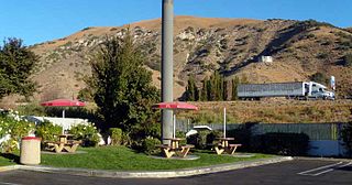
Gorman is an unincorporated community in northwestern Los Angeles County, California, United States. It is located in Peace Valley south of the Tejon Pass, which links Southern California with the San Joaquin Valley and Northern California. Due to this location, the area has served as a historic travel stop dating back to the indigenous peoples of California. Tens of thousands of motorists travel through Gorman daily on the Golden State Freeway since the highway's completion in the mid-20th Century.

The Sutter Buttes are a small circular complex of eroded volcanic lava domes which rise as buttes above the flat plains of the Sacramento Valley in Sutter County, northern California. They are situated just outside Yuba City in the northern part of the state's Central Valley.
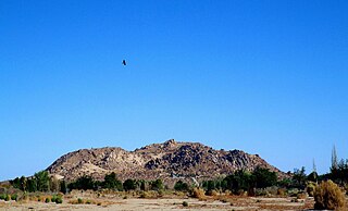
Saddleback Butte State Park is a state park in the Antelope Valley of the western Mojave Desert, in Southern California. It is located east of Lancaster, north of the community of Lake Los Angeles, and south of Edwards in the unincorporated community of Hi Vista.

Lancaster station is owned by and located in the city of Lancaster, California. It serves as a transfer point for several public transportation bus routes as well as the final Metrolink train station on the Antelope Valley Line that originates 69 miles (111 km) away in downtown Los Angeles, at Union Station.

Antelope Valley Transit Authority is the transit agency serving the cities of Palmdale, Lancaster and Northern Los Angeles County. Antelope Valley Transit Authority is operated under contract by MV Transportation, and is affiliated with and offers connecting services with Metro and Metrolink. In 2023, the system had a ridership of 1,523,700, or about 5,500 per weekday as of the first quarter of 2024.

Devil's Punchbowl is a tilted sandstone formation on the northern slopes of the San Gabriel Mountains, in Los Angeles County, California, at an elevation of 4,750 feet (1,450 m).

Wilsona was a 20th-century settlement in the Antelope Valley section of Los Angeles County, California. It lay in the vicinity of Big Rock Wash, at an elevation of 2726 feet in the far northeastern corner of the county, the near the border junction of Los Angeles, Kern, and San Bernardino Counties. Wilsona had a post office beginning in 1916 between the Llano and Gray Mountain post offices. Circa 1929, Valyermo, Llano, Wilsona, Neenach, Domino, and Muroc, were all described as "post offices that serve scattered ranches. All these communities are reached by automobile, and roads lead from the [Antelope Valley] to desert towns lying to the north and east." A 1939 guide to Los Angeles County stated "Antelope Valley has many small communities, among which are Acton, Littlerock, Fairmont, Vincent, Harold, Pearblossom, Llano, Valyermo, Wilsona, Hi Vista, Tierra Bonita, Roosevelt, Redman, Del Sur, Esperanza, Rogers, Lake Hughes, Neenach, Sandberg, and Gorman. Most of these are trading centers for populations, most of which are active either in mining or agricultural pursuits."
There are 9 routes assigned to the "N" zone of the California Route Marker Program, which designates county routes in California. The "N" zone includes county highways lying in Los Angeles and Orange counties.


