Leona Valley, California

Last updated

Leona Valley, California
Los Angeles County California Incorporated and Unincorporated areas Leona Valley Highlighted 0641208.svg
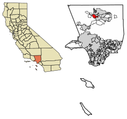
Location of Leona Valley in Los Angeles County, California.
Usa edcp location map.svg
Red pog.svg
Leona Valley, California
Location in the United States
Coordinates: 34°37′6″N118°17′14″W / 34.61833°N 118.28722°W / 34.61833; -118.28722
Country Flag of the United States.svg United States
State Flag of California.svg  California
County Flag of Los Angeles County, California.svg Los Angeles
Area
[1]
  Total18.578 sq mi (48.117 km2)
  Land18.551 sq mi (48.046 km2)
  Water0.027 sq mi (0.071 km2)  0.15%
Elevation
[2]
3,491 ft (1,064 m)
Population
 (2010)
  Total1,607
  Density87/sq mi (33/km2)
Time zone UTC-8 (Pacific (PST))
  Summer (DST) UTC-7 (PDT)
ZIP codes
93551
Area code 661
FIPS code 06-41208
GNIS feature ID2583056
U.S. Geological Survey Geographic Names Information System: Leona Valley, California

Leona Valley (Leona, Spanish for "Lioness") is a census-designated place [2] located in the geographic Leona Valley of northern Los Angeles County, California, in the transition between the Sierra Pelona Mountains and Mojave Desert, just west of Palmdale and the Antelope Valley. The population was 1,607 at the 2010 census.

Contents

Leona Valley is best known for its agriculture, particularly cherries and wine grapes. The town of Leona Valley holds its annual Leona Valley Cherry Festival in honor of its agricultural heritage.

Geography

Leona Valley is located about 10 miles (20 km) west of the Palmdale Civic Center in Southern California. Leona Valley town is located in its namesake, Leona Valley. This valley is a long narrow valley separated from the Antelope Valley by the San Andreas fault ridge, known as Ritter Ridge, so named after one of the settlers from Nebraska in the 1880s. The valley is about a mile wide and 25 miles (40 km) in length. The geographic Leona Valley is also home to the towns of Lake Hughes and Lake Elizabeth.

The ZIP Code is 93551 and the community is inside area code 661.

History

Leona Valley's post colonial history can be best described as land abundant with cattle ranches. In the late 18th century, after the loss of the Tataviam Native Americans – the area's original inhabitants – to Indian Reductions as Mission Indians at the Mission San Fernando immigrants from Spain and Mexico quickly established themselves. The majority of the immigrants were primarily interested in the land in order to establish cattle ranches. During the 1830s, the ranches were broken up into smaller homesteads by farmers from Germany, France and the state of Nebraska. The Ritter family started one of the first wineries in this country in Leona Valley which was later shut down by the U.S. Prohibition period in the early 20th century.

In 1901 Frank D Hall bought the 3000 acre St. Anthony Ranch. The valley was then known as Leonis and he changed the name of the ranch to Leona Valley Ranch and set about building a dairy farm. The Ranch was most of the land west of Bouquet Canyon Rd. The dairy did not work out and the subdivision of the Leona Valley Ranch started in 1918. That first phase of the subdivision was for properties that had roads and water (either had water or was in an area known to be practical for drilling a well). One of the early sales was the southwest corner of Elizabeth Lake Rd and 90th St West. The Nolenberger's built a store and gas station on that lot which opened in 1924. The building is now Hemme Hay and Feed store. In 1927 Frank Hall incorporated Farm Home Builders to handle the next phase that required new roads and a water system. To that end Farm Home Builders took out a loan for $45,000. The Great Depression hit before many sold and it wasn't until the 1940s that most were sold.

The majority of those old large homestead parcels have since been partially subdivided and developed with a mix of custom residences, with Leona Valley still maintaining a spacious beauty.

Demographics

Historical population
CensusPop.Note
U.S. Decennial Census [3]

The 2010 United States Census [4] reported that Leona Valley had a population of 1,607. The population density was 86.5 inhabitants per square mile (33.4/km2). The racial makeup of Leona Valley was 1,456 (90.6%) White (82.9% Non-Hispanic White), [5] 11 (0.7%) African American, 4 (0.2%) Native American, 28 (1.7%) Asian, 0 (0.0%) Pacific Islander, 51 (3.2%) from other races, and 57 (3.5%) from two or more races. Hispanic or Latino of any race were 198 persons (12.3%).

The Census reported that 1,607 people (100% of the population) lived in households, 0 (0%) lived in non-institutionalized group quarters, and 0 (0%) were institutionalized.

There were 590 households, out of which 182 (30.8%) had children under the age of 18 living in them, 394 (66.8%) were opposite-sex married couples living together, 27 (4.6%) had a female householder with no husband present, 23 (3.9%) had a male householder with no wife present. There were 28 (4.7%) unmarried opposite-sex partnerships, and 5 (0.8%) same-sex married couples or partnerships. 114 households (19.3%) were made up of individuals, and 42 (7.1%) had someone living alone who was 65 years of age or older. The average household size was 2.72. There were 444 families (75.3% of all households); the average family size was 3.16.

The population was spread out, with 335 people (20.8%) under the age of 18, 142 people (8.8%) aged 18 to 24, 247 people (15.4%) aged 25 to 44, 632 people (39.3%) aged 45 to 64, and 251 people (15.6%) who were 65 years of age or older. The median age was 47.4 years. For every 100 females, there were 104.2 males. For every 100 females age 18 and over, there were 106.2 males.

There were 677 housing units (some outside of the Leona Valley Community Standards District) at an average density of 36.4 per square mile (14.1/km2), of which 515 (87.3%) were owner-occupied, and 75 (12.7%) were occupied by renters. The homeowner vacancy rate was 4.1%; the rental vacancy rate was 13.8%. 1,412 people (87.9% of the population) lived in owner-occupied housing units and 195 people (12.1%) lived in rental housing units.

According to the 2010 United States Census, Leona Valley had a median household income of $79,375, with 8.1% of the population living below the federal poverty line. [6]

Leona Valley AVA

The Reynolds Family Estate planted vineyards in 2001 and established Leona Valley Winery pioneering a new wine country with the Leona Valley AVA (American Viticulture Area) and a new L.A. County Wine Ordinance promoting wineries and tasting rooms in the area. [7]

Government and infrastructure

The Los Angeles County Department of Health Services operates the Antelope Valley Health Center in Lancaster, serving Leona Valley. [8]

Related Research Articles

<span class="mw-page-title-main">Rosamond, California</span> Unincorporated community in Kern County, California

Rosamond is a unincorporated community in Kern County, California, US, near the Los Angeles county line. Rosamond is part of Greater Los Angeles and is located in the Mojave Desert just north of Lancaster and Palmdale, two of the largest cities in Antelope Valley. As of the 2010 Census, Rosamond's population was 18,150. For statistical purposes, the United States Census Bureau has defined Rosamond as a census-designated place (CDP).

<span class="mw-page-title-main">Acton, California</span> Census designated place in Los Angeles County, California

Acton is an unincorporated census-designated place in Los Angeles County, California, near the Antelope Valley. According to the 2010 census, Acton had a population of 7,596.

<span class="mw-page-title-main">Littlerock, California</span> Census-designated place in California, United States

Littlerock is a census-designated place in California United States. The population was 1,377 at the 2010 census, down from 1,402 at the 2000 census. The Littlerock, and Sun Village community, which is typically referred to as Littlerock, has a population around 15,000. According to the Greater Antelope Valley Economic Alliance report of 2009, the Palmdale / Lancaster urban area has a population of 483,998, which Littlerock is a part of.

<span class="mw-page-title-main">Palmdale, California</span> City in California, United States

Palmdale is a city in northern Los Angeles County in the U.S. state of California. The city lies in the Antelope Valley of Southern California. The San Gabriel Mountains separate Palmdale from the Los Angeles Basin to the south.

<span class="mw-page-title-main">Quartz Hill, California</span> Census-designated place in California, United States

Quartz Hill is a census-designated place (CDP) in Los Angeles County, California, United States. The population was 10,912 at the 2010 census, up from 9,890 at the 2000 census. The name is also shared with the neighboring district areas of its border cities, Palmdale, and Lancaster. Quartz Hill was once home to the Quartz Hill Airport. According to the Greater Antelope Valley Economic Alliance report of 2009, the Palmdale / Lancaster urban area of which Quartz Hill is a part, has a population of 483,998.

<span class="mw-page-title-main">Valley Ranch, California</span> Census-designated place in California, United States

Valley Ranch is a census-designated place in Plumas County, California, United States. The population was 109 at the 2010 census, up from 92 at the 2000 census.

<span class="mw-page-title-main">Cherry Valley, California</span> Census-designated place in California, United States

Cherry Valley is a census-designated place (CDP) in Riverside County, California, United States. The population was 6,362 at the 2010 census, up from 5,891 at the 2000 census. It is situated at the most northwestern point of the San Gorgonio Pass.

<span class="mw-page-title-main">Glen Ellen, California</span> Census designated place in California, United States

Glen Ellen is a census-designated place (CDP) in Sonoma Valley, Sonoma County, California, United States. The population was 784 at the 2010 census, down from 992 at the 2000 census. Glen Ellen is the location of Jack London State Historic Park, Sonoma Valley Regional Park, and a former home of Hunter S. Thompson.

<span class="mw-page-title-main">Lake Los Angeles, California</span> Census-designated place in California, United States

Lake Los Angeles is a census-designated place (CDP) in Los Angeles County, California, United States. The population was 12,328 at the 2010 census, up from 11,523 at the 2000 census. It is located 17 miles (27 km) east of Palmdale's Civic Center. According to the Greater Antelope Valley Economic Alliance report of 2009, the Palmdale / Lancaster urban area has a population of 483,998, of which Lake Los Angeles is a part.

<span class="mw-page-title-main">Carmel Valley Village, California</span> Unincorporated community in California, United States

Carmel Valley Village is an unincorporated community and census-designated place (CDP) in Monterey County, California, United States. In 1946, Byington Ford and Tirey L. Ford Jr. developed the Carmel Valley Village, which included an airpark, shops, and homes. At the time of the 2020 census the CDP population was 4,524, up from 4,407 at the 2010 census. In November 2009, a majority of residents voted against incorporation.

<span class="mw-page-title-main">Cherry Tree, Pennsylvania</span> Borough in Pennsylvania, United States

Cherry Tree is a borough in Indiana County, Pennsylvania, United States. The population was 276 at the 2020 census.

<span class="mw-page-title-main">Antelope, California</span> Census-designated place in California, United States

Antelope is a census-designated place in Sacramento County, California, United States located approximately 15 miles (24 km) northeast of downtown Sacramento and 5 miles (8 km) southwest of Roseville. The population was 45,770 at the 2020 census.

Sun Village is an unincorporated community and census-designated place (CDP) in Los Angeles County, California, United States. It is in the eastern Antelope Valley at an elevation of 2,723 feet (830 m). The center of Sun Village may be considered to be Palmdale Boulevard and 87th Street East as noted at the Los Angeles County Assessors office. As of the 2010 census the population of Sun Village was 11,565, up from 9,375 at the 2000 census.

<span class="mw-page-title-main">Coleville, California</span> Census-designated place in California, United States

Coleville is an unincorporated community and census-designated place (CDP) in Mono County, California, United States. It is located at an elevation of 5,141 feet (1,567 m) in the Antelope Valley on the West Walker River. The population was 419 at the 2020 census, down from 495 at the 2010 census.

<span class="mw-page-title-main">Lake Hughes, California</span> Unincorporated community in California, United States

Lake Hughes is an unincorporated community in northern Los Angeles County, California. It is in the Sierra Pelona Mountains, northwest of Palmdale and north of the Santa Clarita Valley, in the Angeles National Forest. It is on the sag pond waters of Lake Hughes and Elizabeth Lake. The community is rural in character, with a population of 649 in 2010, but also has a strong recreational element centered on the three lakes in the vicinity. The community of Elizabeth Lake is located just east of Lake Hughes, sharing the same ZIP code.

<span class="mw-page-title-main">Bangor, California</span> Census-designated place in California, United States

Bangor is a census-designated place in Butte County, California, about 1.5 miles (2.4 km) from the Yuba County line. The U.S. Geological Survey (USGS) feature ID for the community is 218644, and for the census place is 2612459; and the elevation is given as 761 feet (232 m) above mean sea level (AMSL). The community is in a shallow valley with surrounding hills in the 800–950 foot range. The population was 646 at the 2010 census.

<span class="mw-page-title-main">Elizabeth Lake, California</span> Census-designated place in California, United States

Elizabeth Lake is a census-designated place (CDP) and unincorporated community on Elizabeth Lake (lake), in Los Angeles County, California, United States. As of the 2010 census it had a population of 1,756.

<span class="mw-page-title-main">Green Valley, Los Angeles County, California</span> Census-designated place in California, United States

Green Valley is a census-designated place in the Sierra Pelona Mountains, in Los Angeles County, California. It lies at an elevation of 2936 feet. The population was 1,027 at the 2010 census.

Topaz is an unincorporated community and census-designated place (CDP) in Mono County, California, United States. It is located 3 miles (5 km) north of Coleville, at an elevation of 5,033 feet (1,534 m). Topaz's ZIP Code is 96133. The population was 150 at the 2020 census.

<span class="mw-page-title-main">Walker, Mono County, California</span> Census-designated place in California, United States

Walker is an unincorporated community and census-designated place (CDP) in Mono County, California, United States. It is located 3 miles (5 km) south of Coleville, at an elevation of 5,403 feet (1,647 m). The ZIP Code is 96107, and mail to Walker should be addressed Coleville.

References

  1. U.S. Census Archived 2012-01-25 at the Wayback Machine
  2. 1 2 U.S. Geological Survey Geographic Names Information System: Leona Valley, California
  3. "Census of Population and Housing". Census.gov. Retrieved June 4, 2016.
  4. "2010 Census Interactive Population Search: CA - Leona Valley CDP". U.S. Census Bureau. Archived from the original on July 15, 2014. Retrieved July 12, 2014.
  5. "U.S. Census website". United States Census Bureau . Retrieved December 3, 2018.
  6. "U.S. Census website". December 10, 2014. Retrieved December 3, 2018.
  7. "買取の査定ではどんなことをチェックするの? – 買取の査定ではどんなことをチェックするの?詳しく解説!". Leonavalleywinery.com. Retrieved December 3, 2018.
  8. "Antelope Valley Health Center." Los Angeles County Department of Health Services. Retrieved on March 18, 2010.