In the 1920s, Culver City became a center for film and later television production. It was best known as the home of Metro-Goldwyn-Mayer studios from 1924 to 1986. From 1932 to 1986, it was the headquarters for the Hughes Aircraft Company. National Public Radio West and Sony Pictures Entertainment have headquarters in the city. It has been described as a "largely idyllic...peaceful, semi-suburban community with a relatively low crime rate and high quality of life" best known for its "parks, studio lots, and breakfast burritos".[7]
History
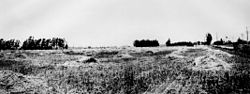
The site of Culver City, 1913
Early history
Archaeological evidence suggests a human presence in the area of present-day Culver City since at least 8000 BCE.[8] The region was the homeland of the Tongva-Gabrieliño Native Americans. For centuries, native people lived in areas currently part of and surrounding Culver City.[9][10][11] California's native people were massacred by waves of Spanish, Mexican and Euro-American invaders through a combination of slavery, disease, relocation, forced labor, imprisonment, broken treaties and a genocidal war of extermination, including paid bounties for dead "Indians".[12] The Spanish and Mexican governments offered concessions and land grants from 1785 to 1846 forming the Ranchos of California. Culver City was founded on the lands of the former Rancho La Ballona and Rancho Rincon de los Bueyes.[13] When Culver City was founded, native Latino people were not allowed to buy property.[14]
During the American Civil War, a U.S. Army post called Camp Latham was established from 1861 to 1862 on the south bank of Ballona Creek.
Ballona Road - 1874 - present-day Washington Boulevard surveyed from roughly Elenda Street (the "school lot" is La Ballona Elementary) to Hoover Street
Culver City
Culver City in 1943
Harry Culver first attempted to establish Culver City in 1913. It was officially incorporated on September 20, 1917, and named after its founder.[15] The area benefited from pre-existing transportation links; Culver's first ads read "All roads lead to Culver City".[9] The city was explicitly founded as a whites-only sundown town, as were most of the suburbs and towns outside the downtown and Central Avenue districts of Los Angeles.[16][17] Culver ran ads promoting "this model little white city", while his close associate, Guy M. Rush, promoted lot sales "restricted to Caucasian race".[18][19] The city also at times excluded people of non-Christian religious faiths.[14]
The weekly Culver City Call was the first newspaper in the community. The paper was founded in 1915.
Culver Center, one of Southern California's first shopping malls, was completed in 1950[21] on Venice Boulevard near the Overland Avenue intersection.[22]
Hughes Aircraft Company
Hughes Aircraft opened its Culver City plant in July 1941. There the company built the H-4 Hercules transport (commonly called the "Spruce Goose"). Hughes was also an active subcontractor during World War II. It developed and patented a flexible feed chute for faster loading of machine guns on B-17 bombers, and manufactured electric booster drives for machine guns. Hughes produced more ammunition belts than any other American manufacturer, and built 5,576 wings and 6,370 rear fuselage sections for VulteeBT-13 trainers.[23][24]
Hughes grew after the war, and in 1953 Howard Hughes donated all his stock in the company to the Howard Hughes Medical Institute. After he died in 1976, the institute sold the company, which made it the second-best-endowed medical research foundation in the world.[25]
The studios (1960s, 1970s and 1980s)
Bicycles parked in front of the Culver Theater in Culver City for a 1977 showing of King Kong
The Hal Roach Studios were demolished in 1963. In the late 1960s, much of the MGM backlot acreage (lot 3 and other property on Jefferson Boulevard), and the nearby 28.5 acres (11.5ha) known as RKO Forty Acres, once owned by RKO Pictures and later Desilu Productions, were sold by their owners. In 1976 the sets were razed to make way for redevelopment. Today, the RKO site is the southern expansion of the Hayden Industrial Tract, while the MGM property has been converted into a subdivision and a shopping center known as Raintree Plaza.
In the early 1990s, Culver City launched a successful revitalization program in which it renovated its downtown as well as several shopping centers in the Sepulveda Boulevard corridor near Westfield Culver City. Around the same time, Sony's motion picture subsidiaries, Columbia Pictures and TriStar Pictures, moved into the former Metro-Goldwyn-Mayer lot which was renamed Columbia Studios in 1990 and took on its current name, Sony Pictures Studios, a year later.
There was an influx of art galleries and restaurants on the eastern part of the city, which was formally designated the Culver City Art District.[26]
Culver City's major geographic feature is Ballona Creek, which runs northeast to southwest through most of the city before it drains into Santa Monica Bay in Marina Del Rey.
According to the United States Census Bureau, the city has a total area of 5.1 square miles (13.2km2), over 99% of which is land. Over the years, it has annexed more than 40 pieces of adjoining land.
Neighborhoods
The city recognizes 15 neighborhoods within city limits:[27]
Culver City, California – Racial and ethnic composition Note: the US Census treats Hispanic/Latino as an ethnic category. This table excludes Latinos from the racial categories and assigns them to a separate category. Hispanics/Latinos may be of any race.
According to the 2020 Census, the population of Culver City was 46.5% Non-Hispanic White, 16.1% Asian, 15.2% Hispanic White, 8.24% Black or African American, and 5.57% Other Hispanic.[36][37]
The Wende Museum possesses a collection of Soviet and East German visual art and everyday artifacts to promote an understanding of Soviet art, history and culture between 1945 and 1991.[44] Additionally, the Museum of Jurassic Technology, founded in 1988 by David Hildebrand Wilson and Diana Drake Wilson, provides over 30 permanent exhibits displaying an eclectic mix of items that blend fact and fiction.[45]
The architecture of Culver City reflects its history as an early location for film studios and, more recently, as a site for architectural experimentation, particularly for the projects of Eric Owen Moss at the Hayden Tract. The architecture office of Morphosis headquartered here. Styles represented include Mission Revival and Colonial Revival from the city's early days, to the PWA Moderne of the 1930s, to modern, postmodern, and deconstructivist styles from the past few decades. Notable architectural landmarks include:[46]
Robert Frost Auditorium, at Culver City High School, 4401 Elenda St. Constructed in 1963–64, its unique scallop shell design became an instant modern architectural landmark for the city. Its original 1,250-seat design was the inspiration of then 26-year-old Andrew Nasser, a consulting structural engineer with Johnson & Nielsen. Credit was claimed, however, by Ralph Flewelling of Flewelling & Moody, the project architects. The record was set straight 54 years later at the unveiling of a $16.3M renovation in 2018. Capacity was increased to 1,300 seats, acoustics improved, and a new 40-foot high steel proscenium arch supports catwalks, lighting, and air conditioning (Hodgetts + Fung architects).[50][51]
The Culver City station of the Los Angeles Metro E Line sits at the Culver Junction near Venice and Robertson Boulevards in Culver City. The E Line provides a light rail connection from Culver City to Downtown Los Angeles and East Los Angeles to the east and Downtown Santa Monica to the west, mostly following the right-of-way that the Pacific ElectricSanta Monica Air Line used, also known as the Exposition Boulevard line. Culver City station was the western terminus of what was then known as the Expo Line from its opening on June 20, 2012, to the opening of Expo Line phase two on May 20, 2016.[61]
Culver CityBus was founded on March 4, 1928, making it the second oldest municipal bus line in California[62] and the oldest public transit bus system still operating in Los Angeles County.[63]Big Blue Bus was founded on April 14, 1928.[63][64] Culver CityBus operates seven regular bus lines as well as a short-term downtown circulator shuttle.
Culver CityBus near Wilshire and Westwood
The Culver City Transit Center in the Westfield Culver City parking serves as a bus depot for three Culver CityBus lines and two Metro bus lines. The Washington Fairfax Hub, just across the border of the City of Los Angeles under the I-10 freeway, connects residents to seven bus lines, two operated by Culver CityBus and five operated by Metro.
The Baldwin Hills Parklands Link is a shuttle service operated by Los Angeles County that stops at Stoneview Nature Center on weekends only.
Bike routes
Elenda Bikeway, bioswale and two-lane protected section
The city is served by multiple separated bike paths:
Culver City is served by the Culver City Police Department, and the Culver City Fire Department, which operates three stations and a fire training facility.[67][68]
↑Herman, Arthur. Freedom's Forge: How American Business Produced Victory in World War II, pp. 277–81, Random House, New York, NY, 2012. ISBN978-1-4000-6964-4.
↑Parker, Dana T. Building Victory: Aircraft Manufacturing in the Los Angeles Area in World War II, pp. 49–58, Cypress, CA, 2013. ISBN978-0-9897906-0-4.
12Parker, Dana T. Building Victory: Aircraft Manufacturing in the Los Angeles Area in World War II, p. 49, Cypress, CA, 2013. ISBN978-0-9897906-0-4.
This page is based on this Wikipedia article Text is available under the CC BY-SA 4.0 license; additional terms may apply. Images, videos and audio are available under their respective licenses.