South Robertson, Los Angeles

Last updated
South Robertson
B'nai David Judea, Los Angeles.JPG
Bnai David Judea building
CountryUnited States
State California
County Los Angeles
City Los Angeles
Time zone UTC-8 (PST)
  Summer (DST) UTC-7 (PDT)
ZIP Code
90035
Website soronc.org

South Robertson is an area on the Westside of Los Angeles that is served by the South Robertson neighborhood council. [1] It contains the following city neighborhoods: Beverlywood, Castle Heights, Cheviot Hills, Crestview, La Cienega Heights and Reynier Village. The area is notable as a center for the Jewish community.[ citation needed ]

Contents

Geography

Boundaries

According to the South Robertson Neighborhood Council's map, South Robertson is bounded roughly by the Santa Monica Freeway and Venice Boulevard on the south, La Cienega Boulevard on the east, Gregory Way (to Robertson) on the north, Whitworth (from Robertson to Roxbury) on the north, Roxbury and Beverwil on the west. [2]

The Mapping L.A. project of the Los Angeles Times, identifies a geographically similar area called Pico-Robertson. Its street borders are: north, Gregory Way and Pico Boulevard; northeast, LeDoux Road and Olympic and San Vicente Boulevards, roughly Beverly Glen Drive; [3] east, La Cienega Boulevard; south, Airdrome Street and Hillcrest Country Club; west, Robertson Boulevard, Beverly Green Drive and S. Roxbury Drive. [4]

Neighborhoods in the South Robertson Neighborhood Council area

The following neighborhoods are within the boundaries established by the neighborhood council: Beverlywood, Castle Heights, Cheviot Hills, Crestview, La Cienega Heights and Reynier Village.

Population

2000

The 2000 U.S. census counted 18,019 residents in the 1,03-square-mile Pico-Robertson neighborhood—an average of 17,468 people per square mile, among the highest population densities for the city. In 2008, the city estimated that the population had increased to 19,253. The median age for residents was 36, older than the city at large; the percentages of residents aged 19 to 34 and 65 and older were among the county's highest. [3]

The neighborhood was considered "not especially diverse" ethnically, with a high percentage of white people. The breakdown was whites, 73.5%; Latinos, 7.3%; Asians, 5.7%; blacks, 5.6%; and others, 7.9%. Iran (37.2%) and Israel (5.7%) were the most common places of birth for the 34.6% of the residents who were born abroad—about the same percentage as in the city at large. [3]

The median yearly household income in 2008 dollars was $63,356, an average figure for Los Angeles. The average household size of 2.1 people was low for Los Angeles. Renters occupied 73.1% of the housing stock and house- or apartment owners held 26.9%. [3]

Education

The following public schools are within the council area:

Jewish community

Chabad campus on Pico Blvd. in Pico-Robertson, in a collegiate style reminiscent of the Brooklyn borough of New York City Chabad Bais Sonia Gutte Campus, Pico Blvd., Beverlywood, Los Angeles.JPG
Chabad campus on Pico Blvd. in Pico-Robertson, in a collegiate style reminiscent of the Brooklyn borough of New York City

The neighborhood features more than thirty certified kosher restaurants, [5] including delis, Chinese, Italian and Mexican restaurants, a donut shop, a frozen yogurt shop, bakeries, and butchers. The community features four men's mikvahs and one woman's mikvah, the largest known as the Los Angeles Mikvah.

There are several Jewish day schools located in the Pico-Robertson area. The Chabad community operates four schools, Bais Chaya Mushka and Bais Chana, both of which are on Pico Boulevard, as well as the newly relocated Cheder Menachem on La Cienega. Yeshiva University High School has campuses on both South Robertson Boulevard and West Pico Boulevard.

The community overall has a wide variety of Jewish denominational groups. Over the past two decades, the Orthodox community has grown to become the largest Jewish denomination in the area. This is evident in the growth of the Chabad community.

According to Chabad, [6] the Hasidic movement has eleven centers in the immediate Pico-Robertson area, including the two high schools, boys cheder, day school, six synagogues, and a community center. Minyan Finder reports over twenty synagogues operating in the area. [7]

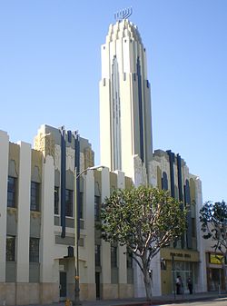
In 1993, the neighborhood became home to the Los Angeles Museum of Tolerance.

See also

Neighborhood councils of Los Angeles

Related Research Articles

<span class="mw-page-title-main">Fairfax Avenue</span> Street in the city of Los Angeles, California

Fairfax Avenue is a street in the north central area of the city of Los Angeles, California. It runs from La Cienega Boulevard in Culver City at its southern end to Hollywood Boulevard in Hollywood on its northern end. From La Cienega Boulevard to Sunset Boulevard, it separates the Westside from the central part of the city along with Venice Boulevard, La Cienega Boulevard, Hauser Boulevard, San Vicente Boulevard, South Cochran Avenue, Wilshire Boulevard, 6th Street, Cochran Avenue, 4th Street, La Brea Avenue, Fountain Avenue and Sunset Boulevard.

The Los Angeles Westside is an urban region in western Los Angeles County, California. It has no official definition, but sources like LA Weekly and the Mapping L.A. survey of the Los Angeles Times place the region on the western side of the Los Angeles Basin south of the Santa Monica Mountains.

Beverlywood is a neighborhood in the Westside of the city of Los Angeles, California.

West Los Angeles is an area within the city of Los Angeles, California. The residential and commercial neighborhood is divided by the Interstate 405 freeway, and each side is sometimes treated as a distinct neighborhood, mapped differently by different sources. Each lies within the larger Westside region of Los Angeles County.

<span class="mw-page-title-main">La Cienega Boulevard</span> Highway in California

La Cienega Boulevard is a major north–south arterial road that runs between El Segundo Boulevard in Hawthorne, California on the south and the Sunset Strip/Sunset Boulevard in West Hollywood to the north. It was named for Rancho Las Cienegas, literally "The Ranch Of The Swamps," an area of marshland south of Rancho La Brea.

<span class="mw-page-title-main">Faircrest Heights, Los Angeles</span> Neighborhood of Los Angeles

Faircrest Heights is a neighborhood in Mid-City, Los Angeles, California.

<span class="mw-page-title-main">Mid City, Los Angeles</span> Neighborhood of Los Angeles in California, United States of America

Mid City is a neighborhood in Central Los Angeles, California.

<span class="mw-page-title-main">San Vicente Boulevard</span> Street in Western Los Angeles running southeast of Beverly Hills, United States

San Vicente Boulevard is a major northwest-southeast thoroughfare located in the western portion of the metropolitan area of Los Angeles, CA.

Pico Boulevard is a major Los Angeles street that runs from the Pacific Ocean at Appian Way in Santa Monica to Central Avenue in Downtown Los Angeles, California, USA. It is named after Pío Pico, the last Mexican governor of Alta California.

<span class="mw-page-title-main">Robertson Boulevard</span> Street in Los Angeles

Robertson Boulevard is a street in Los Angeles, in the U.S. state of California, that also passes through the incorporated cities of West Hollywood, Beverly Hills, and Culver City.

<span class="mw-page-title-main">Doheny Drive</span> North-south thoroughfare in Los Angeles County, California

Doheny Drive is a north–south thoroughfare mostly through Beverly Hills and West Hollywood, in Los Angeles County, California.

<span class="mw-page-title-main">Mid-City West, Los Angeles</span> Neighborhood of Los Angeles in California, United States

Mid-City West is a area in the western part of Central Los Angeles that is served by the Mid City West Neighborhood Council. It contains the neighborhoods of Beverly–Fairfax, Beverly Grove, Burton Way, Carthay Circle, Melrose, Miracle Mile and Park La Brea.

<span class="mw-page-title-main">Los Angeles's 5th City Council district</span> American legislative district

Los Angeles City Council District 5 is one of the 15 districts of the Los Angeles City Council. District 5 represents Los Angeles communities in the Westside, central-eastern Santa Monica Mountains, and central-southern San Fernando Valley. Katy Young Yaroslavsky is the current council member.

<span class="mw-page-title-main">Los Angeles's 10th City Council district</span> American legislative district

Los Angeles City Council District 10 is one of the 15 districts of the Los Angeles City Council.

<span class="mw-page-title-main">Reynier Village, Los Angeles</span> Neighborhood of Los Angeles in California, United States

Reynier Village is a neighborhood on the Westside of Los Angeles, California.

<span class="mw-page-title-main">History of the Jews in Los Angeles</span>

Jews in Los Angeles comprise approximately 17.5 percent of the city's population, and 7% of the county's population, making the Jewish community the largest in the world outside of New York City and Israel. As of 2015, over 700,000 Jews live in the County of Los Angeles, and 1.232 million Jews live in California overall. Jews have immigrated to Los Angeles since it was part of the Mexican state of Alta California, but most notably beginning at the end of the 19th century to the present day. The Jewish population rose from about 2,500 in 1900 to at least 700,000 in 2015. The large Jewish population has led to a significant impact on the culture of Los Angeles. The Jewish population of Los Angeles has seen a sharp increase in the past several decades, owing to internal migration of Jews from the East Coast, as well as immigration from Israel, France, the former Soviet Union, the UK, South Africa, and Latin America, and also due to the high birth rate of the Hasidic and Orthodox communities who comprise about 10% of the community's population.

<span class="mw-page-title-main">Castle Heights, Los Angeles</span> Neighborhood of Los Angeles in California, United States

Castle Heights is a neighborhood on the Westside of the city of Los Angeles, California.

Crestview is a neighborhood in the Westside of the city of Los Angeles, California.

La Cienega Heights is a neighborhood in the Westside of the city of Los Angeles, California.

References

  1. "South Robertson Neighborhood Council". soronc.org/. Retrieved 2 March 2023.
  2. "South Robertson Map". Soronc.org. Retrieved 2 March 2023.
  3. 1 2 3 4 "Pico-Robertson," Mapping L.A., Los Angeles Times
  4. Colored map, Mapping L.A., Los Angeles Times
  5. "certified eateries". kosherla.info.
  6. "Chabad.org". www.chabad.org.
  7. "goDaven! Minyanim Everywhere". www.godaven.com.

Coordinates: 34°03′21″N118°22′47″W / 34.0557°N 118.3798°W / 34.0557; -118.3798