
Marina del Rey is an unincorporated seaside community in Los Angeles County, California, with an eponymous harbor that is a major boating and water recreation destination of the greater Los Angeles area. The port is North America's largest man-made small-craft harbor and is home to approximately 5,000 boats. The area is a popular tourism destination for both land and water activities such as paddle board and kayak rentals, dining cruises, and yacht charters. Land activities include bicycling on several bicycle paths, walking paths along the waterfront, and birdwatching (birding). Wildlife watching opportunities include California sea lions and harbor seals. Dolphins and whales occasionally visit the deeper waters of the harbor. This Westside locale is approximately 4 miles (6.4 km) south of Santa Monica, 4 miles (6.4 km) north of Los Angeles International Airport, and 12.5 miles (20.1 km) west-southwest of Downtown Los Angeles.

Loyola Marymount University (LMU) is a private Jesuit and Marymount research university in Los Angeles, California. It is located on the west side of the city near Playa Vista. LMU is the parent school to Loyola Law School. LMU offers 55 major and 59 minor undergraduate degrees and programs across six undergraduate colleges. The Graduate Division offers 47 master's degree programs, one education doctorate, one doctorate in juridical science, a Juris Doctor and 13 credential programs. LMU's sports teams are called the Lions and compete at the NCAA Division I level as members of the West Coast Conference in 20 sports.

Playa del Rey is a seaside neighborhood on the westside of Los Angeles in the Santa Monica Bay region of Los Angeles County, California. It has a ZIP code of 90293 and area codes of 310 and 424. As of 2018, the community had a population of 16,230 people.

Westchester is a neighborhood in the City of Los Angeles and the South Bay Region of Los Angeles County, California, United States.

Palms is a community in the Westside region of Los Angeles, California, founded in 1886 and the oldest neighborhood annexed to the city, in 1915. The 1886 tract was marketed as an agricultural and vacation community. Today it is a primarily residential area, with many apartment buildings, ribbons of commercial zoning and a single-family residential area in its northwest corner. As of the 2000 census the population of Palms was 42,545.

Mar Vista is a neighborhood on the Westside of Los Angeles, California. In 1927, Mar Vista became the 70th community to be annexed to Los Angeles. It was designated as an official city neighborhood in 2006.
West Los Angeles is an area within the city of Los Angeles, California, United States. The residential and commercial neighborhood is divided by the Interstate 405 freeway, and each side is sometimes treated as a distinct neighborhood, mapped differently by different sources. Each lies within the larger Westside region of Los Angeles County.

Rancho Park is a residential neighborhood in the Westside of the city of Los Angeles, California with mostly single family homes and tree lined streets. The community is nestled between West Los Angeles and Cheviot Hills. This enclave draws young professionals and families and is home to residents working in a variety of professional occupations. History proves the neighborhood was once a part of Westwood until Olympic Blvd. was placed dividing the area North and South. The Southern section, now known as Rancho Park, felt cut off from its North side lobbying for its own identity in the 1930s.

Playa Vista is a neighborhood in the Westside area of Los Angeles, California, United States. The area was the headquarters of Hughes Aircraft Company from 1941 to 1985 and the site of the construction of the Hughes H-4 Hercules "Spruce Goose" aircraft. The area began development in 2002 as a planned community with residential, commercial, and retail components. The community attracted businesses in technology, media and entertainment and is part of Silicon Beach.

Del Rey is a neighborhood in the Westside of Los Angeles, surrounded on three sides by Culver City, California. Within it lie a police station, the largest public housing complex on the Westside, a public middle school and six public elementary schools. It is served by a neighborhood council and a residents association. Del Rey, with a 32,000+ population, has a large number of military veterans.

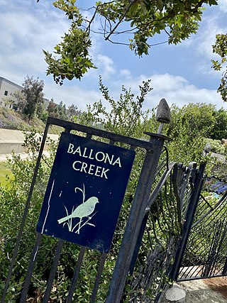
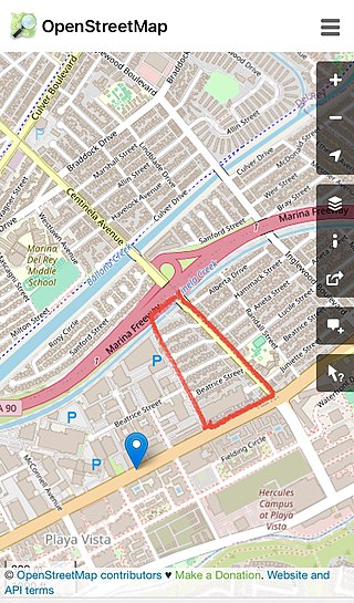
Ballona Creek is an 8.5-mile (13.7 km) channelized stream in southwestern Los Angeles County, California, United States, that was once a "year-round river lined with sycamores and willows". The urban watercourse begins in the Mid-City neighborhood of Los Angeles, flows through Culver City and Del Rey, and passes the Ballona Wetlands Ecological Preserve, the sailboat harbor Marina del Rey, and the small beachside community of Playa del Rey before draining into Santa Monica Bay. The Ballona Creek drainage basin carries water from the Santa Monica Mountains on the north, from the Baldwin Hills to the south, and as far as the Harbor Freeway (I-110) to the east.
The Ballona Creek Bike Path is a 6.7-mile (10.8 km) Class I bicycle path and pedestrian route in California. The bike path follows the north bank of Ballona Creek until it reaches Santa Monica Bay at the Pacific Ocean. The route is defined by, and recognized for, the dramatic contrast between the channelized waterway’s stark cement geometry and the abundant wildlife of the verdant Ballona Wetlands.
Lincoln Boulevard is a major northwest–southeast boulevard near Santa Monica Bay in Los Angeles County in California. Over 8 miles (13 km) in length, it connects Los Angeles International Airport (LAX) with Santa Monica. A portion of Lincoln Boulevard is signed as part of California State Route 1, making it a major route to go along the Pacific Coast in Los Angeles.

Marymount California University was a private Catholic university in Rancho Palos Verdes, California. Originally founded by the Religious of the Sacred Heart of Mary (RHSM), the university awarded associate, bachelor's, and graduate degrees. The institution was accredited by the WASC Senior College and University Commission. The university closed in August 2022.

Rancho La Ballona was a 13,920-acre (56.3 km2) Mexican land grant in the present-day Westside region of Los Angeles County, Southern California.
Alsace is a place name designating what was originally an interurban trolley stop, and now an approximately five-block enclave of unincorporated Los Angeles County in the Westside region, surrounded by Del Rey, just north of the Playa Vista neighborhood of Los Angeles, California, United States.
The Mar Vista Community Council is a city-sanctioned neighborhood council of the City of Los Angeles serving six districts or "zones," collectively referred to as Mar Vista. It is in the Westside region of Los Angeles.

Port Ballona is an archaic place name for an area near the center of Santa Monica Bay in coastal Los Angeles County, where Playa Del Rey and Del Rey Lagoon are located today. Port Ballona was a planned harbor and town site from circa 1859 to 1903. The name comes from the Rancho La Ballona Mexican land grant.

The Dickinson and Gillespie Building, is located at 200 Culver Boulevard in downtown Playa Del Rey, California, in the City of Los Angeles. This two-story commercial building, created in 1922, was an extensive remodel of the Hotel Playa, a hotel opened in 1906 on the same site.


