Playa del Rey, Los Angeles

Last updated
Playa del Rey
Palisades Del Rey
Playa Del Rey Los Angeles batch 2023 March 06.jpg
Location map Southern Los Angeles.png
Red pog.svg
Playa del Rey
Location within Southern Los Angeles
U.S. - Los Angeles Metropolitan Area location map.svg
Red pog.svg
Playa del Rey
Location within the Los Angeles metropolitan area
USA California location map.svg
Red pog.svg
Playa del Rey
Location within California
Usa edcp location map.svg
Red pog.svg
Playa del Rey
Location within the United States
Coordinates: 33°57′25″N118°26′10″W / 33.95694°N 118.43611°W / 33.95694; -118.43611
Country Flag of the United States.svg  United States
State Flag of California.svg  California
County Los Angeles
City Los Angeles

Playa del Rey (Spanish for "Beach of the King") is a seaside suburb in the Santa Monica Bay and the South Bay region of Los Angeles County, California. It has a ZIP code of 90293 and area codes of 310 and 424. As of 2018, the community had a population of 16,230 people.

Contents

History

Playa del Rey: Ballona Wetlands and Creek, 1902 PlayadelRey-1902.jpg
Playa del Rey: Ballona Wetlands and Creek, 1902
Playa del Rey lagoon, hotel, pavilion and pier, ca.1908 Playa del Rey lagoon showing Del Rey Hotel, Playa Del Rey Pavilion and pier, Los Angeles, ca.1908 (CHS-5380).jpg
Playa del Rey lagoon, hotel, pavilion and pier, ca.1908

Lower Playa del Rey was originally wetlands and sand dune soil, but natural flooding was halted by levees made of earthen soil, boulders and reinforced concrete with a soft-bottom submerged soil that promotes both tidal flow in good weather and facilitated the flow of freshwater into the ocean in rainy weather, resulting in a dynamic estuarine river known as Ballona Creek.

The wetlands area were inhabited by the Tongva came to the wetlands three to five thousand years ago. The area was important for fishing and shellfish harvesting. The usage of wooden plank boats known as te'aats were used to paddle out to the Channel Islands. [1] Guashna was the major village in the area and was an important regional trade center. [2]

In the 1870s, Playa Del Rey was the location of the first attempt at a dredged harbor in Santa Monica Bay. Under contract with the Atchison, Topeka & Santa Fe Railroad, Moye Wicks' syndicate spent $300,000 to dredge Port Ballona Harbor, for shipping to the Orient. [3] Within three years, winter waves brought flooding, but what remained of man's early efforts became the Del Rey Lagoon, now a municipal public park. [4]

The historic Dickinson & Gillespie building, built in 1922 in a Spanish Colonial Revival style. Dickinson Gillespie building Playa Del Rey view 002 (cropped).jpg
The historic Dickinson & Gillespie building, built in 1922 in a Spanish Colonial Revival style.

In 1902, buyers interested in land at the new Playa Del Rey development were instructed to travel by streetcar to Alla Station where “tally-hos” awaited them. The new development eventually got its own streetcar stop on the Redondo Beach via Playa del Rey Line beginning from the Ivy Station. [5] In 1910, the Playa del Rey Motordome was built, the first board track in the world; it was used for bike and also early auto racing. [6]

Palisades del Rey was the name of the original 1921 neighborhood land development by Dickinson & Gillespie Co. that later came to be called Playa del Rey. The company advertised this area of sand dunes as the last stretch of coastal land in the city of Los Angeles to be developed. [7] All of the houses in this area were custom built, many as beach homes owned by Hollywood actors and producers, including Cecil B. Demille, Charles Bickford, and others.[ citation needed ]

Construction in Playa del Rey surged in 1928 with the development of the Del Rey Hills neighborhood in the Eastern part of the community (to the East of Pershing Drive), and the move of Loyola University (now Loyola Marymount University) to the adjacent community of Westchester.[ citation needed ]

The southern portion of the original Playa del Rey development, which came to be known as Surfridge, is now vacant. Between 1966 and 1975, the houses that were once there were either moved or demolished to facilitate the expansion of Los Angeles International Airport (LAX) and to address concerns about the noise of increasing jet plane traffic. The noise from the flights made it less desirable to live on the dunes above the ocean under the LAX flight path. The City of Los Angeles condemned the southern section of Playa del Rey under the power of eminent domain and purchased all of the homes. [8] [ irrelevant citation ] Today, one can see only barbed-wire fences protecting vacant land and old streets where houses once sat. Recent LAX rejuvenation plans call for the city to finally remove the old streets that still line the empty neighborhood.[ citation needed ] The condemned areas of the community are now a protected habitat of the endangered El Segundo blue butterfly. [9]

Playa del Rey in the 1950s and early 1960s was known as a great Los Angeles area "surfing spot," but due to the many rock jetties that were built to prevent beach erosion, the good surf has mostly disappeared. The beach at the northernmost end of Playa del Rey is still known as Toes Over Beach, Toes Beach, or just "Toes" by the local surfing community, a name derived from the toes-over or hang ten surfing maneuver. Most surfers now flock south of Dockweiler Beach to El Porto (the northernmost part of beach in the city of Manhattan Beach) or north of Marina del Rey to Venice Beach. The lifeguard and park services are uniform across the entire 20-mile (32 km) stretch of beach. [10]

One danger for beachgoers is the uncontrolled water runoff from the creek, and the occasional emergency overflow from the giant Hyperion treatment plant to the south. [11] Under normal conditions, the plant discharges treated water 5 miles (8.0 km) out to sea, but a rarely used one-mile (1.6 km) outflow pipe exists for emergencies or during maintenance. Wastewater discharged from this shorter pipe is close enough to shore to severely impact beach conditions when it is in use.

Locals refer to the small area of housing closest to the beach, where Culver Boulevard joins Vista del Mar, as "The Jungle," a nickname given to a group of closely built 1956 apartments bounded by Trolley Place and Trolleyway Street on its east and west respectively, and including the streets Fowling, Rees, Sunridge and Surf. The small sidewalks between homes had/have deep green overgrowth, which added to the name.[ citation needed ]

Today, the Pacific Avenue Bridge between Playa Del Rey and the jetty between Ballona Creek and the Marina is accessible to foot traffic and bicycle traffic, but not to automobiles. Bikers, skaters and joggers can cross this bridge to continue north to Santa Monica, and to the South Bay. It is the only pedestrian crossing over Ballona Creek between the ocean and Centinela Avenue, and the Lincoln Boulevard and Marina Freeway bridges both lack sidewalks.

Both the University of California, Los Angeles and Loyola Marymount University have crew teams that practice on the Ballona Creek channel and in Marina del Rey. [12]

Geography

Del Rey Lagoon Park sign, Playa Del Rey, Los Angeles Del Rey Lagoon Park sign Playa Del Rey California.jpg
Del Rey Lagoon Park sign, Playa Del Rey, Los Angeles

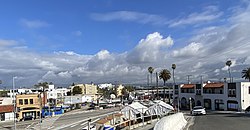
Considered part of Silicon Beach, Playa del Rey is a coastal neighborhood and a district of the city of Los Angeles. [13] Its location immediately north of Los Angeles International Airport exposes some residents to air and noise pollution generated at the airport. Over the years, expansions at the airport have forced more than a thousand residents to move and hundreds of houses to be demolished. [14]

The community is bordered by the Pacific Ocean to the west, Marina del Rey and Ballona Creek [15] to the north, the Ballona Wetlands and Playa Vista to the northeast, Westchester to the east, and Los Angeles International Airport and El Segundo to the south.

Sand dunes and beach access at Playa Del Rey, California Sand dunes at Playa Del Rey, California.jpg
Sand dunes and beach access at Playa Del Rey, California

The city of Los Angeles has three small parks in Playa del Rey: Del Rey Lagoon Park, the .5-acre (2,000 m2) Titmouse Park, [16] and Vista Del Mar Park. Del Rey Lagoon Park, which has an area of about 14 acres (57,000 m2), also has a shallow saltwater swamp-pond known as Del Rey Lagoon. The pond has an area of about 5 acres (20,000 m2), with a maximum depth of about five ft (1.5 m). The lagoon’s depth varies over time of day, as it is partially connected with the Ballona Creek by an underground pipe. The park is bounded by Ballona Creek to the north, Convoy Street to the south, Pacific Avenue to the west, and Esplanade and an apartment complex to the east.

Playa del Rey's rolling hills and depression wetland ponds are the result of ancient, wind-blown, compacted sand dunes that rise up to 125 feet (38 m) above sea level, originally called and often referred to as The Del Rey Hills or "The Bluffs." These dunes run parallel to the coastline, from Playa del Rey, all the way south to Palos Verdes.

Demographics

Beach at Playa del Rey Breakers on The Shore at Playa del Rey.jpg
Beach at Playa del Rey
Overlooking the entrance to the marina and Ballona Creek, with the tightly packed area known as The Jungle in the foreground. Playa del Rey jungle.jpg
Overlooking the entrance to the marina and Ballona Creek, with the tightly packed area known as The Jungle in the foreground.
The community's proximity to LAX has made airport expansion a controversial issue to residents. Playa del rey lax.jpg
The community's proximity to LAX has made airport expansion a controversial issue to residents.

According to data from the Los Angeles Times's "Mapping L.A." project, the area's demography was 72.6% Non-Hispanic White, 7.7% Asian, 3.9% Black, 10.0% Latino and 5.8% of other backgrounds. [17]

94.7% of employed Playa Del Rey residents work in a white-collar profession. 65.6% of all residents 25 years of age or older have at least a bachelor's degree, and 39.8% of residents have obtained a graduate-level education or more. As of 2021, the median price for a single family home in the 90293 zip code has exceeded $3 million, [18] and the average income is $148,296, which is among the wealthiest in Los Angeles. [19]

Economy

As Playa del Rey is located in the heart of the Silicon Beach, the economy has become largely driven by the tech sector.[ citation needed ] The neighborhood is also home to a large number of airline and aerospace employees, owing to its proximity to LAX. The vast majority of land in Playa del Rey is zoned for residential purposes only. It is known for its large ocean-view estates, but the bulk of the population lives in the eastern portion, which is densely developed with apartment and condominium complexes. Only portions of Manchester Avenue, Pershing Drive and Culver Boulevard have businesses—mainly restaurants and a pharmacy—and offices mixed in with residential buildings.

Government and infrastructure

Los Angeles Fire Department Station 5 (Westchester/LAX Area) is in the area.

A brush fire near Loyola Marymount University. With help of air support, the fire was put out a few minutes later. PlayaDelRey BrushFire.jpg
A brush fire near Loyola Marymount University. With help of air support, the fire was put out a few minutes later.

Los Angeles Police Department operates the Pacific Community Police Station at 12312 Culver Boulevard, 90066, serving the neighborhood. [20]

The Los Angeles County Department of Health Services SPA 5 West Area Health Office serves Playa del Rey. [21]

Playa del Rey lies entirely within the 11th council district of Los Angeles, and is represented on the city council by Traci Park. [22]

Education

Playa del Rey is within the Los Angeles Unified School District. The area is within Board District 4. [23] As of 2009, Steve Zimmer represents the district. [24]

Notable schools in the area include Westchester Enriched Sciences Magnets (6–8) and St. Bernard High School, a private Roman Catholic school.

As of 2014, the Wiseburn School District allows parents in Playa del Rey to send their children to Wiseburn schools on inter-district transfers. [25]

Notable people

Related Research Articles

<span class="mw-page-title-main">Marina del Rey, California</span> Census-designated place in the United States

Marina del Rey is an unincorporated seaside community in Los Angeles County, California, with an eponymous harbor that is a major boating and water recreation destination of the greater Los Angeles area. The port is North America's largest man-made small-craft harbor and is home to approximately 5,000 boats. The area is a popular tourism destination for both land and water activities such as paddle board and kayak rentals, dining cruises, and yacht charters. Land activities include bicycling on several bicycle paths, walking paths along the waterfront, and birdwatching (birding). Wildlife watching opportunities include California sea lions and harbor seals. Dolphins and whales occasionally visit the deeper waters of harbor. This Westside locale is approximately 4 miles (6.4 km) south of Santa Monica, 4 miles (6.4 km) north of Los Angeles International Airport, and 12.5 miles (20.1 km) west-southwest of Downtown Los Angeles.

<span class="mw-page-title-main">Westchester, Los Angeles</span> Neighborhood of Los Angeles in the United States

Westchester is a neighborhood in the City of Los Angeles and the South Bay Region of Los Angeles County, California.

<span class="mw-page-title-main">Santa Monica Bay</span> Bight in the Pacific Ocean

Santa Monica Bay is a bight of the Pacific Ocean in Southern California, United States. Its boundaries are slightly ambiguous, but it is generally considered to be the part of the Pacific within an imaginary line drawn between Point Dume, in Malibu, and the Palos Verdes Peninsula. Its eastern shore forms the western boundary of the Los Angeles Westside and South Bay regions. Although it was fed by the Los Angeles River until the river's catastrophic change of course in 1825, the only stream of any size now flowing into it is Ballona Creek. Smaller waterways draining into the bay include Malibu Creek, Topanga Creek, and Santa Monica Creek.

<span class="mw-page-title-main">Playa Vista, Los Angeles</span> Neighborhood of Los Angeles in California, United States

Playa Vista is a neighborhood in the Westside area of Los Angeles, California, United States. The area was the headquarters of Hughes Aircraft Company from 1941 to 1985 and the site of the construction of the Hughes H-4 Hercules "Spruce Goose" aircraft. The area began development in 2002 as a planned community with residential, commercial, and retail components. The community attracted businesses in technology, media and entertainment and is part of Silicon Beach.

<span class="mw-page-title-main">Del Rey, Los Angeles</span> Neighborhood of Los Angeles in California, United States of America

Del Rey is a neighborhood in the Westside of Los Angeles, surrounded on three sides by Culver City, California. Within it lie a police station, the largest public housing complex on the Westside, a public middle school and six public elementary schools. It is served by a neighborhood council and a residents association. Del Rey, with a 32,000+ population, has a large number of military veterans.

<span class="mw-page-title-main">Ballona Creek</span> Urbanized river in Los Angeles, California, United States.

Ballona Creek is an 8.5-mile (13.7 km) channelized stream in southwestern Los Angeles County, California, United States, that was once a "year-round river lined with sycamores and willows". The urban watercourse begins in the Mid-City neighborhood of Los Angeles, flows through Culver City and Del Rey, and passes the Ballona Wetlands Ecological Preserve, the sailboat harbor Marina del Rey, and the small beachside community of Playa del Rey before draining into Santa Monica Bay. The Ballona Creek drainage basin carries water from the Santa Monica Mountains on the north, from the Baldwin Hills to the south, and as far as the Harbor Freeway (I-110) to the east.

<span class="mw-page-title-main">Dockweiler State Beach</span> State beach in Los Angeles County, California, United States

Dockweiler State Beach is a beach in Los Angeles, California, with 3.75 miles (6.04 km) of shoreline, a hang gliding practice and training area. Although a unit of the California state park system, it is managed by the Los Angeles County Department of Beaches and Harbors. Part of the park is located directly under the flight path of the adjacent Los Angeles International Airport (LAX). The 91-acre (37 ha) property was established in 1948. Originally part of Venice-Hyperion Beach State Park, it was renamed in honor of prominent early Angeleno Isidore B. Dockweiler in 1955.

<span class="mw-page-title-main">Ballona Wetlands</span> Estuary and marsh in California, United States

Ballona Wetlands Ecological Reserve is a protected area that once served as the natural estuary for neighboring Ballona Creek. The 577-acre (2.34 km2) site is located in Los Angeles County, California, just south of Marina del Rey. Ballona—the second-largest open space within the city limits of Los Angeles, behind Griffith Park—is owned by the state of California and managed by the California Department of Fish and Wildlife. The preserve is bisected generally east-west by the Ballona Creek channel and bordered by the 90 Marina freeway to the east.

<span class="mw-page-title-main">Marvin Braude Bike Trail</span> Bike path in Los Angeles County, California, United States

The Marvin Braude Bike Trail is a 22-mile (35 km) paved bicycle path that runs mostly along the shoreline of Santa Monica Bay in Los Angeles County, California. The coastal bike trail is widely acknowledged as Los Angeles’ “most popular bike path.”

<span class="mw-page-title-main">Ballona Creek Bike Path</span> Cycling route in Los Angeles County, California

The Ballona Creek Bike Path is a 6.7-mile (10.8 km) Class I bicycle path and pedestrian route in California. The bike path follows the north bank of Ballona Creek until it reaches Santa Monica Bay at the Pacific Ocean. The route is defined by, and recognized for, the dramatic contrast between the channelized waterway’s stark cement geometry and the abundant wildlife of the verdant Ballona Wetlands.

Marina Peninsula is a neighborhood in western Los Angeles, California. It is often considered a subsection of the adjacent neighborhood of Venice. Because of its name it is sometimes erroneously thought to be part of the adjacent community of Marina del Rey, California, but it was annexed to Los Angeles along with the rest of Venice in 1925.

<span class="mw-page-title-main">Rancho La Ballona</span> Historical cattle ranch in Los Angeles, California, USA

Rancho La Ballona was a 13,920-acre (56.3 km2) Mexican land grant in the present-day Westside region of Los Angeles County, Southern California.

<span class="mw-page-title-main">Palisades del Rey, California</span> Former settlement in California, United States

Palisades del Rey was a 1921 neighborhood land development by Dickinson & Gillespie Co. that later came to be called the Playa del Rey district of Los Angeles County, California. It lay at an elevation of 135 feet. All of the houses in this area were custom built, many as beach homes owned by Hollywood actors and producers, including Cecil B. DeMille, Charles Bickford, and others.

The Wiseburn Unified School District is a school district in Los Angeles County, California operating elementary and middle schools, and hosting charter high schools. Its headquarters are on the grounds of the Da Vinci charter schools facility in El Segundo. Previously they were in Hawthorne.

<span class="mw-page-title-main">Port Ballona, California</span> 19th century planned harbor of Santa Monica Bay

Port Ballona is an archaic place name for an area near the center of Santa Monica Bay in coastal Los Angeles County, where Playa Del Rey and Del Rey Lagoon are located today. Port Ballona was a planned harbor and town site from circa 1859 to 1903. The name comes from the Rancho La Ballona Mexican land grant.

<span class="mw-page-title-main">Dickinson & Gillespie building</span> 1922 structure in Playa Del Rey, Los Angeles

The Dickinson and Gillespie Building, is located at 200 Culver Boulevard in downtown Playa Del Rey, California, in the City of Los Angeles. This two-story commercial building, created in 1922, was an extensive remodel of the Hotel Playa, a hotel opened in 1906 on the same site.

<span class="mw-page-title-main">Ballona Lagoon</span> Tidal wetland in Southern California, US

The Ballona Lagoon is a soft-bottomed channel and 16-acre (65,000 m2) tidal marsh in the Marina Peninsula neighborhood of Los Angeles that feeds the Venice Canals with water from the Pacific Ocean via a tide gate.

<span class="mw-page-title-main">Del Rey Lagoon Park</span> Municipal park in California, US

Del Rey Lagoon Park is a 14-acre (57,000 m2) municipal park in the Playa Del Rey neighborhood of Los Angeles, United States, with a lagoon that is part of the greater Ballona Creek watershed.

<span class="mw-page-title-main">Oxford Basin</span> Body of water in California, US

Oxford Basin is a 10.7-acre (43,000 m2) constructed wetland and wildlife conservation area in the northwest corner of Marina del Rey, California, located between Washington Boulevard and Admiralty Way.

<span class="mw-page-title-main">Guashna</span> Former Tongva village at Playa Vista, Los Angeles

Guashna was a Tongva village located at Playa Vista, Los Angeles at the mouth of Ballona Creek. The site has also been referred to as Sa'angna, with various sources debating whether Sa'angna, meaning "place of tar," was a regional referent rather than a village name or whether it was a separate nearby village. The initial place name was said to be Sa'an; the village suffix "ngna" was added by Bernice Johnston to her 1962 map of Gabrieleño villages "despite her having found no mention of the term in baptismal records." Sa'angna is also not to be confused with Suangna. The Tongva referred to the Ballona Wetlands as Pwinukipar, meaning "full of water." Another alternate name may Waachnga.

References

  1. "History of Ballona Wetlands". Friends of Ballona Wetlands. Retrieved 2022-12-27.
  2. Village at Playa Vista: Volume III (PDF). City of Los Angeles. 2009. pp. 21–24.
  3. Dukesherer, D.J. (2005) Beach of the King, the Early History of Playa del Rey, Westchester and Playa Vista, page 39 (Central Historical Group Publishing).
  4. "DEL REY LAGOON". City of Los Angeles Department of Recreation and Parks. 2015-01-13. Retrieved 2021-07-23.
  5. Dukesherer, D.J. (2005) Beach of the King, the Early History of Playa del Rey, Westchester and Playa Vista, page 65 (Central Historical Group Publishing).
  6. Dukesherer, D.J. (2005) Beach of the King, the Early History of Playa del Rey, Westchester and Playa Vista, page 16 (Central Historical Group Publishing).
  7. Del Rey Hills (now Playa del Rey) 1928 - Los Angeles, California Scripophily.net
  8. The Argonaut: Top Stories
  9. Mattoni, Rudolf H. T., "The Endangered El Segundo Blue Butterfly," The Journal of Research on the Lepidoptera, Volume 29 (4), Winter 1990. PDF 19.5 MB Archived 2003-10-25 at the Wayback Machine
  10. Los Angeles county fire department provides the lifeguards. —Episode #1 LA County Ocean Lifeguards
  11. KABC (September 24, 2015). "Dockweiler State Beach closed after tampon applicators, condoms, needles wash ashore". ABC7 Los Angeles. Retrieved 2020-10-21.
  12. "The UCLA Rowing Camp uses the same facilities as the Bruin Rowers, including the UCLA Boathouse in Marina del Rey. "—2017 UCLA Rowing camp
  13. "32 Top Silicon Beach Companies 2022 | Built in LA".
  14. "Los Angeles Ghost Town: At the Hands of LAX" Archived 2013-04-29 at the Wayback Machine
  15. "A Short History". www.ballonacreek.org. Archived from the original on 2012-01-21.
  16. Pool, Bob (2008-04-29). "To some, this park's name is for the birds". Los Angeles Times. Archived from the original on 2021-06-08. Retrieved 2022-09-27.
  17. "Playa del Rey". Mapping L.A. Retrieved 2021-07-23.
  18. "90293, CA Real Estate & Homes for Sale | Redfin".
  19. "Playa Del Rey Population & Demographics, Median Income – Point2". www.point2homes.com. Retrieved 2021-06-18.
  20. "Pacific Community Police Station - Los Angeles Police Department". www.lapdonline.org. Retrieved 2020-06-06.
  21. "About Us." Los Angeles County Department of Health Services. Retrieved on March 18, 2010.
  22. Wikipedia page on Los Angeles's 11th City Council district
  23. Board District 4 Map. Los Angeles Unified School District . Retrieved on November 24, 2008.
  24. "Board Members." Los Angeles Unified School District . Retrieved on September 16, 2009.
  25. "Home" (Archive). Wiseburn School District. Retrieved on April 4, 2014. "Also serving the children of employees from the surrounding aerospace, technology, travel, and entertainment industries, as well as families living in the Westchester, Playa del Rey, Playa Vista, Mar Vista, and Ladera Heights area on an interdistrict permit transfer."
  26. Film Stars of Playa Del Rey; Charles Bickford, by Duke Dukesherer, Examiner.com.
  27. Ding, Kevin. "News: Jackson accepts Lakers extension." The Orange County Register . Friday November 30, 2007. Retrieved on June 13, 2009.
  28. "Donda West dies at 58; local resident and mother of hip-hop artist Kanye West Archived 2012-04-20 at the Wayback Machine ." The Argonaut . November 15, 2007. Retrieved on June 13, 2009.

Further reading

See also