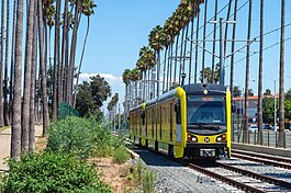
K Line | |||||||||||||||||||||||||
---|---|---|---|---|---|---|---|---|---|---|---|---|---|---|---|---|---|---|---|---|---|---|---|---|---|
Overview | |||||||||||||||||||||||||
Other name(s) | Crenshaw/LAX Line Green Line/C Line (south of Aviation/Century) | ||||||||||||||||||||||||
Status | Partially open | ||||||||||||||||||||||||
Owner | Los Angeles County Metropolitan Transportation Authority | ||||||||||||||||||||||||
Line number | 807 | ||||||||||||||||||||||||
Termini |
| ||||||||||||||||||||||||
Stations | 12 active (13 total) | ||||||||||||||||||||||||
Website | metro | ||||||||||||||||||||||||
Service | |||||||||||||||||||||||||
Type | Light rail | ||||||||||||||||||||||||
System | Los Angeles Metro Rail | ||||||||||||||||||||||||
Depot(s) | Division 16 (Westchester) Division 22 (Hawthorne) | ||||||||||||||||||||||||
Rolling stock | Kinki Sharyo P3010 operating in 1 or 2 car consists | ||||||||||||||||||||||||
Daily ridership | 3,170 (weekday, April 2024) [1] | ||||||||||||||||||||||||
Ridership | 998,245 (2023) | ||||||||||||||||||||||||
History | |||||||||||||||||||||||||
Opened | October 7, 2022 [2] | ||||||||||||||||||||||||
Technical | |||||||||||||||||||||||||
Line length | 11 mi (18 km) [3] | ||||||||||||||||||||||||
Number of tracks | 2 | ||||||||||||||||||||||||
Character | At-grade in exclusive right of way, with underground and aerial sections | ||||||||||||||||||||||||
Track gauge | 4 ft 8+1⁄2 in (1,435 mm) standard gauge | ||||||||||||||||||||||||
Electrification | Overhead line, 750 V DC | ||||||||||||||||||||||||
Operating speed | 55 mph (89 km/h) (max.) 20 mph (32 km/h) (avg.) | ||||||||||||||||||||||||
|
The K Line is a light rail line in Los Angeles County, California. It is one of six lines in the Los Angeles Metro Rail system operated by the Los Angeles County Metropolitan Transportation Authority (Metro), and is the newest named line in the system, having opened on October 7, 2022. The line currently consists of two separate noncontiguous segments. The 5.9-mile (9.5 km) northern segment runs north–south between the Jefferson Park and Westchester neighborhoods of Los Angeles, passing through various South Los Angeles neighborhoods and the city of Inglewood. The southern segment runs north–south between the Westchester neighborhood of Los Angeles and the city of Redondo Beach.
On November 3, 2024, the C and K lines underwent service changes to accommodate pre-revenue testing at the upcoming LAX/Metro Transit Center station, scheduled to open in 2025. The C Line's western terminus was redirected to Aviation/Century station and the southern segment of the K Line was created between Aviation/Century station and Redondo Beach station. Once LAX/Metro Transit Center station opens, the C Line will terminate at this station, and the K Line will operate as a single, continuous service through it. The LAX Automated People Mover, which will offer a connection to the airport's terminals, will begin service at LAX/Metro Transit Center station in 2026.
The northern terminus of the northern segment is at Expo/Crenshaw station, a transfer point to the E Line. The K Line station here is underground and does not provide a track connection to the at-grade E Line. Provisions are in place to allow the line to extend further north. The route follows Crenshaw Boulevard from Exposition Boulevard south to 67th Street. It travels underground in a one-mile (1.6 km) deep-bore tunnel, which transitions into an at-grade segment in the median of Crenshaw Boulevard (between 48th and 59th Streets) where trains run synchronized to existing traffic signals. From 59th and 67th Streets, the line returns underground into a shallow cut-and-cover tunnel for a half-mile (0.8 km).
South of there, the route emerges from the tunnel and enters the Harbor Subdivision right of way, which runs parallel to Florence Avenue and Aviation Boulevard. The line mostly operates at-grade in this exclusive right-of-way, briefly transitioning onto elevated viaducts to cross over major thoroughfares including La Brea Avenue and I-405.
The southern terminus of the northern segment is Westchester/Veterans station. The extension under construction continues along an exclusive right of way, crossing over Manchester Avenue, Century Boulevard, and Imperial Highway. North of Century Boulevard, LAX/Metro Transit Center station will be at-grade and serve as the new western terminus of the C Line and function as a transfer point to the currently under construction LAX Automated People Mover.
The northern terminus of the southern segment begins at Century Boulevard, at Aviation/Century station, which sit on a viaduct and is shared with the C Line. The line then briefly enters an open trench as it passes close to the LAX runways [4] before splitting from each other at a wye west of Aviation/LAX station. The line then heads roughly south through El Segundo before ending at Redondo Beach station. [5] [6] [7] Until LAX/Metro Transit Center station opens, Metro is operating a bus shuttle called the "C & K Line Link" from Westchester/Veterans station to Aviation/LAX station via Aviation/Century station.
K Line service hours are approximately from 4:30 a.m. until 12:00 a.m. daily. Trains operate every 10 minutes throughout most of the day. Trains run every 20 minutes after 8:00 p.m. every day and before 8:00 a.m. on weekends. [8]
Time | 4A | 5-7A | 8A-1P | 2-7P | 8P-12A |
---|---|---|---|---|---|
Weekdays | 12 | 10 | 20 | ||
Weekends/Holidays | 20 | 10 | 20 |
The K Line currently serves 12 stations, with one final station expected to open in 2025. The following is the complete list of stations, from north to south:
Station | Opened | City (Neighborhood) | Major connections and notes |
---|---|---|---|
Expo/Crenshaw | October 7, 2022 [2] | Los Angeles (Jefferson Park) | Park and ride: 450 spaces (closed Sunday) |
Martin Luther King Jr. | Los Angeles (Baldwin Hills/Leimert Park) | ||
Leimert Park | Los Angeles (Leimert Park) | ||
Hyde Park | Los Angeles (Hyde Park) | ||
Fairview Heights | Inglewood | Park and ride: 200 spaces | |
Downtown Inglewood | SoFi Stadium via shuttle bus | ||
Westchester/Veterans | Los Angeles (Westchester) | (southern segment) via C & K Line Link | |
LAX/Metro Transit Center | 2025 [7] | Los Angeles (Westchester) | LAX Automated People Mover (2026) [9] |
Aviation/Century | November 3, 2024 [6] | Los Angeles (Westchester) | (northern segment) via C & K Line Link LAX via LAX Shuttle |
Mariposa | August 12, 1995 [a] | El Segundo | |
El Segundo | Park and ride: 93 spaces | ||
Douglas | Park and ride: 30 spaces | ||
Redondo Beach | Hawthorne and Redondo Beach [b] | Park and ride: 450 spaces |
Year | Ridership | %± |
---|---|---|
2022 | 257,765 | — |
2023 | 998,245 | +287.3% |
Source: Metro [10] |
Extending the C Line (formerly the Green Line) to Los Angeles International Airport was an early goal of Los Angeles transit planners. Studies in 1984 and 1988 outlined routes from the Aviation/LAX station, running northeast to LAX and Westchester, similar to later plans for the second phase of the Sepulveda Transit Corridor. [11] Although planners planned to add a spur towards LAX, they did not include it over fears that commuters would not use the line if they had to go through the airport on the way to work. [12] The proposed extension to LAX was further complicated by concerns from the Federal Aviation Administration that the overhead lines of the rail line would interfere with the landing paths of airplanes. Amid ambivalence at LAX and L.A. City Hall, the plans to extend the line to the airport were shelved. [13] To serve the once bustling aerospace sector in El Segundo, the line went south to Redondo Beach station. [12] Access to the airport requires connecting to a shuttle bus at the Aviation/LAX station. [14]
A north–south line along Crenshaw Boulevard was planned following the 1992 Los Angeles riots as a way to better serve transit-dependent residents in the corridor while at the same time providing stimulus for positive economic growth in the South Los Angeles region. [15] The corridor was originally served by Los Angeles Railway Line 5 yellow streetcars until 1955 when the service was replaced with buses. [15] The proposed line would link the E and C lines via Crenshaw and Florence, and a wye would be constructed to connect the K Line tracks to the C Line tracks near the Aviation/LAX station. There would also be a station serving the LAX Airport (Aviation/Century station), completing the LAX connection envisioned by planners in the 1980s. [16] The new line was championed by State Senator Diane Watson and County Supervisor Yvonne Brathwaite Burke, both representing portions of the corridor.
A Major Investment Study was initiated in 1993, [17] and after more than a decade of study, a Final Environmental Impact Report was completed in May 2011. [18] The FTA gave its approval to build the line in 2012, [19] and heavy construction began in June 2014, funded by Measure R. [20] Los Angeles County Supervisor Mark Ridley-Thomas was a key advocate for tunneling and other grade separation along the line. He also convinced Metro in 2013 to add an extra underground station at Leimert Park (Crenshaw/Vernon). [21] [22] [23] [24]
The route was designated as the K Line in November 2019. [25] Originally scheduled to open in 2019, the project saw repeated delays. In April 2020, Metro announced that the completion date for the project would be pushed to no earlier than May 2021 due to construction issues. The support structures for bridges and tunnels had concrete plinths that were incorrectly installed, requiring extensive repairs to sections where tracks had already been installed. [26] The K Line was substantially complete on June 17, 2022. [27]
Even with the line's completion, it won't connect to the C Line or LAX until late 2024. Metro is currently constructing a new station at LAX/Metro Transit Center, providing Metro riders a seamless transfer to the airport terminals via the LAX Automated People Mover system. [28] [29] [30] During construction, Metro is only operating the K Line from Expo/Crenshaw station to Westchester/Veterans station with a shuttle service providing passengers access to the LAX shuttle and the C Line at Aviation/LAX station. [31] The northern portion of the line ultimately opened on October 7, 2022. [2]
Varying service patterns have been proposed for integrating the completed K Line into the rest of the system over the course of its planning and construction, all of which have involved sharing trackage and infrastructure facilities with the existing C Line. Although some early proposals would have sent trains through all three directions of the wye, this was rejected by Metro because it would cause too much wear and tear on the track switch mechanisms. [32] [33]
The debate over service patterns proved somewhat contentious. [34] In 2018, with the line then scheduled to open within the year, the Metro board of directors overrode a recommendation by operations staff that would have had a single line operating between Expo/Crenshaw and Norwalk station. Passengers from the Redondo Beach area would have been served by a shuttle to the LAX area, where they would need to transfer to another train to continue east or north. Instead, board members approved a one-year pilot of a configuration that would combine an Expo-to-Norwalk line with another line that would connect Redondo Beach with Willowbrook/Rosa Parks station, allowing transfers to the A and J Lines. [35] [36] The approved plan would have incurred higher operating expenses but board members argued it would retain better transfer opportunities for South Bay residents. [37]
Ongoing construction delays led to a reassessment of that plan in 2022. Metro recommended public outreach aimed at reformulating the operating plan before the connection to the C Line opens in 2024; [38] in March 2023, Metro indicated that it would recommend Option 2 in the figure above, in which the K Line would run north–south between Expo/Crenshaw and Redondo Beach, while the C Line would run west-east between LAX and Norwalk. [39] On June 22, 2023, Metro's board of directors officially approved the implementation of Option 2 based on staff recommendation and public opinion. [5]
While the stations on the K Line were built to accommodate three-car trains, the former C Line stations built south of Interstate 105 were only built to accommodate two-car trains. To enable increased capacity of the line, Metro plans to lengthen the platforms at Aviation/LAX station, Mariposa station, Douglas station, and Redondo Beach station. The project would also add traction power substations and replace catenary wire and track ties. [40] In April 2023, the state awarded Metro $95 million for the project, which is expected to cost $141 million. The project is expected to be complete in time for the 2028 Summer Olympics. [41]
The line was from its inception intended to offer a connection to LAX via an Automated People Mover (APM). However, at the time the line was designed, it was unclear where exactly that connection would take place. While Metro expected that the connection would be at Aviation/Century station, ultimately the route chosen for the LAX Automated People Mover intersected with the new line at 96th Street, about half a mile to the north, requiring the design of an additional station while the overall line was still under construction.
In 2014, Metro approved the planning and scoping of this station, which was called Aviation/96th in planning documents but was ultimately designated LAX/Metro Transit Center station. [42] [43] This station is intended to serve as Metro Rail's main gateway to the airport itself, while the Aviation/Century station will serve destinations along the busy Century Boulevard corridor.
While initial plans called for the full length of the project to be opened for service while the LAX/Metro Transit Center was under development, delays in the opening of the main line meant that major construction on the station was already underway by the time the line was ready. As a result, the line opened on October 7, 2022 only from Expo/Crenshaw station to Westchester/Veterans station. [2]
The C Line and K lines will began operating along their final service patterns on November 3, 2024, with Aviation/Century station opening. [6] However, the segment of both lines between Westchester/Veterans station and Aviation/Century station, including LAX/Metro Transit Center station, will not provide passenger service for a period of pre-revenue testing before they open at a later date. [38] [44] [7]
Metro is currently working on the initial environmental study of a corridor extension of the K Line from its Redondo Beach terminus toward the southeast. The C Line Extension would roughly follow the Harbor Subdivision ROW into the South Bay, to the Torrance Regional Transit Center (RTC). [45] Metro and the public are considering two alternatives in the DEIR: an elevated light-rail extension along Hawthorne Boulevard, and an at-grade extension along a BNSF line beside Condon Avenue. The study of the South Bay Extension will lead to the publication of a Draft Environmental Impact Report (DEIR). The study was expected to be completed in 2011. The project was placed on hold in the spring of 2012 due to uncertain funding. With the passage of Measure M in 2016, $619 million was cited for the Green Line Extension south, and the study resumed. The DEIR was released in January 2023. [46] The study area includes the former Harbor Subdivisions right of way. The extension study includes the Redondo Beach station to the Torrance Transit Center, a 4.5-mile (7.2 km) extension study area. [47]
According to the LA County Expenditure Plan (Measure M), groundbreaking for the project is scheduled for 2026, with an expected opening in 2030–2033. The timeline is expected to be accelerated under the Twenty-eight by '28 initiative [48]
The project became an extension of the K Line upon the completion of Aviation/Century station, along with its associated service changes, on November 3, 2024. [6]
The original plans for the Crenshaw/LAX Line project connected Wilshire Boulevard to Los Angeles International Airport. However, once light rail was selected as the preferred mode, the cost for the entire route exceeded the project budget, so part of the corridor north of Exposition Boulevard was deferred until funds became available.
The final design for the Crenshaw/LAX project included a tunneled station at Expo/Crenshaw to accommodate a potential northward extension, which increased the cost of the original project by $236 million. [49]
With the passage of Measure M and the enthusiastic support of the city of West Hollywood, the K Line Northern Extension, which would travel north from the current Expo/Crenshaw terminus, connecting along the way to the B and D lines, is currently under development. Three options are being studied, all ending at the B Line's Hollywood/Highland station, with an optional station at the Hollywood Bowl also being considered. The San Vicente Alternative, also known as the hybrid alternative, follows Crenshaw Boulevard and San Vicente Boulevard, turning north on Fairfax Avenue to serve The Original Farmers Market and Television City before turning on Beverly Boulevard to connect back to San Vicente Boulevard near Cedars-Sinai Medical Center towards West Hollywood at Pacific Design Center. Finally, serving new stations on Santa Monica Boulevard, the route curves north again towards Hollywood. The other two options follow a traditional north–south routing on either Fairfax Avenue or La Brea Avenue.
On Metro Rail's internal timetables, the K Line is called line 807.
The K Line is operated by Division 16 (Southwestern Yard) in Westchester directly east of the northern runways of the Los Angeles International Airport, and adjacent to the future LAX/Metro Transit Center station. Trains access the yard via crossovers from the north and south sides of the yard.
As of 2024, the Kinki Sharyo P3010 is the only rolling stock to serve the K Line. Trains run in one- or two-car consists. Metro is planning to extend the platforms south of Aviation/Century station to be able to eventually accommodate up to three-car trains. [40]
The Los Angeles County Metropolitan Transportation Authority (LACMTA), branded as Metro, is the county agency that plans, operates, and coordinates funding for most of the public transportation system in Los Angeles County, California, the most populated county in the United States.
Los Angeles has a complex multimodal transportation infrastructure, which serves as a regional, national and international hub for passenger and freight traffic. The system includes the United States' largest port complex; an extensive freight and passenger rail infrastructure, including light rail lines and rapid transit lines; numerous airports and bus lines; vehicle for hire companies; and an extensive freeway and road system. People in Los Angeles rely on cars as the dominant mode of transportation, but since 1990 the Los Angeles County Metropolitan Transportation Authority has built over one hundred miles (160 km) of light and heavy rail serving more and more parts of Los Angeles and the greater area of Los Angeles County; Los Angeles was the last major city in the United States to get a permanent rail system installed.
Crenshaw Boulevard is a north-south thoroughfare that runs through Crenshaw and other neighborhoods along a 23-mile route in the west-central part of Los Angeles, California, United States.
The Los Angeles Metro Rail is an urban rail transit system serving Los Angeles County, California, United States, consisting of six lines: four light rail lines and two rapid transit lines, serving a total of 102 stations. The system connects with the Metro Busway bus rapid transit system, the Metrolink commuter rail system, as well as several Amtrak lines. Metro Rail is owned and operated by the Los Angeles County Metropolitan Transportation Authority (Metro).
Hollywood/Highland station is an underground rapid transit station on the B Line of the Los Angeles Metro Rail system. It is located under Hollywood Boulevard at its intersection with Highland Avenue, after which the station is named, in the Los Angeles neighborhood of Hollywood.
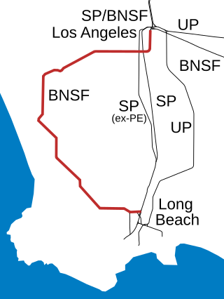
The Harbor Subdivision is a single-track main line of the BNSF Railway which stretches 53 miles (85 km) between rail yards near downtown Los Angeles and the ports of Los Angeles and Long Beach across southwestern Los Angeles County. It was the primary link between two of the world's busiest harbors and the national rail network. Mostly displaced with the April 15, 2002 opening of the more direct Alameda Corridor, the Harbor Sub takes a far more circuitous route from origin to destination, owing to its growth in segments over the decades. The subdivision was built in this fashion beginning in the early 1880s to serve the ports and the various businesses that developed along it.
The C Line is a 17.8-mile (28.6 km) light rail line running between the Los Angeles neighborhood of Westchester and the city of Norwalk within Los Angeles County, California. It is one of six lines forming the Los Angeles Metro Rail system and opened on August 12, 1995. Along the route, the line also serves the cities of Downey, Hawthorne, and Lynwood, as well as several unincorporated communities in the South Los Angeles region including Athens, Del Aire, and Willowbrook. The fully grade-separated route runs mainly in the median strip of Interstate 105 for its latitude portion and in a mixture of viaducts, embankments, and an open trench for its western leg. A free shuttle bus to Los Angeles International Airport (LAX) is available at Aviation/LAX and Aviation/Century stations.
Aviation/LAX station is an elevated light rail station on the C Line of the Los Angeles Metro Rail system. It is located over Aviation Boulevard, after which the station is named, near its intersection with Imperial Highway and south of Century Freeway in the Westchester neighborhood of Los Angeles, California and immediately adjacent to the Del Aire neighborhood. It opened as part of the Green Line on August 12, 1995. The station was initially named Aviation Blvd/I-105, but in 2003, it was renamed Aviation/LAX to highlight its proximity to Los Angeles International Airport.
This article covers streets in Los Angeles, California between and including 41st Street and 250th Street. Major streets have their own linked articles; minor streets are discussed here.
Measure R was a ballot measure during the November 2008 elections in Los Angeles County, California, that proposed a half-cent sales taxes increase on each dollar of taxable sales for thirty years in order to pay for transportation projects and improvements. The measure was approved by voters with 67.22% of the vote, just over the two-thirds majority required by the state of California to raise local taxes. The project was touted as a way to "improve the environment by getting more Angelenos out of their cars and into the region's growing subway, light rail, and bus services." It will result in the construction or expansion of a dozen rail lines in the county.
Expo/Crenshaw station is a light rail station in the Los Angeles Metro Rail system located in the Jefferson Park neighborhood of Los Angeles at the intersection of Crenshaw and Exposition Boulevards. During construction, it was known as the Crenshaw station. The station is the transfer point between the E Line, which stops at two street-level platforms alongside Exposition Boulevard, and the K Line, which has its northern terminus at a single island platform under Crenshaw Boulevard.
Aviation Boulevard is a major north–south thoroughfare in western and the South Bay region of Los Angeles County, California.
The D Line Subway Extension Project is a construction project in Los Angeles County, California, extending the rapid transit D Line of the Los Angeles Metro Rail system from its current terminus at Wilshire/Western in Koreatown, Los Angeles, to the Westside region. The project is being supervised by the Los Angeles County Metropolitan Transportation Authority (Metro). The subway has been given high priority by Metro in its long-range plans, and funding for the project was included in two county sales tax measures, Measure R and Measure M.
The Sepulveda Transit Corridor is a two-phased planned transit corridor that aims to connect the Los Angeles Basin to the San Fernando Valley through Sepulveda Pass in Los Angeles, California, by supplementing the existing I-405 freeway through the pass. The corridor would partly parallel I-405, and proposed alternatives include heavy rail rapid transit or a monorail line connecting the G Line in the Valley to the D Line and E Line on the Westside, and the K Line near Los Angeles International Airport.
Aviation/Century station is an elevated light rail station on the C and K lines of the Los Angeles Metro Rail system. It is located alongside Aviation Boulevard above its intersection with Century Boulevard, located in the Westchester neighborhood of Los Angeles.
LAX/Metro Transit Center station is an under construction light rail transport hub in the Los Angeles Metro Rail system, located near Aviation Boulevard and 96th Street in the Westchester district of Los Angeles. The station was designed as a station for the C and K lines. It will serve as the transfer point between Metro Rail and the LAX Automated People Mover (APM) serving the Los Angeles International Airport terminals and facilities. Additionally, the station will have connections to Metro Bus, other municipal bus lines, a customer service center, and a Metro Bike Share hub. Metro is scheduled to start serving the station sometime in 2025, although the APM connection is not scheduled to open until early 2026.
The K Line Northern Extension, formerly known as the Crenshaw Northern Extension, is a project planning a Los Angeles Metro Rail light rail transit corridor extension connecting Expo/Crenshaw station to Hollywood/Highland station in Hollywood. The corridor is a fully underground, north-south route along mostly densely populated areas on the western side of the Los Angeles Basin; it would be operated as part of the K Line. The Los Angeles County Metropolitan Transportation Authority (Metro) is prioritizing the project along with pressure from the West Hollywood residents. Construction is slated to start in 2041 and begin service by 2047 unless means to accelerate the project are found.
The history of the Los Angeles Metro Rail and Busway system begins in the early 1970s, when the traffic-choked region began planning a rapid transit system. The first dedicated busway opened along I-10 in 1973, and the region's first light rail line, the Blue Line opened in 1990. Today the system includes over 160 miles (260 km) of heavy rail, light rail, and bus rapid transit lines, with multiple new lines under construction as of 2019.
The Lincoln Boulevard Transit Corridor is a proposed 10-mile (16 km) bus rapid transit or light rail line in the public transport network of the Los Angeles County Metropolitan Transportation Authority in Los Angeles County, California. It is planned to operate on a north to south route on Lincoln Boulevard between the C and K Line's LAX/Metro Transit Center station with the E Line's Downtown Santa Monica station on the Los Angeles Metro Rail system. A proposed completion date of 2047 for BRT and an unknown date for rail conversion. It is funded by Measure M and Measure R. The route will have signal priority at traffic lights and will have a dedicated right of way.