Baldwin Hills and surrounding areas were part of Rancho La Cienega o Paso de la Tijera and later owned by the 19th century L.A. pioneer Elias "Lucky" Baldwin.[1][2][3] The Sanchez Adobe de Rancho La Cienega o Paso de la Tijera was once the center of the rancho. In the 1920s, an addition was built linking the structures and the building was converted into a larger clubhouse for the Sunset Golf Course.[2]
In 1950, new homes in Baldwin Hills were designed by Paul W. Trousdale & Associates (of Trousdale Estates fame) and advertised as being near the "$30 million Crenshaw-Santa Barbara Shopping Center.[7]
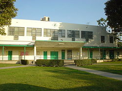
Baldwin Hills reservoir after collapse of the dam in 1963
1960s
On December 14, 1963, a crack appeared in the Baldwin Hills Dam impounding the Baldwin Hills Reservoir. Within a few hours, water rushing through the crack eroded the earthen dam, gradually widening the crack until the dam failed catastrophically at 3:38p.m. When the crack was discovered, police with bullhorns urged the evacuation of the area, but six people were killed.[8] Two hundred homes were completely wiped out, and an additional 1500 to 2000 houses and apartment buildings were damaged,[8] and most of Baldwin Vista and the historic Village Green community were flooded. The dam's failure was ultimately determined to be the result of subsidence, caused by overexploitation of the Inglewood Oil Field. The dam's failure prompted the Los Angeles Department of Water and Power to close and drain other small local reservoirs with similar designs, such as the Silver Lake Reservoir. The Baldwin Hills Dam was not rebuilt—instead, the empty reservoir was demolished, filled with earth, landscaped, and converted to Kenneth Hahn Regional Park.
1980s
During the summer of 1985, a brush fire along La Brea Avenue spread up the canyon towards the homes along Don Carlos Drive in Baldwin Hills Estates. Many homes were destroyed despite the efforts of the Los Angeles Fire Department to suppress the flames. The fire killed three people and destroyed 69 homes;[9] the arsonist was never caught.
In 1985, the Los Angeles Times noted that Baldwin Hills is "now often called the Black Beverly Hills".[10]
Baldwin Hills Estates is locally known as "The Dons", because all but one street begins with the formal title of the city's original land holders.[11] The oldest two streets in the neighborhood are Don Luis Drive and Don Mariano Drive. Old maps show those streets with the names Sprague Drive and Maryann Drive. Susan Miller Dorsey High School has called its school mascot The Dorsey Dons and Donnas after this neighborhood. The neighborhood is east of La Brea, southwest of Santo Tomas Drive, south of the Jim Gilliam Recreation Center and north of Stocker Street). It is sometimes called "the Black Beverly Hills".[12] The neighborhood is characterized by hillside houses with swimming pools, and modern condominiums (the latter often jut out from steep hillsides, perched on stilts).
Baldwin Village - In 1988, Baldwin Village became be a distinct community in the city's General Plan, and signs were to be posted to identify the area. It is bounded by La Brea Avenue, Marlton Avenue, Obama Boulevard, Martin Luther King Jr. Boulevard and Santo Thomas Drive.[13] The neighborhood is the most densely populated part of Baldwin Hills, made up of many midcentury apartment complexes. Built before 1973, the area's apartments are subject to Los Angeles' rent stabilization ordinance and have been an important source of affordable housing in the otherwise very expensive Westside. One of the largest single complexes, the 669-unit Baldwin Village Apartments, has been acquired by the Housing Authority and converted into deed-restricted affordable housing.[14]
Baldwin Vista is bounded by La Cienega Boulevard to the West, La Brea Avenue to the East, Coliseum Street to the North, and Kenneth Hahn Park to the South.[15] Containing houses on the north side of the mountain and in the hills.
Baldwin Hills Scenic Overlook State Park - The entrance to the park is located at 6300 Hetzler Road in Culver City, CA.[17][18] The 8.5-acre (3.4ha) park is open daily from 8 a.m. to sunset. The park includes an amphitheater, the Evan Frankel Discovery Center, picnic tables, and walking paths.
Baldwin Hills is served by Los Angeles Unified School District. Baldwin Hills also has a charter school.[9] The schools operating within Baldwin Hills borders are:
New LA Elementary School, a charter school, is on the grounds of Baldwin Hills Elementary. A California law called Proposition 39 allows New LA to occupy space on the grounds of Baldwin Hills Elementary. In 2022, area community members advocated for the charter school to move to another location since they believed that it meant there would not be enough space for the public elementary to operate efficiently.[27]
↑ Meares, Hadley (March 17, 2022). "Baldwin Hills, 'The Black Beverly Hills': The Life And Times of the Community". LAist. Retrieved April 20, 2022. The rolling hills in South Los Angeles that now hosts these neighborhoods were once part of the Rancho La Cienega o Paso de la Tijera, eventually owned by the randy, wily 19th century L.A. pioneer Elias 'Lucky' Baldwin
↑ Hedegaard, Erik (March 28, 2016). "Mike Love's Cosmic Journey". Rolling Stone Magazine. Retrieved September 18, 2024. He grew up in Baldwin Hills, California, an L.A. suburb inland of the 405...
Leimert Park BeatArchived September 28, 2023, at the Wayback Machine —a collaborative online community focused on Leimert Park: "The Soul of Los Angeles and the African American cultural center of the city."
This page is based on this Wikipedia article Text is available under the CC BY-SA 4.0 license; additional terms may apply. Images, videos and audio are available under their respective licenses.