Vermont Vista, Los Angeles

Last updated
Vermont Vista
VermontVistaSignage.jpg
Vermont Vista neighborhood sign
located on Vermont Avenue between
99th Street and Century Boulevard
Location map Southern Los Angeles.png
Red pog.svg
Vermont Vista
Location within Los Angeles
Coordinates: 33°57′36″N118°17′45″W / 33.960000°N 118.2959017°W / 33.960000; -118.2959017
Country Flag of the United States.svg  United States
State Flag of California.svg  California
County Flag of Los Angeles County, California.svg Los Angeles
CityFlag of Los Angeles, California.svg  Los Angeles
Time zone Pacific
ZIP Code
90061
Area code 323

Vermont Vista is a neighborhood in Los Angeles, California, within the South Los Angeles area.

Contents

History

Beginning in 2000, the Eighth District Empowerment Congress began working on the "Naming Neighborhoods Project" to identify and name individual communities that had historically been grouped together and regarded as part of South Central Los Angeles. [1]

The first focus group was held at Hebrew Union College in June 2000. Through research, a meeting with an urban historian, and numerous community meetings, the Empowerment Congress ultimately outlined sixteen unique neighborhoods, including the neighborhood of Vermont Vista. The names were submitted to City Council in October 2001 and approved in February 2002. [1]

Geography

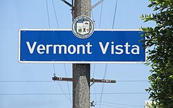
By city council action (C.F. #01-1874), "Vermont Vista" was officially named and designated as being bounded by the following streets: West Manchester Boulevard on the north, South Vermont Avenue on the west, the Harbor Freeway (I-110) on the east, and 99th Street on the south. [1] The motion was made as part of the Eighth District Empowerment Congress's "Naming Neighborhoods Project" to identify and name individual communities that had historically been grouped together and regarded as part of South Central. [1]

The Department of Transportation was instructed to install signage at the following intersections: Northbound Vermont Avenue at 99th Street, Northbound Figueroa Street at 99th Street Southbound Hoover Street at 87th Street and Eastbound Manchester Avenue at Menlo Avenue. [2]

The neighborhood of Magnolia Square, which was officially designated at the same time, is on the south.

The Los Angeles Times Mapping L.A. project, which defines neighborhoods by merging together neighboring census tracts, combines the above-designated neighborhood of Vermont Vista with the neighborhood of Magnolia Square. Per the Los Angeles Times, Vermont Vista is bounded by Manchester Boulevard on the north, Vermont Avenue on the west, the Harbor Freeway on the east, and West 120th Street on the south. [3] It is bordered by Vermont Knolls on the north, Broadway-Manchester on the east, Gardena on the south, and Athens and Westmont on the west. [4]

Vermont Vista as outlined by the Empowerment Congress Southeast Neighborhood Council Empowerment Congress Southeast Map.jpg
Vermont Vista as outlined by the Empowerment Congress Southeast Neighborhood Council

Demographics

The following data from the Los Angeles Times Mapping L.A. project covers the combined city-designated neighborhoods of Vermont Vista and Magnolia Square:

A total of 23,291 people lived in the area's 1.65 square miles, according to the 2000 U.S. census—averaging 14,154 people per square mile, among the highest population densities in the city as a whole. Population was estimated at 24,891 in 2008. The median age was 24, considered young when compared to the city as a whole. The percentages of residents aged birth to 18 were among the county's highest. [3]

Latinos made up 52.1% of the population, with black people at 45%, white 1.1%, Asian 0.8%, and other 1%. Mexico and El Salvador were the most common places of birth for the 31.3% of the residents who were born abroad, an average percentage of foreign-born when compared with the city or county as a whole. [3]

The $31,272 median household income in 2008 dollars was considered low for the city and county. The percentage of households earning $20,000 or less was high, compared to the county at large. The average household size of 3.5 people was high for the city. Renters occupied 59.6% of the housing units, and homeowners occupied the rest. [3]

In 2000 there were 1,419 families headed by single parents, or 28.2%, a rate that was high for the county and the city. The percentages of never-married women (41.7) and never-married men (37.9) were among the county's highest. [3]

Just 6% of residents aged 25 and older had completed a four-year degree in 2000, which was a low figure when compared with the city and the county at large; the percentage of those residents with less than a high school diploma was high for the county. [3]

Development

In 2020, a $33.7 million mixed-use development opened at 88th Street and Vermont. [5]

The project, built on city-owned property, was among the first affordable housing developments funded by Measure HHH. [6]

Education

The schools within the official Vermont Vista boundaries are: [7]

The following schools are south of 99th Street, outside the official boundaries of Vermont Vista, and in the neighborhood of Magnolia Square. However, they are within the boundaries set by the Los Angeles Times Mapping LA project:

Government

Vermont Vista lies within Los Angeles City Council District 8. [8]

The following government services are located within the boundaries of Vermont Vista:

Parks and recreation

See also

Related Research Articles

<span class="mw-page-title-main">Westchester, Los Angeles</span> Neighborhood of Los Angeles in the United States

Westchester is a neighborhood in the City of Los Angeles and the Westside Region of Los Angeles County, California.

<span class="mw-page-title-main">Mar Vista, Los Angeles</span> Neighborhood of Los Angeles in California, United States of America

Mar Vista is a neighborhood on the Westside of Los Angeles, California. In 1927, Mar Vista became the 70th community to be annexed to Los Angeles. It was designated as an official city neighborhood in 2006.

<span class="mw-page-title-main">Pico-Union, Los Angeles</span> Neighborhood of Los Angeles in California, United States of America

Pico-Union is a neighborhood in Central Los Angeles, California. The name "Pico-Union" refers to the neighborhood that surrounds the intersection of Pico Boulevard and Union Avenue. Located immediately west of Downtown Los Angeles, it is home to over 40,000 residents.

<span class="mw-page-title-main">West Adams, Los Angeles</span> Neighborhood of Los Angeles in California, United States

West Adams is a historic neighborhood in the South Los Angeles region of Los Angeles, California. The area is known for its large number of historic buildings, structures and notable houses and mansions.

<span class="mw-page-title-main">South Park, Los Angeles</span> Neighborhood of Los Angeles in California, United States

South Park is a 1.41 square miles (3.65 km2) neighborhood within the South Los Angeles region of Los Angeles, California.

<span class="mw-page-title-main">Harbor Gateway, Los Angeles</span> Neighborhood of Los Angeles in California, United States

The Harbor Gateway is a 5.14-square-mile residential and industrial area (13.3 km2) in the Los Angeles Harbor Region, in the southern part of the city. The neighborhood is narrow and long, running along a north-south axis. Its unusual shape has given it the alternative name of "the Shoestring Strip". The northern limit of the neighborhood is Imperial Highway, a city street just north of I-105.

<span class="mw-page-title-main">Vermont Square, Los Angeles</span> Neighborhood of Los Angeles in California, United States

Vermont Square is a neighborhood in Los Angeles, California, within the South Los Angeles region. The Vermont Square Branch library, a designated Historic–Cultural Monument, is located in the community.

<span class="mw-page-title-main">Hyde Park, Los Angeles</span> Neighborhood of Los Angeles in California, United States

Hyde Park is a neighborhood in the South region of Los Angeles, California. Formerly a separate city, it was consolidated with Los Angeles in 1923.

<span class="mw-page-title-main">University Park, Los Angeles</span> Neighborhood of Los Angeles in California, United States

University Park is a 1.17 square miles (3.0 km2) neighborhood in the South Los Angeles region of Los Angeles, California. It is the home of the University of Southern California (USC), Mount St. Mary's College and Hebrew Union College. Additionally, the neighborhood is the home of the historic Shrine Auditorium.

<span class="mw-page-title-main">Vermont Knolls, Los Angeles</span> Neighborhood of Los Angeles in California, United States

Vermont Knolls is a neighborhood in Los Angeles, California, within the South Los Angeles region.

<span class="mw-page-title-main">Historic South Central Los Angeles</span> Neighborhood of Los Angeles in California, United States

Historic South Central Los Angeles is a 2.25-square-mile neighborhood in Los Angeles, California, within the South Los Angeles region. It is the site of the Bob Hope Patriotic Hall.

<span class="mw-page-title-main">Harbor City, Los Angeles</span> Neighborhood of Los Angeles in California, United States

Harbor City is a highly diverse neighborhood in the Harbor region of Los Angeles, California, with a population upward of 36,000 people. Originally part of the Rancho San Pedro Spanish land grant, the 2.58-square-mile (6.7 km2) Harbor City was brought into Los Angeles as a preliminary step in the larger city's consolidation with the port cities of Wilmington and San Pedro.

<span class="mw-page-title-main">Manchester Square, Los Angeles</span> Neighborhood of Los Angeles in California, United States

Manchester Square is a neighborhood in Los Angeles, California, within the South Los Angeles region.

<span class="mw-page-title-main">West Park Terrace, Los Angeles</span> Neighborhood of Los Angeles in California, United States

West Park Terrace is a neighborhood in South Los Angeles. The 2009 Mapping L.A. project of the Los Angeles Times gave the same area a different name: Grammercy Park.

<span class="mw-page-title-main">Florence, Los Angeles</span> Neighborhood of Los Angeles in California, United States

Florence is a neighborhood in Los Angeles, California. The neighborhood, part of the South Los Angeles region, is home to over 46,000 residents.

<span class="mw-page-title-main">Broadway-Manchester, Los Angeles</span> Neighborhood of Los Angeles in California, United States

Broadway-Manchester is a 1.5-square-mile neighborhood in Los Angeles, California. The neighborhood, part of the South Los Angeles area, is home to over 23,000 residents.

Green Meadows is a neighborhood in South Los Angeles, California, with a population of more than thirty thousand people. Green Meadows is within the South Los Angeles Community Plan area and is the home of Locke College Preparatory Academy.

Vermont-Slauson is a 1.44-square-mile neighborhood within the South Los Angeles region of Los Angeles, California.

<span class="mw-page-title-main">Exposition Park, Los Angeles</span> Neighborhood of Los Angeles in California, United States

Exposition Park is a neighborhood in the south region of Los Angeles, California. It is home to Exposition Park, which includes the Los Angeles Memorial Coliseum, BMO Stadium, Exposition Rose Garden and three museums: the California African American Museum, the California Science Center and the Natural History Museum of Los Angeles County. It is also home to a Science Center Academy.

<span class="mw-page-title-main">Magnolia Square, Los Angeles</span> Neighborhood of Los Angeles in California, United States

Magnolia Square is a neighborhood in Los Angeles, California.

References

  1. 1 2 3 4 "Council File 01-1874" (PDF). No. 40. City of Los Angeles. October 2001. Retrieved 31 August 2020.
  2. "Council Fire 01-1874" (PDF). No. 41. City of Los Angeles. February 15, 2002. Retrieved 31 August 2020.
  3. 1 2 3 4 5 6 "Vermont Vista," Mapping L.A., Los Angeles Times
  4. "South L.A.," Mapping L.A., Los Angeles Times
  5. "Affordable Housing Unwrapped at 88th & Vermont". No. January 02, 2020. Urbanize.la. Retrieved 3 September 2022.
  6. "Affordable Housing and Community Center Rising at 88th & Vermont". No. September 13, 2018. Urbanize.la. Retrieved 31 August 2020.
  7. "Vermont Vista Schools," Mapping L.A., Los Angeles Times
  8. "Council District 8 Map" (PDF). Retrieved 3 May 2022.
  9. "Mark Twain Branch Library". Los Angeles Public Library. Retrieved 21 November 2022.
  10. "Hancock Post Office". USPS.com. Retrieved 21 November 2022.
  11. Los Angeles City Department of Recreation and Parks: Algin Sutton