West Adams Terrace, Los Angeles

Last updated
West Adams Terrace
Location map Los Angeles.png
Red pog.svg
West Adams Terrace
Location within Los Angeles
Coordinates: 34°01′59″N118°19′08″W / 34.033°N 118.319°W / 34.033; -118.319
CountryUnited States
State California
County Los Angeles
Time zone Pacific
Zip Code
90018
Area code 323

West Adams Terrace is a neighborhood in the West Adams area of Los Angeles. Dating back to 1905, it contains seven Los Angeles Historic-Cultural Monuments, one property on the National Register of Historic Places and one Green Book property. In 2003, the neighborhood was designated a Historic Preservation Overlay Zone.

Contents

History

In 1905, West Adams Terrace was platted in from what had been called the Bauer tract. The area on the north side of Adams Street (west of Western Avenue) was under the control of the Mesa Land Company, a syndicate headed by William Miles, president, and Charles McKenzie, H.R. Callender, S.J. White and C.G. Andrews. Noted as "the last piece of available elevated land [with] a magnificent view of the valley and surrounding foothills", the land was divided into 235 lots with building restrictions ranging from $2,500 to $5,000. [1] [2] The earliest use of the name "West Adams Terrace" in the Los Angeles Times was on July 16, 1905. The area was then described as a "beautiful residence subdivision" with lots being sold for $40,000.

During the next few years, the Times continued to report sales in the neighborhood. [3] [4] On March 6, 1910, the Times announced that architect A.B. Benton had completed plans for a residence for F.M. Vale on Eleventh Avenue in West Adams Terrace. [5]

In the 1950s, a Green Book property serving African-American tourists was located in the neighborhood. [6] The name West Adams Terrace continued to be used for residential sales in both the Los Angeles Times and the Los Angeles Sentinel . [7] [8] [9] [10] [11]

Geography

In 1905, the Times noted that West Adams Terrace was located between Adams Street on the south and Twenty-third Street on the north and between Eighth Avenue on the east and Twelfth Avenue on the west. [2] In 1906, the Times noted a different boundary - Thirteenth Avenue on the west. [3]

In 2002, the city defined the area as: the north side of West Adams Boulevard on the south, the Santa Monica I-10 Freeway on the north, the rear lot line of the parcels on the west side of Thirteenth Avenue on the west, and the west side of Western Avenue on the east. [12]

Historic Preservation Overlay Zone

On December 2, 2003, the Los Angeles City Council adopted The West Adams Terrace HPOZ (Historic Preservation Overlay Zone). The designation reflected the high concentration of Craftsman and Colonial Revival architectural styles as well as the neighborhood's high level of architectural integrity from the period in which the properties were constructed (1887-1951). [12]

The West Adams Terrace HPOZ is bounded by 13th Avenue to the west, the Santa Monica Freeway to the north, Gramercy Place, 24th Street, and Western Avenue to the east, and West Adams Boulevard to the south (excluding both Joseph Pomeroy Widney High and the 24th Street Elementary School from the HPOZ). [13] [14]

Historic-Cultural Monuments

Gordon L. McDonough House, 2008
2532 5th Avenue Gordon L. McDonough House.jpg
Gordon L. McDonough House, 2008
2532 5th Avenue

(listed in order of HCM number)

Notable properties

Valle Vista Tourist Home, 2021
2408 Cimarron Street Valle Vista Tourist Home.jpg
Valle Vista Tourist Home, 2021
2408 Cimarron Street

Education

LAUSD has two schools in West Adams Terrace:

In 2013, 24th Street Elementary School became the first campus in Los Angeles to make use of a "parent trigger" law that enabled parents to install a new administration. The school failed to meet the state's educational standards in English and mathematics. [22] The parents voted to take control of the school, and organize it as a hybrid charter school, with the Los Angeles Unified School District operating kindergarten through 5th grade and a private entity, Crown Prep Academy, running grades 5 through 8. [23]

Parks and recreation

Benny H. Potter West Adams Avenues Memorial Park with the South Seas House (Historic-Cultural Monument #757) on right Benny H. Potter West Adams Avenues Memorial Park.jpg
Benny H. Potter West Adams Avenues Memorial Park with the South Seas House (Historic-Cultural Monument #757) on right

Related Research Articles

<span class="mw-page-title-main">Hancock Park, Los Angeles</span> Neighborhood of Los Angeles in California, United States

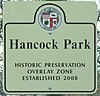
Hancock Park is a neighborhood in the Wilshire area of Los Angeles, California. Developed in the 1920s, the neighborhood features architecturally distinctive residences, many of which were constructed in the early 20th century. Hancock Park is covered by a Historic Preservation Overlay Zone (HPOZ).

<span class="mw-page-title-main">Miracle Mile, Los Angeles</span> Neighborhood of Los Angeles, California, USA

Miracle Mile is a neighborhood in the city of Los Angeles, California.

<span class="mw-page-title-main">West Adams, Los Angeles</span> Neighborhood of Los Angeles in California, United States

West Adams is a neighborhood in the South Los Angeles region of Los Angeles, California. The neighborhood is known for its large number of historic buildings, structures, notable houses, and mansions. It contains several Historic Preservation Overlay Zones as well as designated historic districts.

Carthay is a half-square-mile neighborhood in Central Los Angeles, California. It contains Carthay Circle, Carthay Square and South Carthay. There are three Los Angeles Historic Preservation Overlay Zones in Carthay.

<span class="mw-page-title-main">Harvard Heights, Los Angeles</span> Neighborhood of Los Angeles in California, United States

Harvard Heights is a neighborhood in Central Los Angeles, California. It lies within a municipally designated historic preservation overlay zone designed to protect its architecturally significant single-family residences, including the only remaining Greene and Greene house in Los Angeles.

<span class="mw-page-title-main">Jefferson Park, Los Angeles</span> Neighborhood of Los Angeles in California, United States

Jefferson Park is a neighborhood in the South Los Angeles region of the City of Los Angeles, California. There are fourteen Los Angeles Historic-Cultural Monuments in the neighborhood, and in 1987, the 1923 Spanish Colonial Revival Jefferson Branch Library was added to the National Register of Historic Places. A portion of the neighborhood is a designated Historic Preservation Overlay Zone (HPOZ).

<span class="mw-page-title-main">Carthay Circle, Los Angeles</span> Neighborhood of Los Angeles in California, United States of America

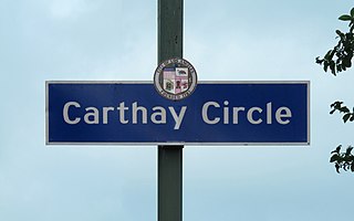
Carthay Circle is a neighborhood in the Mid-City West region of Central Los Angeles, California. Originally named Carthay Center, the neighborhood was later renamed after the famed Carthay Circle Theatre.

<span class="mw-page-title-main">Angelino Heights, Los Angeles</span> Neighborhood of Los Angeles in Los Angeles County, California, United States

Angelino Heights, alternately spelled Angeleno Heights, is one of the oldest neighborhoods in Los Angeles. Situated between neighboring Chinatown and Echo Park, the neighborhood is known for its concentration of eclectic architectural styles from three eras: Victorian, Turn of the Century and Revival. Carroll Avenue is listed on the National Register of Historic Places and there are over thirty Historic-Cultural Monuments in the neighborhood.

Mid-Wilshire is a neighborhood in the central region of Los Angeles, California. It is known for the Los Angeles County Museum of Art, the Petersen Automotive Museum, and the Miracle Mile shopping district.

<span class="mw-page-title-main">Wilshire Park, Los Angeles</span> Neighborhood of Los Angeles in California, United States

Wilshire Park is a neighborhood in the Central Los Angeles region of Los Angeles, California.

<span class="mw-page-title-main">Melrose Hill, Los Angeles</span> Neighborhood of Los Angeles in California, United States of America

Melrose Hill is a neighborhood in Los Angeles. A portion of the neighborhood is designated as a Historic Preservation Overlay Zone.

<span class="mw-page-title-main">Kinney Heights, Los Angeles</span> Neighborhood in Los Angeles, California, United States

Kinney Heights is a neighborhood in Los Angeles, California, bounded by Arlington, 23rd, Adams, and Hermosa, just south of Interstate 10. Kinney Heights is a subdistrict of the West Adams district of South Los Angeles, California; Curbed also associates it with Jefferson Park.

<span class="mw-page-title-main">Garvanza, Los Angeles</span> Neighborhood of Los Angeles in California, United States

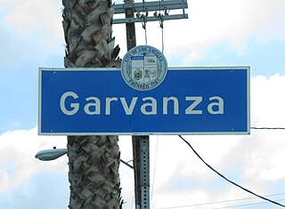
Garvanza is a neighborhood in northeast Los Angeles. Fourteen Los Angeles Historic-Cultural Monuments are located in the neighborhood.

<span class="mw-page-title-main">Victoria Park, Los Angeles</span> Neighborhood of Los Angeles in California, United States of America

Victoria Park is a neighborhood in the central region of Los Angeles, California. There are three Los Angeles Historic-Cultural Monuments located in Victoria Park.

<span class="mw-page-title-main">Wellington Square, Los Angeles</span> Neighborhood of Los Angeles in California, United States of America

Wellington Square is a neighborhood in Mid-City Los Angeles, California at the western edge of the West Adams District.

<span class="mw-page-title-main">Adams-Normandie, Los Angeles</span> Neighborhood in Los Angeles, California, United States

Adams-Normandie is a Historic Preservation Overlay Zone (HPOZ) in South Los Angeles, California.

<span class="mw-page-title-main">Angelus Vista, Los Angeles</span> Neighborhood of Los Angeles in California, United States

Angelus Vista is a neighborhood in Los Angeles, California. There is one Los Angeles Historic-Cultural Monument in neighborhood.

<span class="mw-page-title-main">West Adams Heights, Los Angeles</span> Neighborhood of Los Angeles in California, United States of America

West Adams Heights is a neighborhood in Central Los Angeles, California. It contains three Los Angeles Historic-Cultural Monuments.

<span class="mw-page-title-main">Western Heights, Los Angeles</span> Neighborhood of Los Angeles in California, United States of America

Western Heights is a neighborhood in Central Los Angeles, California. It contains one Los Angeles Historic-Cultural Monument.

References

  1. "Bauer Tract Sold". Los Angeles Herald. July 9, 1905. Retrieved 20 February 2024.
  2. 1 2 "Among Owners and Dealers". Los Angeles Times. July 16, 1905. p. 35. Retrieved 16 June 2022.
  3. 1 2 "Quarter Million for a Hotel". Los Angeles Times. November 29, 1906. p. 112. Retrieved 15 June 2022. Recent sales by the same fim in West Adams Terrace...
  4. "Report Busy Week". Los Angeles Times. July 25, 1909. p. section V, page 18. Retrieved 15 June 2021. Alice S. McKevitt and Clara W. Gries, two lots in West Adams Terrace
  5. "The Architects". Los Angeles Times. March 6, 1910. p. Part V, page 24. Retrieved 25 March 2021.
  6. 1 2 "SurveyLA: African American History in Los Angeles" (PDF). OHP.CA.Gov. Office of Historic Preservation. November 2017. p. 65. Retrieved 25 March 2021.
  7. "classified ad". Los Angeles Sentinel. February 5, 1948. Edgehill, near West Adams Terrace... $23,500
  8. "Classified Ad". Los Angeles Times. April 14, 1952. Retrieved 16 June 2022. $75... West Adams Terrace apartment
  9. "classified ad". Los Angeles Sentinel. March 29, 1962. West Adams Terrace...2516 8th Avenue...asking $31,500
  10. "classified ad". Los Angeles Sentinel. March 29, 1990. Just listed...West Adams Terrace....A Charmer.
  11. "Classified Ad". Los Angeles Times. May 3, 1992. Retrieved 16 June 2022. If you want a bargain... West Adams Terrace Masterpiece
  12. 1 2 3 "West Adams Terrace HPOZ" (PDF). LACity.org. December 9, 2010. Retrieved 25 March 2021.
  13. "Council File 03-1050" (PDF). LACity.org. January 1, 2003. Retrieved 25 March 2021.
  14. "Council File: 03-1050". LACityClerkConnect. LACity.org. December 19, 2003. Retrieved 16 June 2021. ... bounded by 13th Avenue to the west, the Santa Monica Freeway (10) to the north, Gramercy Place, 24th Street and Western Avenue to the east and West Adams Boulevard to the south ...
  15. "West Adams Terrace". HistoricPlacesLA.org. p. 22. Retrieved 25 March 2021. ...the Clark Library located in West Adams Terrace
  16. "Eugene W. Britt House". LAConservancy.org. Los Angeles Conservancy . Retrieved 1 January 2025. Located in the West Adams Terrace Historic Preservation Overlay Zone, it won a 1984 Conservancy Preservation Award, and is a local, state, and nationally registered landmark.
  17. 1 2 3 Barragan, Bianca (May 1, 2018). "Mapped: The historic, stately homes of West Adams Boulevard". Curbed.com. Retrieved 25 March 2021.
  18. O'Connor, Pauline (June 21, 2015). "Historic Craftsman in West Adams Terrace Asking $950,000". Curbed.com. Retrieved 25 March 2021.
  19. O'Connor, Pauline (July 2, 2016). "Historic Adobe in West Adams Terrace by Henry Harwood Hewitt". Curbed.com. Retrieved 25 March 2021.
  20. "McCarty Memorial Christian Church". NPGallery Digital Asset Management System. Retrieved 18 June 2021.
  21. "West Adams Terrace". HistoricPlacesLA.org. p. 22. Retrieved 25 March 2021. Educational facilities were another type of civic institution found in each neighborhood. Sometimes they were selling points for new residential subdivisions. The development of the 24th Street School was integral to the development of the West Adams Terrace neighborhood
  22. Lowry, Brandon (16 February 2023). "Parent Trigger Law At LAUSD: 24th Street Elementary School The Target Of New Parent Petition" via Huff Post.
  23. "Parents Take Control of School". 14 August 2013.
  24. "Benny H. Potter West Adams Avenues Memorial Park". LAParks.org. 6 August 2014. Retrieved 16 June 2021.
  25. "South Seas House". LAParks.org. 31 July 2014. Retrieved 17 June 2021.