Western Heights, Los Angeles

Last updated
Western Heights
View of 20th street in Western Heights.jpg
View of 20th street in Western Heights
Location map Los Angeles.png
Red pog.svg
Western Heights
Location within Los Angeles
Coordinates: 34°02′20″N118°18′48″W / 34.0389°N 118.3132°W / 34.0389; -118.3132
Country Flag of the United States.svg  United States of America
State Flag of California.svg  California
County Flag of Los Angeles County, California.svg Los Angeles
Time zone Pacific
Zip Code
90018
Area code Area code 323

Western Heights is a neighborhood in Central Los Angeles, California. It contains one Los Angeles Historic-Cultural Monument.

Contents

History

According to the Los Angeles Times, Western Heights began development in 1903 or '04 and was well established by World War 1 . [1] In the 1920s, some of the area's wealthier residents began to move further west to Beverly Hills. [1]

The original subdivisions that composed Western Heights were: the "Orange Crest Tract", the "West Garfield Heights Tract", the "Garfield Heights Tract", the "Florence Heights Tract", the "Kinney Heights Tract", the "Belevdere Heights Tract" and the "Western Heights Tract". [2] Neighborhood residences were constructed in several architectural styles, including Craftsman, American Foursquare, Tudor Revival, Colonial Revival, Monterey Revival, Mediterranean Revival, Spanish Colonial Revival, and Mission. [2] Architects included Paul Williams and John C. Austin. [1]

In 1993, the Western Heights Neighborhood Association received a $10,000 in grants from Sears Savings Bank for security improvements and beautification projects. [3]

In 1998, the Western Heights Neighborhood Association appealed the city's approval of a wireless telecommunication facility located at 2362 West Washington Boulevard. The city denied the association's appeal and instead issued the applicant a conditional permit requiring the structure's windows and ornamental detail to be painted, the brick exterior to remain exposed, and the roof to be cleaned. [4]

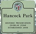
In 2000, a City Council Motion sponsored by council members Mike Hernandez and Mark Ridley-Thomas initiated proceedings to establish a Western Heights Historic Preservation Overlay Zone(HPOZ). [5] It was approved the following year. [6]

Geography

Western Heights Signage at
Gramercy Place and 21st Street WesternHeightsSignage copy.jpg
Western Heights Signage at
Gramercy Place and 21st Street

The Western Heights neighborhood is bounded by Western Avenue on the east, Washington Boulevard on the north, Arlington on the west and the Santa Monica Freeway on the South. [7]

In 2005, due to the proximity of Western Heights to the Santa Monica Freeway and large arterial streets, city council authorized the Western Heights Neighborhood Association, at its own cost, to install landscaped traffic barriers to reduce unsafe cut-through vehicular traffic. [8] The motion was amended in 2010 and noted the street closures located as: 20th Street at Manhattan Place (full closure on eastern side of the intersection), 20th Street at Arlington (partial closure on eastern side of the intersection), and 21st Street at Arlington (partial closure on eastern side of the intersection). [9]

Historic Preservation Overlay Zone

On November 14, 2000, the city's Planning and Land Use Management Committee considered establishing a Historic Preservation Overlay Zone for the Western Heights Area. [10]

The Western Heights HPOZ survey identified approximately 138 neighborhood parcels of which 117 were identified as "contributing" (defined as structures which add to the historical content) and 21 were identified as "non-contributing" resources. Because of the high concentration (approx. 84%) of contributing resources, the neighborhood met the definition of a "Preservation Zone" as "any area of the City of Los Angeles containing structures, landscaping, natural features or sites having historic, architectural, cultural or aesthetic significance ... " [11]

Initially, the HPOZ area was to include the commercial structures along Washington Boulevard and Western Avenue. Some of the structures are in the architectural style of Streamline Moderne or 1920s Commercial/Utilitarian. [12] Per city staff recommendation, the commercial properties along the two thoroughfares were excluded from the HPOZ as most of them were "non-contributing" structures. [11]

On June 13, 2001, the HPOZ was approved. [6]

Education

Western Heights is zoned to schools in the Los Angeles USD: [1]

Notable Locations

Kissam House
Historic-Cultural Monument No. 761 Kissam House.jpg
Kissam House
Historic-Cultural Monument No. 761

In Media

Filming locations in Western Heights include: [15]

Related Research Articles

<span class="mw-page-title-main">Los Feliz, Los Angeles</span> Neighborhood of Los Angeles in California, United States

Los Feliz is a hillside neighborhood in the greater Hollywood area of Los Angeles, California, abutting Hollywood and encompassing part of the Santa Monica Mountains. The neighborhood is named after the Feliz family of Californios who had owned the area since 1795, when José Vicente Féliz was granted Rancho Los Feliz.

<span class="mw-page-title-main">Miracle Mile, Los Angeles</span> Neighborhood of Los Angeles, California, USA

Miracle Mile is a neighborhood in the city of Los Angeles, California.

<span class="mw-page-title-main">West Adams, Los Angeles</span> Neighborhood of Los Angeles in California, United States

West Adams is a neighborhood in the South Los Angeles region of Los Angeles, California. The area is known for its large number of historic buildings, structures and notable houses and mansions. It contains several Historic Preservation Overlay Zones as well as designated historic districts.

<span class="mw-page-title-main">Harvard Heights, Los Angeles</span> Neighborhood of Los Angeles in California, United States

Harvard Heights is a neighborhood in Central Los Angeles, California. It lies within a municipally designated historic preservation overlay zone designed to protect its architecturally significant single-family residences, including the only remaining Greene and Greene house in Los Angeles.

<span class="mw-page-title-main">Jefferson Park, Los Angeles</span> Neighborhood of Los Angeles in California, United States

Jefferson Park is a neighborhood in the South Los Angeles region of the City of Los Angeles, California. There are fourteen Los Angeles Historic-Cultural Monuments in the neighborhood, and in 1987, the 1923 Spanish Colonial Revival Jefferson Branch Library was added to the National Register of Historic Places. A portion of the neighborhood is a designated Historic Preservation Overlay Zone (HPOZ).

<span class="mw-page-title-main">Carthay Circle, Los Angeles</span> Neighborhood of Los Angeles in California, United States of America

Carthay Circle is a neighborhood in the Mid-City West region of Central Los Angeles, California. Originally named Carthay Center, the neighborhood was later renamed after the famed Carthay Circle Theatre.

<span class="mw-page-title-main">Angelino Heights, Los Angeles</span> Neighborhood of Los Angeles in Los Angeles County, California, United States

Angelino Heights, alternately spelled Angeleno Heights, is one of the oldest neighborhoods in Los Angeles. Situated between neighboring Chinatown and Echo Park, the neighborhood is known for its concentration of eclectic architectural styles from three eras: Victorian, Turn of the Century and Revival. Carroll Avenue is listed on the National Register of Historic Places and there are over thirty Historic-Cultural Monuments in the neighborhood.

Mid-Wilshire is a neighborhood in the central region of Los Angeles, California. It is known for the Los Angeles County Museum of Art, the Petersen Automotive Museum, and the Miracle Mile shopping district.

<span class="mw-page-title-main">Mid City, Los Angeles</span> Neighborhood of Los Angeles in California, United States of America

Mid City is a neighborhood in Central Los Angeles, California.

<span class="mw-page-title-main">Wilshire Park, Los Angeles</span> Neighborhood of Los Angeles in California, United States

Wilshire Park is a neighborhood in the Central Los Angeles region of Los Angeles, California.

<span class="mw-page-title-main">Melrose Hill, Los Angeles</span> Neighborhood of Los Angeles in California, United States of America

Melrose Hill is a neighborhood in Los Angeles. A portion of the neighborhood is designated as a Historic Preservation Overlay Zone.

<span class="mw-page-title-main">Lafayette Square, Los Angeles</span> Neighborhood of Los Angeles in California, United States of America

LaFayette Square is a historic semi-gated neighborhood in the central region of Los Angeles, California.

<span class="mw-page-title-main">Kinney Heights, Los Angeles</span> Neighborhood in Los Angeles, California, United States

Kinney Heights is a neighborhood in Los Angeles, California, bounded by Arlington, 23rd, Adams, and Hermosa, just south of Interstate 10. Kinney Heights is a subdistrict of the West Adams district of South Los Angeles, California; Curbed also associates it with Jefferson Park.

<span class="mw-page-title-main">Wellington Square, Los Angeles</span> Neighborhood of Los Angeles in California, United States of America

Wellington Square is a neighborhood in Mid-City Los Angeles, California at the western edge of the West Adams District.

<span class="mw-page-title-main">Adams-Normandie, Los Angeles</span> Neighborhood in Los Angeles, California, United States

Adams-Normandie is a Historic Preservation Overlay Zone (HPOZ) in South Los Angeles, California.

<span class="mw-page-title-main">Mid-City Heights, Los Angeles</span> Neighborhood of Los Angeles in California, United States

Mid-City Heights is a neighborhood in Los Angeles, California. It lies within the larger Mid-City area of Los Angeles.

<span class="mw-page-title-main">Angelus Vista, Los Angeles</span> Neighborhood of Los Angeles in California, United States

Angelus Vista is a neighborhood in Los Angeles, California. There is one Los Angeles Historic-Cultural Monument in neighborhood.

<span class="mw-page-title-main">West Adams Heights, Los Angeles</span> Neighborhood of Los Angeles in California, United States of America

West Adams Heights is a neighborhood in Central Los Angeles, California. It contains three Los Angeles Historic-Cultural Monuments.

West Adams Terrace is a neighborhood in the West Adams area of Los Angeles. Dating back to 1905, it contains seven Los Angeles Historic-Cultural Monuments, one property on the National Register of Historic Places and one Green Book property. In 2003, the neighborhood was designated a Historic Preservation Overlay Zone.

References

  1. 1 2 3 4 5 6 Wedner, Diane (September 16, 2007). "Taking Over From Titans". Los Angeles Times . Retrieved 13 March 2021.
  2. 1 2 "CF 00-2143" (PDF). LACity.org. June 13, 2001. p. 80. Retrieved 10 March 2021.
  3. Doherty, Jake (April 4, 1993). "WESTERN HEIGHTS : Grants Awarded for Improvements". Los Angeles Times . Retrieved 13 March 2021.
  4. "Conditional Use Appeal" (PDF). LACity.org. August 24, 1998. Retrieved 12 March 2021.
  5. "CF 00-2143" (PDF). LACity.org. June 13, 2001. p. 54. Retrieved 10 March 2021. The Western Heights Historic Resources Survey was undertaken as a result of a City Council Motion sponsored by Council members Mike Hernandez and Mark Ridley-Thomas "to initiate proceedings to establish an Historic Preservation Overlay Zone
  6. 1 2 "CF 00-2143" (PDF). LACity.org. June 13, 2001. p. 3. Retrieved 10 March 2021. At the meeting of the Council held June 13, 2001, the following action was taken:Attached report adopted
  7. "Council File: 05-1279" (PDF). June 17, 2005. Retrieved 10 March 2021. The Western Heights neighborhood within Council District Ten is bounded by Western Avenue on the East, Washington Boulevard on the North, Arlington on the West and the Santa Monica Freeway to the South.
  8. "Council File: 05-1279" (PDF). June 17, 2005. Retrieved 10 March 2021. Due in part to the proximity of Western Heights to the Santa Monica Freeway and large arterial streets, this area experiences unsafe cut-through vehicular traffic...
  9. "Council File 10-1498 Motion" (PDF). LACity.org. August 13, 2010. Retrieved 10 March 2021.
  10. "CF 00-2143" (PDF). LACity.org. June 13, 2001. p. 27. Retrieved 10 March 2021. At its meeting held November 14, 2000, the Planning and Land Use Management Committee...
  11. 1 2 "CF 00-2143" (PDF). LACity.org. June 13, 2001. p. 58. Retrieved 10 March 2021.
  12. "CF 00-2143" (PDF). LACity.org. June 13, 2001. p. 81. Retrieved 10 March 2021. These structures are commercial adaptions of the contemporary architectural and revival styles: Streamline Moderne,1920s Commercial/Utilitarian
  13. Communications, Emmis (January 1998). Dial Them For Murder.{{cite book}}: |work= ignored (help)
  14. "Kissam House". HistoricPlacesLA.org. Retrieved 13 March 2021.
  15. Blake, Lindsay (February 26, 2021). "Dee Snider Rocks Out at a Western Heights Craftsman in Twisted Sister's Iconic 'We're Not Gonna Take It' Music Video". Dirt.com. Retrieved 12 March 2021.