Wilshire Vista, Los Angeles

Last updated
Wilshire Vista
WilshireVista1.jpg
Wilshire Vista neighborhood sign
located at the intersection of
Pico Boulevard and Stanley.
Location map Western Los Angeles.png
Red pog.svg
Wilshire Vista
Location within Los Angeles
Coordinates: 34°03′00″N118°21′36″W / 34.0500°N 118.360°W / 34.0500; -118.360
Country Flag of the United States.svg  United States of America
State Flag of California.svg  California
County Flag of Los Angeles County, California.svg Los Angeles
Time zone Pacific
Zip Code
90010
Area code 323

Wilshire Vista is a neighborhood in the central region of Los Angeles.

Contents

History

A portion of Wilshire Vista was part of a 120-acre farm purchased in 1870 by Joseph Masselin, a French miner who had failed at prospecting in the 1849 California Gold Rush and then settled in the Los Angeles area in 1870. His heirs sold 73 acres fronting on Wilshire Boulevard to Walter G. McCarty, John A. Vaughn and John Evans, who combined it with other land to form the Wilshire Vista tract. [1]

Sales and development began in 1922 on 85 acres of high, rolling ground between Pico, Cahuenga and Wilshire boulevards, with "the promising of a [street]car line, the new Los Angeles High School within eight minutes walk, the Page Military Academy on the adjoining property, the convenience to the city and beaches via the boulevards, as well as Country Club Drive and San Vicente Boulevard running across the tract." [2]

In 2001, the Los Angeles Times noted that Wilshire Vista was historically an African-American community, but had now become more varied in ethnic composition with the arrival of young families and single professionals. [3]

in 2015, the northwest corner of Wilshire Vista was determined historically significant by SurveyLA and was named the "Orange Grove Avenue-Ogden Drive-Genesee Avenue Multi-Family Residential Historic District". [4] This part of Wilshire Vista contains a unique district of multifamily homes adjacent to single family homes, built between 1927-1950 and most of which (96 percent) are still in their original condition. [5]

Geography

Wilshire Vista is bounded by San Vicente Boulevard on the north, Hauser Boulevard on the east, Pico Boulevard on the south and Fairfax Avenue on the west. [6] [7]

Notable Landmarks

1074-76 S. Genesee 1074-1076 S Genesee, LA.jpg
1074-76 S. Genesee
1080-82 S. Genesee 1080-1082 S Genesee, LA.jpg
1080-82 S. Genesee

Related Research Articles

<span class="mw-page-title-main">Fairfax Avenue</span> Street in the city of Los Angeles, California

Fairfax Avenue is a street in the north central area of the city of Los Angeles, California, United States. It runs from La Cienega Boulevard in Culver City at its southern end to Hollywood Boulevard in Hollywood on its northern end. From La Cienega Boulevard to Sunset Boulevard between West Hollywood and Hollywood, Fairfax Avenue separates the Westside from the central part of the city along with Venice Boulevard, La Cienega Boulevard, Hauser Boulevard, San Vicente Boulevard, South Cochran Avenue, Wilshire Boulevard, 6th Street, Cochran Avenue, 4th Street, La Brea Avenue, Fountain Avenue and Sunset Boulevard.

<span class="mw-page-title-main">Koreatown, Los Angeles</span> Neighborhood of Los Angeles in California, United States

Koreatown is a neighborhood in central Los Angeles, California, centered near Eighth Street and Irolo Street.

<span class="mw-page-title-main">Highland Park, Los Angeles</span> Neighborhood of Los Angeles in California, United States

Highland Park is a neighborhood in Los Angeles, California, located in the city's Northeast region. It was one of the first subdivisions of Los Angeles and is inhabited by a variety of ethnic and socioeconomic groups.

<span class="mw-page-title-main">Miracle Mile, Los Angeles</span> Neighborhood of Los Angeles, California, USA

Miracle Mile is a neighborhood in the city of Los Angeles, California.

<span class="mw-page-title-main">Harvard Heights, Los Angeles</span> Neighborhood of Los Angeles in California, United States

Harvard Heights is a neighborhood in Central Los Angeles, California. It lies within a municipally designated historic preservation overlay zone designed to protect its architecturally significant single-family residences, including the only remaining Greene and Greene house in Los Angeles.

Picfair Village is a neighborhood in the Central area of the city of Los Angeles, California.

<span class="mw-page-title-main">Carthay Circle, Los Angeles</span> Neighborhood of Los Angeles in California, United States of America

Carthay Circle is a neighborhood in the Mid-City West region of Central Los Angeles, California. Originally named Carthay Center, the neighborhood was later renamed after the famed Carthay Circle Theatre.

<span class="mw-page-title-main">Wilshire Boulevard</span> Major thoroughfare in the United States

Wilshire Boulevard (['wɪɫ.ʃɚ]) is a prominent 15.83 mi (25.48 km) boulevard in the Los Angeles area of Southern California, extending from Ocean Avenue in the city of Santa Monica east to Grand Avenue in the Financial District of downtown Los Angeles. One of the principal east–west arterial roads of Los Angeles, it is also one of the major city streets through the city of Beverly Hills. Wilshire Boulevard runs roughly parallel to Santa Monica Boulevard from Santa Monica to the west boundary of Beverly Hills. From the east boundary, it runs a block south of Sixth Street to its terminus.

Mid-Wilshire is a neighborhood in the central region of Los Angeles, California. It is known for the Los Angeles County Museum of Art, the Petersen Automotive Museum, and the Miracle Mile shopping district.

<span class="mw-page-title-main">Mid City, Los Angeles</span> Neighborhood of Los Angeles in California, United States of America

Mid City is a neighborhood in Central Los Angeles, California.

<span class="mw-page-title-main">Arlington Heights, Los Angeles</span> Neighborhood of Los Angeles in California, United States

Arlington Heights is a neighborhood in Central Los Angeles, California.

<span class="mw-page-title-main">San Vicente Boulevard</span> Street in Western Los Angeles running southeast of Beverly Hills, United States

San Vicente Boulevard is a major northwest-southeast thoroughfare located in the western portion of the metropolitan area of Los Angeles, CA.

<span class="mw-page-title-main">Pico Boulevard</span> Major Los Angeles street

Pico Boulevard is a major Los Angeles street that runs from the Pacific Ocean at Appian Way in Santa Monica to Central Avenue in Downtown Los Angeles, California, United States. It is named after Pío Pico, the last Mexican governor of Alta California.

The western border of Santa Monica, California, is the 3-mile (4.8 km) stretch of Santa Monica Bay. On its other sides, the city is bordered by various districts of Los Angeles: the northwestern border is Pacific Palisades, the eastern border is Brentwood north of Wilshire Boulevard and West Los Angeles south of Wilshire, the northeastern border is generally San Vicente Boulevard up to the Riviera Country Club, the southwestern border is Venice Beach and the southern border is with West Los Angeles and Mar Vista.

<span class="mw-page-title-main">Mid-City West, Los Angeles</span> Los Angeles neighborhood in Central LA

Mid-City West is an area in the western part of Central Los Angeles that is served by the Mid City West Neighborhood Council. It contains the neighborhoods of Beverly–Fairfax, Beverly Grove, Burton Way, Carthay Circle, Melrose, Miracle Mile and Park La Brea.

<span class="mw-page-title-main">Wilshire Center, Los Angeles</span> Neighborhood of Los Angeles in California, United States of America

Wilshire Center is a neighborhood in the Wilshire region of Los Angeles, California.

<span class="mw-page-title-main">Victoria Park, Los Angeles</span> Neighborhood of Los Angeles in California, United States of America

Victoria Park is a neighborhood in the central region of Los Angeles, California. There are three Los Angeles Historic-Cultural Monuments located in Victoria Park.

<span class="mw-page-title-main">Brookside, Los Angeles</span> Neighborhood of Los Angeles in California, United States of America

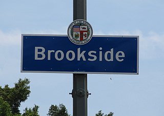
Brookside is a neighborhood in Los Angeles, California. It is an enclave of eight tree-lined streets and 400 homes. The neighborhood consists primarily of one-story and two-story, predominantly single-family residences in various Period Revival styles including Spanish Colonial Revival, Tudor Revival, Mediterranean Revival, and French Revival; later buildings were constructed in the Minimal Traditional and Ranch styles.

Liberty Park is a private park in Los Angeles, CA. It is located on Wilshire Boulevard in the Koreatown Neighborhood. It is now considered a L.A. City Cultural Monument.

<span class="mw-page-title-main">Angelus Vista, Los Angeles</span> Neighborhood of Los Angeles in California, United States

Angelus Vista is a neighborhood in Los Angeles, California. There is one Los Angeles Historic-Cultural Monument in neighborhood.

References

  1. "Big Addition Made to Wilshire Vista," Los Angeles Times, December 17, 1922, page V-5
  2. "Wilshire Vista Started With a Selling Boom," Los Angeles Times, October 29, 1922, page V-2
  3. Los Angeles Times "Looking for the Hotspots" April 29, 2001
  4. SurveyLA report: "Orange Grove Avenue-Ogden Drive-Genesee Avenue Multi-Family Residential Historic District" October 15, 2014
  5. 1 2 3 "Wilshire Vista residents seeking Historic District Designation LarchmontBuzz August 4, 2019
  6. P.I.C.O. Neighborhood Council Map
  7. Wilshire Vista Neighborhood Association map
  8. 1 2 List of Cultural Historic Monuments
  9. The Atlantic "Urban Oil Fields of Los Angeles" August 26, 2014
  10. "Pico Blvd. Drill Sites". STAND - L.A. Retrieved 23 November 2022. Packard Well Site: 5733 W. Pico Blvd., Los Angeles / Well Count: 51 total active wells / Company: Freeport-McMoRan / Distance from homes: 125 feet