Corona, California | |
---|---|
City of Corona | |
Top: view of Corona; bottom: Corona Historic Civic Center Theater | |
Nicknames: | |
Motto(s): "To Cherish Our Past, To Plan Our Future" | |
![]() Location of Corona in Riverside County, California | |
Location within Greater Los Angeles | |
Coordinates: 33°52′N117°34′W / 33.867°N 117.567°W Coordinates: 33°52′N117°34′W / 33.867°N 117.567°W | |
Country | ![]() |
State | ![]() |
County | ![]() |
Incorporated | July 13, 1896 [3] |
Government | |
• Type | Council–manager [4] |
• Mayor | Jacque Casillas [4] |
Area | |
• City | 39.97 sq mi (103.53 km2) |
• Land | 39.95 sq mi (103.47 km2) |
• Water | 0.02 sq mi (0.05 km2) 0.27% |
Elevation | 679 ft (207 m) |
Population | |
• City | 152,374 |
• Estimate (2019) [8] | 169,868 |
• Rank | 3rd in Riverside County 31st in California 156th in the United States |
• Density | 4,251.91/sq mi (1,641.68/km2) |
• Metro | 4,224,851 |
Time zone | UTC−8 (Pacific) |
• Summer (DST) | UTC−7 (PDT) |
ZIP codes | 92877–92883 |
Area code | 951 |
FIPS code | 06-16350 |
GNIS feature IDs | 1652691, 2410232 |
Website | City Government Tourism site |
Corona (Spanish for 'crown') is a city in Riverside County, California, United States. As of the 2010 census, the city had a population of 152,374, up from 124,966 at the 2000 census. The cities of Norco and Riverside lie to the north and northeast, Chino Hills and Yorba Linda to the northwest, and the Cleveland National Forest and the Santa Ana Mountains to the southwest, and unincorporated Riverside County along the rest of the border, respectively. Corona is approximately 48 miles (77 kilometers) southeast of Los Angeles and 95 miles (153 km) north-northwest of San Diego.
Corona, located along the western edge of Southern California's Inland Empire region, is known as the "Circle City" due to Grand Boulevard's 3 mi (4.8 km) circular layout. It is one of the most residential cities in the Inland Empire, but also has a large industrial portion on the northern half, being the headquarters of companies such as Fender Musical Instruments Corporation, Monster Beverage Corporation, and supercar manufacturer Saleen.
Corona is Spanish for crown or wreath. Originally called South Riverside, citizens wanted to distinguish their city from the larger city of Riverside to the north. When it came time to incorporate the city a number of different names were considered, but the name Corona was chosen to play upon a unique feature of the city, the one-mile diameter drive that circled the center of the town. [9] [10]
Corona was founded at the height of the Southern California citrus boom in 1886, and is situated at the upper end of the Santa Ana River Canyon, a significant pass through the Santa Ana Mountains. The town of Corona was once the "Lemon Capital of the World". A museum there presents the lemon's former role in the local economy. The city derived its name (and its nickname, "The Circle City") from the unique layout of its streets, with a standard grid enclosed by the circular Grand Boulevard, 2.75 miles (4.43 kilometers) in circumference. [11] The street layout was designed by Hiram Clay Kellogg, a civil engineer from Anaheim who was an influential figure in the early development of Orange County.
Corona was established as a town by the South Riverside Land and Water Company. The company was incorporated in 1886; founding members included ex-Governor of Iowa Samuel Merrill, R.B. Taylor, George L. Joy, A.S. Garretson, and Adolph Rimpau. [12] Originally a citrus growers' organization, it purchased the lands of Rancho La Sierra of Bernardo Yorba, and the Rancho Temescal grant and the colony of South Riverside was laid out. They also secured the water rights to Temescal Creek, its tributaries and Lee Lake. Dams and pipelines were built to carry the water to the colony. In 1889, the Temescal Water Company was incorporated, to supply water for the new colony. This company purchased all the water-bearing lands in the Temescal valley and began drilling artesian wells. [13]
Originally located in San Bernardino County, the city was named "South Riverside" and received its post office in that name on either May 27 [14] or August 11, 1887 [15] with Charles H. Cornell as the town's first postmaster. [14] In 1893, South Riverside became part of the new Riverside County. In 1896, the city was renamed "Corona" for its circular Grand Boulevard, where three international automobile races were held in 1913, 1914 and 1916. [16]
The city of Corona has been popular among celebrities drawn to its upscale areas and relative privacy compared to Los Angeles. Lucille Ball and Desi Arnaz spent time at their ranch, located in north Corona, and played golf often at the Cresta Verde Golf Course in the northeastern section of the city. [17] After their divorce, Mr. Arnaz continued to live in Corona.
In recent years Corona has been known as the "Gateway to the Inland Empire". Prior to the 1980s, the city was largely an agricultural community, dominated by citrus orchards, ranches, and dairy farms. High real estate prices in Los Angeles and Orange counties made the area's land desirable to developers and industrialists, and by the late 1990s Corona was considered a major suburb of Los Angeles.[ citation needed ]
Housing development in the city has been accelerated by access to the area via the SR 91, with many families leaving Orange County to larger, more affordable housing available in the city. The construction of the nearby SR 71 has linked Corona to the Pomona and San Gabriel valleys. Due to traffic caused by Corona's considerable growth, toll lanes have been built along the 91 freeway, with future toll lane expansions under construction and in the planning stages along Interstate 15. While there were talks to construct a proposed 10 mi (16 km) automobile and rail tunnel under Santiago Peak to connect Interstate 15 in Corona with Interstate 5 and SR 55 in Orange County to reduce commuter traffic on the crowded 91 freeway, this concept has been shelved indefinitely.
In 2002, the city government considered an initiative to secede from Riverside County and form an autonomous Corona County because the city government and some residents were dissatisfied with how services were handled in nearby areas. The effort was also considered by areas in other cities in the western part of the county as far south as Murrieta. Whether nearby cities such as Norco would have been included in the new county are unknown. The proposed county would have been bordered by San Bernardino County to the northwest, and by Orange County to the west, but it never came to fruition. [18]
Name | Date placed | Description | Location | Placed by |
---|---|---|---|---|
Butterfield Stage Station | 1934 | First used 1858 | 20730 Temescal Canyon Road | Corona Woman's Improvement Club |
Corona Founders Monument | 1936 | Land purchase of May 4, 1886 | Corona City Park | 20-30 Club of Corona |
Old Temescal Road | 1959 | Route of Luiseno and Gabrieleno Indians, and early white settlers | 11 mi (18 km) south on old Highway 71 | Corona Woman's Improvement Club and State Park Commission |
Painted Rock | May 4, 1927 | Indian pictograph | Old Temescal Canyon Road | Corona Woman's Improvement Club |
Third Serrano Adobe | 1981 | Owned by Josefa Serrano, widow of Leandro | I-15 and Old Temescal Road | E Clampus Vitus, Hydro Conduit Corp., Phil Porretta family |
Serrano Tanning Vats | 1981 | Built 1819 | I-15 and Old Temescal Road | E Clampus Vitus, Hydro Conduit Corp., Phil Porretta family |
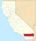
Corona is located in western Riverside County, east of Orange County.
According to the United States Census Bureau, the city has a total area of 38.9 square miles (101 km2), of which, 38.8 square miles (100 km2) of it is land and 0.1 square miles (0.26 km2) of it (0.27%) is water.
Corona experiences a warm Mediterranean climate (Köppen climate classification CSa) and has mild to cool winters and hot summers. Most of the rainfall (as in all of Southern California) occurs during winter and early spring.
Winter days are pleasant, with the average highs staying in the mid to upper 60s. But compared to other areas in Southern California, winter lows are colder, with common frost and chilly mornings. Snowfall within city limits is rare. Snow flurries will occasionally fall, usually once every other year, but it very rarely snows where it accumulates. The nearby Santa Ana Mountains receive a dusting of snow a few times each winter.
Spring brings pleasant weather with daytime temperatures in the mid to upper 70s, and nighttime lows in the upper 40s. Spring showers are common during the beginning of the season, while becoming a rarity by late May.
Summertime is hot, with highs averaging in the low to mid 90s. During the hottest months, daytime temperatures in Corona can exceed 100 degrees. [20] [21] In early summer, Corona receives common overcast weather known as "May Gray" and "June Gloom". Summer thunderstorms are sporadic and usually happen between July and September from the North American Monsoons, bringing increased humidity and scattered thunderstorms.
Autumn features warm days and sharply cooler evenings, but can be windy due to the Santa Ana winds, blowing in 2 or 3 times a year from October to December.
Climate data for Corona, California | |||||||||||||
---|---|---|---|---|---|---|---|---|---|---|---|---|---|
Month | Jan | Feb | Mar | Apr | May | Jun | Jul | Aug | Sep | Oct | Nov | Dec | Year |
Record high °F (°C) | 91 (33) | 93 (34) | 100 (38) | 100 (38) | 107 (42) | 110 (43) | 118 (48) | 113 (45) | 114 (46) | 108 (42) | 99 (37) | 94 (34) | 118 (48) |
Average high °F (°C) | 66 (19) | 69 (21) | 71 (22) | 77 (25) | 80 (27) | 87 (31) | 92 (33) | 93 (34) | 90 (32) | 83 (28) | 74 (23) | 67 (19) | 79 (26) |
Average low °F (°C) | 40 (4) | 43 (6) | 45 (7) | 48 (9) | 52 (11) | 57 (14) | 62 (17) | 64 (18) | 60 (16) | 52 (11) | 45 (7) | 42 (6) | 51 (11) |
Record low °F (°C) | 19 (−7) | 25 (−4) | 25 (−4) | 28 (−2) | 28 (−2) | 39 (4) | 41 (5) | 41 (5) | 41 (5) | 29 (−2) | 26 (−3) | 22 (−6) | 19 (−7) |
Average precipitation inches (mm) | 3.01 (76) | 3.06 (78) | 2.32 (59) | 1.02 (26) | .35 (8.9) | .04 (1.0) | .10 (2.5) | .12 (3.0) | .24 (6.1) | .54 (14) | 1.07 (27) | 2.08 (53) | 13.95 (354) |
Average precipitation days | 6.9 | 7.0 | 5.5 | 3.7 | 1.2 | 0.3 | 1.0 | 1.2 | 1.7 | 2.2 | 4.1 | 6.2 | 41 |
Mean monthly sunshine hours | 200 | 210 | 270 | 310 | 305 | 295 | 370 | 350 | 290 | 250 | 210 | 205 | 3,265 |
Source: [22] |
Businesses with global, national or major regional headquarters in Corona include:
According to the City's 2017 Comprehensive Annual Financial Report, [25] the top employers in the city are:
# | Employer | # of Employees |
---|---|---|
1 | Corona-Norco Unified School District | 5,399 |
2 | Corona Regional Medical Center | 1,113 |
3 | Kaiser Permanente | 995 |
4 | All American Asphalt | 840 |
5 | City of Corona | 805 |
6 | Fender | 650 |
7 | Monster Energy | 607 |
8 | TWR Framing | 600 |
9 | Thermal Structures | 500 |
10 | Veg-Fresh Farms | 425 |
11 | Core-Mark | 421 |
Historical population | |||
---|---|---|---|
Census | Pop. | %± | |
1900 | 1,434 | — | |
1910 | 3,540 | 146.9% | |
1920 | 4,129 | 16.6% | |
1930 | 7,018 | 70.0% | |
1940 | 8,764 | 24.9% | |
1950 | 10,223 | 16.6% | |
1960 | 13,336 | 30.5% | |
1970 | 27,519 | 106.4% | |
1980 | 37,791 | 37.3% | |
1990 | 76,095 | 101.4% | |
2000 | 124,966 | 64.2% | |
2010 | 152,374 | 21.9% | |
2019 (est.) | 169,868 | [8] | 11.5% |
U.S. Decennial Census [26] |
The 2010 United States Census [27] reported that Corona had a population of 152,374. The population density was 3,914.0 people per square mile (1,511.2/km2). The racial makeup of Corona was 90,925 (59.7%) White (40.1% Non-Hispanic White), [28] 8,934 (5.9%) African American, 1,153 (0.8%) Native American, 16,205 (10.6%) Asian, 552 (0.4%) Pacific Islander, 28,003 (18.4%) from other races, and 7,759 (5.1%) from two or more races. Hispanic or Latino of any race were 66,447 persons (41.9%); 33.7% of Corona's population are Mexican-American, 2.1% Puerto Rican, 1.2% Cuban, 1.2% Salvadoran, 1.1% Guatemalan, 0.5% Colombian, 0.5% Peruvian, 0.5% Argentine, 0.3% Honduran, 0.2% Nicaraguan, and 0.2% Ecuadorian. Among Asian-Americans, 2.3% of Corona's population were Filipino, 2.1% Vietnamese, 1.7% Korean, 1.4% Indian-Americans, 1.1% Chinese, 0.7% Japanese, 0.4% Pakistani, 0.2% Thai, and 0.1% Bangladeshi. Among The second largest group of Corona's population is made up of Caucasian-Americans; the largest groups were 11.1% German-American, 6.7% Irish, 6.2% English, 4.0% Italian, 2.7% French, 1.6% Polish, 1.3% Dutch, 1.2% Norwegian, 1.1% Scottish, 1.1% Swedish. Middle Eastern/North African (MENA) people made up 2.5% of the population. [29]
The Census reported that 151,863 people (99.7% of the population) lived in households, 229 (0.2%) lived in non-institutionalized group quarters, and 282 (0.2%) were institutionalized.
There were 44,950 households, out of which 22,735 (50.6%) had children under the age of 18 living in them, 27,357 (60.9%) were opposite-sex married couples living together, 5,971 (13.3%) had a female householder with no husband present, 3,004 (6.7%) had a male householder with no wife present. There were 2,690 (6.0%) unmarried opposite-sex partnerships, and 360 (0.8%) same-sex married couples or partnerships. 6,455 households (14.4%) were made up of individuals, and 2,224 (4.9%) had someone living alone who was 65 years of age or older. The average household size was 3.38. There were 36,332 families (80.8% of all households); the average family size was 3.72.
The population was spread out, with 45,674 people (30.0%) under the age of 18, 15,504 people (10.2%) aged 18 to 24, 44,215 people (29.0%) aged 25 to 44, 35,801 people (23.5%) aged 45 to 64, and 11,180 people (7.3%) who were 65 years of age or older. The median age was 32.5 years. For every 100 females, there were 97.0 males. For every 100 females age 18 and over, there were 94.5 males.
There were 47,174 housing units at an average density of 1,211.8 per square mile (467.9/km2), of which 30,210 (67.2%) were owner-occupied, and 14,740 (32.8%) were occupied by renters. The homeowner vacancy rate was 2.3%; the rental vacancy rate was 5.3%. 103,170 people (67.7% of the population) lived in owner-occupied housing units and 48,693 people (32.0%) lived in rental housing units.
During 2009–2013, Corona had a median household income of $77,123, with 10.8% of the population living below the federal poverty line. [28]
As of the census [30] of 2000, there were 124,996 people, 37,839 households, and 30,384 families residing in the city. The population density was 3,555.5 people per square mile (1,372.7/km2). There were 39,271 housing units at an average density of 1,117.3 per square mile (431.4/km2). The racial makeup of the city was 75.0% White, 6.4% Black or African American, 0.9% Native American, 7.5% Asian, 0.3% Pacific Islander, 17.5% from other races, and 5.3% from two or more races. 25.5% of the population were Hispanic or Latino of any race.
There were 37,839 households, out of which 49.6% had children under the age of 18 living with them, 63.8% were married couples living together, 11.2% had a female householder with no husband present, and 19.7% were non-families. 14.4% of all households were made up of individuals, and 3.8% had someone living alone who was 65 years of age or older. The average household size was 3.3 and the average family size was 3.6.
In the city, the population was spread out, with 33.4% under the age of 18, 8.9% from 18 to 24, 35.1% from 25 to 44, 16.8% from 45 to 64, and 5.8% who were 65 years of age or older. The median age was 30 years. For every 100 females, there were 98.0 males. For every 100 females age 18 and over, there were 95.6 males.
The median income for a household in the city was $98,615, and the median income for a family was $83,505 (these figures had risen to $88,620 and $95,450 respectively as of a 2007 estimate [31] ). Males had a median income of $44,752 versus $31,884 for females. The per capita income for the city was $21,001. About 6.0% of families and 8.3% of the population were below the poverty line, including 10.1% of those under age 18 and 7.3% of those age 65 or over.
The City of Corona is composed of three districts. Each district is split in half into west and east sub-districts by Corona's Main St - a major Inland Empire street running north-south through the middle of the city. The larger neighborhoods of Corona are located within these sub-districts, and a few of these neighborhoods contain smaller communities often referred to by the names of their planned communities, parks, or nearby geographic references.
Directly north of the City of Corona borders the City of Norco, the City of Riverside is to the east, and Chino Hills is on its northwest border. This area (north of State Route 91) is primarily residential and commercial. The makeup is primarily middle and upper-middle income, with most housing being built after the late 1990s, and is known for being well maintained and safe.
Northwest Corona contains 4 neighborhoods, yet only one of them is residential - Auburndale. The other three neighborhoods in Northwest Corona - Auto Center, Corona Airport, and Prado Wetlands - are nearly completely free of any residences and mainly serve commercial interests.
Heavily contrasting its neighbor to the west, Northeast Corona is primarily residential. Only two commercial areas exist - The southern half of Parkridge is nearly completely commercial (south of E Parkridge Ave), while the second commercial area occupies the southern portion of Corona Hills south of the 91 Freeway, along Sampson Ave and the Temescal Wash (this is also the only portion of North Corona located south of the 91 Freeway).
The Downtown/North Main area straddles the Northwest neighborhood of Auburndale (Downtown West) and the Northeast neighborhood of Parkridge along (Downtown East) North Main Street.
The central city area includes the inner circle of Grand Boulevard as well as all areas south of State Route 91 and north of Ontario Avenue. This is the oldest area of the city by far, with most housing having been built around 1910. This part of the city has a mixed Hispanic and white population, and consists of many restored historic residences.
South Main Street Palms Historic District, a section of the central city street lined with different species of palms and historic houses, extends from Olive St to Chase Dr. [39]
South Corona is home to the newest planned communities of Corona and is located south of Ontario Avenue. Most of the housing was built after the early 2000s. This area has the highest rated schools in the city (as well as some of the highest in the region).
Although the arguments of the opponents of annexation included the fear of being "Coronians" and losing the area's identity, Temescal Valley's ZIP Code remains associated with Corona. [46]
Federal:
State:
Local:
This article needs additional citations for verification . (April 2012) (Learn how and when to remove this template message) |
The city is served by the Chino Valley (SR 71), Ontario (I-15), and Riverside (SR 91) freeways.
The city is also linked with the 91 Line and Inland Empire–Orange County Line of the Metrolink commuter rail system, providing service to Los Angeles, Perris, San Bernardino, and Oceanside from North Main Corona Metrolink Station in the Downtown area and West Corona Metrolink Station in Corona's West Side.
The city's downtown area is circled by Grand Boulevard, which is unique for being perfectly circular. The street is approximately 1 mi (1.6 km) in diameter.
Corona's public transportation includes the following bus lines: RTA route 1 from West Corona to UC Riverside, RTA route 3 from Corona Regional Medical Center to Swan Lake in nearby Eastvale, RTA route 214 from Downtown Corona to The Village shopping center in Orange, RTA route 206 from Downtown Corona to Temecula, OCTA bus route from Anaheim to South Corona Walmart (Ontario Avenue), and the Corona Cruiser blue and red lines.
There is a proposal to erect a new four-lane freeway along or near Cajalco Road to connect Interstates 15 and 215, although the plan remains controversial. In addition, there is a possibility of constructing a 7.5 mi (12.1 km) tunnel under the Santiago Peak Mountains to the Eastern Transportation Corridor of the FastTrak toll-road company system in Orange, due to increased commuter traffic on State Route 91, which needs to be reduced by another freeway between Orange and Riverside counties.
Corona Municipal Airport (FAA designator: AJO) serves the city and has a 3,200-foot (980 m) runway. On January 20, 2008, two small passenger aircraft collided over Corona, killing all four men aboard the planes and another man on the ground. In the past ten years, there have been five fatal plane crashes around Corona.
Corona is served by the following three hospitals:
The city of Corona is a part of the Corona-Norco Unified School District. [50]
There are five high schools in Corona: Corona, Centennial, Lee V. Pollard, Orange Grove, Santiago.
There are five middle schools in Corona: Auburndale, Citrus Hills, Corona Fundamental, El Cerrito, Raney.
There are also 28 elementary schools in the city: John Adams, Susan B. Anthony, Cesar Chavez, Corona Ranch, Coronita, Dwight Eisenhower, Foothill, Ben Franklin, Garretson, Home Gardens, Jefferson, Lincoln Alternative, William McKinley, Orange, Parkridge, Prado View, Promenade, Riverview, Ronald Reagan, Sierra Vista, Stallings, Temescal Valley, Dr. Bernice Todd, Vandermolen, Vicentia, Victress Bower, George Washington and Woodrow Wilson.
Private schools include St. Edward Catholic School [51] and Crossroads Christian School.
The World Mosquito Control Association (WMCA) is located in Corona. [52]
Southern California Edison provides most of the city's electricity and a small part of the city is serviced by Corona Department of Water and Power. Waste Management Inc. provides waste disposal for the city.
The Corona Sunnyslope Cemetery [53] is a for-profit cemetery established in 1892. [54] Notable burials include USC Trojans athletic director Jess Hill.
California Institution for Women of the California Department of Corrections and Rehabilitation has a "Corona, CA" mailing address, [55] but is in the City of Chino. [56]
The Arts Alive Council is a non-profit organization created with the purpose to "foster, promote, and increase the public knowledge and appreciation of the arts and cultural activities in the greater Corona Area." Members include the Corona Symphony Orchestra, Circle City Chorale, Christian Arts and Theater, and Corona Dance Academy. [57]
Off Broadway Corona Theater (OBCTheater) is a non-profit organization. They produce two to three theatrical productions each year that are presented at the Corona Civic Center Auditorium. [58]
The following are Corona's sister cities as designated by Sister Cities International. [69]
Southern California is a geographic and cultural region that generally comprises the southern portion of the U.S. state of California. It includes the Los Angeles metropolitan area, the second most populous urban agglomeration in the United States. The region generally contains ten of California's 58 counties: Imperial, Kern, Los Angeles, Orange, Riverside, San Bernardino, San Diego, Santa Barbara, San Luis Obispo and Ventura counties. The Colorado Desert and the Colorado River are located on southern California's eastern border with Arizona, and San Bernardino County shares a border with Nevada to the northeast. Southern California's southern border with Baja California is part of the Mexico–United States border.
San Bernardino County, officially the County of San Bernardino, is a county located in the southern portion of the U.S. state of California, and is located within the Inland Empire area. As of the 2010 U.S. Census, the population was 2,035,210, making it the fifth-most populous county in California and the 14th-most populous in the United States. The county seat is San Bernardino.
Greater Los Angeles, also called the Southland, with a 2019 population of 18,710,563, is the second-largest urban region area in the United States, encompassing five counties in southern California extending from Ventura County in the west to San Bernardino County and Riverside County in the east, with Los Angeles County in the center and Orange County to the southeast. According to the U.S. Census Bureau, the Los Angeles–Anaheim–Riverside combined statistical area covers 33,954 square miles (87,940 km2), making it the largest metropolitan region in the United States by land area. However, more than half of this area lies in the sparsely populated eastern areas of Riverside and San Bernardino counties. In addition to being the nexus of the world's largest entertainment industry, Greater Los Angeles is also a global center of business, international trade, education, media, fashion, tourism, science and technology, sports, and transportation. It is the 3rd largest metropolitan area by nominal GDP in the world with an economy exceeding $1 trillion in output.
El Cerrito is a census-designated place (CDP) in Riverside County, California, United States. It is an unincorporated area mostly surrounded by the city of Corona. The population was 5,100 at the 2010 census, up from 4,590 at the 2000 census.
Lake Elsinore is a city in western Riverside County, California, United States. Established as a city in 1888, it is on the shore of Lake Elsinore, a natural freshwater lake about 3,000 acres (1,200 ha) in size. The city has grown from a small resort town in the late 19th and early 20th centuries to a population of well above 60,000 as of 2017.
Moreno Valley is a city in Riverside County, California and is part of the Riverside-San Bernardino-Ontario Metropolitan Area. It is the second-largest city in Riverside County by population and one of the Inland Empire's population centers. As of the 2010 census, the city's population was 193,365. Moreno Valley is also part of the larger Greater Los Angeles area.
Perris is a city in Riverside County, California, United States, located 71 miles (114 km) east-southeast of Los Angeles, California, and 81 miles (130 km) north of San Diego, California. It is known for Lake Perris, which hosts a variety of flora and fauna. The city is most widely recognized for having many choices involving aerial activities, such as skydiving and hot-air ballooning. Perris is within the Inland Empire metropolitan area of Southern California.
Eastvale is a city located in northwestern Riverside County, California, the Inland Empire region of Southern California. The area transitioned from a dairy farm enclave to a developed community starting in the 1990s and was formally incorporated on October 1, 2010. As of the 2010 census it had a population of 53,901 and in 2019 the population was estimated at 64,147. The city's name is derived from "East Vale" as a listed school district in 1893 by the Riverside County Board of Commissioners.
Riverside–La Sierra is a train station served by Metrolink commuter rail in the La Sierra South neighborhood of Riverside, California, United States. Due to its large parking area, it is the second-largest station served by Metrolink, after Union Station. La Sierra University is located a few miles from the station.
The Riverside Transit Agency (RTA) is the main transit agency for western Riverside County, California, United States. RTA provides both local and regional services throughout the region with 39 fixed-routes, 9 CommuterLink routes, and Dial-A-Ride services using a fleet of 339 vehicles. In the cities of Corona, Beaumont and Banning, RTA coordinates regional services with municipal transit systems. In Riverside, RTA coordinates with the city's Riverside Special Services, which provides ADA complementary service to RTA's fixed-route services.
Corona–North Main is a station on Metrolink's Inland Empire–Orange County and 91/Perris Valley Lines located in Corona, California. The station is located at 250 East Blaine Street, near North Main Street. Corona–North Main station consists of two side platforms serving two tracks. A parking lot with 500 spaces is available for passengers.
The Corona-Norco Unified School District (CNUSD) is a school district in Riverside County, California, in the United States, serving the cities of Corona, Norco, and Eastvale. It is the largest public school district in Riverside County and was named the California Exemplary School District of 2019. CNUSD has 50 schools in operation: 30 elementary schools, 3 K-8 academies, 8 intermediate schools, 1 Hybrid school, and 8 high schools. The school board is composed of five members, elected by geographical district and serve a four-year term with the elections are being held in November of even-numbered years.
Many of the existing freeways in Southern California's Inland Empire were completed in the late 1970s. The only exception is the segment of the Foothill Freeway, State Route 210 between San Dimas and San Bernardino, completed in July 2007. In general, most of the higher paying jobs are located in Los Angeles and Orange County. Thus, workers must commute daily up to two hours in each direction on the existing network. As the population increases, traffic congestion is projected to increase as well. In 2007, Forbes magazine ranked the area first in its list of America's most unhealthy commutes, beating every other major metropolitan area in the country, as Inland area drivers breathe the unhealthiest air and have the highest rate of fatal auto accidents per capita.
Riverside County is a county located in the southern portion of the U.S. state of California. As of the 2010 census, the population was 2,189,641, making it the fourth-most populous county in California and the 10th-most populous in the United States. The name was derived from the city of Riverside, which is the county seat.
Rancho Temescal was a farming outpost of Mission San Luis Rey de Francia, one of the 21 Franciscan missions established in California by Spain during the late 18th and early 19th centuries. The Mission was located on the coast where Oceanside, California is today. The Rancho was settled in 1819 by Leandro Serrano, and became the first non-native settlement within the boundaries of what would become Riverside County, California.
Jurupa Valley is a city in the northwest corner of Riverside County, California. It was the location of one of the earliest non-native settlements in the county, Rancho Jurupa. The Rancho was initially an outpost of the Mission San Gabriel Arcángel, then a Mexican land grant in 1838. The name is derived from a Native American village that existed in the area prior to the arrival of Europeans.
Coronita is a census-designated place in Riverside County, California. Coronita sits at an elevation of 630 feet (190 m). The 2010 United States census reported Coronita's population was 2,608.
Temescal Valley is a census-designated place in Riverside County, California. Temescal Valley sits at an elevation of 1,138 feet (347 m). The 2010 United States census reported Temescal Valley's population was 22,535.
The Inland Empire (IE) is a metropolitan area and region in Southern California, inland of and adjacent to Los Angeles. It includes the cities of western Riverside County and southwestern San Bernardino County, and is sometimes considered to include the desert communities of the Coachella and Victor Valleys, respectively on the other sides of the San Gorgonio Pass and San Bernardino Mountains from the Santa Ana River watershed that forms the bulk of the Inland Empire; a much broader definition includes all of Riverside and San Bernardino counties. The combined land area of the counties of the Inland Empire is larger than ten U.S. states – West Virginia, Maryland, Hawaii, Massachusetts, Vermont, New Hampshire, New Jersey, Connecticut, Delaware and Rhode Island – and is slightly smaller than the combined area of the last five.
The Corona Founders Monument is a monument built in 1936 to the founding fathers of the City of Corona in the Riverside County, California. The monument was designated a California Historic Landmark (No.738) on June 6, 1960. The monument is in the Corona City Park in the 100 block of 6th Street of Corona, California. The founding fathers at first called the city South Riverside after the company they started the South Riverside Land and Water Company.
...Grand Boulevard seems a quaint oddity. A perfect circle, with a circumference just over 2.75 miles, it's the rationale for Corona's tagline as the 'Circle City'.
16756 Chino-Corona Road, Corona, CA 92880
![]() | Wikimedia Commons has media related to Corona, California . |