
San Bernardino County, officially the County of San Bernardino, is a county located in the southern portion of the U.S. state of California, and is located within the Inland Empire area. As of the 2010 U.S. Census, the population was 2,035,210, making it the fifth-most populous county in California and the 14th-most populous in the United States. The county seat is San Bernardino.

East Blythe is a former census-designated place (CDP) and unincorporated community in Riverside County, California, United States. The 2000 census population was three.

Glen Avon was a census-designated place (CDP) in Riverside County, California, United States. The population was 20,199 at the 2010 census, up from 14,853 at the 2000 census. On July 1, 2011, the CDP became part of the City of Jurupa Valley.
Highgrove is a census-designated place (CDP) in Riverside County, California, United States. The population was 3,988 at the 2010 census, up from 3,445 at the 2000 census. The City of Riverside has plans to annex Highgrove.

Mira Loma, now officially part of Jurupa Valley, was a census-designated place (CDP) in Riverside County, California, United States. Its population was 21,930 in the 2010 census, up from 17,617 in the 2000 census.

Pedley was a census-designated place (CDP) in Riverside County, California, United States. The population was 12,672 at the 2010 census, up from 11,207 at the 2000 census. On July 1, 2011, the CDP became part of the City of Jurupa Valley.

Rubidoux was a census-designated place and unincorporated community in Riverside County, California, until July 1, 2011, when it became a neighborhood of the newly formed city of Jurupa Valley. The city is located within Southern California's Inland Empire region, which is part of the Greater Los Angeles Area. Along with the rest of Jurupa Valley, Rubidoux has transformed from a rural area of quarries and dairy farms, in mid to late 20th century, to a suburb of the two larger regions. As of the 2010 census, the population was 34,280, up from 29,180 at the 2000 census.

Sunnyslope was a census-designated place (CDP) in Riverside County, California, United States. The population was 5,153 at the 2010 census, up from 4,437 at the 2000 census. On July 1, 2011, the CDP became part of the City of Jurupa Valley.

Plaster City is an unincorporated community in Imperial County in the U.S. state of California. It is located 17 miles (27 km) west of El Centro, at an elevation of 105 feet.

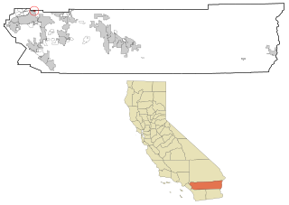
Eastvale is a city located in northwestern Riverside County, California, the Inland Empire region of Southern California. The area transitioned from a dairy farm enclave to a developed community starting in the 1990s and was formally incorporated on October 1, 2010. As of the 2010 census it had a population of 53,901 and in 2019 the population was estimated at 64,147. The city's name is derived from "East Vale" as a listed school district in 1893 by the Riverside County Board of Commissioners.

California's 31st State Senate district is one of 40 California State Senate districts. It is currently represented by Democrat Richard Roth of Riverside.
Mountain Center is an unincorporated community and census-designated place in the San Jacinto Mountains, within western central Riverside County, California.

California's 60th State Assembly district is one of 80 California State Assembly districts. It is currently represented by Democrat Sabrina Cervantes of Riverside.

California's 61st State Assembly district is one of 80 California State Assembly districts. It is currently represented by Democrat Jose Medina of Riverside.

Corral de Tierra is an unincorporated community in Monterey County, California. It is located in the Corral de Tierra Valley, on the former land grant of Corral de Tierra, at an elevation of 404 feet.

Riverside County is a county located in the southern portion of the U.S. state of California. As of the 2010 census, the population was 2,189,641, making it the fourth-most populous county in California and the 10th-most populous in the United States. The name was derived from the city of Riverside, which is the county seat.

Jurupa Valley is a city in Riverside County, California. On March 8, 2011, voters approved a ballot measure, designated as Measure A, to incorporate the area into its own city; as a result, the area has been an incorporated city since July 1, 2011. The identity of the city previously containing Jurupa Valley is not recorded.

Crestmore Heights is a census-designated place in Riverside County, California. Crestmore Heights sits at an elevation of 1,033 feet (315 m). The 2010 United States census reported Crestmore Heights's population was 384.
Mead Valley is a census-designated place in Riverside County, California. Mead Valley sits at an elevation of 1,663 feet (507 m). The 2010 United States census reported Mead Valley's population was 18,510.
Richard Dale Roth is an American politician currently serving in the California State Senate. A Democrat, he represents the 31st Senate District, encompassing northwestern Riverside County, including the cities of Corona, Eastvale, Jurupa Valley, Moreno Valley, Norco, Perris, and Riverside.


