Radec, California

Last updated
Radec
Populated place
First settled1883
Founded bySamuel V. Tripp
Named for "Cedar" spelled backwards
Elevation
520 m (1,706 ft)
Time zone UTC-8 (PST)
  Summer (DST) UTC-7 (PDT)
Zip code
92536
Area code(s) 951
FIPS code 06-59150
GNIS feature ID 252960

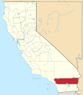
Radec is a small unincorporated community in Riverside County, California, United States. Located roughly 15 miles east by southeast of the city of Temecula, the community of Radec ('Cedar' spelled backwards) is located along Highway 79. Having bought land in the area in 1883, early settler Samuel Tripp set up a post office there. [1] As of 1893–4, a local directory listed the area as growing honey, hay and stock, but also as having "no commercial interest of any kind." A total of 14 people, mainly farmers and beekeepers, plus a laborer and Tripp, are listed in the directory. [2] The County of Riverside owns a small, non-operational cemetery in Radec. [3]
See also

Related Research Articles

Santa Rosa Mountains (California)

The Santa Rosa Mountains are a short mountain range in the Peninsular Ranges system, located east of the Los Angeles Basin and northeast of the San Diego metropolitan area of southern California, in the southwestern United States.

Aguanga, California census-designated place in California, United States

Aguanga is a census-designated place located within the Inland Empire, Riverside County, California. It is located about 18 miles (29 km) east of Temecula and 22 miles (35 km) south-southeast of Hemet. Aguanga lies at an elevation of 1955 feet. As of the 2010 census, it had a population of 1,128.

Lake Hemet

Lake Hemet is a water storage reservoir located in the San Jacinto Mountains in Mountain Center, Riverside County, California, with a capacity of 14,000 acre feet (17,000,000 m3) of water. It was created in 1895 with the construction of the Hemet Dam, and is owned and operated by the Lake Hemet Municipal Water District (LHMWD).

The Temecula massacre took place in December 1846 east of present-day Temecula, California, United States. It was part of a series of related events in the Mexican–American War. A combined force of California militia and Cahuilla Indians attacked and killed an estimated 33 to 40 Luiseño Indians. The Mexicans took the military action in retaliation for the Indians' killing 11 Californio lancers, in what was called the Pauma Massacre.

Skinner Reservoir, also known as Lake Skinner, is a reservoir in western Riverside County, California, located at the foot of Bachelor Mountain in the Auld Valley, approximately 10 miles (16 km) northeast of Temecula. It was created in 1973 by the construction of the Skinner Clearwell Dam on Tucalota Creek, and currently has a capacity of 44,200 acre feet (54,500,000 m3). Located just off Rancho California Road, The address of the reservoir is: 37701 Warren Road, Temecula, CA 92592.

Rancho Jurupa was a 40,569-acre (164.18 km2) Mexican land grant in California, United States, that is divided by the present-day counties of Riverside and San Bernardino. The land was granted to Juan Bandini by Governor Juan B. Alvarado in 1838. Located along both banks of the Santa Ana River in southern California, the rancho included much of the land in the present day city of Jurupa Valley, as well as the downtown area in the city of Riverside.

Alvord Unified School District (AUSD) is a school district headquartered in Riverside, California, United States.

Temecula Creek, formerly known as the Temecula River, runs 32.6 miles (52.5 km) through southern Riverside County, California, United States, past the rural communities of the Temecula Valley along the State Route 79 corridor, such as Radec and Aguanga, and ending 0.5 miles (0.80 km) southeast of the city center of Temecula. The creek is filled with boulders and is typically dry and sandy. It is a relatively undeveloped coastal-draining watershed. Until the 1920s, water flowed in Temecula Creek year-round.

Cornelia White House building in California, United States

The Cornelia White House is a historic 1893 wooden residential structure located in downtown Palm Springs, California, and is one of the oldest surviving structures – of any kind – in the town.

Rancho Santa Rosa (Moreno)

Rancho Santa Rosa was a 47,815-acre (193.50 km2) Mexican land grant in present day Riverside County, California given in 1846 by Governor Pio Pico to Juan Moreno. At the time of the US patent, Rancho Santa Rosa was a part of San Diego County. Riverside County was created by the California Legislature in 1893 by taking land from both San Bernardino and San Diego Counties. The site is now registered as a California Historical Landmark.

Rancho Temecula was a 26,609-acre (107.68 km2) Mexican land grant in present-day Riverside County, California given on 14 December 1844 by Governor Manuel Micheltorena to Feliz Valdez. The grant extended south along the east bank Murrieta Creek to Temecula Creek and encompassed present-day Temecula, Murrieta and Murrieta Hot Springs. At the time of the US patent, Rancho Temecula was a part of San Diego County. Riverside County was created by the California Legislature in 1893 by taking land from both San Bernardino and San Diego Counties.

Riverside County, California County in California, United States

Riverside County is a county located in the southern portion of the U.S. state of California. As of the 2010 census, the population was 2,189,641, making it the fourth-most populous county in California and the 11th-most populous in the United States. The name was derived from the city of Riverside, which is the county seat.

Rancho Temescal (Serrano) human settlement in California, United States of America

Rancho Temescal was a Mexican land grant in present-day Temescal Valley in Riverside County, California, granted by Governor José María de Echeandía in 1828 to Leandro Serrano.

The Elsinore Trough is a graben rift valley in Riverside County, southern California. It is created by the Elsinore Fault Zone.

Willow Springs Station, was a changing station at Alamos or Willow Springs along the Second Division route of the Butterfield Overland Mail, in what is now Murrieta, in Riverside County, California. It was also known as Alamos, Clines's or Kline's, or Willows, was one of the later Butterfield Overland Mail stations, placed in 1859, between some of the original stations for changing teams and providing water between stops in hot dry areas. Willow Springs, also originally known as Alamos Springs was located west of the hills that line the east side of the Temecula Valley, on land of the Rancho Temecula, near Santa Gertrudis Creek on the low flood plain of Murrieta Creek, between Santa Gertrudis and Warm Springs Creek.

Butterfield Valley is a valley along the course of Temecula Creek, in Riverside County, California. Its lower end is now filled by Vail Lake. It heads at 33°27′39″N116°55′34″W and its mouth is at the site of the Vail Lake Dam at the head of the deep canyon Temecula Creek has cut through Oak Mountain to the Pauba Valley.

Oak Mountain is a mountain in the northern Peninsular Ranges System, in Riverside County, in southern California.

Pauba Valley is a valley along the course of Temecula Creek, in Riverside County, California.

Hamilton Creek is a tributary stream of Cahuilla Creek,, in Riverside County, California. Its mouth is found in the Anza Valley at an elevation of 3,865 feet / 1,178 meters. Its source is at 33°32′46″N116°34′36″W at an elevation of 4,800 feet on the southwest facing slope of Lookout Mountain in the Santa Rosa Mountains.

References

  1. Lech, Steve (2004). Along the Old Roads: A History of the Portion of Southern California that became Riverside County: 1772–1893. Steve Lech. pp. 148–9. OCLC   56035822.
  2. Bynon, A.A. (1893). History and Directory of Riverside County, 1893–4. Riverside, California: Riverside Daily Press. OCLC   26408357 , 26432388
  3. Hunneman, John (July 13, 2001). "Nothing backward about Radec". San Diego Union Tribune.

Coordinates: 33°27′51″N116°54′50″W / 33.4642°N 116.9139°W / 33.4642; -116.9139