Thousand Palms, California | |
---|---|
Coordinates: 33°49′01″N116°23′14″W / 33.81694°N 116.38722°W | |
Country | United States |
State | California |
County | Riverside |
Area | |
• Total | 23.636 sq mi (61.217 km2) |
• Land | 23.636 sq mi (61.217 km2) |
• Water | 0 sq mi (0 km2) 0% |
Elevation | 246 ft (75 m) |
Population | |
• Total | 7,967 |
• Density | 340/sq mi (130/km2) |
Time zone | UTC-8 (PST) |
• Summer (DST) | UTC-7 (PDT) |
ZIP code | 92276 |
Area codes | 442/760 |
FIPS code | 06-78596 |
GNIS feature IDs | 1656643, 2409313 |
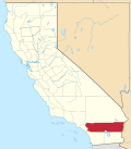
Thousand Palms is a census-designated place (CDP) in the Coachella Valley of Riverside County, California, United States. The population was 7,715 at the 2010 census, up from 5,120 at the 2000 census.
Thousand Palms is located at 33°49′01″N116°23′14″W / 33.816868°N 116.387143°W . [4] It borders the cities of Rancho Mirage and Palm Desert. According to the United States Census Bureau, the CDP has a total area of 23.6 square miles (61 km2), all of it land.
The Coachella Valley Preserve is a 20,000-acre large nature preserve consisting of several natural desert oases, aeolian sand dunes, and California fan palm tree groves. It is home to endangered wildlife such as the Coachella Valley fringe-toed lizard and other rare endemic species to the Sonoran Desert. [5] The oases with their springs and ponds were created as the lines of the San Andreas Fault allow for underground water to rise to the surface. It is home to 183 bird species, and also an endangered fish species, the Desert pupfish. [6] The preserve has over 25 miles of hiking trails and has been inhabited for centuries by Native Americans. The preserve was also a popular stagecoach stop between Los Angeles and the gold mines along the Colorado River. [7]
This area was previously known as 100 Palm Spring, as seen on 1874 maps and an official Land Office map dating to 1891. The post office was established in 1915, and the area was named Edom, California after the ancient Asian nation. However, in 1919, a residents petition was carried out and the name was changed to Thousand Palms. [8]
The location had a post office called Edom in 1913. The post office was moved in 1938 and then renamed "Thousand Palms" in 1939. [9]
The Coachella Valley Firebirds of the American Hockey League, an affiliate of the Seattle Kraken of the National Hockey League, play their home games at Acrisure Arena located on Varner Road.
At the 2010 census Thousand Palms had a population of 7,715. The population density was 326.4 inhabitants per square mile (126.0/km2). The racial makeup of Thousand Palms was 5,763 (74.7%) White, 105 (1.4%) African American, 75 (1.0%) Native American, 129 (1.7%) Asian, 10 (0.1%) Pacific Islander, 1,422 (18.4%) from other races, and 211 (2.7%) from two or more races. Hispanic or Latino of any race were 4,051 persons (52.5%). [10]
The census reported that 7,685 people (99.6% of the population) lived in households, 30 (0.4%) lived in non-institutionalized group quarters, and no one was institutionalized.
There were 2,849 households, 817 (28.7%) had children under the age of 18 living in them, 1,431 (50.2%) were opposite-sex married couples living together, 314 (11.0%) had a female householder with no husband present, 151 (5.3%) had a male householder with no wife present. There were 165 (5.8%) unmarried opposite-sex partnerships, and 45 (1.6%) same-sex married couples or partnerships. 727 households (25.5%) were one person and 465 (16.3%) had someone living alone who was 65 or older. The average household size was 2.70. There were 1,896 families (66.5% of households); the average family size was 3.26.
The age distribution was 1,754 people (22.7%) under the age of 18, 636 people (8.2%) aged 18 to 24, 1,629 people (21.1%) aged 25 to 44, 1,771 people (23.0%) aged 45 to 64, and 1,925 people (25.0%) who were 65 or older. The median age was 43.3 years. For every 100 females, there were 100.2 males. For every 100 females age 18 and over, there were 96.5 males.
There were 3,705 housing units at an average density of 156.8 per square mile, of the occupied units 2,227 (78.2%) were owner-occupied and 622 (21.8%) were rented. The homeowner vacancy rate was 4.4%; the rental vacancy rate was 11.9%. 5,591 people (72.5% of the population) lived in owner-occupied housing units and 2,094 people (27.1%) lived in rental housing units.
At the 2000 census there were 5,120 people, 1,912 households, and 1,260 families in the CDP. The population density was 1,279.7 inhabitants per square mile (494.1/km2). There were 2,557 housing units at an average density of 639.1 per square mile (246.8/km2). The racial makeup of the CDP was 74.8% White, 0.7% Black, 0.9% Native American, 0.7% Asian, 0.3% Pacific Islander, 19.4% from other races, and 3.2% from two or more races. Hispanic or Latino of any race were 43.6%. [11]
Of the 1,912 households 28.2% had children under the age of 18 living with them, 51.7% were married couples living together, 9.3% had a female householder with no husband present, and 34.1% were non-families. 26.5% of households were one person and 17.0% were one person aged 65 or older. The average household size was 2.7 and the average family size was 3.3.
The age distribution was 25.6% under the age of 18, 7.1% from 18 to 24, 25.1% from 25 to 44, 19.1% from 45 to 64, and 23.0% 65 or older. The median age was 39 years. For every 100 females, there were 100.2 males. For every 100 females age 18 and over, there were 97.8 males.
The median household income was $34,172 and the median family income was $37,500. Males had a median income of $33,325 versus $25,543 for females. The per capita income for the CDP was $16,790. About 9.4% of families and 12.8% of the population were below the poverty line, including 17.0% of those under age 18 and 7.1% of those age 65 or over.
In the Riverside County Board of Supervisors, Thousand Palms is in 4th District, Represented by Democrat V. Manuel Perez Supervisor of the 4th District [12]
In the California State Legislature, Thousand Palms is in the 19th Senate District , represented by Democrat Monique Limón, and in the 47th Assembly District , represented by Republican Greg Wallis. [13]
In the United States House of Representatives, Thousand Palms is in California's 25th congressional district , represented by Democrat Raul Ruiz. [14]
Electricity in Thousand Palms is served by the Imperial Irrigation District.
Desert Hills is an unincorporated community and census-designated place (CDP) in Mohave County, Arizona, United States. The population was 2,764 at the 2020 census, up from 2,245 at the 2010 census.
Desert Shores is a census-designated place (CDP) in Imperial County, California, US. It is part of the El Centro Metropolitan Statistical Area.
Heber is a census-designated place (CDP) in Imperial County, California. Heber is located 4.5 miles (7 km) north-northwest of Calexico. The population was 4,275 at the 2010 census, up from 2,566 in 2000.
Ocotillo is a census-designated place (CDP) in Imperial County, California. Ocotillo is located 26 miles (42 km) west of El Centro, The population was 215 at the 2020 census, down from 266 at the 2010 census and 296 at the 2000 census. It is part of the El Centro, California Metropolitan Statistical Area.
Salton City is a census-designated place (CDP) in Imperial County, California. It is the largest Imperial County development on the Salton Sea coast. It is part of the El Centro, California Metropolitan Statistical Area. The population was 3,763 at the 2010 census, up from 978 in 2000. The reported population for 2020 was 5,155.
Desert View Highlands is a census-designated place (CDP) in Los Angeles County, California, United States. The population was 2,360 at the 2010 census, up from 2,337 at the 2000 census. It is surrounded by the City of Palmdale.
Spring Garden is a census-designated place (CDP) in Plumas County, California, United States. The population was 16 at the 2010 census, down from 55 at the 2000 census.
Bermuda Dunes is a census-designated place (CDP) in Riverside County, California. The population was 7,282 at the 2010 census. Situated approximately 19 miles (31 km) east of Palm Springs, Bermuda Dunes is located in the mid-valley area of the Coachella Valley, between the cities of Palm Desert, La Quinta, and Indio.
Coachella is a city in Riverside County, California, United States. It is the namesake and easternmost city of the Coachella Valley, in Southern California's Colorado Desert. Originally a railroad town, Coachella is a prominent hub for agriculture and shipping across Southern California and the Western United States.
Mecca is an unincorporated community located in Riverside County, California, United States. The desert community lies on the north shore of the Salton Sea in the Eastern Coachella Valley and is surrounded by agricultural land.
Palm Desert is a city in the Coachella Valley region of eastern Riverside County, California. The city is located in the Colorado Desert arm of the Sonoran Desert, about 14 miles (23 km) east of Palm Springs, 121 miles (195 km) northeast of San Diego and 122 miles (196 km) east of Los Angeles. The population was 51,163 at the 2020 census, and the city has been one of the state's fastest-growing since 1980, when its population was 11,801.
Joshua Tree is a census-designated place (CDP) in San Bernardino County, California, United States. The population was 7,414 at the 2010 census. At approximately 2,700 feet above sea level, Joshua Tree and its surrounding communities are located in the High Desert of California. The center of the business district in Joshua Tree is on California State Route 62.
Lenwood is a census-designated place (CDP) in the Mojave Desert near Barstow, in San Bernardino County, California.
Morongo Valley is a census-designated place (CDP) on State Route 62 in San Bernardino County, California, United States. The population was 3,552 at the 2010 census, up from 1,929 at the 2000 census. The town is bordered by Yucca Valley, California.
Mountain View Acres is a census-designated place (CDP) in the Victor Valley of the Mojave Desert, within San Bernardino County, California.
Jamestown is a unincorporated community in Tuolumne County, California, United States. Formerly a California Gold Rush town, Jamestown was designated a California Historical Landmark on March 16, 1949. It is the home of Railtown 1897 State Historic Park and the Sierra Railway, which operates steam passenger trains. For statistical purposes, the United States Census Bureau has defined the community as a census-designated place (CDP). The population was 3,433 at the 2010 census, up from 3,017 at the 2000 census.
Salton Sea Beach is a census-designated place (CDP) in Imperial County, California, located 2.5 miles (4 km) southeast of Desert Shores. The population was 508 at the 2020 census, up from 422 at the 2010 census, up from 392 at the 2000 census. It is part of the El Centro, California Metropolitan Statistical Area. It was the location of the Naval Auxiliary Air Station Salton Sea.
Twentynine Palms is a city in San Bernardino County, California. It serves as one of the entry points to Joshua Tree National Park.
Thermal is an unincorporated community within the Coachella Valley in Riverside County, California, United States, located approximately 25 miles (40 km) southeast of Palm Springs and about 9.5 miles (15.3 km) north of the Salton Sea. The community's elevation is 138 feet (42 m) below mean sea level. It is served by area codes 760 and 442 and is in ZIP Code 92274. The population was 2,865 at the 2010 census. For statistical purposes, the United States Census Bureau has defined Thermal a census-designated place (CDP), which does not precisely correspond to the historical community.
Desert Palms is a census-designated place in the Coachella Valley of eastern Riverside County, southern California. A gated 55+ senior living community, Sun City Palm Desert, comprises the majority of the included area.