Lakeland Village, California

Last updated

Lakeland Village
Rainy Day in Lakeland Village, California.jpg
Lakeland Village neighborhood, with Lake Elsinore in the background
Riverside County California Incorporated and Unincorporated areas Lakeland Village Highlighted.svg
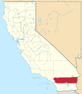
Location in Riverside County and the state of California
Usa edcp location map.svg
Red pog.svg
Lakeland Village
Location in the United States
Coordinates: 33°38′19″N117°20′38″W / 33.63861°N 117.34389°W / 33.63861; -117.34389 [1]
Country United States
State California
County Riverside
Area
[2]
  Total8.739 sq mi (22.633 km2)
  Land8.676 sq mi (22.471 km2)
  Water0.063 sq mi (0.162 km2)  0.72%
Elevation
[1]
1,283 ft (391 m)
Population
 (2020) [3]
  Total12,364
  Density1,425/sq mi (550/km2)
Time zone UTC-8 (PST)
  Summer (DST) UTC-7 (PDT)
ZIP code
92530
Area code 951
FIPS code 06-39598
GNIS feature ID 1660880

Lakeland Village is a census-designated place (CDP) in Riverside County, California, United States. The population was 11,541 at the 2010 census, more than double the 5,626 reported at the 2000 census.

Contents

Geography

According to the United States Census Bureau, the CDP has a total area of 8.7 square miles (23 km2), of which, 8.7 square miles (23 km2) of it is land and 0.06 square miles (0.16 km2) of it (0.72%) is water. It is next to the city of Lake Elsinore. Rome Hill is a 1,444 feet/440 meters hill near the southwest part of Lake Elsinore.

Demographics

Historical population
CensusPop.Note
U.S. Decennial Census [4]

2010

At the 2010 census Lakeland Village had a population of 11,541. The population density was 1,320.7 inhabitants per square mile (509.9/km2). The racial makeup of Lakeland Village was 7,764 (67.3%) White, 285 (2.5%) African American, 131 (1.1%) Native American, 168 (1.5%) Asian, 21 (0.2%) Pacific Islander, 2,575 (22.3%) from other races, and 597 (5.2%) from two or more races. Hispanic or Latino of any race were 5,114 persons (44.3%). [5]

The census reported that 11,403 people (98.8% of the population) lived in households, 4 (0%) lived in non-institutionalized group quarters, and 134 (1.2%) were institutionalized.

There were 3,538 households, 1,547 (43.7%) had children under the age of 18 living in them, 1,815 (51.3%) were opposite-sex married couples living together, 538 (15.2%) had a female householder with no husband present, 281 (7.9%) had a male householder with no wife present. There were 343 (9.7%) unmarried opposite-sex partnerships, and 24 (0.7%) same-sex married couples or partnerships. 623 households (17.6%) were one person and 180 (5.1%) had someone living alone who was 65 or older. The average household size was 3.22. There were 2,634 families (74.4% of households); the average family size was 3.62.

The age distribution was 3,267 people (28.3%) under the age of 18, 1,216 people (10.5%) aged 18 to 24, 3,070 people (26.6%) aged 25 to 44, 3,076 people (26.7%) aged 45 to 64, and 912 people (7.9%) who were 65 or older. The median age was 33.0 years. For every 100 females, there were 103.3 males. For every 100 females age 18 and over, there were 103.3 males.

There were 3,967 housing units at an average density of 454.0 per square mile, of the occupied units 2,284 (64.6%) were owner-occupied and 1,254 (35.4%) were rented. The homeowner vacancy rate was 3.8%; the rental vacancy rate was 9.3%. 7,152 people (62.0% of the population) lived in owner-occupied housing units and 4,251 people (36.8%) lived in rental housing units.

2000

At the 2000 census there were 5,626 people, 1,966 households, and 1,338 families in the CDP. The population density was 2,439.8 inhabitants per square mile (942.0/km2). There were 2,185 housing units at an average density of 947.6 per square mile (365.9/km2). The racial makeup of the CDP was 79.0% White, 1.8% African American, 1.6% Native American, 1.0% Asian, 0.1% Pacific Islander, 12.7% from other races, and 3.8% from two or more races. Hispanic or Latino of any race were 31.0%. [6]

Lakeland Village School Lakeland Village School, Elsinore Mountains from Rome Hill.jpg
Lakeland Village School

Of the 1,966 households 38.6% had children under the age of 18 living with them, 49.9% were married couples living together, 11.8% had a female householder with no husband present, and 31.9% were non-families. 23.8% of households were one person and 7.6% were one person aged 65 or older. The average household size was 2.9 and the average family size was 3.4.

The age distribution was 30.9% under the age of 18, 8.6% from 18 to 24, 31.4% from 25 to 44, 20.0% from 45 to 64, and 9.1% 65 or older. The median age was 33 years. For every 100 females, there were 103.3 males. For every 100 females age 18 and over, there were 102.2 males.

The median household income was $34,136 and the median family income was $36,528. Males had a median income of $31,634 versus $26,356 for females. The per capita income for the CDP was $14,922. About 14.3% of families and 16.5% of the population were below the poverty line, including 19.2% of those under age 18 and 10.8% of those age 65 or over.

Government

In the California State Legislature, Lakeland Village is in the 28th Senate District , represented by Democrat Lola Smallwood-Cuevas, and in the 67th Assembly District , represented by Democrat Sharon Quirk-Silva. [7]

In the United States House of Representatives, Lakeland Village is in California's 42nd congressional district , represented by Democrat Robert Garcia. [8]

Education

It is in the Lake Elsinore Unified School District. [9]

Related Research Articles

<span class="mw-page-title-main">Mayflower Village, California</span> Census-designated place in California, United States

Mayflower Village is a census-designated place (CDP) in the San Gabriel Valley, in Los Angeles County, California, United States. The population was 5,515 at the 2010 census, up from 5,081 at the 2000 census. The ZIP Codes serving the community are 91006, which is served by Arcadia and 91016, which is served by Monrovia.

Heritage Village is a census-designated place (CDP) in the town of Southbury in New Haven County, Connecticut, United States. The population was 3,736 at the 2010 census.

<span class="mw-page-title-main">Poquonock Bridge, Connecticut</span> Census-designated place in Connecticut, United States

Poquonock Bridge is a village and census-designated place (CDP) in the town of Groton in New London County, Connecticut, United States. The population was 1,686 at the 2020 census.

<span class="mw-page-title-main">Fussels Corner, Florida</span> Census-designated place in Florida, United States

Fussels Corner is a census-designated place (CDP) in Polk County, Florida, United States. The population was 5,313 at time of the 2000 census. It is part of the Lakeland–Winter Haven Metropolitan Statistical Area.

<span class="mw-page-title-main">Gibsonia, Florida</span> Unincorporated community in Florida, United States

Gibsonia is a former census-designated place (CDP) in Polk County, Florida, United States. The population was 4,507 at the 2000 census. Most of the community's core is now part of neighboring Lakeland. It is part of the Lakeland–Winter Haven Metropolitan Statistical Area.

<span class="mw-page-title-main">Jan Phyl Village, Florida</span> Census-designated place in Florida, United States

Jan Phyl Village is a census-designated place (CDP) in Polk County, Florida, United States. The population was 5,633 at the 2000 census. It is part of the Lakeland–Winter Haven Metropolitan Statistical Area.

<span class="mw-page-title-main">Kathleen, Florida</span> Census-designated place in Florida, United States

Kathleen is a census-designated place (CDP) in Polk County, Florida, United States. The population was 3,280 at the 2000 census. It is part of the Lakeland–Winter Haven Metropolitan Statistical Area.

<span class="mw-page-title-main">Lakeland Highlands, Florida</span> Census-designated place in Florida, United States

Lakeland Highlands is an unincorporated community and census-designated place (CDP) in Polk County, Florida, United States. The population was 11,056 at the 2010 census. It is part of the Lakeland–Winter Haven Metropolitan Statistical Area. It is an affluent residential community located south of the Lakeland city limits, and north of the Mulberry city limits. Lakeland Highlands neighbors Medulla, and together the two communities make up much of what is known as South Lakeland (unincorporated).

<span class="mw-page-title-main">Medulla, Florida</span> Census-designated place in Florida, United States

Medulla is an unincorporated community and census-designated place (CDP) in western Polk County, Florida, United States. It is part of the Lakeland–Winter Haven Metropolitan Statistical Area. Medulla is an affluent residential community located south of the Lakeland city limits, and north of the Mulberry city limits. Medulla neighbors Lakeland Highlands, and together the two communities make up much of what is known as south (unincorporated) Lakeland. The population was 8,892 at the 2010 census. The area is addressed to Lakeland, with zip codes 33811 and 33813.

<span class="mw-page-title-main">Waverly, Florida</span> Census-designated place in Florida, United States

Waverly is a census-designated place (CDP) in east-central Polk County, Florida, United States. The population was 1,927 at the 2000 census. It is part of the Lakeland–Winter Haven Metropolitan Statistical Area.

<span class="mw-page-title-main">Glasgow Village, Missouri</span> Place in Missouri, United States

Glasgow Village is an unincorporated community and census-designated place (CDP) in St. Louis County, Missouri, United States. The population was 5,429 at the 2010 census.

<span class="mw-page-title-main">Crestwood Village, New Jersey</span> CDP in Ocean County, New Jersey, US

Crestwood Village is an unincorporated community and census-designated place (CDP) located within Manchester Township, in Ocean County, in the U.S. state of New Jersey. As of the 2010 United States Census, the CDP's population was 7,907.

<span class="mw-page-title-main">Leisure Village, New Jersey</span> Populated place in Ocean County, New Jersey, US

Leisure Village is an unincorporated community and census-designated place (CDP) located within Lakewood Township, in Ocean County, in the U.S. state of New Jersey. As of the 2010 United States Census, the CDP's population was 4,400. The sprawling active adult community is also locally known as "Original" Leisure Village because it was the first of three neighboring active adult communities bearing similar names. Leisure Village East, and Leisure Village West are the other two communities nearby. Original Leisure Village (OLV) is also referred to by the moniker "The Village of Seven Lakes."

<span class="mw-page-title-main">Leisure Village East, New Jersey</span> Populated place in Ocean County, New Jersey, US

Leisure Village East is an unincorporated community and census-designated place (CDP) located within Lakewood Township, in Ocean County, in the U.S. state of New Jersey. As of the 2010 United States Census, the CDP's population was 4,217. Leisure Village East is one of several active adult communities bearing similar names. Leisure Village and Leisure Village West are the other two communities nearby.

<span class="mw-page-title-main">Lakeland North, Washington</span> Census-designated place in Washington, United States

Lakeland North is a census-designated place (CDP) in King County, Washington, United States. The population was 13,663 at the 2020 census. Part of the community was annexed into neighboring Auburn in 2008.

<span class="mw-page-title-main">Lakeland South, Washington</span> Census-designated place in Washington, United States

Lakeland South is a census-designated place (CDP) in King County, Washington, United States. The population was 13,169 at the 2020 census.

<span class="mw-page-title-main">Loveland Park, Ohio</span> Census-designated place in Ohio, United States

Loveland Park is a census-designated place (CDP) located in Symmes Township, Hamilton County and Deerfield Township, Warren County, in the southwestern part of the U.S. state of Ohio. The CDP is named after the city of Loveland. The population was 1,737 at the 2020 census.

<span class="mw-page-title-main">Eastchester (CDP), New York</span> CDP in New York, United States

Eastchester is a census-designated place (CDP) in Westchester County, New York, United States. The population was 19,554 at the 2010 census. The Eastchester CDP consists of the Town of Eastchester excluding the villages of Bronxville and Tuckahoe.

<span class="mw-page-title-main">Windsor, Wisconsin</span> Village in Wisconsin, United States

Windsor is a village and former town in Dane County, Wisconsin. The population was 8,754 at the time of the 2020 census. The communities of Lake Windsor, Morrisonville, and Token Creek are located within the village. Windsor voted to incorporate as a village on November 3, 2015; prior to its incorporation, it was a town, and a portion of the town was a census-designated place. Windsor is a part of the Census Bureau's Madison metropolitan statistical area.

<span class="mw-page-title-main">Warm Springs, California</span> Census-designated place in California, United States

Warm Springs is a census-designated place in Riverside County, California. Warm Springs sits at an elevation of 1,365 feet (416 m). The 2010 United States census reported Warm Springs's population was 2,676.

References

  1. 1 2 "Lakeland Village". Geographic Names Information System . United States Geological Survey, United States Department of the Interior . Retrieved November 11, 2014.
  2. "2010 Census U.S. Gazetteer Files – Places – California". United States Census Bureau.
  3. "Lakeland Village CDP, California". United States Census Bureau. Retrieved November 13, 2021.
  4. "Census of Population and Housing". Census.gov. Retrieved June 4, 2016.
  5. "2010 Census Interactive Population Search: CA - Lakeland Village CDP". U.S. Census Bureau. Archived from the original on July 15, 2014. Retrieved July 12, 2014.
  6. "U.S. Census website". United States Census Bureau . Retrieved January 31, 2008.
  7. "Statewide Database". UC Regents. Archived from the original on February 1, 2015. Retrieved December 8, 2014.
  8. "California's 42nd Congressional District - Representatives & District Map". Civic Impulse, LLC.
  9. "2020 CENSUS - SCHOOL DISTRICT REFERENCE MAP: Riverside County, CA" (PDF). U.S. Census Bureau. p. 2 (PDF p. 3/6). Retrieved October 4, 2024. - Text list