Lakeview, California

Last updated
Lakeview
Riverside County California Incorporated and Unincorporated areas Lakeview Highlighted.svg
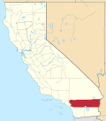
Location in Riverside County and the state of California
Usa edcp location map.svg
Red pog.svg
Lakeview
Location in the United States
Coordinates: 33°50′19″N117°07′05″W / 33.83861°N 117.11806°W / 33.83861; -117.11806 Coordinates: 33°50′19″N117°07′05″W / 33.83861°N 117.11806°W / 33.83861; -117.11806 [1]
Country United States
State California
County Riverside
Area
[2]
  Total3.260 sq mi (8.443 km2)
  Land3.260 sq mi (8.443 km2)
  Water0 sq mi (0 km2)  0%
Elevation
[1]
1,450 ft (442 m)
Population
 (2010)
  Total2,104
  Density650/sq mi (250/km2)
Time zone UTC-8 (PST)
  Summer (DST) UTC-7 (PDT)
ZIP code
92567
Area code(s) 951
FIPS code 06-39836
GNIS feature ID 1652740

Lakeview is a census-designated place (CDP) in Riverside County, California, United States. The population was 2,104 at the 2010 census, up from 1,619 at the 2000 census. The community is named for nearby Mystic Lake.

Contents

Geography

According to the United States Census Bureau, the CDP has a total area of 3.3 square miles (8.5 km2), all of it land.

Demographics

Historical population
CensusPop.
U.S. Decennial Census [3]

2010

At the 2010 census Lakeview had a population of 2,104. The population density was 645.4 inhabitants per square mile (249.2/km2). The racial makeup of Lakeview was 1,117 (53.1%) White, 15 (0.7%) African American, 48 (2.3%) Native American, 7 (0.3%) Asian, 2 (0.1%) Pacific Islander, 842 (40.0%) from other races, and 73 (3.5%) from two or more races. Hispanic or Latino of any race were 1,350 persons (64.2%). [4]

The census reported that 2,089 people (99.3% of the population) lived in households, 15 (0.7%) lived in non-institutionalized group quarters, and no one was institutionalized.

There were 538 households, 285 (53.0%) had children under the age of 18 living in them, 347 (64.5%) were opposite-sex married couples living together, 63 (11.7%) had a female householder with no husband present, 40 (7.4%) had a male householder with no wife present. There were 31 (5.8%) unmarried opposite-sex partnerships, and 4 (0.7%) same-sex married couples or partnerships. 67 households (12.5%) were one person and 31 (5.8%) had someone living alone who was 65 or older. The average household size was 3.88. There were 450 families (83.6% of households); the average family size was 4.12.

The age distribution was 681 people (32.4%) under the age of 18, 220 people (10.5%) aged 18 to 24, 523 people (24.9%) aged 25 to 44, 494 people (23.5%) aged 45 to 64, and 186 people (8.8%) who were 65 or older. The median age was 30.9 years. For every 100 females, there were 98.1 males. For every 100 females age 18 and over, there were 103.3 males.

There were 599 housing units at an average density of 183.8 per square mile, of the occupied units 390 (72.5%) were owner-occupied and 148 (27.5%) were rented. The homeowner vacancy rate was 1.0%; the rental vacancy rate was 4.5%. 1,475 people (70.1% of the population) lived in owner-occupied housing units and 614 people (29.2%) lived in rental housing units.

2000

At the 2000 census there were 1,619 people, 476 households, and 392 families in the CDP. The population density was 499.8 inhabitants per square mile (193.0/km2). There were 528 housing units at an average density of 163.0 per square mile (62.9/km2). The racial makeup of the CDP was 67.5% White, 0.9% African American, 2.7% Native American, 0.4% Asian, 0.1% Pacific Islander, 23.4% from other races, and 5.1% from two or more races. Hispanic or Latino of any race were 43.7%. [5]

Of the 476 households 40.3% had children under the age of 18 living with them, 65.1% were married couples living together, 10.7% had a female householder with no husband present, and 17.6% were non-families. 12.6% of households were one person and 4.2% were one person aged 65 or older. The average household size was 3.4 and the average family size was 3.7.

The age distribution was 32.7% under the age of 18, 8.2% from 18 to 24, 27.7% from 25 to 44, 21.7% from 45 to 64, and 9.6% 65 or older. The median age was 33 years. For every 100 females, there were 102.9 males. For every 100 females age 18 and over, there were 97.5 males

The median household income was $46,141, the median family income was $46,941. Males had a median income of $39,355 versus $27,813 for females. The per capita income for the CDP was $13,591. About 12.4% of families and 16.9% of the population were below the poverty line, including 21.1% of those under age 18 and 16.8% of those age 65 or over.

Government

In the California State Legislature, Lakeview is in the 23rd Senate District , represented by Republican Rosilicie Ochoa Bogh, and the 67th Assembly District , represented by Republican Kelly Seyarto. [6]

In the United States House of Representatives, Lakeview is in California's 42nd congressional district , represented by Republican Ken Calvert. [7]

Related Research Articles

Palermo, California Census-designated place in California, United States

Palermo is a census-designated place (CDP) in Butte County, California, United States. The population was 5,382 at the 2010 census, down from 5,720 at the 2000 census.

Cantua Creek, California Census-designated place in California, United States

Cantua Creek is a census-designated place (CDP) in Fresno County, California, United States. As of the 2010 census, the population was 466, down from the 655 reported at the 2000 census. Cantua Creek is located 11 miles (18 km) south-southwest of Tranquillity, at an elevation of 295 feet.

Humboldt Hill, California Census-designated place in Humboldt County, California, U.S.

Humboldt Hill is a census-designated place (CDP) in Humboldt County, California, United States. Humboldt Hill rises to an elevation of 636 feet (194 m). The population was 3,414 at the 2010 census, up from 3,246 at the 2000 census. The area is in the 95503 zip code and part of unincorporated Eureka.

Round Valley, California Census-designated place in California, United States

Round Valley is a census-designated place (CDP) in Inyo County, California, United States. Round Valley is located 7.5 miles (12 km) northeast of Mount Tom, at an elevation of 4692 feet. The population was 435 at the 2010 census, up from 278 at the 2000 census.

Dustin Acres, California Census-designated place in California, United States

Dustin Acres is a census-designated place (CDP) in Kern County, California, United States. Dustin Acres is located 6.5 miles (10 km) north-northeast of Taft, at an elevation of 384 feet (117 m). The population was 652 at the 2010 census, up from 585 at the 2000 census.

Lost Hills, California Census-designated place in California, United States

Lost Hills is a census-designated place (CDP) in Kern County, California, United States. Lost Hills is located 42 miles (68 km) west-northwest of Bakersfield, at an elevation of 305 feet (93 m). The population was 2,412 at the 2010 census, up from 1,938 at the 2000 census. About 75% of the population is engaged in agricultural positions.

North Lakeport, California Census-designated place in California, United States

North Lakeport is a census-designated place (CDP) in Lake County, California, United States. The population was 3,314 at the 2010 census, up from 2,879 at the 2000 census.

Citrus, California Census-designated place in California, United States

Citrus is a census-designated place (CDP) in Los Angeles County, California, United States. It is located in the San Gabriel Valley between Azusa to the north and west, Glendora to the east, and Covina to the south. Generally, this is referred to by locals as "unincorporated Covina" or "unincorporated Azusa". The population was 10,866 at the 2010 census, up from 10,581 at the 2000 census. Citrus is named after Citrus Avenue, which passes through the community.

Belden, California Census-designated place in California, United States

Belden is a census-designated place (CDP) in Plumas County, California, United States. Belden is located on the North Fork Feather River, 7 miles (11.3 km) southwest of Caribou. The population was 22 at the 2010 census, down from 26 in 2000.

Hamilton Branch, California Census-designated place in California, United States

Hamilton Branch is a census-designated place (CDP) in Plumas County, California, United States. The population was 587 at the 2000 census.

Lake Almanor Country Club, California Census-designated place in California, United States

Lake Almanor Country Club is a census-designated place (CDP) in Plumas County, California, United States. The population was 419 at the 2010 census, down from 847 at the 2000 census. The ZIP code for the CDP is 96137.

Prattville, California Census-designated place in California, United States

Prattville is a census-designated place (CDP) in Plumas County, California, United States. The population was 33 at the 2010 census, up from 28 at the 2000 census.

Tobin, California Census-designated place in California, United States

Tobin is a census-designated place (CDP) in Plumas County, California, United States. The population was 12 at the 2010 census, up from 11 at the 2000 census.

Camp Pendleton Mainside, California Census-designated place in California, United States

Camp Pendleton Mainside is a census-designated place (CDP) in San Diego County, California, located at the southeast corner of the Marine Corps Base Camp Pendleton. Per the 2020 census, the population was 9,683. It was formerly known as Camp Pendleton North, but its name was changed for the 2020 Census. Along with Camp Pendleton South, it is one of two CDPs located on the base.

Camp Pendleton South, California Census-designated place in California, United States

Camp Pendleton South is a census-designated place (CDP) in San Diego County, California, located at the southwest corner of the Marine Corps Base Camp Pendleton. The population was 10,616 at the 2010 census, up from 8,854 at the 2000 census. Much of the population are residents of Camp Pendleton barracks situated in the area, as well as housing communities for married Marine and Navy personnel and their families.

Highlands-Baywood Park, California Unincorporated community in California, United States

Highlands-Baywood Park is an unincorporated community in San Mateo County, California, United States. The population was 4,027 at the 2010 census.

Freedom, California Census-designated place in California, United States

Freedom is a census-designated place (CDP) in Santa Cruz County, California, United States. The population was 3,070 at the 2010 census.

Ivanhoe, California Census designated place in California, United States

Ivanhoe is a census-designated place (CDP) in Tulare County, California, United States. The population was 4,495 at the 2010 census, up from 4,474 at the 2000 census.

Lakeview, Georgia CDP in Georgia, United States

Lakeview is a census-designated place (CDP) in Catoosa and Walker counties in the U.S. state of Georgia. The population was 4,820 at the 2000 census and 4,777 at the 2020 census. It is part of the Chattanooga, TN–GA Metropolitan Statistical Area.

Stallion Springs, California Census-designated place in California, United States

Stallion Springs is a census-designated place (CDP) in the Tehachapi Mountains, in Kern County, California, USA. The population was 2,488 at the 2010 census, up from 1,522 at the 2000 census. Stallion Springs is located in the greater Tehachapi Area.

References

  1. 1 2 "Lakeview". Geographic Names Information System . United States Geological Survey . Retrieved November 11, 2014.
  2. "2010 Census U.S. Gazetteer Files – Places – California". United States Census Bureau.
  3. "Census of Population and Housing". Census.gov. Retrieved June 4, 2016.
  4. "2010 Census Interactive Population Search: CA - Lakeview CDP". U.S. Census Bureau. Archived from the original on July 15, 2014. Retrieved July 12, 2014.
  5. "U.S. Census website". United States Census Bureau . Retrieved 2008-01-31.
  6. "Statewide Database". Regents of the University of California. Archived from the original on February 1, 2015. Retrieved April 12, 2015.
  7. "California's 42nd Congressional District - Representatives & District Map". Civic Impulse, LLC.