Artesia, California

Last updated

Artesia, California
Artesia 20060708 01.JPG
Pioneer Boulevard in Artesia, California
Flag of Artesia, California.gif
Artesia california seal.jpg
Los Angeles County California Incorporated and Unincorporated areas Artesia Highlighted 0602896.svg
Location of Artesia in Los Angeles County, California.
USA California location map.svg
Red pog.svg
Artesia
Location in California
Usa edcp location map.svg
Red pog.svg
Artesia
Artesia (the United States)
North America laea location map.svg
Red pog.svg
Artesia
Artesia (North America)
Coordinates: 33°52′2″N118°4′50″W / 33.86722°N 118.08056°W / 33.86722; -118.08056
Country Flag of the United States.svg United States
State Flag of California.svg  California
County Los Angeles
Incorporated May 29, 1959 [1]
Named for the local artesian wells
Government
  Type council-manager government
   Mayor Tony Lima [2]
   Mayor Pro Tem Ali Sajjad Taj [2]
   City Council [2] Melissa Ramoso
Monica Manalo
Rene Trivino
   City Manager Aldo Schindler [2]
Area
[3]
  Total1.62 sq mi (4.20 km2)
  Land1.62 sq mi (4.20 km2)
  Water0.00 sq mi (0.00 km2)  0%
Elevation
[4]
52 ft (16 m)
Population
 (2020)
  Total16,395
  Density10,120.37/sq mi (3,906.37/km2)
Time zone UTC-8 (PST)
  Summer (DST) UTC-7 (PDT)
ZIP codes
90701
Area code 562
FIPS code 06-02896
GNIS feature IDs 1660272, 2409735
Website www.cityofartesia.us

Artesia (Spanish for "artesian aquifer") is a city in southeast Los Angeles County, California. Artesia was incorporated on May 29, 1959, and is one of Los Angeles County's Gateway Cities. The city has a 2010 census population of 16,522. Artesia is surrounded on the west, south, and east sides by Cerritos, with Norwalk to the north. Artesia is the home of the East West Ice Palace, an ice rink which is co-owned by Michelle Kwan. It was also the childhood home of former First Lady Pat Nixon, who lived there from 1914 to 1931, though the property on which she grew up is now part of neighboring Cerritos.

Contents

History

The village of Artesia was established upon the completion of the Artesia School District on May 3, 1875. It was named for the many flowing artesian wells in the area, which made the village ideal for farming and agriculture.

In the 1920s and 1930s, Dutch and Portuguese farmers developed Artesia into one of the most important dairy districts in Southern California. After World War II, as with many other cities in the region, Artesia was pressured by developers to build residential tracts. The city of Dairy Valley was incorporated in 1956, and later became the city of Cerritos. As the demand for housing continued, dairymen moved their operations further east into Chino and north into the Central Valley. Artesia finally incorporated on May 29, 1959.

Before Artesia was incorporated, some rural areas, like Hawaiian Gardens, were considered part of Artesia for mapping and postage purposes.

In 1993, the Artesia Historical Society was formed, with the mission of preserving and protecting the archives and historic sites of the city. In 2002, the Historical Society salvaged and restored one of the last remaining Spanish-styled homes in the city into a historical civic museum open to the public. [5]

Characteristics

Artesia water tower

Artesia Water Tower Artesia Water Tower - panoramio.jpg
Artesia Water Tower

One of the more familiar landmarks in the city is the Artesia water tower. Not much is known about its active past or when it was constructed. The City of Artesia is currently trying to have the tower declared as a Historical Landmark and is asking its citizens for historical information and photos of the tower.

The water tower can hold 50,000 gallons of water and was once owned by the Southern California Water Company before being sold to the City of Artesia in 1988. The tower was intended to be used only as a point of historical interest, and to provide a special identity to the community. Shortly after its purchase, the then green tower was quickly painted to its current color with the addition of the name Artesia painted on two sides.

It sits on top of an artesian well; built in 1911. However, no record of its construction can be found. Although it may have once been a smaller wooden tower, to qualify for historic designation in California, factual documentation must be presented.

The Artesia water tower was also featured in the motion picture Freddy's Dead: The Final Nightmare in 1991 and was known in the film as the Springwood water tower. [6]

It was also featured in season 1, episode 17, "Didn't Pay Taxes", of the television show My Name Is Earl , in March 2006. [7]

Cultural Shopping District

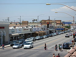
There are a large number of Indian-owned stores and restaurants along Pioneer Boulevard in Artesia. Despite this concentration of Indian-owned businesses, Asian Indians made up only 7.9% of the population of Artesia in the 2010 Census. [8]

Proposals have often been made to designate a portion of the city as "Little India" [9] (along the lines of Little Saigon in nearby Westminster and Garden Grove). Another proposal has been for a "Little India" sign at the Pioneer Boulevard exit off of the Artesia Freeway. Opposition, primarily from other ethnicities in the city, has so far balked such plans.

According to the Los Angeles Times article "Artesia Thinks the World of Itself," [10] four of five City Council members were outraged at Assemblyman Rudy Bermudez's attempt to make the designation without consulting the local council. The council members won a bill requiring local approval of proposed freeway sign designations. Mayor Larry Nelson said that Indian Americans constituted less than 1% of the city's population and that East Asian markets outnumber Indian ones 3 to 1. Thus, the name is the "International and Cultural Shopping District."

Geography

Artesia is located at 33°52′2″N118°4′50″W / 33.86722°N 118.08056°W / 33.86722; -118.08056 (33.867215, -118.080622). [11]

According to the United States Census Bureau, the city has a total area of 1.6 square miles (4.1 km2), all land.

Demographics

Historical population
CensusPop.Note
1950 3,223
1960 9,993210.1%
1970 14,75747.7%
1980 14,301−3.1%
1990 15,4648.1%
2000 16,3805.9%
2010 16,5220.9%
2020 16,395−0.8%
U.S. Decennial Census [12]

2010

At the 2010 census Artesia had a population of 16,522. The population density was 10,194.7 inhabitants per square mile (3,936.2/km2). The racial makeup of Artesia was 6,446 (39.0%) White (21.3% Non-Hispanic White), [13] 589 (3.6%) African American, 94 (0.6%) Native American, 6,131 (37.1%) Asian, 40 (0.2%) Pacific Islander, 2,630 (15.9%) from other races, and 592 (3.6%) from two or more races. Hispanic or Latino of any race were 5,910 persons (35.8%). [14]

The census reported that 15,909 people (96.3% of the population) lived in households, 69 (0.4%) lived in non-institutionalized group quarters, and 544 (3.3%) were institutionalized.

There were 4,535 households, 1,933 (42.6%) had children under the age of 18 living in them, 2,673 (58.9%) were opposite-sex married couples living together, 670 (14.8%) had a female householder with no husband present, 334 (7.4%) had a male householder with no wife present. There were 150 (3.3%) unmarried opposite-sex partnerships, and 30 (0.7%) same-sex married couples or partnerships. 661 households (14.6%) were one person and 306 (6.7%) had someone living alone who was 65 or older. The average household size was 3.51. There were 3,677 families (81.1% of households); the average family size was 3.80.

The age distribution was 3,719 people (22.5%) under the age of 18, 1,680 people (10.2%) aged 18 to 24, 4,421 people (26.8%) aged 25 to 44, 4,454 people (27.0%) aged 45 to 64, and 2,248 people (13.6%) who were 65 or older. The median age was 38.2 years. For every 100 females, there were 98.4 males. For every 100 females age 18 and over, there were 96.1 males.

There were 4,697 housing units at an average density of 2,898.2 per square mile, of the occupied units 2,523 (55.6%) were owner-occupied and 2,012 (44.4%) were rented. The homeowner vacancy rate was 0.7%; the rental vacancy rate was 3.7%. 8,930 people (54.0% of the population) lived in owner-occupied housing units and 6,979 people (42.2%) lived in rental housing units.

According to the 2010 United States Census, Artesia had a median household income of $59,845, with 13.5% of the population living below the federal poverty line. [13]

2000

At the 2000 census there were 16,380 people in 4,470 households, including 3,625 families, in the city. The population density was 10,126.1 inhabitants per square mile (3,909.7/km2). There were 4,598 housing units at an average density of 2,842.5 per square mile (1,097.5/km2). The racial makeup of the city was 44.18% White, 3.55% Black or African American, 0.78% Native American, 27.41% Asian, 0.54% Pacific Islander, 18.47% from other races, and 5.07% from two or more races. 38.29% of the population was Hispanic or Latino of any race. [15] Of the 4,470 households 40.7% had children under the age of 18 living with them, 60.4% were married couples living together, 14.1% had a female householder with no husband present, and 18.9% were non-families. 15.3% of households were one person and 6.7% were one person aged 65 or older. The average household size was 3.54 and the average family size was 3.87.

The age distribution was 27.2% under the age of 18, 10.1% from 18 to 24, 29.4% from 25 to 44, 21.0% from 45 to 64, and 12.4% 65 or older. The median age was 34 years. For every 100 females, there were 100.5 males. For every 100 females age 18 and over, there were 95.8 males.

The median income per household in the city was $44,500, and the median income per family was $47,017. Males had a median income of $34,447 versus $25,256 for females. The per capita income for the city was $15,763. About 8.7% of families and 11.5% of the population were below the poverty line, including 12.2% of those under age 18 and 7.4% of those age 65 or over.

Ancestry and ethnicity

Traditional Portuguese festival at Artesia, 1948 Florine Gonsalves at Portuguese festival in Artesia, California - 1948.jpg
Traditional Portuguese festival at Artesia, 1948

45.8% of the residents of Artesia are foreign-born, and 25.2% are not US citizens.

For Europeans, 9.4% of Artesia is of Portuguese ancestry, with 49.4% of those foreign-born. Dutch is the second most commonly reported European ancestry at 4.6%. [16]

27.4% of Artesia is of Asian ancestry. The most commonly reported ancestries are Filipino 10.4%, Chinese 5.1%, Indian 4.6%, and Korean 4.5%.

3.6% of Artesia is Black or African American. [8]

38.3% of Artesia is Hispanic or Latino, with most of those being of Mexican descent (32.4%). [8]

According to Mapping L.A., Mexican and Filipino were the most common ancestries in 2000. Mexico and the Philippines were the most common foreign places of birth. [17]

Government

Local Government

City Council

The City Council is composed of five members elected at large by the citizens of Artesia to serve for four-year overlapping terms. The City Council is responsible to the residents of Artesia for the implementation of all programs and services provided by the city. [18]

Current City Council Members [19]
PositionNameTerm Expiry
MayorTony Lima2024
Mayor Pro TemAli Sajjad Taj2026
CouncilmemberMonica Manalo2024
CouncilmemberRene Trevino2026
CouncilmemberMelissa Ramoso2026

City Council Meetings

The regular meetings of the Artesia City Council are held on the second Monday of each month beginning at 7:00 p.m. at Artesia City Hall, Council Chambers, 18747 Clarkdale Ave. Artesia, CA 90701. [19]

Commissions

There are four commissions serving the City of Artesia, composed of five individuals who serve voluntarily. Each member of the City Council appoints one person to each commission for a term of four years. [20]

Disaster Council

The Disaster Council is an advisory body to the City Council which provides policies and suggestions to the City Council to adopt for emergency circumstances like earthquakes, fires, flooding, or terrorist attack. [21]


State and Federal Representation

In the California State Legislature, Artesia is in the 36th Senate District , represented by Republican Janet Nguyen, and in the 67th Assembly District , represented by Democrat Sharon Quirk-Silva. [22]

In the United States House of Representatives, Artesia is in California's 45th congressional district , represented by Republican Michelle Steel. [23]

Education

Artesia residents are served by the ABC Unified School District.

Infrastructure

Fire protection in Artesia is provided by the Los Angeles County Fire Department [24] [25] with ambulance transport by Care Ambulance Service. [26]

The Los Angeles County Sheriff's Department operates the Lakewood Station in Lakewood, serving Artesia. [27]

The Los Angeles County Department of Health Services operates the Whittier Health Center in Whittier, serving Artesia. [28]

The United States Postal Service Artesia Post Office is located at 11721 183rd Street. [29]

Related Research Articles

<span class="mw-page-title-main">Bellflower, California</span> City in California, United States

Bellflower is a city located in southeast Los Angeles County, California, in the Los Angeles metropolitan area. It was founded in 1906 and incorporated on September 3, 1957. As of the 2020 census, the city had a total population of 79,190, up from 76,616 at the 2010 census. This made it the 65th most densely populated city in the United States, of cities over 50,000 residents.

<span class="mw-page-title-main">Cudahy, California</span> City in California, United States

Cudahy is a city located in southeastern Los Angeles County, California, United States. In area, Cudahy is the second smallest city in Los Angeles County after Hawaiian Gardens but with one of the highest population densities of any incorporated city in the United States. It is part of the Gateway Cities region and had a population of 23,805 as of the 2010 U.S. Census.

<span class="mw-page-title-main">Diamond Bar, California</span> City in California, United States

Diamond Bar is a city in eastern Los Angeles County, California, United States. At the 2010 census it had a population of 55,544, and in 2019 the population was estimated to be 55,720. It is named after the "diamond over a bar" branding iron registered in 1918 by ranch owner Frederic E. Lewis (1884–1963). The city features a public Los Angeles County golf course.

<span class="mw-page-title-main">Hawaiian Gardens, California</span> City in California, United States

Hawaiian Gardens is a city in Los Angeles County, California, United States. It is the smallest city in the county in area and was incorporated on April 9, 1964. The population was 14,149 at the 2020 census, down slightly from 14,254 at the 2010 census.

<span class="mw-page-title-main">La Habra Heights, California</span> City in California, United States

La Habra Heights is a city in Los Angeles County, California, United States. The population was 5,325 at the 2010 census, down from 5,712 at the 2000 census. La Habra Heights is a suburban canyon community located on the border of Orange and Los Angeles counties. The zoning is 1-acre (4,000 m2) lots with a variety of home and ranch style properties. La Habra Heights features open space and there are no sidewalks in the community. La Habra Heights has no commercial activity with few exception. Hacienda Park is the main park in the city and runs along Hacienda Road.

<span class="mw-page-title-main">La Mirada, California</span> City in California, United States

La Mirada is a city in southeast Los Angeles County, California United States, and is one of the Gateway Cities, on the border with Orange County. The population was 48,008 at the 2020 census. The La Mirada Theatre for the Performing Arts and the Splash! La Mirada Regional Aquatics Center are two of its major attractions. It is the home of Biola University, an evangelical Christian institution of higher education.

<span class="mw-page-title-main">Lawndale, California</span> City in California, United States

Lawndale is a city in Los Angeles County, California, United States. The population was 32,769 at the 2010 census, up from 31,712 according to the 2000 census. The city is in the South Bay region of the Greater Los Angeles Area.

<span class="mw-page-title-main">Lennox, California</span> Census-designated place in California, United States

Lennox is a census-designated place (CDP) in the South Bay region of Los Angeles County, California, United States. The population was 22,753 at the 2010 census, down from 22,950 at the 2000 census.

<span class="mw-page-title-main">Norwalk, California</span> City in California, United States

Norwalk is a city in Los Angeles County, California, United States. The population was 102,773 at the 2020 census.

<span class="mw-page-title-main">Paramount, California</span> City in California, United States

Paramount is a city in Los Angeles County, California, United States. According to the 2010 census, the city had a total population of 54,098, down from 55,266 at the 2000 census. Paramount is part of the Greater Los Angeles Area and is bordered by Compton and Lynwood to the west, South Gate and Downey to the north, Bellflower to the east and south, and Long Beach to the south.

<span class="mw-page-title-main">Quartz Hill, California</span> Census-designated place in California, United States

Quartz Hill is a census-designated place (CDP) in Los Angeles County, California, United States. The population was 10,912 at the 2010 census, up from 9,890 at the 2000 census. The name is also shared with the neighboring district areas of its border cities, Palmdale, and Lancaster. Quartz Hill was once home to the Quartz Hill Airport. According to the Greater Antelope Valley Economic Alliance report of 2009, the Palmdale / Lancaster urban area of which Quartz Hill is a part, has a population of 483,998.

<span class="mw-page-title-main">San Dimas, California</span> City in California, United States

San Dimas is a city in the San Gabriel Valley of Los Angeles County, California, United States. At the 2020 census, its population was 34,924. It historically took its name from San Dimas Canyon in the San Gabriel Mountains above the northern section of present-day San Dimas.

<span class="mw-page-title-main">South El Monte, California</span> City in California, United States

South El Monte is a city in the San Gabriel Valley, in Los Angeles County, California, United States. At the 2010 census, the city had a population of 20,116, down from 21,144 at the 2000 census.

<span class="mw-page-title-main">West Athens, California</span> Unincorporated community in California, United States

West Athens is a census-designated place (CDP) in Los Angeles County, California. The population was 9,393 at the 2020 census. It is an unincorporated community within the 2nd Supervisorial District of Los Angeles County. West Athens is served by the Los Angeles County Sheriff's Department, operating out of the South Los Angeles Station. The approximate boundaries for West Athens are: 87th Street to the north, Vermont Avenue to the east, El Segundo Boulevard to the south, and approximately Western Avenue to Van Ness Avenue to the west. West Athens is predominantly residential, with commercial uses along its main corridors. Los Angeles Southwest Community College lies within the West Athens neighborhood and city limits.

<span class="mw-page-title-main">West Carson, California</span> Unincorporated community in California, United States

West Carson is an unincorporated community in the South Bay region of Los Angeles County, California. The population was 22,870 at the 2020 census. For statistical purposes, the United States Census Bureau has defined West Carson as a census-designated place (CDP).

<span class="mw-page-title-main">West Rancho Dominguez, California</span> Unincorporated community in California, United States

West Rancho Dominguez, formerly known as West Compton and also known as East Gardena, is an unincorporated census-designated place (CDP) located in southern Los Angeles County, California. Per the 2020 census, the population was 24,347. The community lies to the west of the city of Compton. The ZIP Codes encompassing the CDP area are 90220 & 90248.

<span class="mw-page-title-main">Buena Park, California</span> City in California, United States

Buena Park is a city in northern Orange County, California, United States. As of the 2020 census its population was 84,034. It is the location of several tourist attractions, including Knott's Berry Farm. It is about 12 miles (20 km) northwest of downtown Santa Ana, the county seat, and is within the Los Angeles metropolitan area.

<span class="mw-page-title-main">Montclair, California</span> City in California, United States

Montclair is a city in the Pomona Valley, in southwestern San Bernardino County, California, 35 miles (56 km) east of downtown Los Angeles. The population was 37,865 in the 2020 United States Census.

<span class="mw-page-title-main">Lake Los Angeles, California</span> Census-designated place in California, United States

Lake Los Angeles is a census-designated place (CDP) in Los Angeles County, California, United States. The population was 12,328 at the 2010 census, up from 11,523 at the 2000 census. It is located 17 miles (27 km) east of Palmdale's Civic Center. According to the Greater Antelope Valley Economic Alliance report of 2009, the Palmdale / Lancaster urban area has a population of 483,998, of which Lake Los Angeles is a part.

<span class="mw-page-title-main">Lakewood, California</span> City in California, United States

Lakewood is a city in Los Angeles County, California, United States. The population was 82,496 at the 2020 census. It is bordered by Long Beach on the west, northwest and south, Bellflower on the north, Cerritos on the northeast, Cypress on the east, and Hawaiian Gardens on the southeast. Major thoroughfares include Lakewood, Bellflower, and Del Amo Boulevards and Carson and South Streets. The San Gabriel River Freeway (I-605) runs through the city's eastern regions.

References

  1. "California Cities by Incorporation Date". California Association of Local Agency Formation Commissions. Archived from the original (Word) on November 3, 2014. Retrieved August 25, 2014.
  2. 1 2 3 4 "City Council". Artesia, CA. Retrieved October 17, 2023.
  3. "2020 U.S. Gazetteer Files". United States Census Bureau. Retrieved October 30, 2021.
  4. "Artesia". Geographic Names Information System . United States Geological Survey, United States Department of the Interior . Retrieved October 11, 2014.
  5. Archived copy Archived July 2, 2007, at the Wayback Machine cityofartesia.us
  6. Archived copy Archived September 27, 2007, at the Wayback Machine cityofartesia.us
  7. Facebook Post [ user-generated source ]
  8. 1 2 3 Archived copy Archived 2020-02-12 at archive.today factfinder.census.gov
  9. Liu, Michael (2008). "Changing neighborhood: ethnic enclaves and the struggle for social justice". Social Justice. Archived from the original on July 15, 2012.
  10. Artesia Thinks the World of Itself Los Angeles Times. November 26, 2005
  11. "US Gazetteer files: 2010, 2000, and 1990". United States Census Bureau. February 12, 2011. Retrieved April 23, 2011.
  12. "Census of Population and Housing". Census.gov. Retrieved June 4, 2016.
  13. 1 2 "State & County QuickFacts – Artesia (city), California". United States Census Bureau. Archived from the original on May 18, 2012. Retrieved October 27, 2013.
  14. "2010 Census Interactive Population Search: CA - Artesia city". U.S. Census Bureau. Archived from the original on July 28, 2014. Retrieved July 12, 2014.
  15. "U.S. Census website". United States Census Bureau . Retrieved January 31, 2008.
  16. Archived copy factfinder.census.gov Archived February 12, 2020, at archive.today
  17. "Artesia Profile - Mapping L.A. - Los Angeles Times". Los Angeles Times.
  18. "City Council". City of Artesia. Retrieved September 29, 2016.
  19. 1 2 "City Council". City of Artesia. Retrieved July 13, 2018.
  20. "Artesia, CA - Official Website - Commissions". www.cityofartesia.us. Retrieved September 29, 2016.
  21. "Artesia, CA - Official Website - Disaster Council". www.cityofartesia.us. Retrieved September 29, 2016.
  22. "California Districts". UC Regents. Retrieved January 5, 2023.
  23. "California's 45th Congressional District - Representatives & District Map". Civic Impulse, LLC.
  24. "Public Safety". City of Artesia. Archived from the original on September 10, 2011. Retrieved September 11, 2011.
  25. "Battalion 9". Hometown Fire Stations. Los Angeles County Fire Department. Archived from the original on September 3, 2011. Retrieved September 11, 2011.
  26. "911 Service Area". Care Ambulance. Archived from the original on January 8, 2007. Retrieved September 11, 2011.
  27. "Lakewood Station Archived 2009-12-30 at the Wayback Machine ." Los Angeles County Sheriff's Department. Retrieved on January 21, 2010.
  28. "Whittier Health Center." Los Angeles County Department of Health Services. Retrieved on March 18, 2010. Archived May 27, 2010, at the Wayback Machine
  29. "Post Office Location - ARTESIA." United States Postal Service . Retrieved on December 6, 2008.