
The Angeles National Forest (ANF) of the United States Forest Service is located in the San Gabriel Mountains and Sierra Pelona Mountains, primarily within Los Angeles County in southern California. The ANF manages a majority of the San Gabriel Mountains National Monument.
Porter Ranch is a suburban neighborhood of the City of Los Angeles, in the northwest portion of the San Fernando Valley.
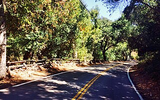
Silverado is an unincorporated community and census-designated place (CDP) in Silverado Canyon, which is located in the Santa Ana Mountains in eastern Orange County, California. Portions of the town sit on a former Mexican land grant Rancho Lomas de Santiago. Silverado is located at the boundaries of Cleveland National Forest. The site is a California Historical Landmark, and is located near the village site of Puhú.

Berry Creek is a census-designated place about 25 miles (40 km) northeast of Oroville, California in hilly terrain at 2,000 feet (610 m) above mean sea level. The community is located along the Oroville-Quincy Highway on the shore of Madrone Lake. The community is home to Berry Creek Elementary School (K-8), 2 small mountain churches, 1 mini mart w/ gas, 1 small community park. Berry Creek is home to the annual Berry Festival which is held during August.
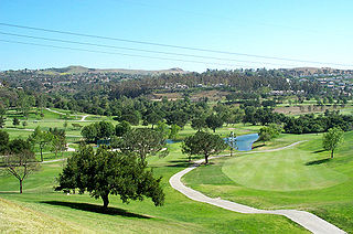
Anaheim Hills is a planned community encompassing the eastern portions of the city of Anaheim, in Orange County, California.

The Sayre Fire, also known as the Sylmar Fire, was a November 2008 wildfire which burned 489 residences in Los Angeles, considered to be the "worst loss of homes due to fire" in the city's history at that time. The fire was first reported at 10:29 p.m. PDT on November 14, 2008, in the Sylmar section of Los Angeles. As of November 20, 2008, the fire was 100% contained, had burned 11,262 acres (46 km2) and destroyed more than 600 structures. The number of homes lost in the Sayre fire exceeded the prior record set in 1961 by the Bel Air Fire which claimed 484 homes, and it remained the most destructive in Los Angeles history until it too was surpassed by the Palisades Fire in 2025. There were no fatalities, just minor injuries to five firefighters and one civilian.
The Jesusita Fire was a wildfire that started on May 5, 2009, in the hills of Santa Barbara, California in the western United States. By the time the fire was contained on May 18 it had burned 8,733 acres (35.34 km2), destroyed 80 homes and damaged 15 more before being 100% contained. The cause of the fire was ultimately traced to local contractors who had left gas cans and hot equipment unattended in dry brush after clearing part of the Jesusita Trail using a weed wacker without any permits or the permission of the landowner.

9,159 wildfires were active in the US state of California during 2009. The fires burned more than 422,147 acres of land from early February through late November, due to Red Flag conditions, destroying hundreds of structures, injuring 134 people, and killing four. The wildfires also caused at least US$134.48 million in damage. Although the fires burned many different regions of California in August, the month was especially notable for several very large fires which burned in Southern California, despite being outside of the normal fire season for that region.

The Station Fire was the largest wildfire of the 2009 California wildfire season. It burned in the Angeles National Forest, igniting on August 26, 2009, near the U.S. Forest Service Angeles Station 11 ranger station on the Angeles Crest Highway, and burned through October 16. It threatened 12,000 structures in the National Forest and the nearby communities of La Cañada Flintridge, Pasadena, Glendale, Acton, La Crescenta, Juniper Hills, Littlerock and Altadena, as well as the Sunland and Tujunga neighborhoods of the City of Los Angeles. Many of these areas faced mandatory evacuations as the flames drew near, but as of September 6, all evacuation orders were lifted. The Station Fire burned on the slopes of Mount Wilson, threatening numerous television, radio and cellular telephone antennas on the summit, as well as the Mount Wilson Observatory, which includes several historically significant telescopes and multimillion-dollar astronomical facilities operated by UCLA, USC, UC Berkeley and Georgia State University.
The May 2014 San Diego County wildfires were a swarm of 20 wildfires that erupted during May 2014, in San Diego County, California, during severe Santa Ana Wind conditions, historic drought conditions, and a heat wave. The main event during mid-May was preceded by a precursor fire that ignited on May 5. The Bernardo Fire has been declared accidental, and officials believe the Cocos Fire was intentionally set. The causes of the other fires are still under investigation by multiple agencies, and a joint task force was formed to coordinate the investigations and facilitate communications. Six injuries and one fire-related fatality were reported.

The October 2007 California wildfires, also known as the Fall 2007 California firestorm, were a series of about thirty wildfires that began igniting across Southern California on October 20. At least 1,500 homes were destroyed and approximately 972,147 acres of land was burned from Santa Barbara County to the U.S.–Mexico border, surpassing the October 2003 California wildfires in scope, which were estimated to have burned 800,000 acres (3,200 km2). The wildfires killed a total of 14 people, with nine of them dying directly from the fires; 160 others were injured, including at least 124 firefighters. At their height, the raging fires were visible from space. These fires included the vast majority of the largest and deadliest wildfires of the 2007 California wildfire season. The only wildfire in 2007 that surpassed any of the individual October 2007 fires in size was the Zaca Fire.

The Sand Fire was a wildfire in 2016 that burned in the Angeles National Forest, east of the Santa Clarita Valley in Los Angeles County, California. The fire, named for the area's Sand Canyon, was fueled by heavy chaparral and brush.

The La Tuna Fire was a wildfire in the Verdugo Mountains in Los Angeles County, Southern California, in September 2017. The fire began from undetermined causes on the afternoon of September 1 in La Tuna Canyon, and burned 7,194 acres (2,911 ha) before its containment on September 9. The fire caused at least ten injuries, the destruction of five homes and five outbuildings, and the evacuations of hundreds more. It was one of the largest wildfires in the history of the city of Los Angeles.

The Creek Fire was a large wildfire that burned in Kagel Canyon and the Angeles National Forest north of Sylmar, a neighborhood in Los Angeles, California, United States, and one of multiple wildfires that broke out across Southern California in December 2017. The Creek Fire burned 15,619 acres (63 km2) and destroyed 123 structures, including 60 homes, before being contained on January 9, 2018, following heavy rainfall from a winter storm. The fire threatened the communities of Santa Clarita, Glendale, Olive View, Lake View Terrace, Sunland-Tujunga, Shadow Hills, Sylmar, Pacoima, Lopez Canyon, and Kagel Canyon, as well as the Olive View–UCLA Medical Center. During the wildfire, 115,000 residents were forced to evacuate their homes.

The Lilac Fire was a fire that burned in northern San Diego County, California, United States, and the second-costliest one of multiple wildfires that erupted in Southern California in December 2017. The fire was first reported on December 7, 2017, burned 4,100 acres (1,659 ha), and destroyed 157 structures, before it was fully contained on December 16. The fire cost at least $8.9 million, including $5 million in firefighting expenses and property damage, and an additional $3.9 million in cleanup and erosion control costs. The fire threatened the communities of Bonsall, Oceanside, Vista, Fallbrook, and Camp Pendleton. During the fire, an estimated 10,000 residents were forced to evacuate, while a total of over 100,000 residents were forced to or advised to evacuate. On December 7, the Lilac Fire also cut the power to 20,000 people.

The Woolsey Fire was a wildfire that started in Los Angeles County and spread north to neighboring Ventura County, both located in the U.S. state of California. The fire ignited on November 8, 2018 and was not fully contained until November 21, 2018. The fire burned 96,949 acres of land, destroyed 1,643 structures, killed three people, and prompted the evacuation of more than 295,000 people. It was one of several fires in California that ignited on the same day, along with the nearby Hill Fire and the destructive Camp Fire in Northern California.

The Apple Fire was a wildfire that burned during the 2020 California wildfire season in Cherry Valley south of Oak Glen and north of Beaumont and Banning in Riverside County, California in the United States. The fire ignited on Friday, July 31, 2020 as three separate smaller blazes within the rural canyons along Oak Glen Road before merging and rapidly expanded to 1,900 acres (769 ha) and destroyed at least one home and two outbuildings in the Cherry Valley area. It now covers at least 33,424 acres (13,526 ha) and created "a plume of smoke so massive that it generated its own winds." The fire was sparked by a diesel-burning vehicle that emitted burning carbon. The fire was named after one of the roadways close to the ignition site, which is named Apple Tree Lane.

The Bobcat Fire was a large wildfire in Los Angeles County during the 2020 California wildfire season. The fire ignited on September 6, 2020, and burned 115,997 acres (46,942 ha) before it was fully contained by November 27. The Bobcat Fire primarily burned in the central San Gabriel Mountains, in and around the Angeles National Forest, and is one of the largest fires on record in Los Angeles County to date.
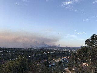
The Silverado Fire was a wildfire that burned in October and November 2020 in southern Orange County, California northeast of Irvine. The fire started on October 26 around 6:47 AM near Orange County Route S-18 and Silverado Canyon Road, fueled by strong Santa Ana winds gusting up to 80 miles per hour (130 km/h) and low humidity. Orange County Fire Authority Chief Brian Fennessy stated, "The winds were extraordinary even by Santa Ana standards. Fire spread is exceeding more than anything I've seen in my 44 years." The fire initially moved south from Loma Ridge toward the Orchard Hills, Northwood and Portola Springs communities of Irvine before moving southeast through Limestone Canyon and toward the communities of Foothill Ranch and Lake Forest. The fire burned in a path similar to that taken by the 2007 Santiago Fire, mostly through terrain that had not seen significant burning in the 13 years since that fire. 100% containment was announced on November 7, 2020.

The Bond Fire was a wildfire that burned 6,686 acres (2,706 ha) in the Santiago Canyon area of Orange County, California in December 2020. The fire caused evacuations of 25,000 residents and injured 2 firefighters. The fire was very close to the burn scar of the Silverado Fire, which took place in October 2020.


